Fraud Blocker Skip to main content

Russell Close Collection

"Exploring the Enchanting Charm of Russell Close

Background imageRussell Close Collection: Hampshire PO13 9 Map

Hampshire PO13 9 Map
Postcode Sector Map of Hampshire PO13 9

Background imageRussell Close Collection: Bexley DA7 4 Map

Bexley DA7 4 Map
Postcode Sector Map of Bexley DA7 4

Background imageRussell Close Collection: Wolverhampton WV11 2 Map

Wolverhampton WV11 2 Map
Postcode Sector Map of Wolverhampton WV11 2

Background imageRussell Close Collection: Worcester WR2 4 Map

Worcester WR2 4 Map
Postcode Sector Map of Worcester WR2 4

Background imageRussell Close Collection: Basildon SS15 6 Map

Basildon SS15 6 Map
Postcode Sector Map of Basildon SS15 6

Background imageRussell Close Collection: Plymouth PL9 8 Map

Plymouth PL9 8 Map
Postcode Sector Map of Plymouth PL9 8

Background imageRussell Close Collection: Greenwich SE7 7 Map

Greenwich SE7 7 Map
Postcode Sector Map of Greenwich SE7 7

Background imageRussell Close Collection: Hillingdon HA6 2 Map

Hillingdon HA6 2 Map
Postcode Sector Map of Hillingdon HA6 2

Background imageRussell Close Collection: Cheshire East CW12 3 Map

Cheshire East CW12 3 Map
Postcode Sector Map of Cheshire East CW12 3

Background imageRussell Close Collection: Shropshire WV15 5 Map

Shropshire WV15 5 Map
Postcode Sector Map of Shropshire WV15 5

Background imageRussell Close Collection: Staffordshire ST14 8 Map

Staffordshire ST14 8 Map
Postcode Sector Map of Staffordshire ST14 8

Background imageRussell Close Collection: Stevenage SG2 8 Map

Stevenage SG2 8 Map
Postcode Sector Map of Stevenage SG2 8

Background imageRussell Close Collection: North Hertfordshire SG8 0 Map

North Hertfordshire SG8 0 Map
Postcode Sector Map of North Hertfordshire SG8 0

Background imageRussell Close Collection: Bracknell Forest RG12 7 Map

Bracknell Forest RG12 7 Map
Postcode Sector Map of Bracknell Forest RG12 7

Background imageRussell Close Collection: Hounslow W4 2 Map

Hounslow W4 2 Map
Postcode Sector Map of Hounslow W4 2

Background imageRussell Close Collection: Malvern Hills WR14 2 Map

Malvern Hills WR14 2 Map
Postcode Sector Map of Malvern Hills WR14 2

Background imageRussell Close Collection: Kirklees WF17 5 Map

Kirklees WF17 5 Map
Postcode Sector Map of Kirklees WF17 5

Background imageRussell Close Collection: Kirklees WF16 0 Map

Kirklees WF16 0 Map
Postcode Sector Map of Kirklees WF16 0

Background imageRussell Close Collection: Rotherham S26 4 Map

Rotherham S26 4 Map
Postcode Sector Map of Rotherham S26 4

Background imageRussell Close Collection: Barnsley S71 2 Map

Barnsley S71 2 Map
Postcode Sector Map of Barnsley S71 2

Background imageRussell Close Collection: Cornwall PL12 4 Map

Cornwall PL12 4 Map
Postcode Sector Map of Cornwall PL12 4

Background imageRussell Close Collection: Cornwall PL18 9 Map

Cornwall PL18 9 Map
Postcode Sector Map of Cornwall PL18 9

Background imageRussell Close Collection: South Kesteven PE6 0 Map

South Kesteven PE6 0 Map
Postcode Sector Map of South Kesteven PE6 0

Background imageRussell Close Collection: Monmouthshire NP4 0 Map

Monmouthshire NP4 0 Map
Postcode Sector Map of Monmouthshire NP4 0

Background imageRussell Close Collection: Brent NW10 0 Map

Brent NW10 0 Map
Postcode Sector Map of Brent NW10 0

Background imageRussell Close Collection: West Norfolk PE30 4 Map

West Norfolk PE30 4 Map
Postcode Sector Map of West Norfolk PE30 4

Background imageRussell Close Collection: West Norfolk PE38 9 Map

West Norfolk PE38 9 Map
Postcode Sector Map of West Norfolk PE38 9

Background imageRussell Close Collection: Newport NP10 8 Map

Newport NP10 8 Map
Postcode Sector Map of Newport NP10 8

Background imageRussell Close Collection: Norfolk NR23 1 Map

Norfolk NR23 1 Map
Postcode Sector Map of Norfolk NR23 1

Background imageRussell Close Collection: North Tyneside NE28 9 Map

North Tyneside NE28 9 Map
Postcode Sector Map of North Tyneside NE28 9

Background imageRussell Close Collection: Swale ME10 1 Map

Swale ME10 1 Map
Postcode Sector Map of Swale ME10 1

Background imageRussell Close Collection: Central Bedfordshire LU6 3 Map

Central Bedfordshire LU6 3 Map
Postcode Sector Map of Central Bedfordshire LU6 3

Background imageRussell Close Collection: Reigate and Banstead KT20 7 Map

Reigate and Banstead KT20 7 Map
Postcode Sector Map of Reigate and Banstead KT20 7

Background imageRussell Close Collection: Woking GU21 4 Map

Woking GU21 4 Map
Postcode Sector Map of Woking GU21 4

Background imageRussell Close Collection: Hereford HR1 1 Map

Hereford HR1 1 Map
Postcode Sector Map of Hereford HR1 1

Background imageRussell Close Collection: Wycombe HP10 8 Map

Wycombe HP10 8 Map
Postcode Sector Map of Wycombe HP10 8

Background imageRussell Close Collection: Chiltern HP6 6 Map

Chiltern HP6 6 Map
Postcode Sector Map of Chiltern HP6 6

Background imageRussell Close Collection: Suffolk Coastal IP17 2 Map

Suffolk Coastal IP17 2 Map
Postcode Sector Map of Suffolk Coastal IP17 2

Background imageRussell Close Collection: Hillingdon HA4 9 Map

Hillingdon HA4 9 Map
Postcode Sector Map of Hillingdon HA4 9

Background imageRussell Close Collection: Gloucester GL9 1 Map

Gloucester GL9 1 Map
Postcode Sector Map of Gloucester GL9 1

Background imageRussell Close Collection: Dudley DY4 0 Map

Dudley DY4 0 Map
Postcode Sector Map of Dudley DY4 0

Background imageRussell Close Collection: North Lincolnshire DN15 8 Map

North Lincolnshire DN15 8 Map
Postcode Sector Map of North Lincolnshire DN15 8

Background imageRussell Close Collection: Stratford-on-Avon CV47 9 Map

Stratford-on-Avon CV47 9 Map
Postcode Sector Map of Stratford-on-Avon CV47 9

Background imageRussell Close Collection: Dartford DA1 4 Map

Dartford DA1 4 Map
Postcode Sector Map of Dartford DA1 4

Background imageRussell Close Collection: County Durham DH8 6 Map

County Durham DH8 6 Map
Postcode Sector Map of County Durham DH8 6

Background imageRussell Close Collection: Braintree CM8 1 Map

Braintree CM8 1 Map
Postcode Sector Map of Braintree CM8 1

Background imageRussell Close Collection: Brentwood CM15 9 Map

Brentwood CM15 9 Map
Postcode Sector Map of Brentwood CM15 9

Background imageRussell Close Collection: Bath and North East Somerset BS40 8 Map

Bath and North East Somerset BS40 8 Map
Postcode Sector Map of Bath and North East Somerset BS40 8


All Professionally Made to Order for Quick Shipping

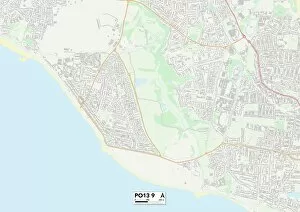
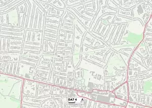
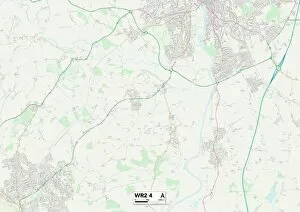
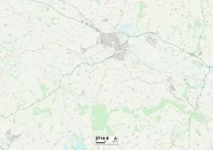
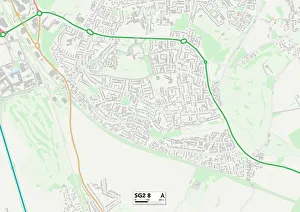
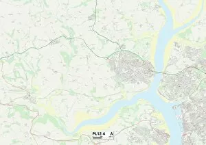
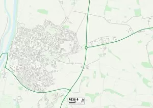
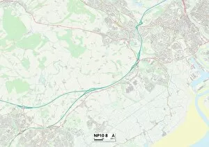
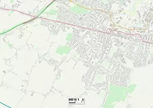
"Exploring the Enchanting Charm of Russell Close: A Journey Through Picturesque Locations" Discover the hidden gems scattered across England as we embark on a virtual journey through Russell Close and its captivating surroundings. From the serene landscapes of Hampshire's PO13 9 Map to the vibrant streets of Bexley's DA7 4 Map, each destination promises a unique experience. Immerse yourself in Wolverhampton's WV11 2 Map, where history seamlessly blends with modernity. Marvel at Worcester's WR2 4 Map, known for its stunning architecture and tranquil atmosphere. The coastal beauty of Plymouth's PL9 8 Map will leave you breathless, while Greenwich's SE7 7 Map offers a glimpse into London's rich maritime heritage. Venture further west to Hillingdon's HA6 2 Map and be captivated by its charming countryside vistas. Explore Cheshire East's CW12 3 Map, where picturesque villages dot the landscape like something out of a storybook. Shropshire’s WV15 5 map invites you to wander through idyllic towns steeped in history. Delve into Staffordshire’s ST14 8 map and uncover ancient castles that stand as testaments to times gone by. Stevenage’s SG2 8 map beckons with its blend of modern amenities and quaint charm. Lastly, North Hertfordshire’s SG8 Omap boasts rolling hillsides dotted with enchanting villages waiting to be discovered. Whether you're an avid traveler or simply seeking inspiration from afar, let Russell Close take you on an unforgettable journey through these mesmerizing locations that showcase England at its finest. So grab your virtual passport and join us as we explore the wonders that await in this remarkable corner of the world.