Fraud Blocker Skip to main content

Physical Geography Collection (page 9)

"Exploring the Diverse Landscapes

Background imagePhysical Geography Collection: Map of the southwestern part of the German Empire, c.1900 (engraving)

Map of the southwestern part of the German Empire, c.1900 (engraving)
532961 Map of the southwestern part of the German Empire, c.1900 (engraving); (add.info.: Map of the southwestern German Empire, circa 1902)

Background imagePhysical Geography Collection: Map of Netherlands and Belgium, c.1900 (engraving)

Map of Netherlands and Belgium, c.1900 (engraving)
532956 Map of Netherlands and Belgium, c.1900 (engraving); (add.info.: Map showing the historical boundaries of Netherlands, Belgium, Luxemburg, with insets of Amsterdam and Brussels, circa 1902)

Background imagePhysical Geography Collection: Map of Spain with Portugal and Andorra, c.1900 (engraving)

Map of Spain with Portugal and Andorra, c.1900 (engraving)
532952 Map of Spain with Portugal and Andorra, c.1900 (engraving); (add.info.: Map of Spain with Portugal and Andorra, with insets of the Azores Islands, Canary Islands, and Madeira Island)

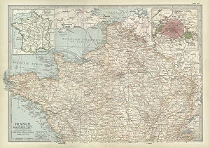
Background imagePhysical Geography Collection: Map of France, c.1900 (engraving)

Map of France, c.1900 (engraving)
532942 Map of France, c.1900 (engraving); (add.info.: Map of northern France with insets showing the provinces of France and Paris and Vicinity, circa 1902)

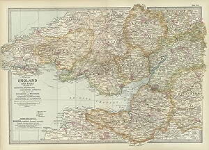
Background imagePhysical Geography Collection: Map of England and Wales, c.1900 (engraving)

Map of England and Wales, c.1900 (engraving)
532924 Map of England and Wales, c.1900 (engraving); (add.info.: Map of England and Wales, with Hereford, Monmouth, Gloucester, Somerset, and parts of Worchester and Wiltshire, circa 1902)

Background imagePhysical Geography Collection: Map of London, England, c.1900 (engraving)

Map of London, England, c.1900 (engraving)
532921 Map of London, England, c.1900 (engraving); (add.info.: Map of London, England, and vicinity, circa 1902, from the 10th edition of Encyclopaedia Britannica.); Encyclopaedia Britannica/UIG.

Background imagePhysical Geography Collection: Map of England and Wales, c.1900 (engraving)

Map of England and Wales, c.1900 (engraving)
532903 Map of England and Wales, c.1900 (engraving); (add.info.: Map showing the historical boundaries of northern England and Wales, including insets of Liverpool, Manchester and Vicinity)

Background imagePhysical Geography Collection: Map of Central Europe, c.1900 (engraving)

Map of Central Europe, c.1900 (engraving)
532900 Map of Central Europe, c.1900 (engraving); (add.info.: Map of Central Europe, circa 1902, From the 10th edition of Encyclopaedia Britannica.); Encyclopaedia Britannica/UIG.

Background imagePhysical Geography Collection: Map of Iceland, c.1900 (engraving)

Map of Iceland, c.1900 (engraving)
533307 Map of Iceland, c.1900 (engraving); (add.info.: Map of Iceland showing glaciers (Jokull), fjords and other geographical features, circa 1902

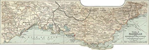
Background imagePhysical Geography Collection: Map of Marseille, France, c.1900 (engraving)

Map of Marseille, France, c.1900 (engraving)
533294 Map of Marseille, France, c.1900 (engraving); (add.info.: Map of Marseille, France, circa 1902, from the 10th edition of Encyclopaedia Britannica.); Encyclopaedia Britannica/UIG.

Background imagePhysical Geography Collection: Map of Rome, c.1900 (engraving)

Map of Rome, c.1900 (engraving)
532848 Map of Rome, c.1900 (engraving); (add.info.: Map of Rome, circa 1900, from the 10th edition of Encyclopaedia Britannica.); Encyclopaedia Britannica/UIG.

Background imagePhysical Geography Collection: Map of South America, c.1900 (engraving)

Map of South America, c.1900 (engraving)
533256 Map of South America, c.1900 (engraving); (add.info.: Map of South America with inset maps of Isthmus of Panama, Galapagos Islands and Trinidad, circa 1902)

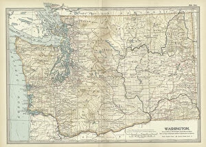
Background imagePhysical Geography Collection: Map of Washington State, c.1900 (engraving)

Map of Washington State, c.1900 (engraving)
533220 Map of Washington State, c.1900 (engraving); (add.info.: Map of Washington State, United States, circa 1902, from the 10th edition of Encyclopaedia Britannica.); Encyclopaedia Britannica/UIG.

Background imagePhysical Geography Collection: Map of Melbourne, c.1900 (engraving)

Map of Melbourne, c.1900 (engraving)
532791 Map of Melbourne, c.1900 (engraving); (add.info.: Map of Melbourne, Australia, circa 1900, from the 10th edition of Encyclopaedia Britannica.); Encyclopaedia Britannica/UIG.

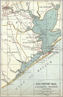
Background imagePhysical Geography Collection: Map of Galveston Bay, Houston and vicinity, c.1900 (engraving)

Map of Galveston Bay, Houston and vicinity, c.1900 (engraving)
532761 Map of Galveston Bay, Houston and vicinity, c.1900 (engraving); (add.info.: Map of Galveston Bay, Houston, circa 1900)

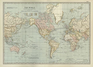
Background imagePhysical Geography Collection: Map of the colonial powers, 1902, c.1900 (engraving)

Map of the colonial powers, 1902, c.1900 (engraving)
532894 Map of the colonial powers, 1902, c.1900 (engraving); (add.info.: Map of the world showing "the Chief Countries and their Colonies," circa 1902)

Background imagePhysical Geography Collection: Map of Sydney, c.1900 (engraving)

Map of Sydney, c.1900 (engraving)
532872 Map of Sydney, c.1900 (engraving); (add.info.: Map of Sydney, Australia, circa 1900, from the 10th edition of Encyclopaedia Britannica.); Encyclopaedia Britannica/UIG.

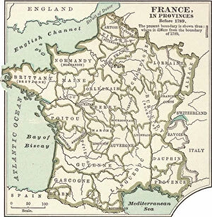
Background imagePhysical Geography Collection: Map of France in Provinces, c.1900 (engraving)

Map of France in Provinces, c.1900 (engraving)
533288 Map of France in Provinces, c.1900 (engraving); (add.info.: Map of the provinces of France before the French Revolution in 1789, circa 1902)

Background imagePhysical Geography Collection: Map of Richmond, c.1900 (engraving)

Map of Richmond, c.1900 (engraving)
532839 Map of Richmond, c.1900 (engraving); (add.info.: Map illustrating battles of the American Civil War held around the Richmond, Virginia, area)

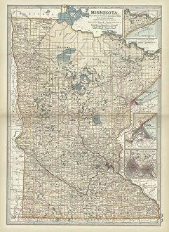
Background imagePhysical Geography Collection: Map of Minnesota, c.1900 (engraving)

Map of Minnesota, c.1900 (engraving)
533188 Map of Minnesota, c.1900 (engraving); (add.info.: Map of Minnesota, United States, with inset maps of Duluth and Minneapolis, circa 1902)

Background imagePhysical Geography Collection: Map of eastern Texas, c.1900 (engraving)

Map of eastern Texas, c.1900 (engraving)
533161 Map of eastern Texas, c.1900 (engraving); (add.info.: Map of the eastern part of Texas, circa 1902, from the 10th edition of Encyclopaedia Britannica.); Encyclopaedia Britannica/UIG.

Background imagePhysical Geography Collection: Map of eastern Tennessee, c.1900 (engraving)

Map of eastern Tennessee, c.1900 (engraving)
533145 Map of eastern Tennessee, c.1900 (engraving); (add.info.: Map of the eastern part of Tennessee with inset map of Chattanooga, circa 1902)

Background imagePhysical Geography Collection: Map of North Carolina, c.1900 (engraving)

Map of North Carolina, c.1900 (engraving)
533130 Map of North Carolina, c.1900 (engraving); (add.info.: Map of North Carolina, United States, circa 1902, from the 10th edition of Encyclopaedia Britannica.); Encyclopaedia Britannica/UIG.

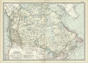
Background imagePhysical Geography Collection: Map of Canada, c.1900 (engraving)

Map of Canada, c.1900 (engraving)
533072 Map of Canada, c.1900 (engraving); (add.info.: Map showing historical boundaries of Canada and Newfoundland, circa 1902)

Background imagePhysical Geography Collection: Map of colonial Africa, c.1900 (engraving)

Map of colonial Africa, c.1900 (engraving)
533053 Map of colonial Africa, c.1900 (engraving); (add.info.: Map of colonial Africa, with insets of Ascension Island, St)

Background imagePhysical Geography Collection: Map of Australia and Tasmania. c1902 (engraving)

Map of Australia and Tasmania. c1902 (engraving)
533041 Map of Australia and Tasmania. c1902 (engraving); (add.info.: Map showing Australia with insets of Melbourne and Port Phillip, Tasmania, and Sydney and Vicinity, circa 1902)

Background imagePhysical Geography Collection: Map of Dublin, c.1900 (engraving)

Map of Dublin, c.1900 (engraving)
532758 Map of Dublin, c.1900 (engraving); (add.info.: Map of Dublin, circa 1900, from the 10th edition of Encyclopaedia Britannica.); Encyclopaedia Britannica/UIG.

Background imagePhysical Geography Collection: Map of Brussels, c.1900 (engraving)

Map of Brussels, c.1900 (engraving)
532721 Map of Brussels, c.1900 (engraving); (add.info.: Map of the city of Brussels, Belgium, circa 1900, from the 10th edition of Encyclopaedia Britannica.); Encyclopaedia Britannica/UIG.

Background imagePhysical Geography Collection: Map of Guadeloupe, c.1900 (engraving)

Map of Guadeloupe, c.1900 (engraving)
533480 Map of Guadeloupe, c.1900 (engraving); (add.info.: Map of Guadeloupe, circa 1902, from the 10th edition of Encyclopaedia Britannica.); Encyclopaedia Britannica/UIG.

Background imagePhysical Geography Collection: Map of Dominica, c.1900 (engraving)

Map of Dominica, c.1900 (engraving)
533477 Map of Dominica, c.1900 (engraving); (add.info.: Map of Dominica, circa 1902, from the 10th edition of Encyclopaedia Britannica.); Encyclopaedia Britannica/UIG.

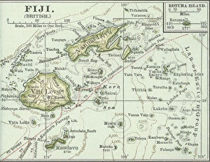
Background imagePhysical Geography Collection: Map of Fiji Islands, c.1900 (engraving)

Map of Fiji Islands, c.1900 (engraving)
533354 Map of Fiji Islands, c.1900 (engraving); (add.info.: Map of Fiji Islands, South Pacific with inset map of Rotuma Island, circa 1902)

Background imagePhysical Geography Collection: Map of New Guinea and Bismarck Archipelago, c.1900 (engraving)

Map of New Guinea and Bismarck Archipelago, c.1900 (engraving)
533344 Map of New Guinea and Bismarck Archipelago, c.1900 (engraving); (add.info.: Map of New Guinea and the Bismarck Archipelago, circa 1902)

Background imagePhysical Geography Collection: Map of Bonin Islands and Sulphur Islands, c.1900 (engraving)

Map of Bonin Islands and Sulphur Islands, c.1900 (engraving)
533329 Map of Bonin Islands and Sulphur Islands, c.1900 (engraving); (add.info.: Inset map of Bonin Islands and Sulphur Islands, circa 1902)

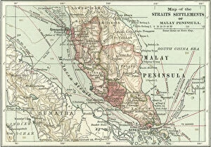
Background imagePhysical Geography Collection: Map of the Malay Peninsula, c.1900 (engraving)

Map of the Malay Peninsula, c.1900 (engraving)
533325 Map of the Malay Peninsula, c.1900 (engraving); (add.info.: Map showing historical boundaries of the Malay Peninsula, Sumatra, and Singapore, circa 1902)

Background imagePhysical Geography Collection: Map of Crete, c.1900 (engraving)

Map of Crete, c.1900 (engraving)
533320 Map of Crete, c.1900 (engraving); (add.info.: Map of Crete, Greece, circa 1902, From the 10th edition of Encyclopaedia Britannica.); Encyclopaedia Britannica/UIG.

Background imagePhysical Geography Collection: Portrait of Heinrich Barth

Portrait of Heinrich Barth
863868 Portrait of Heinrich Barth; (add.info.: Heinrich Barth (1821-65) German explorer and geographer. Engaged by the British government to accompany James Richardson (d1851)

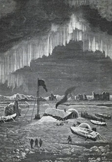
Background imagePhysical Geography Collection: Curtain Aurora Borealis viewed in the Arctic Circle c1880

Curtain Aurora Borealis viewed in the Arctic Circle c1880
865249 Curtain Aurora Borealis viewed in the Arctic Circle c1880.; Universal History Archive/UIG.

Background imagePhysical Geography Collection: Departure of the Fram

Departure of the Fram
673479 Departure of the Fram; (add.info.: Departure of the Fram, Nansen's Fram expedition, 1893-1896, was an attempt by the Norwegian explorer Fridtjof Nansen to reach the geographical North Pole)

Background imagePhysical Geography Collection: The McClure Arctic Expedition of 1850

The McClure Arctic Expedition of 1850
673471 The McClure Arctic Expedition of 1850; (add.info.: The McClure Arctic Expedition of 1850, among numerous British search efforts to determine the fate of the Franklin's lost expedition)

Background imagePhysical Geography Collection: Nordenskiold expedition in Siberia

Nordenskiold expedition in Siberia
673478 Nordenskiold expedition in Siberia; (add.info.: Nordenskiold expedition in Siberia, Nils Adolf Erik Nordenskiold also known as A E Nordenskioeld (18 November 1832, Helsinki)

Background imagePhysical Geography Collection: Member of crew of SS Vega barque

Member of crew of SS Vega barque
673477 Member of crew of SS Vega barque; (add.info.: Member of crew of the 'Vega', SS Vega was a Swedish barque, built in Bremerhaven Germany in 1872)

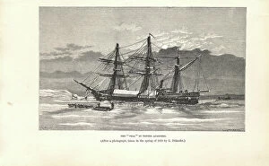
Background imagePhysical Geography Collection: SS Vega barque in winter quarters

SS Vega barque in winter quarters
673476 SS Vega barque in winter quarters; (add.info.: The 'Vega' in wint er quarters, SS Vega was a Swedish barque, built in Bremerhaven Germany in 1872)

Background imagePhysical Geography Collection: Eira Arctic Expedition

Eira Arctic Expedition
673473 Eira Arctic Expedition; (add.info.: Eira Arctic Expedition, In 1884 Sir Allen Young was commissioned to take the steamship Hope in search of Benjamin Leigh Smith's expedition missing in)

Background imagePhysical Geography Collection: Map of London and Vicinity, 1902, c.1900 (engraving)

Map of London and Vicinity, 1902, c.1900 (engraving)
533273 Map of London and Vicinity, 1902, c.1900 (engraving); (add.info.: Map of London, England, circa 1902, from the 10th edition of Encyclopaedia Britannica.); Encyclopaedia Britannica/UIG.

Background imagePhysical Geography Collection: Map of Liverpool, Manchester, c.1900 (engraving)

Map of Liverpool, Manchester, c.1900 (engraving)
533270 Map of Liverpool, Manchester, c.1900 (engraving); (add.info.: Map of Liverpool and Manchester, England, circa 1902)

Background imagePhysical Geography Collection: Map of Norway and Sweden, c.1900 (engraving)

Map of Norway and Sweden, c.1900 (engraving)
532971 Map of Norway and Sweden, c.1900 (engraving); (add.info.: Map of Norway, Sweden, with insets of Kristianiafjord and Stockholm, circa 1902)

Background imagePhysical Geography Collection: Map of Scotland, c.1900 (engraving)

Map of Scotland, c.1900 (engraving)
532936 Map of Scotland, c.1900 (engraving); (add.info.: Map of the central part of Scotland, circa 1902, from the 10th edition of Encyclopaedia Britannica.); Encyclopaedia Britannica/UIG.

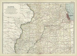
Background imagePhysical Geography Collection: Map of northern Illinois, c.1900 (engraving)

Map of northern Illinois, c.1900 (engraving)
533173 Map of northern Illinois, c.1900 (engraving); (add.info.: Map of the northern part of Illinois, United States, circa 1902)


All Professionally Made to Order for Quick Shipping

"Exploring the Diverse Landscapes: A Journey through Physical Geography" Embark on a captivating journey through physical geography as we delve into the intricate details of our world's diverse landscapes. From the political map of Africa, showcasing its nations and boundaries, to Mappa Mundi - an exquisite ink and color creation from 1265 London that offers a glimpse into medieval cartography. Travel back in time with the antique maps such as Map of Ireland (1897), Great Britain and Ireland (1867), Sicily (1895), Palestine (1875), and even Tasmania. These historical artifacts not only provide geographical information but also offer insights into how our understanding of land has evolved over centuries. Discover the wonders hidden within Antarctica as you explore a unique map overlaid with illustrations of sea gulls, penguins, elephant seals, shrimp, and buildings. Witness China unfold before your eyes through its intricately detailed map or marvel at Earth's tectonic plates marked by lines on a global scale. Experience rare moments captured by nature itself like never before – witness a snow-covered United Kingdom during January 2010 or immerse yourself in Earth's topographic and bathymetric features depicted meticulously on one single map. Physical geography is more than just studying landforms; it is about unraveling stories etched onto every inch of our planet's surface. Join us on this fascinating expedition where maps become windows to exploration, knowledge, and appreciation for the remarkable diversity that exists right beneath our feet.