Fraud Blocker Skip to main content

Part Of Collection (page 5)

"Captivating Moments from Around the World: A Glimpse into Nature, Art

Background imagePart Of Collection: Map of Arabia with part of Turkey and Oman, c.1900 (engraving)

Map of Arabia with part of Turkey and Oman, c.1900 (engraving)
533009 Map of Arabia with part of Turkey and Oman, c.1900 (engraving); (add.info.: Map of Arabia, Turkey, Oman, Aden, with insets map of Jerusalem and Palestine, circa 1902)

Background imagePart Of Collection: Map of Turkey, c.1900 (engraving)

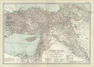
Map of Turkey, c.1900 (engraving)
533006 Map of Turkey, c.1900 (engraving); (add.info.: Map showing the historical boundaries of Turkey in Asia, circa 1902)

Background imagePart Of Collection: Map of Russia with inset of St. Petersburg, c.1900 (engraving)

Map of Russia with inset of St. Petersburg, c.1900 (engraving)
532995 Map of Russia with inset of St. Petersburg, c.1900 (engraving); (add.info.: Map of Russia, with an inset of St. Petersburg, circa 1902)

Background imagePart Of Collection: Map of the northwestern part of South America, c.1900 (engraving)

Map of the northwestern part of South America, c.1900 (engraving)
533259 Map of the northwestern part of South America, c.1900 (engraving); (add.info.: Map of northwest South America: Colombia, Venezuela, British Guiana, Ecuador, Peru, and Bolivia, circa 1902)

Background imagePart Of Collection: Map of northern Ohio, c.1900 (engraving)

Map of northern Ohio, c.1900 (engraving)
533164 Map of northern Ohio, c.1900 (engraving); (add.info.: Map of the northern part of Ohio, United States, circa 1902, from the 10th edition of Encyclopaedia Britannica)

Background imagePart Of Collection: Map of southern India with Bombay, c.1900 (engraving)

Map of southern India with Bombay, c.1900 (engraving)
533019 Map of southern India with Bombay, c.1900 (engraving); (add.info.: Map showing historical boundaries of Southern India with inset map of Bombay (now Mumbai) and the Malay Peninsula

Background imagePart Of Collection: Map of the Empire of Austria-Hungary, c.1900 (engraving)

Map of the Empire of Austria-Hungary, c.1900 (engraving)
532977 Map of the Empire of Austria-Hungary, c.1900 (engraving); (add.info.: Map of Empire of Austria-Hungary and inset of Budapest and Vicinity, circa 1902)

Background imagePart Of Collection: Map of the southwestern part of the German Empire, c.1900 (engraving)

Map of the southwestern part of the German Empire, c.1900 (engraving)
532961 Map of the southwestern part of the German Empire, c.1900 (engraving); (add.info.: Map of the southwestern German Empire, circa 1902)

Background imagePart Of Collection: Map of France, c.1900 (engraving)

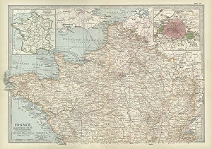
Map of France, c.1900 (engraving)
532942 Map of France, c.1900 (engraving); (add.info.: Map of northern France with insets showing the provinces of France and Paris and Vicinity, circa 1902)

Background imagePart Of Collection: Map of England and Wales, c.1900 (engraving)

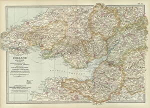
Map of England and Wales, c.1900 (engraving)
532924 Map of England and Wales, c.1900 (engraving); (add.info.: Map of England and Wales, with Hereford, Monmouth, Gloucester, Somerset, and parts of Worchester and Wiltshire, circa 1902)

Background imagePart Of Collection: Map of England and Wales, c.1900 (engraving)

Map of England and Wales, c.1900 (engraving)
532903 Map of England and Wales, c.1900 (engraving); (add.info.: Map showing the historical boundaries of northern England and Wales, including insets of Liverpool, Manchester and Vicinity)

Background imagePart Of Collection: Map of eastern Texas, c.1900 (engraving)

Map of eastern Texas, c.1900 (engraving)
533161 Map of eastern Texas, c.1900 (engraving); (add.info.: Map of the eastern part of Texas, circa 1902, from the 10th edition of Encyclopaedia Britannica.); Encyclopaedia Britannica/UIG.

Background imagePart Of Collection: Map of eastern Tennessee, c.1900 (engraving)

Map of eastern Tennessee, c.1900 (engraving)
533145 Map of eastern Tennessee, c.1900 (engraving); (add.info.: Map of the eastern part of Tennessee with inset map of Chattanooga, circa 1902)

Background imagePart Of Collection: Map of Canada, c.1900 (engraving)

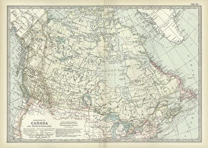
Map of Canada, c.1900 (engraving)
533072 Map of Canada, c.1900 (engraving); (add.info.: Map showing historical boundaries of Canada and Newfoundland, circa 1902)

Background imagePart Of Collection: Depiction of Vaccination. 19th century (print)

Depiction of Vaccination. 19th century (print)
672836 Depiction of Vaccination. 19th century (print); (add.info.: Vaccination is the administration of antigenic material (a vaccine)

Background imagePart Of Collection: French postcard with floral elements, 1900

French postcard with floral elements, 1900
3665720 French postcard with floral elements, 1900 by French School, (20th century); (add.info.: French postcard with floral elements 1900.); Universal History Archive/UIG.

Background imagePart Of Collection: Thomas Lauder Brunton (1844-1916)

Thomas Lauder Brunton (1844-1916)
865197 Thomas Lauder Brunton (1844-1916); (add.info.: Thomas Lauder Brunton (1844-1916) Scottish physician born at Hilston, Roxburgh, Scotland

Background imagePart Of Collection: William Henry Broadbent (1835-1907)

William Henry Broadbent (1835-1907)
865196 William Henry Broadbent (1835-1907); (add.info.: William Henry Broadbent (1835-1907) English physician born at Lindley, near Huddersfield, Yorkshire

Background imagePart Of Collection: Map of Liverpool, Manchester, c.1900 (engraving)

Map of Liverpool, Manchester, c.1900 (engraving)
533270 Map of Liverpool, Manchester, c.1900 (engraving); (add.info.: Map of Liverpool and Manchester, England, circa 1902)

Background imagePart Of Collection: Map of Scotland, c.1900 (engraving)

Map of Scotland, c.1900 (engraving)
532936 Map of Scotland, c.1900 (engraving); (add.info.: Map of the central part of Scotland, circa 1902, from the 10th edition of Encyclopaedia Britannica.); Encyclopaedia Britannica/UIG.

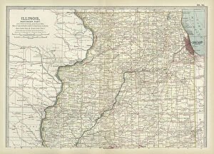
Background imagePart Of Collection: Map of northern Illinois, c.1900 (engraving)

Map of northern Illinois, c.1900 (engraving)
533173 Map of northern Illinois, c.1900 (engraving); (add.info.: Map of the northern part of Illinois, United States, circa 1902)

Background imagePart Of Collection: Map of Amsterdam, c.1900 (engraving)

Map of Amsterdam, c.1900 (engraving)
532699 Map of Amsterdam, c.1900 (engraving); (add.info.: Map of the city of Amsterdam, circa 1900, from the 10th edition of Encyclopaedia Britannica.); Encyclopaedia Britannica/UIG.

Background imagePart Of Collection: Map of Russia showing historical boundaries of Russia in Europe with Poland and Finland, circa 1902

Map of Russia showing historical boundaries of Russia in Europe with Poland and Finland, circa 1902
532992 Map of Russia showing historical boundaries of Russia in Europe with Poland and Finland, circa 1902; (add.info.: Map showing historical boundaries of Russia in Europe with Poland and Finland)

Background imagePart Of Collection: Map of Italy with Sicily and Naples, c.1900 (engraving)

Map of Italy with Sicily and Naples, c.1900 (engraving)
532989 Map of Italy with Sicily and Naples, c.1900 (engraving); (add.info.: Map of central and southern Italy with insets map of Sicily and Naples, circa 1902)

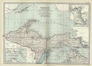
Background imagePart Of Collection: Map of the northern part of Michigan, c.1900 (engraving)

Map of the northern part of Michigan, c.1900 (engraving)
533181 Map of the northern part of Michigan, c.1900 (engraving); (add.info.: Map of the northern part of Michigan, United States, with inset maps of St)

Background imagePart Of Collection: Map of England, c.1900 (engraving)

Map of England, c.1900 (engraving)
532930 Map of England, c.1900 (engraving); (add.info.: Map of England, with Cornwall, Devonshire, Dorset, and an inset of the Channel Islands, circa 1902)

Background imagePart Of Collection: Map of southern Ohio, c.1900 (engraving)

Map of southern Ohio, c.1900 (engraving)
533168 Map of southern Ohio, c.1900 (engraving); (add.info.: Map of the southern part of Ohio, United States, with inset maps of Cincinnati and Cleveland, circa 1902)

Background imagePart Of Collection: Map of England, c.1900 (engraving)

Map of England, c.1900 (engraving)
532911 Map of England, c.1900 (engraving); (add.info.: Map of England with Yorkshire, Lancashire, and Westmorland, circa 1902)

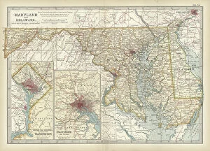
Background imagePart Of Collection: Map of Maryland and Delaware, c.1900 (engraving)

Map of Maryland and Delaware, c.1900 (engraving)
533120 Map of Maryland and Delaware, c.1900 (engraving); (add.info.: Map of Maryland and Delaware, inset maps of District of Columbia and Baltimore, circa 1902)

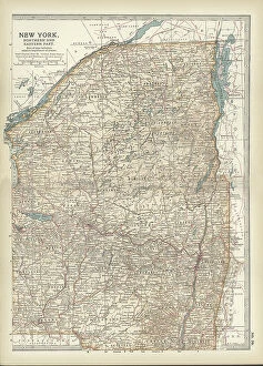
Background imagePart Of Collection: Map of New York State, c.1900 (engraving)

Map of New York State, c.1900 (engraving)
533105 Map of New York State, c.1900 (engraving); (add.info.: Map of north and eastern New York State, United States, circa 1902)

Background imagePart Of Collection: Map of Athens, c.1900 (engraving)

Map of Athens, c.1900 (engraving)
532702 Map of Athens, c.1900 (engraving); (add.info.: Map showing the historical churches of Athens and Piraeus, circa 1900)

Background imagePart Of Collection: President James Buchanan, 1856

President James Buchanan, 1856
2601286 President James Buchanan, 1856; (add.info.: President James Buchanan, 1856); Universal History Archive/UIG.

Background imagePart Of Collection: French postcard with image of a hand, fish and flowers

French postcard with image of a hand, fish and flowers
3665523 French postcard with image of a hand, fish and flowers; (add.info.: French postcard with image of a hand, fish and flowers.); Universal History Archive/UIG.

Background imagePart Of Collection: Map of Turkey, c.1900 (engraving)

Map of Turkey, c.1900 (engraving)
532998 Map of Turkey, c.1900 (engraving); (add.info.: Map showing historical boundaries of the European portion of Turkey, circa 1902)

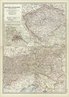
Background imagePart Of Collection: Map of Austria with Vienna, c.1900 (engraving)

Map of Austria with Vienna, c.1900 (engraving)
532980 Map of Austria with Vienna, c.1900 (engraving); (add.info.: Map showing Austria-Hungary, with an inset of Vienna, circa 1902)

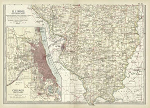
Background imagePart Of Collection: Map of southern Illinois, c.1900 (engraving)

Map of southern Illinois, c.1900 (engraving)
533175 Map of southern Illinois, c.1900 (engraving); (add.info.: Map of the southern part of Illinois, United States, with an inset map of Chicago and Vicinity, circa 1902)

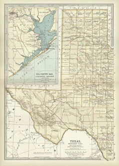
Background imagePart Of Collection: Map of western Texas with Galveston, c.1900 (engraving)

Map of western Texas with Galveston, c.1900 (engraving)
533163 Map of western Texas with Galveston, c.1900 (engraving); (add.info.: Map of the western part of Texas with inset map of Galveston Bay, Galveston, Houston and Vicinity, circa 1902)

Background imagePart Of Collection: Map of England and Wales, c.1900 (engraving)

Map of England and Wales, c.1900 (engraving)
532927 Map of England and Wales, c.1900 (engraving); (add.info.: Map of England and Wales, circa 1902, from the 10th edition of Encyclopaedia Britannica.); Encyclopaedia Britannica/UIG.

Background imagePart Of Collection: Map of southeast Australia, c.1900 (engraving)

Map of southeast Australia, c.1900 (engraving)
533045 Map of southeast Australia, c.1900 (engraving); (add.info.: Map of southeast Australia with Victoria, New South Wales, and parts of South Australia and Queensland, circa 1902)

Background imagePart Of Collection: Map of the western part of Ontario, Canada, c.1900 (engraving)

Map of the western part of Ontario, Canada, c.1900 (engraving)
533408 Map of the western part of Ontario, Canada, c.1900 (engraving); (add.info.: Map of the western part of Ontario, Canada, circa 1902)

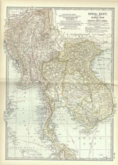
Background imagePart Of Collection: Map of Eastern India, c.1900 (engraving)

Map of Eastern India, c.1900 (engraving)
533022 Map of Eastern India, c.1900 (engraving); (add.info.: Map showing historical boundaries of eastern India, Burma, Siam and French Indo-China, circa 1902)

Background imagePart Of Collection: Map of the eastern part of South America, c.1900 (engraving)

Map of the eastern part of South America, c.1900 (engraving)
533262 Map of the eastern part of South America, c.1900 (engraving); (add.info.: Map showing the historical boundaries of eastern South America, with an inset map of Rio de Janeiro, circa 1902)

Background imagePart Of Collection: Map of the southern part of Missouri, c.1900 (engraving)

Map of the southern part of Missouri, c.1900 (engraving)
533203 Map of the southern part of Missouri, c.1900 (engraving); (add.info.: Map of the southern part of Missouri, United States, circa 1902)

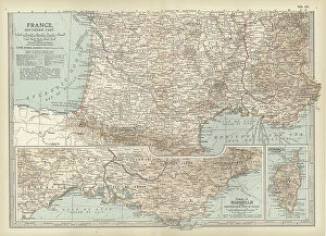
Background imagePart Of Collection: Map of France, c.1900 (engraving)

Map of France, c.1900 (engraving)
532946 Map of France, c.1900 (engraving); (add.info.: Map of France with inset map of Vicinity of Marseille and the Mediterranean Coast of France, and Corsica, circa 1902)

Background imagePart Of Collection: Map of Scotland, c.1900 (engraving)

Map of Scotland, c.1900 (engraving)
532933 Map of Scotland, c.1900 (engraving); (add.info.: Map of Scotland with inset of Shetland Islands, circa 1902, from the 10th edition of Encyclopaedia Britannica.); Encyclopaedia Britannica/UIG.

Background imagePart Of Collection: Map of Pennsylvania, with inset map of Pittsburg, c.1900 (engraving)

Map of Pennsylvania, with inset map of Pittsburg, c.1900 (engraving)
533118 Map of Pennsylvania, with inset map of Pittsburg, c.1900 (engraving); (add.info.: Map of Pennsylvania, with inset map of Pittsburg, circa 1902)

Background imagePart Of Collection: Map of northeastern Africa, c.1900 (engraving)

Map of northeastern Africa, c.1900 (engraving)
533059 Map of northeastern Africa, c.1900 (engraving); (add.info.: Map of northeast Africa, with insets of the Nile Delta and Suez Canal, circa 1902)

Background imagePart Of Collection: Map of England, c.1900 (engraving)

Map of England, c.1900 (engraving)
532914 Map of England, c.1900 (engraving); (add.info.: Map of England, including Nottingham, Leicester, Rutland, Northampton, Huntingdon, Cambridge, Norfolk, circa 1902)


All Professionally Made to Order for Quick Shipping

"Captivating Moments from Around the World: A Glimpse into Nature, Art, and Life" Witnessing the indomitable spirit of nature as Storm Ruth unleashes its fury upon the rugged d Ar-Men lighthouse amidst rough seas in Ile de Sein, Armorique. Behold the enigmatic Pallas cat, Otocolobus manu, gracefully roaming through Cotswold Wildlife Park in Costswolds, Gloucestershire - a true marvel of England's diverse wildlife. Embark on a journey to Argentina's Patagonia region and delve deep into Cueva de las Manos (Cave of Hands), where ancient cave paintings unveil an artistic legacy spanning millennia. Peering beneath our skin with an X-ray reveals the intricate structure of normal knees - a testament to our remarkable skeletal system that supports us every step of the way. Unveiling the hidden complexities behind facial expressions, explore the intricacies of human facial muscles labeled meticulously to understand how emotions manifest themselves on our visage. Dive into an anatomical exploration as we dissect and comprehend each component comprising the human knee joint - a masterpiece of engineering enabling fluid movement and stability. Immerse yourself in Australia's vibrant avian world as you encounter the resplendent Australian King Parrot (Alisterus Scapularis) flaunting its vivid plumage against lush landscapes down under. Discover a universal language beyond words by exploring 26 sign language hand signals representing letters of the alphabet - bridging gaps between cultures through graceful gestures. Embrace moments filled with laughter and camaraderie as one person playfully smashes cake onto another's face - capturing pure joy and shared experiences that create lasting memories. Meet Germany's loyal companion, a majestic Black Labrador Retriever dog exuding warmth and affection while embodying traits that make them beloved family members across the globe.