Fraud Blocker Skip to main content

Old Antique View Collection (page 7)

"Exploring the Past: A Glimpse into Old Antique Views" Step back in time with these captivating antique maps

Background imageOld Antique View Collection: 1861 Johnson Map Of Vermont And New Hampshire

1861 Johnson Map Of Vermont And New Hampshire
1861, Johnson Map of Vermont and New Hampshire

Background imageOld Antique View Collection: 1861 Johnson Map Of China Topography Cartography

1861 Johnson Map Of China Topography Cartography
1861, Johnson Map of China

Background imageOld Antique View Collection: 1860 Valentine Map Of New York City Topography

1860 Valentine Map Of New York City Topography
1860, Valentine Map of New York City

Background imageOld Antique View Collection: 1860 Mitchell Map Of Europe Topography Cartography

1860 Mitchell Map Of Europe Topography Cartography
1860, Mitchell Map of Europe

Background imageOld Antique View Collection: 1860 Mackenzie Map Of Waterfalls And Lakes Topography

1860 Mackenzie Map Of Waterfalls And Lakes Topography
1860, Mackenzie Map of Waterfalls and Lakes

Background imageOld Antique View Collection: 1860 James Polar Projection Of The Globe Antarctica

1860 James Polar Projection Of The Globe Antarctica
1860, James Polar Projection of the Globe, Antarctica, Pacific Center

Background imageOld Antique View Collection: 1860 Black Map Of The World Topography Cartography

1860 Black Map Of The World Topography Cartography
1860, Black Map of the World

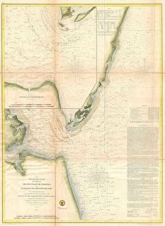
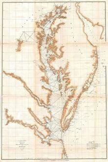
Background imageOld Antique View Collection: 1859 U.S. Coast Survey Chart Or Map Of The Chesapeake Bay

1859 U.S. Coast Survey Chart Or Map Of The Chesapeake Bay
1859, U.S. Coast Survey Chart or Map of the Chesapeake Bay

Background imageOld Antique View Collection: 1859 Delamarche Case Map Of The World Topography

1859 Delamarche Case Map Of The World Topography
1859, Delamarche Case Map of the World

Background imageOld Antique View Collection: 1859 Colton Map Of Arkansas Topography Cartography

1859 Colton Map Of Arkansas Topography Cartography
1859, Colton Map of Arkansas

Background imageOld Antique View Collection: 1858 Dufour Map Of The United States Topography

1858 Dufour Map Of The United States Topography
1858, Dufour Map of the United States

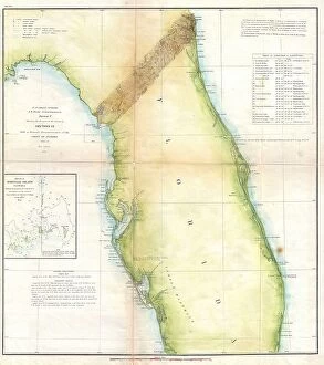
Background imageOld Antique View Collection: 1857 U.S. Coast Survey Map Of Florida Topography

1857 U.S. Coast Survey Map Of Florida Topography
1857, U.S. Coast Survey Map of Florida

Background imageOld Antique View Collection: 1859 U.S. Coast Survey Map Or Nautical Chart Of The Florida Keys And Key West

1859 U.S. Coast Survey Map Or Nautical Chart Of The Florida Keys And Key West
1859, U.S. Coast Survey Map or Nautical Chart of the Florida Keys and Key West

Background imageOld Antique View Collection: 1857 U.S. Coast Survey Map Of New York City And Harbor

1857 U.S. Coast Survey Map Of New York City And Harbor
1857, U.S. Coast Survey Map of New York City and Harbor

Background imageOld Antique View Collection: 1862 Johnson Diagram Of The World Time Zones From Washington

1862 Johnson Diagram Of The World Time Zones From Washington
1862, Johnson Diagram of the World Time Zones from Washington

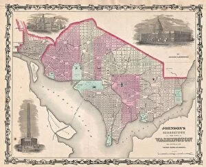
Background imageOld Antique View Collection: 1861 Johnson Map Of Washington D.C. And Georgetown

1861 Johnson Map Of Washington D.C. And Georgetown
1861, Johnson Map of Washington D.C. and Georgetown

Background imageOld Antique View Collection: 1861 Johnson Map Of South America Topography

1861 Johnson Map Of South America Topography
1861, Johnson Map of South America

Background imageOld Antique View Collection: 1861 Johnson Climate Map Of The World W- Tides And Ocean Currents

1861 Johnson Climate Map Of The World W- Tides And Ocean Currents
1861, Johnson Climate Map of the World w- Tides and Ocean Currents

Background imageOld Antique View Collection: 1860 Philips Folding Or Pocket Map Of England And Wales

1860 Philips Folding Or Pocket Map Of England And Wales
1860, Philips Folding or Pocket Map of England and Wales

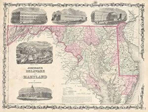
Background imageOld Antique View Collection: 1861 Johnson Map Of Delaware And Maryland Topography

1861 Johnson Map Of Delaware And Maryland Topography
1861, Johnson Map of Delaware and Maryland

Background imageOld Antique View Collection: 1860 Mitchell Map Of Baltimore Topography Cartography

1860 Mitchell Map Of Baltimore Topography Cartography
1860, Mitchell Map of Baltimore

Background imageOld Antique View Collection: 1861 Johnson Map Of Asia Topography Cartography

1861 Johnson Map Of Asia Topography Cartography
1861, Johnson Map of Asia

Background imageOld Antique View Collection: 1859 U.S. Coast Survey Map Of The New England Coa

1859 U.S. Coast Survey Map Of The New England Coa
1859, U.S. Coast Survey Map of the New England Coa

Background imageOld Antique View Collection: 1859 Smith Folding Case Map Of Italy And Switzerland

1859 Smith Folding Case Map Of Italy And Switzerland
1859, Smith Folding Case Map of Italy and Switzerland

Background imageOld Antique View Collection: 1857 U.S. Coast Survey Map Of The Eastern Entrance To Santa Barbara Channel

1857 U.S. Coast Survey Map Of The Eastern Entrance To Santa Barbara Channel
1857, U.S. Coast Survey Map of the Eastern Entrance to Santa Barbara Channel

Background imageOld Antique View Collection: 1860 Blackie Map Of The Cape Of Good Hope Topography

1860 Blackie Map Of The Cape Of Good Hope Topography
1860, Blackie Map of the Cape of Good Hope

Background imageOld Antique View Collection: 1859 U.S. Coast Survey Map Of The Puget Sound And Washington Coast

1859 U.S. Coast Survey Map Of The Puget Sound And Washington Coast
1859, U.S. Coast Survey Map of the Puget Sound and Washington Coast

Background imageOld Antique View Collection: 1859 U.S. Coast Survey Map Of Florida Topography

1859 U.S. Coast Survey Map Of Florida Topography
1859, U.S. Coast Survey Map of Florida

Background imageOld Antique View Collection: 1858 Smith Disturnell Pocket Map Of New York

1858 Smith Disturnell Pocket Map Of New York
1858, Smith, Disturnell Pocket Map of New York

Background imageOld Antique View Collection: 1857 U.S. Coast Survey Map Of The Chesapeake Bay

1857 U.S. Coast Survey Map Of The Chesapeake Bay
1857, U.S. Coast Survey Map of the Chesapeake Bay

Background imageOld Antique View Collection: 1857 Colton Map Of Maine Topography Cartography

1857 Colton Map Of Maine Topography Cartography
1857, Colton Map of Maine

Background imageOld Antique View Collection: 1857 Colton Map Of Canada And Alaska Topography

1857 Colton Map Of Canada And Alaska Topography
1857, Colton Map of Canada and Alaska

Background imageOld Antique View Collection: 1856 Kiepert Map Of Lebanon Topography Cartography

1856 Kiepert Map Of Lebanon Topography Cartography
1856, Kiepert Map of Lebanon

Background imageOld Antique View Collection: 1856 Burritt Huntington Chart Of The Solar System

1856 Burritt Huntington Chart Of The Solar System
1856, Burritt, Huntington Chart of the Solar System

Background imageOld Antique View Collection: 1855 U.S. Coast Survey Nautical Chart Or Map Of The Chesapeake Bay

1855 U.S. Coast Survey Nautical Chart Or Map Of The Chesapeake Bay
1855, U.S. Coast Survey Nautical Chart or Map of the Chesapeake Bay

Background imageOld Antique View Collection: 1855 U.S. Coast Survey Map Of Florida Topography

1855 U.S. Coast Survey Map Of Florida Topography
1855, U.S. Coast survey Map of Florida

Background imageOld Antique View Collection: 1855 U.S. Coast Survey Chart Or Map Of Chesapeake Bay And Delaware Bay

1855 U.S. Coast Survey Chart Or Map Of Chesapeake Bay And Delaware Bay
1855, U.S. Coast Survey Chart or Map of Chesapeake Bay and Delaware Bay

Background imageOld Antique View Collection: 1855 Spruner Map Of The Americas Up To 1776 Topography

1855 Spruner Map Of The Americas Up To 1776 Topography
1855, Spruner Map of the Americas up to 1776

Background imageOld Antique View Collection: 1855 U.S. Coast Survey Chart Or Map Of Chesapeake Bay And Delaware Bay

1855 U.S. Coast Survey Chart Or Map Of Chesapeake Bay And Delaware Bay
1855, U.S. Coast Survey Chart or Map of Chesapeake Bay and Delaware Bay

Background imageOld Antique View Collection: 1855 U.S. Coast Survey Map Of The Chesapeake Bay Entrance

1855 U.S. Coast Survey Map Of The Chesapeake Bay Entrance
1855, U.S. Coast Survey Map of the Chesapeake Bay Entrance

Background imageOld Antique View Collection: 1857 U.S. Coast Survey Chart Or Map Of Chesapeake Bay And Delaware Bay

1857 U.S. Coast Survey Chart Or Map Of Chesapeake Bay And Delaware Bay
1857, U.S. Coast Survey Chart or Map of Chesapeake Bay and Delaware Bay

Background imageOld Antique View Collection: 1855 U.S.C.S. Map Of The Western Coast Of The United States

1855 U.S.C.S. Map Of The Western Coast Of The United States
1855, U.S.C.S. Map of the Western Coast of the United States

Background imageOld Antique View Collection: 1855 U.S. Coast Survey Chart Or Map Of Chesapeake Bay And Delaware Bay

1855 U.S. Coast Survey Chart Or Map Of Chesapeake Bay And Delaware Bay
1855, U.S. Coast Survey Chart or Map of Chesapeake Bay and Delaware Bay

Background imageOld Antique View Collection: 1855 U.S.C.S. Map Or Chart Of Washington And Oregon

1855 U.S.C.S. Map Or Chart Of Washington And Oregon
1855, U.S.C.S. Map or Chart of Washington and Oregon

Background imageOld Antique View Collection: 1857 Dufour Map Of Algeria Topography Cartography

1857 Dufour Map Of Algeria Topography Cartography
1857, Dufour Map of Algeria

Background imageOld Antique View Collection: 1856 Desilver Map Of Northern Italy Topography

1856 Desilver Map Of Northern Italy Topography
1856, Desilver Map of Northern Italy

Background imageOld Antique View Collection: 1857 Colton Map Of Vermont Topography Cartography

1857 Colton Map Of Vermont Topography Cartography
1857, Colton Map of Vermont

Background imageOld Antique View Collection: 1857 Colton Map Of Pennsylvania Topography Cartography

1857 Colton Map Of Pennsylvania Topography Cartography
1857, Colton Map of Pennsylvania


All Professionally Made to Order for Quick Shipping

"Exploring the Past: A Glimpse into Old Antique Views" Step back in time with these captivating antique maps, offering a window into historical landscapes and distant lands. In 1768, James Craig crafted his remarkable Map of New Town, Edinburgh, Scotland. This First Plan of New Town showcases the city's evolution and topography during that era. Travel further back to 1794 when Delisle presented his intricate Map of Southern Ancient Greece, Greek Isles, and Crete. With its detailed depiction of topography, this map reveals the ancient world as it once stood. Take a celestial journey with an 1886 Telescopic View and Map of the Moon. Unveiling lunar topography through cartography and geography, this mesmerizing piece offers insights into our closest neighbor in space. Dating back to 1658, Visscher's Map of North America and South America provides a glimpse into early cartographic endeavors. Explore the vastness of these continents while appreciating their diverse landforms. The Colton Map of Scandinavia from 1855 invites us to discover Norway, Sweden, Finland - countries rich in history and natural beauty. Its meticulous attention to detail showcases both topographical features and geographical nuances. Delve deeper into history with Spruner's 1865 Map of Greece depicting Macedonia and Thrace before the Peloponnesian War. This invaluable resource unveils ancient territories' intricate topographies that shaped civilizations. For those fascinated by urban landscapes, Crutchley's Pocket Map or Plan of London from 1848 is a treasure trove for explorers seeking insight into England's capital city at that time. John Pinkerton presents us with an exquisite glimpse at The British Isles on his renowned map from 1818. Discover England, Scotland & Ireland through Pinkerton’s lens as he captures their unique geographies meticulously. Journey eastward with Colton’s stunningly detailed 1855 Map of Persia, Afghanistan, and Arabia.