Fraud Blocker Skip to main content

Noaa Collection

"NOAA: Unveiling the Beauty and Mystery of Our Blue Marble" Step into a mesmerizing journey as NOAA, the National Oceanic and Atmospheric Administration

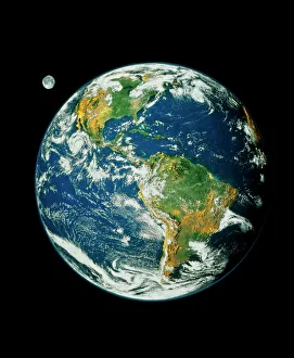
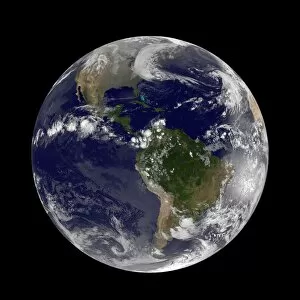
Background imageNoaa Collection: Whole Earth (Blue Marble 2000)

Whole Earth (Blue Marble 2000)
Whole Earth. Composite satellite image of Earth centred on the Americas. This is Blue Marble 2000, one of the most detailed Earth images ever made

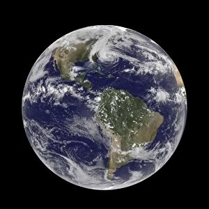
Background imageNoaa Collection: Earth from space, satellite image

Earth from space, satellite image
Earth from space. Satellite image showing North and South America as seen from 35, 000 kilometres above the Earths surface. North is at top and the Moon is at upper right

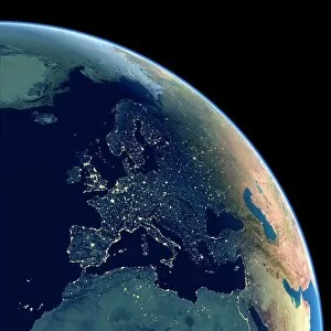
Background imageNoaa Collection: Europe at night, satellite image

Europe at night, satellite image. City lights (yellow) show areas of dense population. There are few lights in North Africa (bottom) and the Arctic (top) since they are more sparsely populated

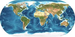
Background imageNoaa Collection: Earth, topographic and bathymetric map

Earth, topographic and bathymetric map. This whole Earth map is centred on the Greenwich meridian, at zero degrees latitude

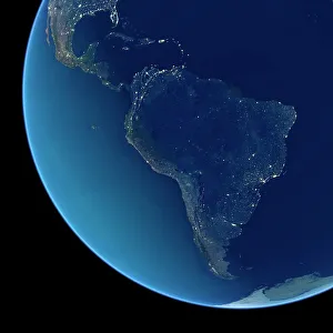
Background imageNoaa Collection: South America at night, satellite image

South America at night, satellite image. City lights (yellow) show areas of dense population, particularly in North America (top left) and South Americas coasts

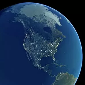
Background imageNoaa Collection: North America at night, satellite image

North America at night, satellite image. City lights (yellow) show areas of dense population, particularly in North America (upper centre)

Background imageNoaa Collection: Earth, topographic and bathymetric map

Earth, topographic and bathymetric map. This map is centred on the Pacific Ocean, at longitude 140 degrees west. Highlands and lowlands of the continents are shown as ridges and flat areas

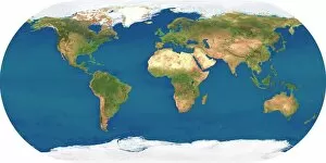
Background imageNoaa Collection: Whole Earth, satellite image

Whole Earth, satellite image. This map is centred on the Greenwich meridian, at zero degrees latitude. Arctic and Antarctic ice is white, oceans are blue and land is green and brown

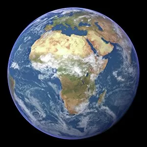
Background imageNoaa Collection: Africa, satellite image

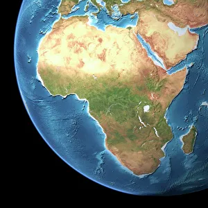
Africa, satellite image
Africa. Satellite image of the Earth centred on Africa. Clouds are white, oceans are blue and land is green and brown. Also seen are Europe (top) Asia (upper right), the Indian Ocean (right)

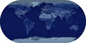
Background imageNoaa Collection: Whole Earth at night, satellite image

Whole Earth at night, satellite image. This map is centred on the Greenwich meridian, at zero degrees latitude. City lights (yellow) show areas of dense population

Background imageNoaa Collection: Africa, topographic map

Africa, topographic map. Highlands and lowlands of the continents are shown as ridges and flat areas. Southern Europe and the Middle East are also seen at top and upper right respectively

Background imageNoaa Collection: Big Blue Marble

Big Blue Marble

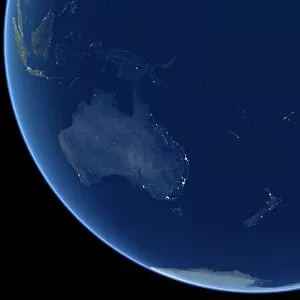
Background imageNoaa Collection: Australia at night, satellite image

Australia at night, satellite image. City lights (yellow) show areas of more dense population, particularly in Southeast Asia (top left) and on Australias east coast

Background imageNoaa Collection: Gulfstream IV N49RF

Gulfstream IV N49RF
NOAA - Gulfstream IV N49RF (msn 1246), operated by NOAA for the US Dept. of Commerce. (NOAA - National Oceanic & Atmospheric Administration) Date: circa 2000

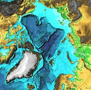
Background imageNoaa Collection: The Arctic, satellite image

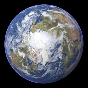
The Arctic, satellite image
The Arctic. Satellite image of the Earth centred on the Arctic. The North Pole is at centre. Clouds and Arctic sea ice are white, oceans are blue and land is green and brown

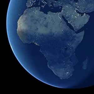
Background imageNoaa Collection: Africa at night, satellite image

Africa at night, satellite image. City lights (yellow) show areas of dense population, particularly in Europe and the Middle East (top)

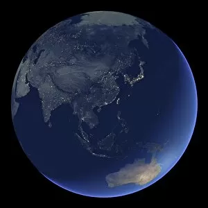
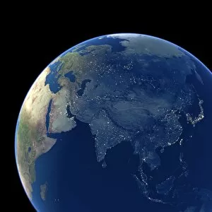
Background imageNoaa Collection: East Asia at night, satellite image

East Asia at night, satellite image
East Asia at night. Satellite image of the Earth at night, centred over China. City lights (yellow) show areas of dense population

Background imageNoaa Collection: January 15, 2003 hydrothermal vents in the Arctic Ocean. On the Gakkel Ridge

January 15, 2003 hydrothermal vents in the Arctic Ocean. On the Gakkel Ridge, which is in the Arctic Ocean between Greenland and Siberia

Background imageNoaa Collection: Satellite thermographic image of the Atlantic Ocean showing coldest areas in Arctic

Satellite thermographic image of the Atlantic Ocean showing coldest areas in Arctic, Antarctic and high Andes as bright orange. National Oceanic and Atmospheric Administration (NOa). Science

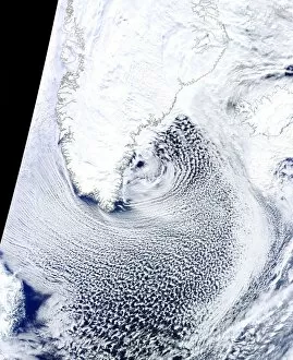
Background imageNoaa Collection: Cloud streets, Greenland, satellite image

Cloud streets, Greenland, satellite image. North is at top, with Greenland and Iceland outlined in black. Cloud streets are parallel lines of clouds aligned with the wind

Background imageNoaa Collection: Hurricane Sandy, 28th October 2012 C014 / 5781

Hurricane Sandy, 28th October 2012 C014 / 5781
Hurricane Sandy. Satellite image of hurricane Sandy off the east coast of the USA (top centre) on 28th October 2012 at 17.45 UTC

Background imageNoaa Collection: Hurricane Sandy, 29th October 2012 C014 / 5782

Hurricane Sandy, 29th October 2012 C014 / 5782
Hurricane Sandy, 29th October 2012

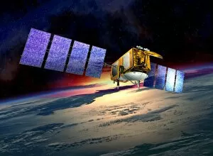
Background imageNoaa Collection: Jason-2 satellite, artwork

Jason-2 satellite, artwork

Background imageNoaa Collection: False-colour IR weather map, Europe & N. Atlantic

False-colour IR weather map, Europe & N. Atlantic
False-colour IR weather map, Europe & N.Atlantic

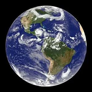
Background imageNoaa Collection: Earth and Hurricane Dean, 20 August 2007

Earth and Hurricane Dean, 20 August 2007
Earth and Hurricane Dean, satellite image. North is at top. Hurricane Dean is the large rotating cloud system (white) at upper left, in the western Caribbean, to the east of Mexico

Background imageNoaa Collection: Asia at night, satellite image

Asia at night, satellite image. City lights (yellow) show areas of dense population. Large, densely populated areas include India (lower centre), China (lower right) and Japan (right)

Background imageNoaa Collection: Arabian Sea, satellite image

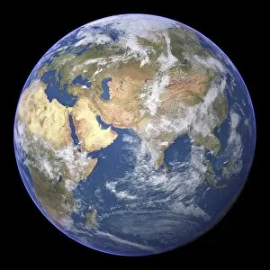
Arabian Sea, satellite image
Arabian Sea. Satellite image of the Earth centred on the Arabian Sea and western India. Clouds and Arctic ice (top) are white, oceans are blue and land is green and brown

Background imageNoaa Collection: The Americas, satellite image

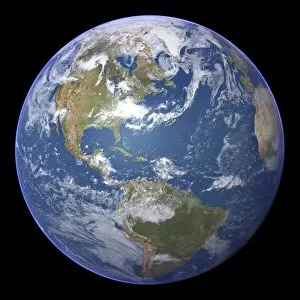
The Americas, satellite image
The Americas. Satellite image of the Earth centred on the Caribbean Islands, with North America at upper left and South America at bottom

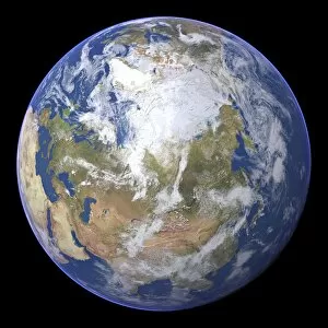
Background imageNoaa Collection: Northern Asia and the Arctic

Northern Asia and the Arctic. Satellite image of the Earth centred on Siberia, with the North Pole at upper centre. Clouds and Arctic sea ice are white, oceans are blue and land is green and brown


All Professionally Made to Order for Quick Shipping

"NOAA: Unveiling the Beauty and Mystery of Our Blue Marble" Step into a mesmerizing journey as NOAA, the National Oceanic and Atmospheric Administration, takes us on an extraordinary exploration of our planet. From Whole Earth (Blue Marble 2000) to stunning satellite images capturing Earth from space, get ready to witness the awe-inspiring wonders that lie beneath our feet. Embark on a visual odyssey with topographic and bathymetric maps showcasing the intricate contours of our landmasses and ocean depths. Marvel at Europe's vibrant nocturnal glow in a captivating satellite image, where cities come alive like constellations against the dark canvas of night. Venturing further south, South America reveals its own enchanting spectacle when illuminated by city lights during nighttime. The vast expanse pulsates with energy as urban centers twinkle amidst nature's grandeur. As we shift focus towards North America at night, behold a tapestry woven by human civilization under starry skies. Witness how cities sprawl across this vast continent while natural landscapes retain their majestic allure even after dusk settles in. Returning to daylight hours, immerse yourself in Africa's breathtaking beauty through vivid satellite imagery. Discover its diverse ecosystems teeming with life – from lush rainforests to expansive deserts – all captured from above. Prepare for an unforgettable sight as NOAA presents us with Whole Earth at night; an ethereal panorama where continents shimmer like celestial bodies suspended in space. Gaze upon this cosmic masterpiece that reminds us of both humanity's interconnectedness and our shared responsibility for preserving this fragile planet we call home. Intricate details are unveiled once more through another striking satellite image of Whole Earth - reminding us just how small yet significant we are within this vast universe surrounding us. Delving deeper into Africa’s terrain via a topographic map allows us to appreciate its geological marvels; mountains rise majestically while rivers carve their paths through ancient landscapes.