
Map Of The World Collection
"Journey through Time: Tracing the Evolution of Our World - From Ancient Babylon to Modern Exploration" Step back in time with an Old Map of the World from 1980


All Professionally Made to Order for Quick Shipping
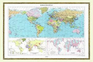
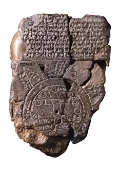
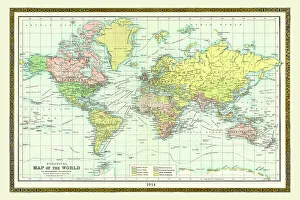
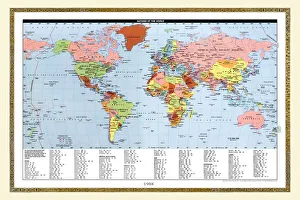
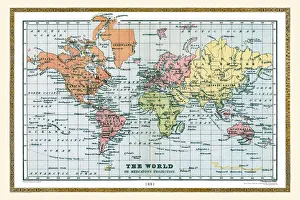
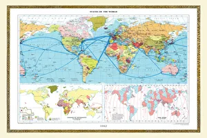
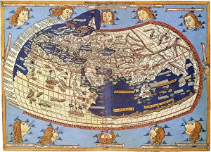
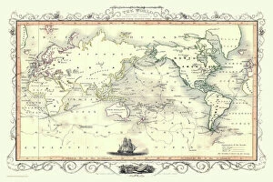
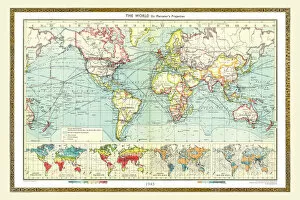
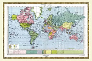
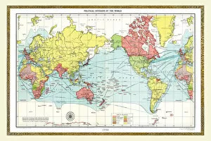
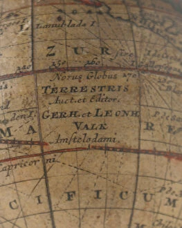
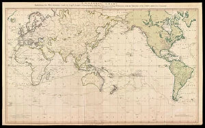
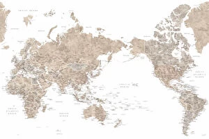
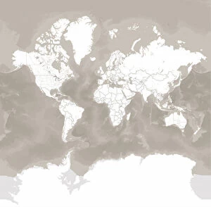
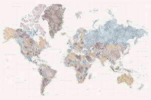
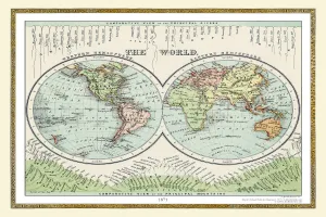
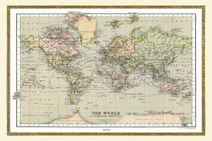
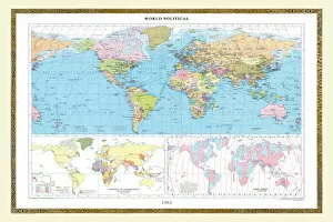
"Journey through Time: Tracing the Evolution of Our World - From Ancient Babylon to Modern Exploration" Step back in time with an Old Map of the World from 1980, revealing a world on the brink of technological advancement. Explore the geopolitical landscape of 1914 through an Old Map of the World, capturing a pivotal moment before World War I reshaped nations. Delve into history as you uncover an Old Map of The World dating all the way back to 1881, offering insights into a bygone era. Marvel at The Babylonian Map of the World, created between c. 510-c. 500 BC by Assyrian Art, showcasing ancient civilizations' understanding of their surroundings. Discover global shifts and boundaries with an Old Map of the World from 1963, reflecting a changing political climate during Cold War tensions. Embark on Captain Cook's voyages depicted on John Tallis' Mercators Projection map from 1851, illustrating exploration that shaped our modern world. Unearth Ptolemy's influential world map from 1467, providing a glimpse into early cartography and ancient geographical knowledge. Witness historical events unfold through an Old Map of the World dated 1945 – witness borders redrawn after WWII and anticipate future changes yet to come. Immerse yourself in Piper's Detailed world map with cities – navigate bustling urban centers and marvel at human civilization's vast reach across continents. Explore Jimmy's rendition - Detailed world map with cities; traverse diverse landscapes while discovering cultural treasures hidden within each cityscape. Travel alongside Abey as his detailed world map with cities unveils interconnectedness amid globalization – see how distance diminishes when cultures converge. Join Idrak on his journey across continents using his detailed world map with cities; experience diversity firsthand as you explore vibrant metropolises around the globe.