Fraud Blocker Skip to main content

Longitude Collection (page 54)

"Exploring the World through Longitude: From Ancient Maps to Lunar Landscapes" Step back in time to 1768, when James Craig unveiled his Map of New Town, Edinburgh

Background imageLongitude Collection: 1877, Mitchell Map of Arizona and New Mexico, topography, cartography, geography

1877, Mitchell Map of Arizona and New Mexico, topography, cartography, geography
1877, Mitchell Map of Arizona and New Mexico

Background imageLongitude Collection: 1875, Meiji 8 Japanese Wall Map of Japan, topography, cartography, geography, land

1875, Meiji 8 Japanese Wall Map of Japan, topography, cartography, geography, land
1875, Meiji 8 Japanese Wall Map of Japan

Background imageLongitude Collection: 1874, U. S. Coast Survey Map of the Mississippi Delta, topography, cartography, geography

1874, U. S. Coast Survey Map of the Mississippi Delta, topography, cartography, geography
1874, U.S. Coast Survey Map of the Mississippi Delta

Background imageLongitude Collection: 1875, U. S. Coast Survey Chart or Map of the Carolina Coast, topography, cartography

1875, U. S. Coast Survey Chart or Map of the Carolina Coast, topography, cartography
1875, U.S. Coast Survey Chart or Map of the Carolina Coast

Background imageLongitude Collection: 1875, Gray Map of Washington and Oregon, topography, cartography, geography, land

1875, Gray Map of Washington and Oregon, topography, cartography, geography, land
1875, Gray Map of Washington and Oregon

Background imageLongitude Collection: 1874, Johnson Map of Missouri and Kansas, topography, cartography, geography, land

1874, Johnson Map of Missouri and Kansas, topography, cartography, geography, land
1874, Johnson Map of Missouri and Kansas

Background imageLongitude Collection: 1874, Mitchell Map of Pennsylvania, topography, cartography, geography, land, illustration

1874, Mitchell Map of Pennsylvania, topography, cartography, geography, land, illustration
1874, Mitchell Map of Pennsylvania

Background imageLongitude Collection: 1874, Mitchell Map of Russia, topography, cartography, geography, land, illustration

1874, Mitchell Map of Russia, topography, cartography, geography, land, illustration
1874, Mitchell Map of Russia

Background imageLongitude Collection: 1874, Mitchell Map of Iowa and Missouri, topography, cartography, geography, land

1874, Mitchell Map of Iowa and Missouri, topography, cartography, geography, land
1874, Mitchell Map of Iowa and Missouri

Background imageLongitude Collection: 1874, Mitchell Map of Vermont and New Hampshire, topography, cartography, geography

1874, Mitchell Map of Vermont and New Hampshire, topography, cartography, geography
1874, Mitchell Map of Vermont and New Hampshire

Background imageLongitude Collection: 1874, Ludlow and Custer Map of The Black Hills, topography, cartography, geography

1874, Ludlow and Custer Map of The Black Hills, topography, cartography, geography
1874, Ludlow and Custer Map of The Black Hills

Background imageLongitude Collection: 1874, Gray Map of North Carolina, topography, cartography, geography, land, illustration

1874, Gray Map of North Carolina, topography, cartography, geography, land, illustration
1874, Gray Map of North Carolina

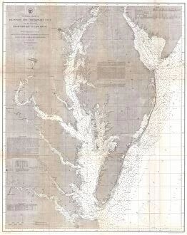
Background imageLongitude Collection: 1873, U. S. Coast Survey Chart or Map of the Chesapeake Bay and Delaware Bay, topography

1873, U. S. Coast Survey Chart or Map of the Chesapeake Bay and Delaware Bay, topography
1873, U.S. Coast Survey Chart or Map of the Chesapeake Bay and Delaware Bay

Background imageLongitude Collection: 1873, U. S. Coast Survey Map of the Delta of the Mississippi River, topography, cartography

1873, U. S. Coast Survey Map of the Delta of the Mississippi River, topography, cartography
1873, U.S. Coast Survey Map of the Delta of the Mississippi River

Background imageLongitude Collection: 1873, Gray Railroad Map of Minnesota and Iowa, topography, cartography, geography

1873, Gray Railroad Map of Minnesota and Iowa, topography, cartography, geography
1873, Gray Railroad Map of Minnesota and Iowa

Background imageLongitude Collection: 1873, U. S. Coast Survey Chart or Map of the Carolina Coast, topography, cartography

1873, U. S. Coast Survey Chart or Map of the Carolina Coast, topography, cartography
1873, U.S. Coast Survey Chart or Map of the Carolina Coast

Background imageLongitude Collection: 1873, Beers Map of New York State, topography, cartography, geography, land, illustration

1873, Beers Map of New York State, topography, cartography, geography, land, illustration
1873, Beers Map of New York State

Background imageLongitude Collection: 1873, Colton Map of the Arctic or North Pole, topography, cartography, geography

1873, Colton Map of the Arctic or North Pole, topography, cartography, geography
1873, Colton Map of the Arctic or North Pole

Background imageLongitude Collection: 1873, U. S. Coast Survey Chart or Map of New Jersey and the Delaware Bay, topography

1873, U. S. Coast Survey Chart or Map of New Jersey and the Delaware Bay, topography
1873, U.S. Coast Survey Chart or Map of New Jersey and the Delaware Bay

Background imageLongitude Collection: 1872, Mitchell Map of Cuba and the Bahamas, topography, cartography, geography, land

1872, Mitchell Map of Cuba and the Bahamas, topography, cartography, geography, land
1872, Mitchell Map of Cuba and the Bahamas

Background imageLongitude Collection: 1873, A. and C. Black Map or Chart of the Solar System, topography, cartography, geography

1873, A. and C. Black Map or Chart of the Solar System, topography, cartography, geography
1873, A. and C. Black Map or Chart of the Solar System

Background imageLongitude Collection: 1873, Beers Map of New York City, topography, cartography, geography, land, illustration

1873, Beers Map of New York City, topography, cartography, geography, land, illustration
1873, Beers Map of New York City

Background imageLongitude Collection: 1872, Mitchell Map of Utah and Nevada, topography, cartography, geography, land, illustration

1872, Mitchell Map of Utah and Nevada, topography, cartography, geography, land, illustration
1872, Mitchell Map of Utah and Nevada

Background imageLongitude Collection: 1872, Walling Map of Washington and Oregon, topography, cartography, geography, land

1872, Walling Map of Washington and Oregon, topography, cartography, geography, land
1872, Walling Map of Washington and Oregon

Background imageLongitude Collection: 1872, Mitchell Map of California w- San Francisco Inset, topography, cartography

1872, Mitchell Map of California w- San Francisco Inset, topography, cartography
1872, Mitchell Map of California w- San Francisco Inset

Background imageLongitude Collection: 1872, Colton Map of the North Pole or Arctic, topography, cartography, geography

1872, Colton Map of the North Pole or Arctic, topography, cartography, geography
1872, Colton Map of the North Pole or Arctic

Background imageLongitude Collection: 1864, Johnson Map of Florida, topography, cartography, geography, land, illustration

1864, Johnson Map of Florida, topography, cartography, geography, land, illustration
1864, Johnson Map of Florida

Background imageLongitude Collection: 1872, Colton Map of Antarctica or the South Pole, topography, cartography, geography

1872, Colton Map of Antarctica or the South Pole, topography, cartography, geography
1872, Colton Map of Antarctica or the South Pole

Background imageLongitude Collection: 1870, Johnson Map of the World showing Temperature and Ocean Currents, topography

1870, Johnson Map of the World showing Temperature and Ocean Currents, topography
1870, Johnson Map of the World showing Temperature and Ocean Currents

Background imageLongitude Collection: 1871, Hardy Map of New York City Fire Departments, topography, cartography, geography

1871, Hardy Map of New York City Fire Departments, topography, cartography, geography
1871, Hardy Map of New York City Fire Departments

Background imageLongitude Collection: 1870, Baur and Bromme Map of the World on Mercator Projection, topography, cartography

1870, Baur and Bromme Map of the World on Mercator Projection, topography, cartography
1870, Baur and Bromme Map of the World on Mercator Projection

Background imageLongitude Collection: 1870, Johnson Map of South America, topography, cartography, geography, land, illustration

1870, Johnson Map of South America, topography, cartography, geography, land, illustration
1870, Johnson Map of South America

Background imageLongitude Collection: 1870, U. S. Coast Survey Map Showing Magnetic Declination in the United States, topography

1870, U. S. Coast Survey Map Showing Magnetic Declination in the United States, topography
1870, U.S. Coast Survey Map Showing Magnetic Declination in the United States

Background imageLongitude Collection: 1870, Brue and Levasseur Pocket Map of Italy, topography, cartography, geography

1870, Brue and Levasseur Pocket Map of Italy, topography, cartography, geography
1870, Brue and Levasseur Pocket Map of Italy

Background imageLongitude Collection: 1869, U. S. Coast Survey Map of the San Francisco Peninsula, topography, cartography

1869, U. S. Coast Survey Map of the San Francisco Peninsula, topography, cartography
1869, U.S. Coast Survey Map of the San Francisco Peninsula

Background imageLongitude Collection: 1870, Colton Pocket Map of Texas, topography, cartography, geography, land, illustration

1870, Colton Pocket Map of Texas, topography, cartography, geography, land, illustration
1870, Colton Pocket Map of Texas

Background imageLongitude Collection: 1869, U. S. C. S. Map of the San Francisco Peninsula, topography, cartography, geography

1869, U. S. C. S. Map of the San Francisco Peninsula, topography, cartography, geography
1869, U.S.C.S. Map of the San Francisco Peninsula

Background imageLongitude Collection: 1869, Kitchen Shannon Map of New York City, topography, cartography, geography, land

1869, Kitchen Shannon Map of New York City, topography, cartography, geography, land
1869, Kitchen Shannon Map of New York City

Background imageLongitude Collection: 1867, Mitchell Map of the United States, topography, cartography, geography, land

1867, Mitchell Map of the United States, topography, cartography, geography, land
1867, Mitchell Map of the United States

Background imageLongitude Collection: 1868, Colton Map of New Jersey, topography, cartography, geography, land, illustration

1868, Colton Map of New Jersey, topography, cartography, geography, land, illustration
1868, Colton Map of New Jersey

Background imageLongitude Collection: 1867, Mitchell Map of New York State, topography, cartography, geography, land, illustration

1867, Mitchell Map of New York State, topography, cartography, geography, land, illustration
1867, Mitchell Map of New York State

Background imageLongitude Collection: 1867, Johnson Map of Asia, topography, cartography, geography, land, illustration

1867, Johnson Map of Asia, topography, cartography, geography, land, illustration
1867, Johnson Map of Asia

Background imageLongitude Collection: 1867, Johnson Map of England and Wales, topography, cartography, geography, land

1867, Johnson Map of England and Wales, topography, cartography, geography, land
1867, Johnson Map of England and Wales

Background imageLongitude Collection: 1867, Mitchell Map of Pennsylvania, topography, cartography, geography, land, illustration

1867, Mitchell Map of Pennsylvania, topography, cartography, geography, land, illustration
1867, Mitchell Map of Pennsylvania

Background imageLongitude Collection: 1867, Colton Pocket Map of New York City and Brooklyn, topography, cartography, geography

1867, Colton Pocket Map of New York City and Brooklyn, topography, cartography, geography
1867, Colton Pocket Map of New York City and Brooklyn

Background imageLongitude Collection: 1866, U. S. Coast Survey Nautical Chart of Map of New York City and Harbor, topography

1866, U. S. Coast Survey Nautical Chart of Map of New York City and Harbor, topography
1866, U.S. Coast Survey Nautical Chart of Map of New York City and Harbor

Background imageLongitude Collection: 1866, U. S. Coast Survey Map of the Chesapeake Bay and Delaware Bay, topography, cartography

1866, U. S. Coast Survey Map of the Chesapeake Bay and Delaware Bay, topography, cartography
1866, U.S. Coast Survey Map of the Chesapeake Bay and Delaware Bay

Background imageLongitude Collection: 1866, U. S. Coast Survey Chart or Map of the Mississippi Sound, Western Part, topography

1866, U. S. Coast Survey Chart or Map of the Mississippi Sound, Western Part, topography
1866, U.S. Coast Survey Chart or Map of the Mississippi Sound, Western Part


All Professionally Made to Order for Quick Shipping

"Exploring the World through Longitude: From Ancient Maps to Lunar Landscapes" Step back in time to 1768, when James Craig unveiled his Map of New Town, Edinburgh, Scotland. This meticulously detailed map showcased the topography of this emerging city and provided a glimpse into its future. Fast forward to 1794, where Delisle's Map of Southern Ancient Greece takes us on a journey through the Greek Isles and Crete. With its intricate depiction of topography, this map offers a window into the ancient world. In 1886, we turn our gaze towards the heavens with a Telescopic View and Map of the Moon. Combining cartography and geography with lunar exploration, this extraordinary piece reveals not only the moon's topography but also humanity's relentless pursuit of knowledge. Venturing further south brings us to Costa Rica Vector Map - an ode to modern cartography that showcases this Central American gem in all its geographical glory. Traveling eastward lands us in Russia as we admire an Antique Map from centuries ago. This historical artifact allows us to trace Russia's past while marveling at how far cartographic techniques have come since then. Returning even further back in time is Ptolemy's iconic Map of the World from around AD 150. Created by Claudius Ptolemy himself, it represents one man's attempt to capture Earth's vastness within parchment boundaries. Leaping ahead several millennia brings us face-to-face with a spacecraft on the Moon - accompanied by a lunar map. Here we witness mankind pushing boundaries once again as we explore new frontiers beyond our own planet. But longitude isn't just about maps; it also encompasses timekeeping precision. Enter Harrison’s First Chronometer - an invention that revolutionized navigation by accurately measuring longitude at sea for sailors worldwide. Turning our attention westward now leads us to Visscher’s 1658 Map of North America and South America.