Fraud Blocker Skip to main content

Land Collection (page 8)

"Land: A Tapestry of Stories and Legends" From the vast plains of Africa to the ancient forests of Norse mythology, land holds tales that transcend time

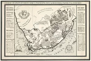
Background imageLand Collection: A Map of the Union of South Africa, 1931 (colour litho)

A Map of the Union of South Africa, 1931 (colour litho)
1198400 A Map of the Union of South Africa, 1931 (colour litho) by Gill, Leslie MacDonald (Max) (1884-1947); 102x153 cm; Private Collection; (add.info.: Gill)

Background imageLand Collection: view of the town of Cardigan, Wales

view of the town of Cardigan, Wales
Vintage 19th century photograph - view of the town of Cardigan, Wales

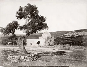
Background imageLand Collection: c. 1900 Holy Land, Palestine, Israel - tomb of Rachel

c. 1900 Holy Land, Palestine, Israel - tomb of Rachel
c.1900 Holy Land, Palestine, Israel - tomb of Rachel

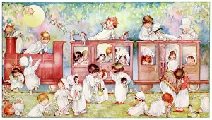
Background imageLand Collection: Fairyland Express, All Aboard for the Land of Nod

Fairyland Express, All Aboard for the Land of Nod
Toddlers in white nightgowns board a train to the Land of Nod, accompanied by various toys as bedtime companions. Date: 1924

Background imageLand Collection: Crab varieties

Crab varieties
Purple land crab, Gecarcinus ruricola 1, hermit crab, Paguristes eremita 2, sea hermit crab, Pagurus bernhardus 3, and sand crab, Cancer arenarius 4

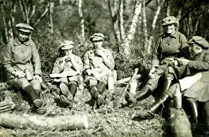
Background imageLand Collection: Lumber Jills, Land Girls in Devon, WW1

Lumber Jills, Land Girls in Devon, WW1
Lumber Jills, Land Girls in breeches, leggings and hobnailed boots, doing forestry work in Devon during the First World War. 1914-1918

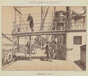
Background imageLand Collection: SS 'Orizaba'and SS 'Oroya', Promenade Deck (litho)

SS "Orizaba"and SS "Oroya", Promenade Deck (litho)
3651324 SS " Orizaba" and SS " Oroya", Promenade Deck (litho) by English School, (19th century); Private Collection; (add.info.: SS " Orizaba" and SS " Oroya")

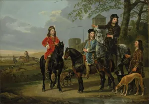
Background imageLand Collection: Equestrian Portrait of Cornelis and Michiel Pompe van Meerdervoort with their Tutor

Equestrian Portrait of Cornelis and Michiel Pompe van Meerdervoort with their Tutor
3493006 Equestrian Portrait of Cornelis and Michiel Pompe van Meerdervoort with their Tutor and Coachman, Starting for the Hunt, c.1652-53 (oil on canvas) by Cuyp

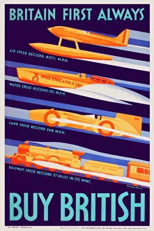
Background imageLand Collection: Patriotic poster, Buy British - Britain Always First

Patriotic poster, Buy British - Britain Always First
Britain Always First - poster celebrating Britihs achievements in breaking speed records on land, water, air and rail. Part of a government campaign to tackle a balance of payments crisis

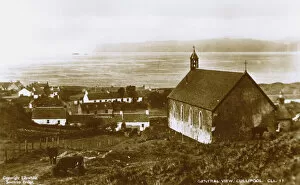
Background imageLand Collection: General view of Cullipool, Isle of Luing, Scotland

General view of Cullipool, Isle of Luing, Scotland. Date: circa 1920

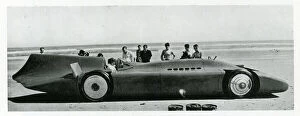
Background imageLand Collection: Sir Malcolm Campbells Blue Bird, Bonneville, Utah, USA

Sir Malcolm Campbells Blue Bird, Bonneville, Utah, USA
Sir Malcolm Campbells Blue Bird at Bonneville Salt Flats, Utah, USA, for the World Land Speed Record 1935. 1935

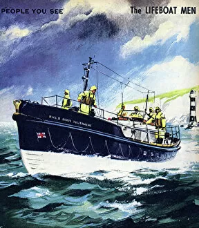
Background imageLand Collection: The Lifeboat Men

The Lifeboat Men. People You See, from Teddy Bear magazine, 1966. Date: 1966

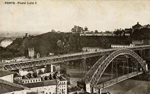
Background imageLand Collection: Dom Luis I Bridge, River Douro, Porto, northern Portugal

Dom Luis I Bridge, River Douro, Porto, northern Portugal
Dom Luis I Bridge over the River Douro, Porto, northern Portugal, opened in 1886. circa 1910

Background imageLand Collection: I saw a ship a-sailing

I saw a ship a-sailing - Traditional nursery rhyme. From The Land of Nursery Rhyme published by JM Dent Date: 1930
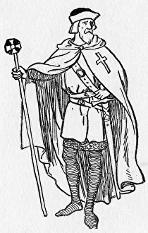
Background imageLand Collection: A knight who guarded The Holy Sepulchre

A knight who guarded The Holy Sepulchre in Jerusalem after the city was captured during the Crusades. 12th century
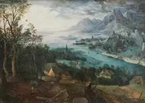
Background imageLand Collection: The Parable of the Sower, 1557 (oil on panel)

The Parable of the Sower, 1557 (oil on panel)
TMK282578 The Parable of the Sower, 1557 (oil on panel) by Bruegel, Pieter the Elder (c.1525-69); 73.7x102.9 cm; The Putnam Foundation, Timken Museum of Art, San Diego

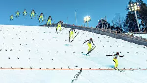
Background imageLand Collection: Anatomy of a Ski Jump

Anatomy of a Ski Jump
Petri Damstén

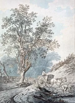
Background imageLand Collection: Cart and Horse, 18th Century. Creator: Joseph Constantine Stadler (fl. 1780-1812)

Cart and Horse, 18th Century. Creator: Joseph Constantine Stadler (fl. 1780-1812)
Cart and Horse 18th Century (soft ground etching)

Background imageLand Collection: Ploughed fields (The furrows), 1888. Artist: Gogh, Vincent, van (1853-1890)

Ploughed fields (The furrows), 1888. Artist: Gogh, Vincent, van (1853-1890)
Ploughed fields (The furrows), 1888. Found in the collection of the Van Gogh Museum, Amsterdam

Background imageLand Collection: Sea and land, Inner Hebrides, Scotland

Sea and land, Inner Hebrides, Scotland
Land and sea view in the Inner Hebrides off the west coast of Scotland. circa 1967

Background imageLand Collection: Bellaghy from the Shieling Hill

Bellaghy from the Shieling Hill - a view of Bellaghy in the distance over rural land. (Location: Northern Ireland; County Londonderry; Bellaghy). Date: circa early 1900s

Background imageLand Collection: Ladies of the Land - Society Workers on a model farm, WW1

Ladies of the Land - Society Workers on a model farm, WW1
A model farm at West Malvern where girls of the higher social classes are trained in the practical work and theory of dairying, including cheese-making, poultry culture, goat-keeping, and so

Background imageLand Collection: In No Mans Land

In No Mans Land
" In No Mans Land: The Dread Territory Which Belongs to Neither German nor Briton" Royal engineers, working in the dark of No Mans Land to construct barbed wire barriers in front of British

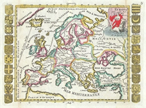
Background imageLand Collection: 1706, De La Feuille Map of Europe, topography, cartography, geography, land, illustration

1706, De La Feuille Map of Europe, topography, cartography, geography, land, illustration
1706, De La Feuille Map of Europe

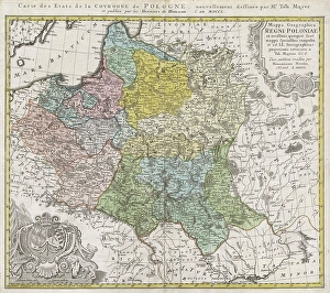
Background imageLand Collection: 1750, Homann Heirs Map of Poland, topography, cartography, geography, land, illustration

1750, Homann Heirs Map of Poland, topography, cartography, geography, land, illustration
1750, Homann Heirs Map of Poland

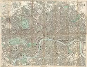
Background imageLand Collection: 1890, Bacon Travelers Pocket Map of London, England, topography, cartography

1890, Bacon Travelers Pocket Map of London, England, topography, cartography
1890, Bacon Travelers Pocket Map of London, England

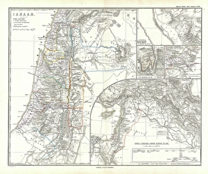
Background imageLand Collection: 1865, Spruner Map of Israel, Canaan, or Palestine in Ancient Times, topography, cartography

1865, Spruner Map of Israel, Canaan, or Palestine in Ancient Times, topography, cartography
1865, Spruner Map of Israel, Canaan, or Palestine in Ancient Times

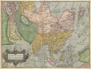
Background imageLand Collection: 1570, Ortelius Map of Asia, first edition, Abraham Ortelius, also Orthellius, 1527 - 1598

1570, Ortelius Map of Asia, first edition, Abraham Ortelius, also Orthellius, 1527 - 1598, Flemish, Netherlandish cartographer and geographer

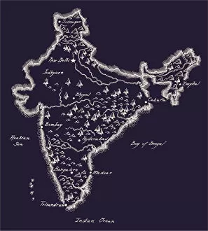
Background imageLand Collection: Antique India Map

Antique India Map
India Map, - Antique style. Includes mountains and water bodies. High detail - vector illustration

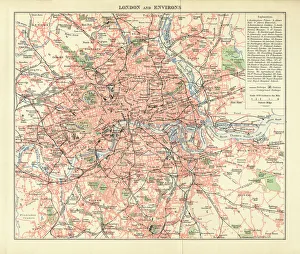
Background imageLand Collection: London and Environs Historical Map, Engraving, 1892

London and Environs Historical Map, Engraving, 1892
Very rare, beautifully detailed engraving of London and Environs Historical Map, Engraving, Published in 1892. Original edition from my own archives. Copyright has expired on this artwork

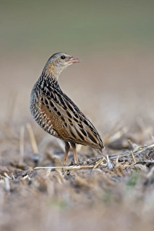
Background imageLand Collection: Corncrake -Crex crex-, listenting to a rivals song, Middle Elbe region, Saxony-Anhalt, Germany

Corncrake -Crex crex-, listenting to a rivals song, Middle Elbe region, Saxony-Anhalt, Germany

Background imageLand Collection: SEA MONSTERS, 1550. Sea monsters inhabiting the north Atlantic and animals found

SEA MONSTERS, 1550. Sea monsters inhabiting the north Atlantic and animals found in northern lands. Woodcut from Sebastian Munsters Cosmographia, Basle, 1550

Background imageLand Collection: USA, Idaho, Double rainbow over landscape

USA, Idaho, Double rainbow over landscape (Large format sizes available)

Background imageLand Collection: Range Rover Sport

Range Rover Sport

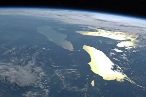
Background imageLand Collection: The Great Lakes, ISS image C016 / 3870

The Great Lakes, ISS image C016 / 3870
The Great Lakes. View from the International Space Station (ISS) of the Great Lakes of the USA and Canada. North is towards upper right. Here, the ISS is over a point to the southeast of Nova Scotia

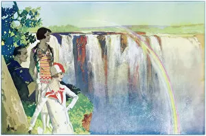
Background imageLand Collection: A Land Of Sunshine

A Land Of Sunshine
The Victoria Falls on the Zambesi River, South Africa, have been described by many travellers as The Eighth Wonder of the World

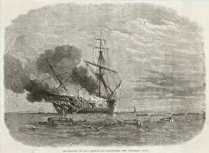
Background imageLand Collection: BOMBAY WRECK

BOMBAY WRECK
When HMS Bombay catches fire off Montevideo, her crew and complement take to the boats : fortunately land is not far off, and the sea is calm

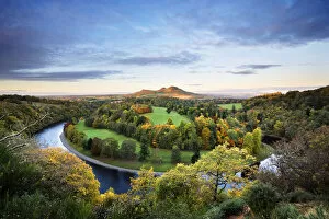
Background imageLand Collection: Overview of River Tweed, Eildon Hills, Scottish Borders, Scotland

Overview of River Tweed, Eildon Hills, Scottish Borders, Scotland

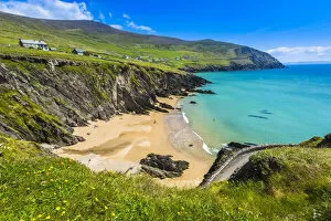
Background imageLand Collection: Scenic, coastal overview, Slea Head, Slea Head Drive, Dingle Peninsula, County Kerry, Ireland

Scenic, coastal overview, Slea Head, Slea Head Drive, Dingle Peninsula, County Kerry, Ireland

Background imageLand Collection: Contract of sale

Contract of sale. The clergyman Bruno sell to Sentefred several lands. Parchment with visigothic writing. 815. From Sant Pere de Codinet Monastery. Chapter Archive. Seu d Urgell. Catalonia. Spain

Background imageLand Collection: Factors governing an invasion by G. H. Davis

Factors governing an invasion by G. H. Davis
The situation of Britain face to face with a German north-west Europe: factors governing an invasion during the Second World War

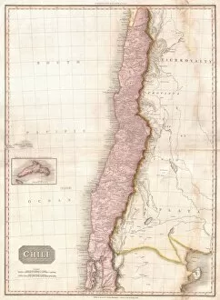
Background imageLand Collection: 1818, Pinkerton Map of Chile, John Pinkerton, 1758 - 1826, Scottish antiquarian, cartographer

1818, Pinkerton Map of Chile, John Pinkerton, 1758 - 1826, Scottish antiquarian, cartographer, UK

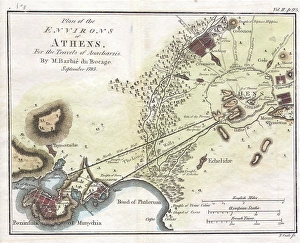
Background imageLand Collection: 1784, Bocage Map of the City of Athens in Ancient Greece, topography, cartography

1784, Bocage Map of the City of Athens in Ancient Greece, topography, cartography
1784, Bocage Map of the City of Athens in Ancient Greece

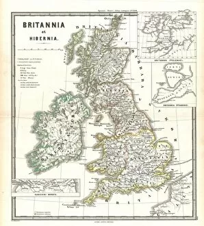
Background imageLand Collection: 1865, Spruner Map of the British Isles, England, Scotland, Ireland, topography, cartography

1865, Spruner Map of the British Isles, England, Scotland, Ireland, topography, cartography
1865, Spruner Map of the British Isles, England, Scotland, Ireland

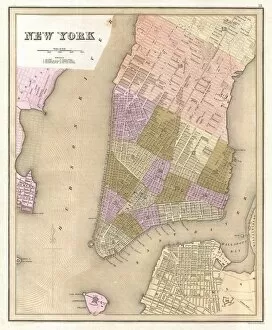
Background imageLand Collection: 1839, Bradford Map of New York City, New York, topography, cartography, geography

1839, Bradford Map of New York City, New York, topography, cartography, geography
1839, Bradford Map of New York City, New York

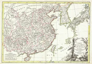
Background imageLand Collection: 1770, Bonne Map of China, Korea, Japan and Formosa, Rigobert Bonne 1727 - 1794, one

1770, Bonne Map of China, Korea, Japan and Formosa, Rigobert Bonne 1727 - 1794, one of the most important cartographers of the late 18th century

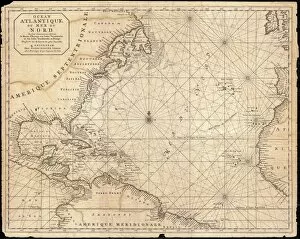
Background imageLand Collection: 1683, Mortier Map of North America, the West Indies, and the Atlantic Ocean, topography

1683, Mortier Map of North America, the West Indies, and the Atlantic Ocean, topography
1683, Mortier Map of North America, the West Indies, and the Atlantic Ocean


All Professionally Made to Order for Quick Shipping

"Land: A Tapestry of Stories and Legends" From the vast plains of Africa to the ancient forests of Norse mythology, land holds tales that transcend time, and is a canvas upon which history, culture, and human resilience are painted. In the political map of Africa, borders define nations but fail to capture the rich tapestry of diversity within its lands. Each region carries stories etched in its soil - from tribal traditions to struggles for independence. The Iroquois creation myth introduces us to Sky Woman, whose descent from above brought forth life on Earth. Her story reminds us that land is not merely a physical entity but also a sacred space intertwined with spirituality. Yggdrasil, the Tree of Life in Norse mythology, stands tall as an emblematic representation of interconnectedness between realms. Its roots delve deep into the earth's core while branches reach towards celestial heights - reminding us that all life stems from this shared ground. Amidst the chaos and devastation of World War I, a momentary respite emerged during the Christmas Truce in 1914. Soldiers laid down their weapons on foreign soil and celebrated together - proving that even amidst conflict, humanity can find solace in our collective connection to land. Australia's map showcases diverse landscapes; from arid deserts to lush rainforests teeming with unique flora and fauna. This continent bears witness to millions of years' worth continental drifts shaping its terrain - a testament to nature's ever-evolving dance with time. The Royal Logistic Corps embodies how land serves as both protector and provider. From supplying troops on distant battlefields to aiding disaster-stricken regions worldwide, they exemplify how our relationship with land extends beyond boundaries or borders. Ceylon's tea industry plantations paint vivid scenes across its map - showcasing laborers working tirelessly amidst rolling hills covered in emerald green leaves. These plantations stand as testaments to human ingenuity harnessing the land's resources to create livelihoods and cultivate a beloved beverage.