
John Bartholomew Son Ltd Collection
"John Bartholomew & Son Ltd: Mapping the World's History" Step into the past with John Bartholomew & Son Ltd


All Professionally Made to Order for Quick Shipping
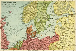
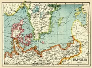
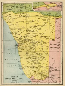
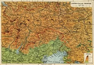
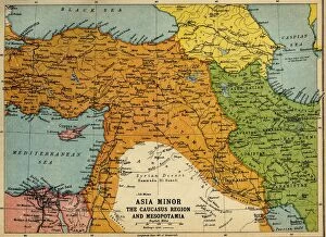
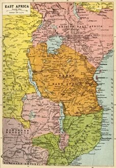
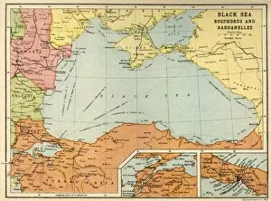
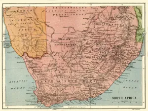
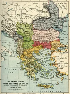
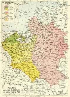
"John Bartholomew & Son Ltd: Mapping the World's History" Step into the past with John Bartholomew & Son Ltd, a renowned cartographic company that left an indelible mark on history. Through their meticulous craftsmanship, they brought to life maps that captured pivotal moments in time. In 1914, amidst the chaos of World War I, John Bartholomew & Son unveiled their masterpiece - "Map of the North Sea and the Baltic. " This intricately detailed creation provided invaluable insights into naval strategies during this tumultuous period. As conflict raged on, another gem emerged from their workshop - "The Baltic Sea and Its Approaches. " Crafted in 1915, this map shed light on crucial battlefronts and helped shape military tactics throughout the war. Expanding their reach beyond Europe's borders, John Bartholomew & Son delved into Africa. Their "Political Map of Africa" (1914) became a beacon of knowledge for explorers and diplomats alike as they navigated through vast landscapes teeming with diversity. No corner of the globe was left untouched by these visionary cartographers. From Asia Minor to Mesopotamia, their maps chronicled key regions embroiled in World War I. The meticulously crafted "Asia Minor, Caucasus Region and Mesopotamia" (c1915) offered invaluable insight into these complex theaters of war. But it wasn't solely about conflict; John Bartholomew & Son also played a vital role in documenting post-war territories. Their work on "The Balkan States After the Wars of 1912-13" (c1920) showcased how borders shifted following intense struggles for independence and power. Their dedication extended even further back in time with maps like "Poland and the Partitions of 1772, 1793 & 1795.