
Jg Bartholomew Collection
John Bartholomew & Son, a renowned cartography company, left an indelible mark on the world with their meticulously crafted maps


All Professionally Made to Order for Quick Shipping
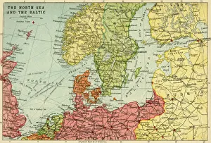
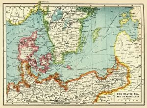
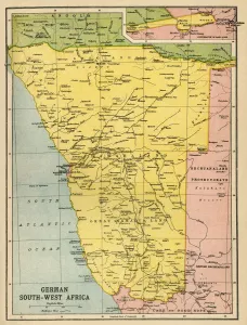
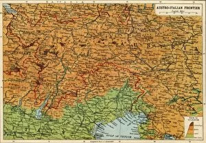
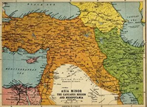
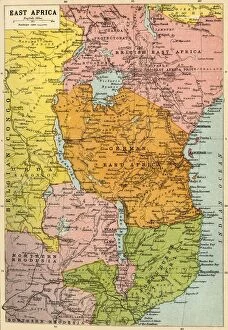
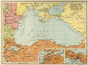
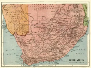
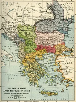
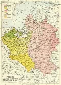
John Bartholomew & Son, a renowned cartography company, left an indelible mark on the world with their meticulously crafted maps. Their map of the North Sea and Baltic in 1914 provides a glimpse into the geopolitical landscape during that time, while their map of German South West Africa sheds light on the First World War. The intricate details captured in their maps are truly awe-inspiring. One cannot help but be captivated by Bartholomew's political map of Africa from 1914. It serves as a testament to their dedication and expertise in accurately representing vast territories. Similarly, their map of Austria-Hungary and its neighboring lands showcases not only geographical boundaries but also historical significance. In times of conflict, Bartholomew's maps played an invaluable role in understanding complex situations. Their depiction of Asia Minor, Caucasus Region, and Mesopotamia during the First World War offers insight into these war-torn regions. Additionally, their East Africa map highlights another theater where battles unfolded. The Black Sea: Bosphorus and Dardanelles map is a masterpiece that captures the strategic importance of these waterways during this era. Meanwhile, Bartholomew's Map of South Africa presents us with an opportunity to explore this diverse land before it underwent significant changes. The Balkan States After the Wars of 1912-13 is yet another example showcasing how John Bartholomew & Son chronicled history through cartography. Finally, Poland and its partitions from 1772 to 1795 remind us that borders have always been subject to change throughout history. Through each creation attributed to John Bartholomew & Son emerges a narrative woven within lines and colors—a story waiting for curious minds to unravel.