Fraud Blocker Skip to main content

Irish Sea Collection

The Irish Sea: A Tapestry of Beauty and History Gazing down from space, the Irish Sea reveals its enchanting allure as it shimmers under the night sky

Background imageIrish Sea Collection: Dalkey Island With Rainbow, Dublin, Ireland

Dalkey Island With Rainbow, Dublin, Ireland

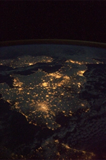
Background imageIrish Sea Collection: UK at night from space

UK at night from space
UK at night, as seen from the International Space Station (ISS). City lights (yellow) show areas of dense population. France is at bottom. Image taken on 24th December 2010

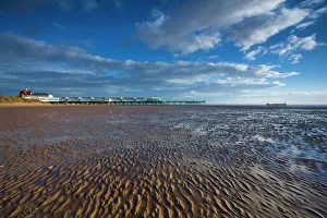
Background imageIrish Sea Collection: England, Lancashire, Lytham St Annes

England, Lancashire, Lytham St Annes. Lytham St Annes pier located near Blackpool, on the Irish Sea Coast

Background imageIrish Sea Collection: Baily lighthouse, Howth, County Dublin, Ireland, Europe

Baily lighthouse, Howth, County Dublin, Ireland, Europe

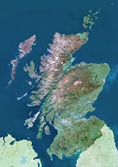
Background imageIrish Sea Collection: Scotland, UK, satellite image

Scotland, UK, satellite image
Scotland, UK. North is at top. Natural colour satellite image showing Scotland in the United Kingdom, with the surrounding territories shaded out

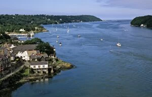
Background imageIrish Sea Collection: Wales. The Menai Strait

Wales. The Menai Strait, Anglesey, North Wales The Menai Strait is a narrow stretch of shallow tidal water, about 14 miles long, which separates the island of Anglesey from the mainland of Wales

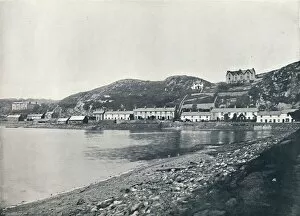
Background imageIrish Sea Collection: Pwllheli - A Sheltered Corner, 1895

Pwllheli - A Sheltered Corner, 1895. From Round the Coast. [George Newnes Limited, London, 1895]

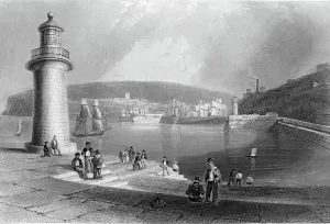
Background imageIrish Sea Collection: Whitehaven Harbour, c. 1840-50 (engraving)

Whitehaven Harbour, c. 1840-50 (engraving)
XJF448259 Whitehaven Harbour, c.1840-50 (engraving) by Bartlett, William Henry (1809-54) (after); Private Collection; (add.info.: Whitehaven is a port town in west Cumbria; ); English

Background imageIrish Sea Collection: Fog shrouds the Skellig Islands, Great Skellig Michael in the foreground, Little Skellig behind

Fog shrouds the Skellig Islands, Great Skellig Michael in the foreground, Little Skellig behind, County Kerry, Munster, Irish Sea, Republic of Ireland, Europe

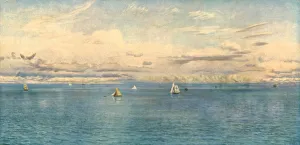
Background imageIrish Sea Collection: Britannias Realm, 1880, (c1930). Creator: John Brett

Britannias Realm, 1880, (c1930). Creator: John Brett
Britannias Realm, 1880, (c1930). Sailing boats off the coast near Tenby in Pembrokeshire, west Wales. Painting in the Tate Gallery, London. From " Modern Masterpieces of British Art"

Background imageIrish Sea Collection: Whitehaven, Cumberland, 1814-1825. Artist: William Daniell

Whitehaven, Cumberland, 1814-1825. Artist: William Daniell
Whitehaven, Cumberland, 1814-1825. From A Voyage Around Great Britain Undertaken between the Years 1814 and 1825 by William Daniell

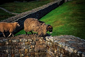
Background imageIrish Sea Collection: Hadrians Wall

Hadrians Wall also called the Roman Wall, Picts Wall, or Vallum Hadriani in Latin, was a defensive fortification in the Roman province of Britannia

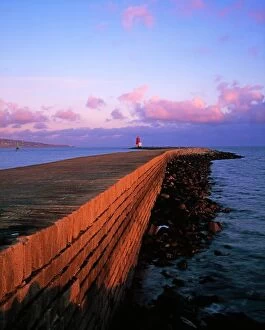
Background imageIrish Sea Collection: Dublin Bay, Co Dublin, Ireland; East Wall With Lighthouse At The End

Dublin Bay, Co Dublin, Ireland; East Wall With Lighthouse At The End

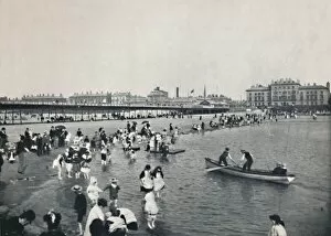
Background imageIrish Sea Collection: Southport - The Pier and the South Lake, 1895

Southport - The Pier and the South Lake, 1895. From Round the Coast. [George Newnes Limited, London, 1895]

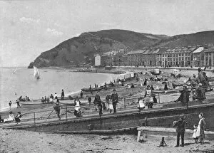
Background imageIrish Sea Collection: Aberystwith, c1900. Artist: ER Gyde

Aberystwith, c1900. Artist: ER Gyde
Aberystwith, c1900. Aberystwyth is a historic market town, administrative centre, and holiday resort within Ceredigion, West Wales, often colloquially known as Aber

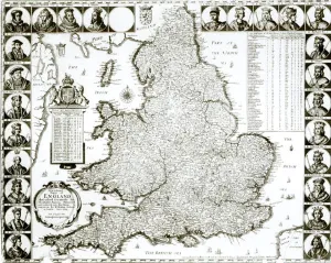
Background imageIrish Sea Collection: Map of England and Wales, 1644 (engraving) (b / w photo)

Map of England and Wales, 1644 (engraving) (b / w photo)
XJF273140 Map of England and Wales, 1644 (engraving) (b/w photo) by Hollar, Wenceslaus (1607-77); Private Collection; Czech, out of copyright

Background imageIrish Sea Collection: Aerial view of Trwyn Du Lighthouse at sunset, Llangoed, Gwynedd, Anglesey, Wales, Great Britain

Aerial view of Trwyn Du Lighthouse at sunset, Llangoed, Gwynedd, Anglesey, Wales, Great Britain, United Kingdom

Background imageIrish Sea Collection: Trwyn Du Lighthouse at sunset, Llangoed, Gwynedd, Anglesey, Wales, Great Britain, United Kingdom

Trwyn Du Lighthouse at sunset, Llangoed, Gwynedd, Anglesey, Wales, Great Britain, United Kingdom

Background imageIrish Sea Collection: Trwyn Du Lighthouse at sunset, Llangoed, Gwynedd, Anglesey, Wales, Great Britain, United Kingdom

Trwyn Du Lighthouse at sunset, Llangoed, Gwynedd, Anglesey, Wales, Great Britain, United Kingdom

Background imageIrish Sea Collection: South Stack Lighthouse at sunset, Anglesey, Holy Island, Wales, Great Britain, United Kingdom

South Stack Lighthouse at sunset, Anglesey, Holy Island, Wales, Great Britain, United Kingdom

Background imageIrish Sea Collection: South Stack Lighthouse at sunset, Anglesey, Holy Island, Wales, Great Britain, United Kingdom

South Stack Lighthouse at sunset, Anglesey, Holy Island, Wales, Great Britain, United Kingdom

Background imageIrish Sea Collection: South Stack Lighthouse at sunset, Anglesey, Holy Island, Wales, Great Britain, United Kingdom

South Stack Lighthouse at sunset, Anglesey, Holy Island, Wales, Great Britain, United Kingdom

Background imageIrish Sea Collection: Aerial view of Trwyn Du Lighthouse at sunset, Llangoed, Gwynedd, Anglesey, Wales, Great Britain

Aerial view of Trwyn Du Lighthouse at sunset, Llangoed, Gwynedd, Anglesey, Wales, Great Britain, United Kingdom

Background imageIrish Sea Collection: Map of Liverpool, Manchester, c.1900 (engraving)

Map of Liverpool, Manchester, c.1900 (engraving)
533270 Map of Liverpool, Manchester, c.1900 (engraving); (add.info.: Map of Liverpool and Manchester, England, circa 1902)

Background imageIrish Sea Collection: Map of the Isle of Man, c.1900 (engraving)

Map of the Isle of Man, c.1900 (engraving)
533276 Map of the Isle of Man, c.1900 (engraving); (add.info.: Map of Isle of Man, United Kingdom, circa 1902, from the 10th edition of Encyclopaedia Britannica.); Encyclopaedia Britannica/UIG.

Background imageIrish Sea Collection: View at sunset towards the Irish Sea, Furness Peninsula and Cumbrian Coast, Sandy Gap

View at sunset towards the Irish Sea, Furness Peninsula and Cumbrian Coast, Sandy Gap, Walney Island, Lancashire, England, United Kingdom, Europe

Background imageIrish Sea Collection: Sunset from Sandy Gap on Walney Island, view towards the distant Black Combe across the Irish Sea

Sunset from Sandy Gap on Walney Island, view towards the distant Black Combe across the Irish Sea, Duddon Estuary and Cumbrian Coast, Walney Island, Lancashire, England, United Kingdom, Europe

Background imageIrish Sea Collection: Sunset from Sandy Gap on Walney Island, view towards the distant Black Combe across the Irish Sea

Sunset from Sandy Gap on Walney Island, view towards the distant Black Combe across the Irish Sea, Duddon Estuary and Cumbrian Coast, Cumbria, England, United Kingdom, Europe

Background imageIrish Sea Collection: Storm clouds gather over the Irish Sea, worn sea defences from South Walney at sunset from

Storm clouds gather over the Irish Sea, worn sea defences from South Walney at sunset from the Cumbrian Coast, Cumbria, England, United Kingdom, Europe

Background imageIrish Sea Collection: Sunset view from Sandy Gap, Walney Island, towards the distant Irish Sea and Black Combe

Sunset view from Sandy Gap, Walney Island, towards the distant Irish Sea and Black Combe, Walney Island, Lancashire, England, United Kingdom, Europe

Background imageIrish Sea Collection: The Hill of Howth, 1858. Creator: Unknown

The Hill of Howth, 1858. Creator: Unknown
The Hill of Howth, 1858. The Bay of Dublin is bounded on the north by the lofty peninsula of Howth, terminating in Bailie Point, whose lighthouse, with its splendid fixed light

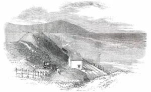
Background imageIrish Sea Collection: Opening of the Whitehaven and Furness Junction Railway - Braestones Station, 1850. Creator: Smyth

Opening of the Whitehaven and Furness Junction Railway - Braestones Station, 1850. Creator: Smyth
Opening of the Whitehaven and Furness Junction Railway - Braestones Station, 1850. Braystones railway station, on the Irish Sea coast, was formerly in Cumberland. It is now part of Cumbria

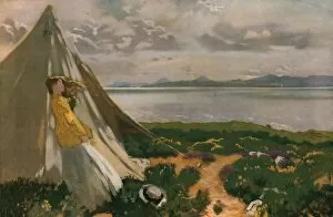
Background imageIrish Sea Collection: A Breezy Day: Howth Head, early 20th century, (c1930). Creator: William Newenham Montague Orpen

A Breezy Day: Howth Head, early 20th century, (c1930). Creator: William Newenham Montague Orpen
A Breezy Day: Howth Head, early 20th century, (c1930). Woman looking out to the Irish Sea at Howth Head, a peninsula on the east coast of Ireland

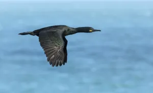
Background imageIrish Sea Collection: Shag (Phalacrocorax aristotelis) in flight over sea. Great Saltee Island, Saltee Islands

Shag (Phalacrocorax aristotelis) in flight over sea. Great Saltee Island, Saltee Islands, County Wexford, Republic of Ireland. June

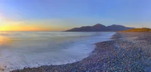
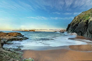
Background imageIrish Sea Collection: Beach at sunrise, Murlough National Nature Reserve, Dundrum, County Down, Northern Ireland, UK

Beach at sunrise, Murlough National Nature Reserve, Dundrum, County Down, Northern Ireland, UK. December 2013

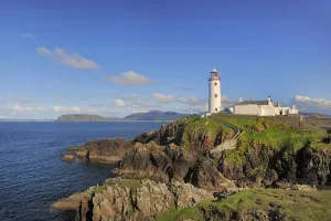
Background imageIrish Sea Collection: Lighthouse on Fanad Head, County Donegal, Republic of Ireland, UK, August 2011

Lighthouse on Fanad Head, County Donegal, Republic of Ireland, UK, August 2011

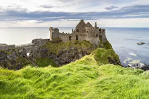
Background imageIrish Sea Collection: View of the ruins of the Dunluce Castle. Bushmills, County Antrim, Ulster region

View of the ruins of the Dunluce Castle. Bushmills, County Antrim, Ulster region, Northern Ireland, United Kingdom

Background imageIrish Sea Collection: Blackhead path lighthouse, Whitehead, County Antrim, Ulster region, northern Ireland

Blackhead path lighthouse, Whitehead, County Antrim, Ulster region, northern Ireland, United Kingdom

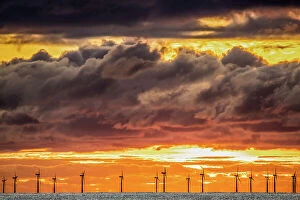
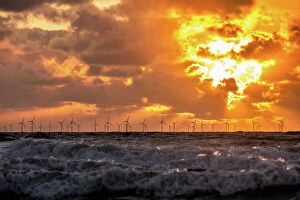
Background imageIrish Sea Collection: Sunset view from Walney Island across the Irish Dea towards the distant Walney Offshore Wind Farm

Sunset view from Walney Island across the Irish Dea towards the distant Walney Offshore Wind Farm, Cumbrian Coast, Cumbria, England, United Kingdom, Europe

Background imageIrish Sea Collection: Sandscale Haws National Nature Reserve, starlings at sunset towards the Irish Sea

Sandscale Haws National Nature Reserve, starlings at sunset towards the Irish Sea and the distant Walney Offshore Wind Farm, Cumbria, England, United Kingdom, Europe

Background imageIrish Sea Collection: Sunset view from Walney Island across the Irish Sea towards the distant Walney Offshore Wind Farm

Sunset view from Walney Island across the Irish Sea towards the distant Walney Offshore Wind Farm, Cumbrian Coast, Cumbria, England, United Kingdom, Europe

Background imageIrish Sea Collection: View of secluded beach near Ballintoy Harbour, County Antrim, Irish Sea, Northern Ireland

View of secluded beach near Ballintoy Harbour, County Antrim, Irish Sea, Northern Ireland. December, 2021

Background imageIrish Sea Collection: The Queen Visiting South Stack Lighthouse, Holyhead... 1853, (1861). Creator: Unknown

The Queen Visiting South Stack Lighthouse, Holyhead... 1853, (1861). Creator: Unknown
The Queen Visiting South Stack Lighthouse, Holyhead, On Her Majestys Return from Ireland, 1853, (1861). Queen Victoria (1819-1901) and her family visited the South Stack Lighthouse in September 1853

Background imageIrish Sea Collection: Queen scallop (Aequipecten opercularis) Isle of Man, July

Queen scallop (Aequipecten opercularis) Isle of Man, July

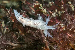
Background imageIrish Sea Collection: Nudibranch (Dendronotus frondosus) Isle of Man, July

Nudibranch (Dendronotus frondosus) Isle of Man, July

Background imageIrish Sea Collection: Razorbill (Alca torda) perched on lichen covered rock. Great Saltee Island, Saltee Islands

Razorbill (Alca torda) perched on lichen covered rock. Great Saltee Island, Saltee Islands, County Wexford, Republic of Ireland. June

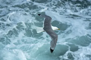
Background imageIrish Sea Collection: Kittiwake (Rissa tridactyla) flying over sea. Great Saltee Island, Saltee Islands

Kittiwake (Rissa tridactyla) flying over sea. Great Saltee Island, Saltee Islands, County Wexford, Republic of Ireland. June

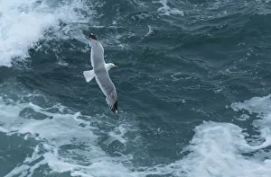
Background imageIrish Sea Collection: Herring gull (Larus argentatus) flying over sea. Great Saltee Island, Saltee Islands

Herring gull (Larus argentatus) flying over sea. Great Saltee Island, Saltee Islands, County Wexford, Republic of Ireland. June


All Professionally Made to Order for Quick Shipping

The Irish Sea: A Tapestry of Beauty and History Gazing down from space, the Irish Sea reveals its enchanting allure as it shimmers under the night sky, separating Scotland and England. This satellite image captures the mesmerizing expanse that connects these lands. On one side lies Lancashire's Lytham St Annes, a coastal gem in England where golden sands meet rolling waves. Further south, Baily Lighthouse stands tall on Howth Peninsula in County Dublin, Ireland - a beacon guiding ships through treacherous waters. Venturing westward brings us to Wales and its captivating Menai Strait. Here, nature weaves an intricate tapestry of rugged beauty between mainland Wales and Anglesey Island. Traveling back in time to 1895, Pwllheli emerges as a sheltered corner nestled within this maritime realm. The tranquility of Whitehaven Harbour during the mid-19th century is etched forever in an engraving from c1840-50 - a testament to human ingenuity coexisting with nature's grandeur. Yet even amidst serene scenes lie moments of mystery. Fog envelops the Skellig Islands off County Kerry's coast; Great Skellig Michael takes center stage while Little Skellig peeks shyly from behind - an ethereal sight that captivates all who witness it. Delving further into history reveals Whitehaven's bustling harbor during 1814-1825; artist William Daniell immortalizes this vibrant hub where trade thrived amid breathtaking surroundings. In Britannia's Realm circa 1880 (c1930), John Brett paints a vivid picture encompassing not only land but also sea - showcasing how intertwined they are within this region rich with heritage. And let us not forget Hadrian's Wall standing resolute against time itself – a symbol of ancient Roman engineering marvels that once guarded Britannia’s northern frontier.