Fraud Blocker Skip to main content

Ings Road Collection

Discover the charm of Ings Road and its surrounding areas

Background imageIngs Road Collection: York YO19 6 Map

York YO19 6 Map
Postcode Sector Map of York YO19 6

Background imageIngs Road Collection: Barnsley S73 0 Map

Barnsley S73 0 Map
Postcode Sector Map of Barnsley S73 0

Background imageIngs Road Collection: Leeds LS9 9 Map

Leeds LS9 9 Map
Postcode Sector Map of Leeds LS9 9

Background imageIngs Road Collection: Wakefield WF1 1 Map

Wakefield WF1 1 Map
Postcode Sector Map of Wakefield WF1 1

Background imageIngs Road Collection: North Yorkshire YO13 9 Map

North Yorkshire YO13 9 Map
Postcode Sector Map of North Yorkshire YO13 9

Background imageIngs Road Collection: York YO8 6 Map

York YO8 6 Map
Postcode Sector Map of York YO8 6

Background imageIngs Road Collection: Redcar & Cleveland TS10 3 Map

Redcar & Cleveland TS10 3 Map
Postcode Sector Map of Redcar & Cleveland TS10 3

Background imageIngs Road Collection: Kirklees WF17 8 Map

Kirklees WF17 8 Map
Postcode Sector Map of Kirklees WF17 8

Background imageIngs Road Collection: Kirklees WF16 9 Map

Kirklees WF16 9 Map
Postcode Sector Map of Kirklees WF16 9

Background imageIngs Road Collection: Kirklees WF15 6 Map

Kirklees WF15 6 Map
Postcode Sector Map of Kirklees WF15 6

Background imageIngs Road Collection: Kirklees WF12 7 Map

Kirklees WF12 7 Map
Postcode Sector Map of Kirklees WF12 7

Background imageIngs Road Collection: Wakefield WF9 5 Map

Wakefield WF9 5 Map
Postcode Sector Map of Wakefield WF9 5

Background imageIngs Road Collection: York YO41 5 Map

York YO41 5 Map
Postcode Sector Map of York YO41 5

Background imageIngs Road Collection: York YO26 9 Map

York YO26 9 Map
Postcode Sector Map of York YO26 9

Background imageIngs Road Collection: Boston PE22 0 Map

Boston PE22 0 Map
Postcode Sector Map of Boston PE22 0

Background imageIngs Road Collection: East Lindsey LN12 2 Map

East Lindsey LN12 2 Map
Postcode Sector Map of East Lindsey LN12 2

Background imageIngs Road Collection: Selby LS24 9 Map

Selby LS24 9 Map
Postcode Sector Map of Selby LS24 9

Background imageIngs Road Collection: East Riding of Yorkshire HU17 7 Map

East Riding of Yorkshire HU17 7 Map
Postcode Sector Map of East Riding of Yorkshire HU17 7

Background imageIngs Road Collection: Kirklees HD5 8 Map

Kirklees HD5 8 Map
Postcode Sector Map of Kirklees HD5 8

Background imageIngs Road Collection: Kingston upon Hull HU8 0 Map

Kingston upon Hull HU8 0 Map
Postcode Sector Map of Kingston upon Hull HU8 0

Background imageIngs Road Collection: Doncaster DN10 4 Map

Doncaster DN10 4 Map
Postcode Sector Map of Doncaster DN10 4

Background imageIngs Road Collection: West Lindsey DN21 4 Map

West Lindsey DN21 4 Map
Postcode Sector Map of West Lindsey DN21 4

Background imageIngs Road Collection: West Lindsey DN21 3 Map

West Lindsey DN21 3 Map
Postcode Sector Map of West Lindsey DN21 3

Background imageIngs Road Collection: East Riding of Yorkshire DN14 9 Map

East Riding of Yorkshire DN14 9 Map
Postcode Sector Map of East Riding of Yorkshire DN14 9

Background imageIngs Road Collection: Doncaster DN5 9 Map

Doncaster DN5 9 Map
Postcode Sector Map of Doncaster DN5 9

Background imageIngs Road Collection: Doncaster DN5 0 Map

Doncaster DN5 0 Map
Postcode Sector Map of Doncaster DN5 0

Background imageIngs Road Collection: Doncaster DN5 7 Map

Doncaster DN5 7 Map
Postcode Sector Map of Doncaster DN5 7

Background imageIngs Road Collection: Bradford BD20 6 Map

Bradford BD20 6 Map
Postcode Sector Map of Bradford BD20 6


All Professionally Made to Order for Quick Shipping

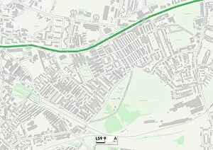
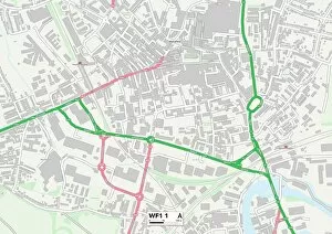
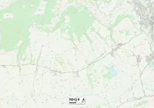
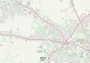
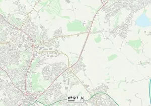
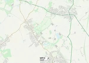
Discover the charm of Ings Road and its surrounding areas. Located in the heart of Yorkshire, this vibrant road connects various towns and cities, offering a diverse range of attractions. Starting from York YO19 6 Map, you can explore the historic city with its stunning architecture and rich heritage. Head south to Barnsley S73 0 Map for a taste of traditional Yorkshire culture, where you can visit local markets and enjoy delicious regional cuisine. If you're craving some urban excitement, make your way to Leeds LS9 9 Map. This bustling city is known for its thriving arts scene, trendy shops, and vibrant nightlife. Just a short drive away is Wakefield WF1 1 Map – home to fascinating museums like The Hepworth Wakefield and beautiful parks perfect for leisurely strolls. For nature enthusiasts, North Yorkshire YO13 9 Map offers breathtaking landscapes that are ideal for hiking or simply enjoying peaceful countryside views. Further east lies York YO8 6 Map with its picturesque streets lined with charming shops and cafes. Heading towards the coast? Redcar & Cleveland TS10 3 Map awaits. Enjoy sandy beaches, coastal walks along rugged cliffsides, or indulge in fish and chips by the sea. As we venture into Kirklees territory - WF17 8 Map welcomes visitors with scenic beauty while WF16 9 Map boasts historical landmarks such as Oakwell Hall Museum. Don't miss out on exploring WF15 6Map's hidden gems including tranquil parks perfect for picnics. Lastly but not least important is Kirklees' WF12-7 map which surprises visitors with unique attractions like National Coal Mining Museum - an immersive experience into England's industrial past. With so much to see across these locations within easy reach from Wakefield WF9-5 map; Ings Road truly offers something special for everyone seeking adventure or relaxation in this captivating part of Yorkshire.