
Hydrological Collection
"Exploring the Hydrological Wonders: From Woodland Rivers to Iguazu Falls" A serene woodland river flows gracefully, showcasing the beauty wonders


All Professionally Made to Order for Quick Shipping
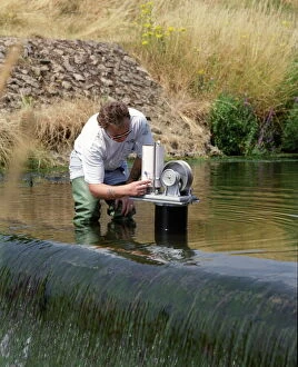
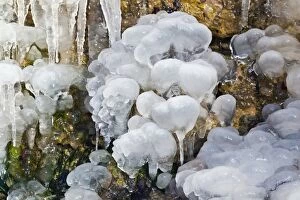
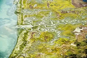
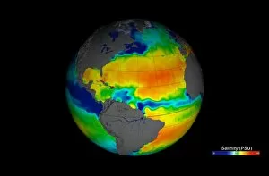
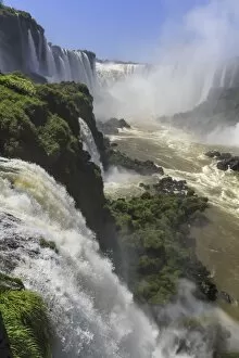
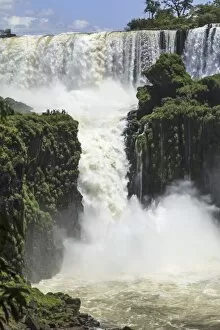
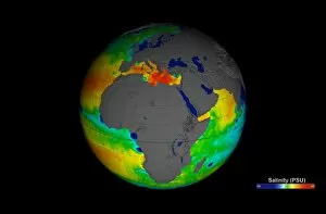
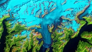
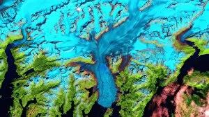
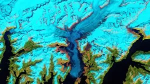
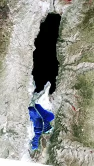
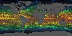
"Exploring the Hydrological Wonders: From Woodland Rivers to Iguazu Falls" A serene woodland river flows gracefully, showcasing the beauty wonders. Measuring water levels becomes a crucial task in understanding the hydrological dynamics of our planet. "The eternal vicissitudes of a dewdrop" - a captivating color litho that symbolizes the ever-changing nature of water. Delicate ice formations mesmerize with their intricate patterns and reflect the power of hydrology (Ice formations C013 / 6070). San Juan River, USA - an emblematic example of how rivers shape landscapes and influence ecosystems (C018 / 1812). Langebaan Lagoon, South Africa - a stunning coastal feature shaped by complex hydrological processes (C017 / 1925). Witnessing the ebb and flow at Langebaan Lagoon reminds us of nature's perpetual dance with water (C017 / 1924). Aquarius image reveals sea surface salinity variations, providing valuable insights into global hydrology (C017 / 6816). Stand in awe as Iguazu Falls roars with immense power, demonstrating nature's mastery over hydrological forces (F008 / 4424). The cascading waters at Iguazu Falls create breathtaking vistas that leave visitors spellbound (F008 / 4412). Dare to venture into Devil's Throat at Iguazu Falls for an up-close encounter with raw hydrometeorological might (F008/4425) Witnessing the majestic Iguazu Falls is an unforgettable experience that highlights Earth's remarkable hydrological diversity (F008/4415).