Fraud Blocker Skip to main content

Highfield Avenue Collection

Highfield Avenue is a sprawling road that connects various towns and cities across the UK

Background imageHighfield Avenue Collection: Wolverhampton WV10 8 Map

Wolverhampton WV10 8 Map
Postcode Sector Map of Wolverhampton WV10 8

Background imageHighfield Avenue Collection: Wolverhampton WV14 0 Map

Wolverhampton WV14 0 Map
Postcode Sector Map of Wolverhampton WV14 0

Background imageHighfield Avenue Collection: Warrington WA5 1 Map

Warrington WA5 1 Map
Postcode Sector Map of Warrington WA5 1

Background imageHighfield Avenue Collection: Wigan WN6 8 Map

Wigan WN6 8 Map
Postcode Sector Map of Wigan WN6 8

Background imageHighfield Avenue Collection: Wigan WN1 3 Map

Wigan WN1 3 Map
Postcode Sector Map of Wigan WN1 3

Background imageHighfield Avenue Collection: Berkshire RG14 5 Map

Berkshire RG14 5 Map
Postcode Sector Map of Berkshire RG14 5

Background imageHighfield Avenue Collection: Staffordshire ST3 5 Map

Staffordshire ST3 5 Map
Postcode Sector Map of Staffordshire ST3 5

Background imageHighfield Avenue Collection: Kirklees HD8 8 Map

Kirklees HD8 8 Map
Postcode Sector Map of Kirklees HD8 8

Background imageHighfield Avenue Collection: Warrington WA4 5 Map

Warrington WA4 5 Map
Postcode Sector Map of Warrington WA4 5

Background imageHighfield Avenue Collection: Wigan WA3 3 Map

Wigan WA3 3 Map
Postcode Sector Map of Wigan WA3 3

Background imageHighfield Avenue Collection: Wigan WN7 3 Map

Wigan WN7 3 Map
Postcode Sector Map of Wigan WN7 3

Background imageHighfield Avenue Collection: Cornwall TR9 6 Map

Cornwall TR9 6 Map
Postcode Sector Map of Cornwall TR9 6

Background imageHighfield Avenue Collection: New Forest SO41 9 Map

New Forest SO41 9 Map
Postcode Sector Map of New Forest SO41 9

Background imageHighfield Avenue Collection: Southampton SO17 1 Map

Southampton SO17 1 Map
Postcode Sector Map of Southampton SO17 1

Background imageHighfield Avenue Collection: Derbyshire Dales SK17 8 Map

Derbyshire Dales SK17 8 Map
Postcode Sector Map of Derbyshire Dales SK17 8

Background imageHighfield Avenue Collection: Lichfield WS7 9 Map

Lichfield WS7 9 Map
Postcode Sector Map of Lichfield WS7 9

Background imageHighfield Avenue Collection: Walsall WS4 1 Map

Walsall WS4 1 Map
Postcode Sector Map of Walsall WS4 1

Background imageHighfield Avenue Collection: Wakefield WF8 4 Map

Wakefield WF8 4 Map
Postcode Sector Map of Wakefield WF8 4

Background imageHighfield Avenue Collection: Wakefield WF8 2 Map

Wakefield WF8 2 Map
Postcode Sector Map of Wakefield WF8 2

Background imageHighfield Avenue Collection: East Riding of Yorkshire YO25 5 Map

East Riding of Yorkshire YO25 5 Map
Postcode Sector Map of East Riding of Yorkshire YO25 5

Background imageHighfield Avenue Collection: Rotherham S26 6 Map

Rotherham S26 6 Map
Postcode Sector Map of Rotherham S26 6

Background imageHighfield Avenue Collection: Barnsley S71 3 Map

Barnsley S71 3 Map
Postcode Sector Map of Barnsley S71 3

Background imageHighfield Avenue Collection: Barnsley S70 6 Map

Barnsley S70 6 Map
Postcode Sector Map of Barnsley S70 6

Background imageHighfield Avenue Collection: Barnsley S63 9 Map

Barnsley S63 9 Map
Postcode Sector Map of Barnsley S63 9

Background imageHighfield Avenue Collection: Ealing UB6 0 Map

Ealing UB6 0 Map
Postcode Sector Map of Ealing UB6 0

Background imageHighfield Avenue Collection: Hampshire PO7 7 Map

Hampshire PO7 7 Map
Postcode Sector Map of Hampshire PO7 7

Background imageHighfield Avenue Collection: Staffordshire ST10 1 Map

Staffordshire ST10 1 Map
Postcode Sector Map of Staffordshire ST10 1

Background imageHighfield Avenue Collection: Staffordshire ST7 4 Map

Staffordshire ST7 4 Map
Postcode Sector Map of Staffordshire ST7 4

Background imageHighfield Avenue Collection: Staffordshire ST5 0 Map

Staffordshire ST5 0 Map
Postcode Sector Map of Staffordshire ST5 0

Background imageHighfield Avenue Collection: Renfrewshire PA2 8 Map

Renfrewshire PA2 8 Map
Postcode Sector Map of Renfrewshire PA2 8

Background imageHighfield Avenue Collection: Chesterfield S41 7 Map

Chesterfield S41 7 Map
Postcode Sector Map of Chesterfield S41 7

Background imageHighfield Avenue Collection: Castle Point SS7 1 Map

Castle Point SS7 1 Map
Postcode Sector Map of Castle Point SS7 1

Background imageHighfield Avenue Collection: Castle Point SS7 3 Map

Castle Point SS7 3 Map
Postcode Sector Map of Castle Point SS7 3

Background imageHighfield Avenue Collection: Cornwall PL25 4 Map

Cornwall PL25 4 Map
Postcode Sector Map of Cornwall PL25 4

Background imageHighfield Avenue Collection: Preston PR2 8 Map

Preston PR2 8 Map
Postcode Sector Map of Preston PR2 8

Background imageHighfield Avenue Collection: Fylde PR4 0 Map

Fylde PR4 0 Map
Postcode Sector Map of Fylde PR4 0

Background imageHighfield Avenue Collection: Stockport SK6 3 Map

Stockport SK6 3 Map
Postcode Sector Map of Stockport SK6 3

Background imageHighfield Avenue Collection: Stockport SK6 2 Map

Stockport SK6 2 Map
Postcode Sector Map of Stockport SK6 2

Background imageHighfield Avenue Collection: Barnet NW11 9 Map

Barnet NW11 9 Map
Postcode Sector Map of Barnet NW11 9

Background imageHighfield Avenue Collection: Barnet NW9 0 Map

Barnet NW9 0 Map
Postcode Sector Map of Barnet NW9 0

Background imageHighfield Avenue Collection: Oxford OX3 7 Map

Oxford OX3 7 Map
Postcode Sector Map of Oxford OX3 7

Background imageHighfield Avenue Collection: West Norfolk PE37 7 Map

West Norfolk PE37 7 Map
Postcode Sector Map of West Norfolk PE37 7

Background imageHighfield Avenue Collection: Huntingdonshire PE28 4 Map

Huntingdonshire PE28 4 Map
Postcode Sector Map of Huntingdonshire PE28 4

Background imageHighfield Avenue Collection: South Ribble PR5 5 Map

South Ribble PR5 5 Map
Postcode Sector Map of South Ribble PR5 5

Background imageHighfield Avenue Collection: Hampshire PO14 1 Map

Hampshire PO14 1 Map
Postcode Sector Map of Hampshire PO14 1

Background imageHighfield Avenue Collection: South Ribble PR25 4 Map

South Ribble PR25 4 Map
Postcode Sector Map of South Ribble PR25 4

Background imageHighfield Avenue Collection: Norfolk NR13 5 Map

Norfolk NR13 5 Map
Postcode Sector Map of Norfolk NR13 5

Background imageHighfield Avenue Collection: Rochdale OL10 4 Map

Rochdale OL10 4 Map
Postcode Sector Map of Rochdale OL10 4


All Professionally Made to Order for Quick Shipping

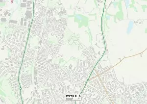
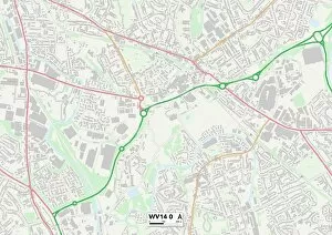
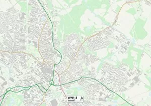
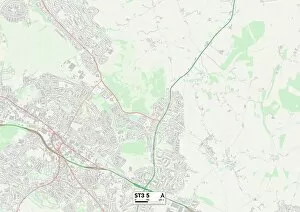
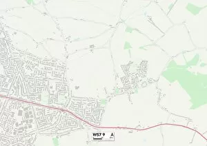
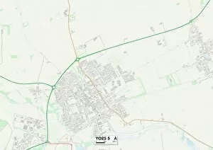
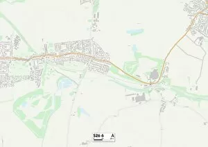
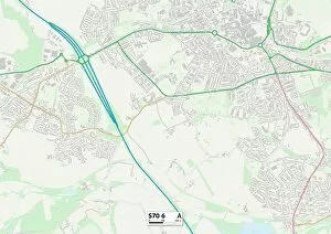
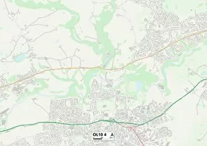
Highfield Avenue is a sprawling road that connects various towns and cities across the UK. From Wolverhampton to Warrington, Wigan to Berkshire, Staffordshire to Kirklees, this avenue weaves its way through diverse landscapes and communities. Each map pinpoints a different location along Highfield Avenue, showcasing the vastness of its reach. Starting in Wolverhampton (WV10 8 Map), Highfield Avenue sets off on its journey, passing through bustling streets and quiet neighborhoods alike. It then ventures into Warrington (WA5 1 Map), where it intersects with other major roads, becoming a vital artery for commuters. Continuing onwards, Highfield Avenue enters Wigan (WN6 8 Map) before making another stop at WN1 3 Map. These areas are known for their industrial heritage and vibrant culture. The avenue serves as a lifeline for residents here, connecting them to nearby towns and cities. As Highfield Avenue stretches further eastward, it reaches Berkshire (RG14 5 Map). Here it meanders through picturesque countryside dotted with charming villages and historic landmarks. This section of the avenue offers breathtaking views that captivate both locals and visitors alike. Moving northwards into Staffordshire (ST3 5 Map), Highfield Avenue becomes enveloped by rolling hillsides and quaint market towns. Its presence provides convenience for those seeking an escape from urban life while still maintaining accessibility to larger cities. Next on its route is Kirklees (HD8 8 Map), where the avenue passes through scenic woodlands and rural landscapes. This area offers tranquility amidst nature's beauty while remaining connected to neighboring regions via Highfield Avenue. Returning westward towards Wolverhampton once again but taking an alternate path this time around; Highfield Avenue traverses WV14 0 Map - yet another significant waypoint along its extensive course.