Fraud Blocker Skip to main content

Hall Road Collection

Hall Road is a diverse and well-connected street that stretches across various regions in the UK

Background imageHall Road Collection: Cheshire East SK9 3 Map

Cheshire East SK9 3 Map
Postcode Sector Map of Cheshire East SK9 3

Background imageHall Road Collection: Norfolk NR27 0 Map

Norfolk NR27 0 Map
Postcode Sector Map of Norfolk NR27 0

Background imageHall Road Collection: Suffolk NR35 2 Map

Suffolk NR35 2 Map
Postcode Sector Map of Suffolk NR35 2

Background imageHall Road Collection: West Norfolk PE34 4 Map

West Norfolk PE34 4 Map
Postcode Sector Map of West Norfolk PE34 4

Background imageHall Road Collection: Norfolk NR14 8 Map

Norfolk NR14 8 Map
Postcode Sector Map of Norfolk NR14 8

Background imageHall Road Collection: Norfolk NR12 8 Map

Norfolk NR12 8 Map
Postcode Sector Map of Norfolk NR12 8

Background imageHall Road Collection: Leeds LS26 8 Map

Leeds LS26 8 Map
Postcode Sector Map of Leeds LS26 8

Background imageHall Road Collection: Rushmoor GU14 6 Map

Rushmoor GU14 6 Map
Postcode Sector Map of Rushmoor GU14 6

Background imageHall Road Collection: South Lakeland LA10 5 Map

South Lakeland LA10 5 Map
Postcode Sector Map of South Lakeland LA10 5

Background imageHall Road Collection: Colchester CO7 7 Map

Colchester CO7 7 Map
Postcode Sector Map of Colchester CO7 7

Background imageHall Road Collection: Cannock Chase WS15 4 Map

Cannock Chase WS15 4 Map
Postcode Sector Map of Cannock Chase WS15 4

Background imageHall Road Collection: Wakefield WF2 8 Map

Wakefield WF2 8 Map
Postcode Sector Map of Wakefield WF2 8

Background imageHall Road Collection: Shropshire WV16 6 Map

Shropshire WV16 6 Map
Postcode Sector Map of Shropshire WV16 6

Background imageHall Road Collection: Warrington WA1 4 Map

Warrington WA1 4 Map
Postcode Sector Map of Warrington WA1 4

Background imageHall Road Collection: Staffordshire ST14 8 Map

Staffordshire ST14 8 Map
Postcode Sector Map of Staffordshire ST14 8

Background imageHall Road Collection: Staffordshire ST14 7 Map

Staffordshire ST14 7 Map
Postcode Sector Map of Staffordshire ST14 7

Background imageHall Road Collection: Sutton SM6 0 Map

Sutton SM6 0 Map
Postcode Sector Map of Sutton SM6 0

Background imageHall Road Collection: Cheshire East SK9 5 Map

Cheshire East SK9 5 Map
Postcode Sector Map of Cheshire East SK9 5

Background imageHall Road Collection: East Riding of Yorkshire YO43 3 Map

East Riding of Yorkshire YO43 3 Map
Postcode Sector Map of East Riding of Yorkshire YO43 3

Background imageHall Road Collection: East Riding of Yorkshire YO42 2 Map

East Riding of Yorkshire YO42 2 Map
Postcode Sector Map of East Riding of Yorkshire YO42 2

Background imageHall Road Collection: Rotherham S26 3 Map

Rotherham S26 3 Map
Postcode Sector Map of Rotherham S26 3

Background imageHall Road Collection: Sheffield S13 9 Map

Sheffield S13 9 Map
Postcode Sector Map of Sheffield S13 9

Background imageHall Road Collection: Hounslow TW7 7 Map

Hounslow TW7 7 Map
Postcode Sector Map of Hounslow TW7 7

Background imageHall Road Collection: Trafford WA14 3 Map

Trafford WA14 3 Map
Postcode Sector Map of Trafford WA14 3

Background imageHall Road Collection: St. Helens WA11 0 Map

St. Helens WA11 0 Map
Postcode Sector Map of St. Helens WA11 0

Background imageHall Road Collection: Rotherham S60 2 Map

Rotherham S60 2 Map
Postcode Sector Map of Rotherham S60 2

Background imageHall Road Collection: Somerset TA7 8 Map

Somerset TA7 8 Map
Postcode Sector Map of Somerset TA7 8

Background imageHall Road Collection: Barking and Dagenham RM6 4 Map

Barking and Dagenham RM6 4 Map
Postcode Sector Map of Barking and Dagenham RM6 4

Background imageHall Road Collection: Havering RM2 6 Map

Havering RM2 6 Map
Postcode Sector Map of Havering RM2 6

Background imageHall Road Collection: Thurrock RM15 4 Map

Thurrock RM15 4 Map
Postcode Sector Map of Thurrock RM15 4

Background imageHall Road Collection: Chesterfield S43 1 Map

Chesterfield S43 1 Map
Postcode Sector Map of Chesterfield S43 1

Background imageHall Road Collection: Rochford SS5 4 Map

Rochford SS5 4 Map
Postcode Sector Map of Rochford SS5 4

Background imageHall Road Collection: Rochford SS4 1 Map

Rochford SS4 1 Map
Postcode Sector Map of Rochford SS4 1

Background imageHall Road Collection: Cornwall PL26 8 Map

Cornwall PL26 8 Map
Postcode Sector Map of Cornwall PL26 8

Background imageHall Road Collection: Preston PR2 9 Map

Preston PR2 9 Map
Postcode Sector Map of Preston PR2 9

Background imageHall Road Collection: Preston PR1 9 Map

Preston PR1 9 Map
Postcode Sector Map of Preston PR1 9

Background imageHall Road Collection: South Kesteven PE10 0 Map

South Kesteven PE10 0 Map
Postcode Sector Map of South Kesteven PE10 0

Background imageHall Road Collection: Argyllshire PA24 8 Map

Argyllshire PA24 8 Map
Postcode Sector Map of Argyllshire PA24 8

Background imageHall Road Collection: Huntingdonshire PE19 2 Map

Huntingdonshire PE19 2 Map
Postcode Sector Map of Huntingdonshire PE19 2

Background imageHall Road Collection: Fenland PE14 8 Map

Fenland PE14 8 Map
Postcode Sector Map of Fenland PE14 8

Background imageHall Road Collection: Fenland PE14 7 Map

Fenland PE14 7 Map
Postcode Sector Map of Fenland PE14 7

Background imageHall Road Collection: Stockport SK7 3 Map

Stockport SK7 3 Map
Postcode Sector Map of Stockport SK7 3

Background imageHall Road Collection: Camden NW8 9 Map

Camden NW8 9 Map
Postcode Sector Map of Camden NW8 9

Background imageHall Road Collection: Suffolk NR34 0 Map

Suffolk NR34 0 Map
Postcode Sector Map of Suffolk NR34 0

Background imageHall Road Collection: Suffolk NR32 5 Map

Suffolk NR32 5 Map
Postcode Sector Map of Suffolk NR32 5

Background imageHall Road Collection: Suffolk NR33 8 Map

Suffolk NR33 8 Map
Postcode Sector Map of Suffolk NR33 8

Background imageHall Road Collection: Suffolk NR32 3 Map

Suffolk NR32 3 Map
Postcode Sector Map of Suffolk NR32 3

Background imageHall Road Collection: Norfolk NR29 4 Map

Norfolk NR29 4 Map
Postcode Sector Map of Norfolk NR29 4


All Professionally Made to Order for Quick Shipping

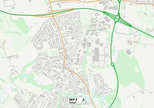
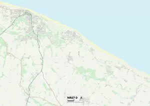
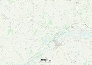
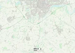
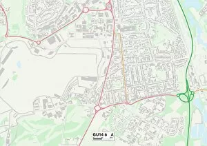
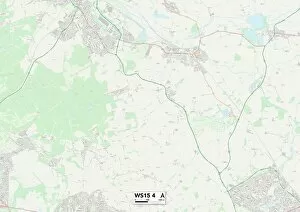
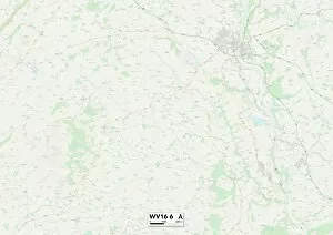
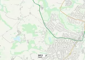
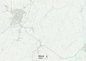
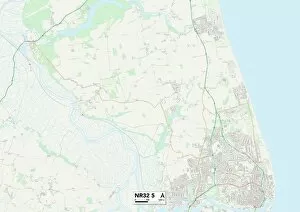
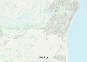
Hall Road is a diverse and well-connected street that stretches across various regions in the UK. From Cheshire East to Norfolk, Suffolk to West Norfolk, this road weaves through picturesque landscapes and vibrant communities. Starting in Cheshire East (SK9 3 Map), it offers a scenic route surrounded by lush greenery and charming villages. As you venture further east, you'll find yourself in Norfolk (NR27 0 Map), where the road continues its journey amidst stunning coastal views and sandy beaches. Heading south towards Suffolk (NR35 2 Map), Hall Road takes you through quaint market towns with historic architecture and bustling local markets. Further along in West Norfolk (PE34 4 Map), this road leads you to peaceful countryside vistas dotted with enchanting cottages. As Hall Road extends into Norfolk once again (NR14 8 Map), it showcases the region's idyllic rural charm, passing through rolling hills and verdant farmlands. Continuing northwards, Leeds (LS26 8 Map) welcomes travelers with its lively atmosphere and cultural attractions. Crossing over Rushmoor (GU14 6 Map) brings an urban touch to your journey as modern developments blend seamlessly with natural surroundings. South Lakeland's beauty awaits on Hall Road too (LA10 5 Map), offering breathtaking lakeside scenery that captivates all who pass by. Colchester's rich history unfolds as you traverse its streets on Hall Road (CO7 7 Map). Ancient ruins stand alongside contemporary structures, creating a unique juxtaposition of old and new. Cannock Chase's serene woodlands beckon next on your adventure along this road (WS15 4 Map). Finally, reaching Wakefield (WF2 8Map) allows for exploration of its vibrant city center before venturing into Shropshire (WV16-6Map). Here, tranquil countryside landscapes await those seeking solace from the hustle and bustle of everyday life.