Fraud Blocker Skip to main content

Gulf Of Mexico Collection (page 8)

The Gulf of Mexico: A Captivating Blend of History, Natural Beauty

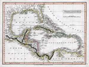
Background imageGulf Of Mexico Collection: Map of the West Indies, 18th century(?). Artist: Barlow

Map of the West Indies, 18th century(?). Artist: Barlow
Map of the West Indies, 18th century(?)

Background imageGulf Of Mexico Collection: A map of the West Indies, 1808. Artist: C Smith

A map of the West Indies, 1808. Artist: C Smith
A map of the West Indies, 1808

Background imageGulf Of Mexico Collection: A map of St Lucia, the West Indies, 1758. Artist: N Bellun

A map of St Lucia, the West Indies, 1758. Artist: N Bellun
A map of St Lucia, the West Indies, 1758

Background imageGulf Of Mexico Collection: Fleet passing the fort and obstructions, Battle of Mobile Bay, August 5, 1864, (1862-1867)

Fleet passing the fort and obstructions, Battle of Mobile Bay, August 5, 1864, (1862-1867)
Fleet passing the fort and obstructions, Battle of Mobile Bay, August 5, 1864, (1864-1867). The Battle of Mobile Bay saw a Union fleet commanded by Admiral David Farragut defeat a much smaller

Background imageGulf Of Mexico Collection: Campeche, Yucatan, Mexico, 19th century. Artist: Edouard Riou

Campeche, Yucatan, Mexico, 19th century. Artist: Edouard Riou
Campeche, Yucatan, Mexico, 19th century. View of the port city of Campeche on the Gulf of Mexico

Background imageGulf Of Mexico Collection: Aerial view of the littoral combat ship Independence underway during builders trials

Aerial view of the littoral combat ship Independence underway during builders trials
Gulf of Mexico, July 12, 2009 - The littoral combat ship Independence (LCS-2) underway during builders trials. Builders trials are the first opportunity for the shipbuilder and the U.S

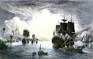
Background imageGulf Of Mexico Collection: Ships entering the Mississippi River from the Gulf of Mexico, 1700s

Ships entering the Mississippi River from the Gulf of Mexico, 1700s
Sailing ships at the mouth of the Mississippi River in the late 1700s. Hand-colored engraving of a 19th-century illustration

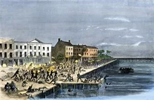
Background imageGulf Of Mexico Collection: Busy New Orleans waterfront, late 1800s

Busy New Orleans waterfront, late 1800s
Steamboats and barges on the Mississippi River at New Orleans, circa 1880. Hand-colored woodcut of a 19th-century illustration

Background imageGulf Of Mexico Collection: Battle at Galveston, Texas, US Civil War

Battle at Galveston, Texas, US Civil War
Rebel attack on the 43rd Massachusetts Volunteers at Galveston, Texas, 1863. Hand-colored woodcut of a 19th-century illustration

Background imageGulf Of Mexico Collection: Confederate explosive mines blocking a river, Civil War

Confederate explosive mines blocking a river, Civil War
Barrel torpedo, or mine, used by Confederates to blockade a southern river mouth, 1860s. Hand-colored woodcut of a 19th-century illustration

Background imageGulf Of Mexico Collection: Map Central America Caribbean Islands Gulf Of Mexico

Map Central America Caribbean Islands Gulf Of Mexico
Map of Central America and the Caribbean islands. Published by Johannes Janssonius, Amsterdam, circa 1650

Background imageGulf Of Mexico Collection: 18th century map of Central America and the Gulf of Mexico engraved by Balthasar Ruyter

18th century map of Central America and the Gulf of Mexico engraved by Balthasar Ruyter

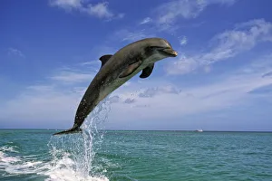
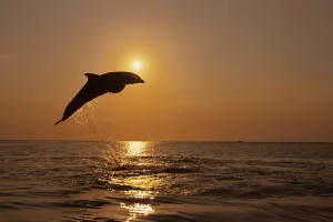
Background imageGulf Of Mexico Collection: Bottle Nose Dolphin Jumping Roatan Honduras Summer

Bottle Nose Dolphin Jumping Roatan Honduras Summer

Background imageGulf Of Mexico Collection: Bottle Nose Dolphin Jumping @ Sunset Roatan Honduras Summer Backlit Silhouette

Bottle Nose Dolphin Jumping @ Sunset Roatan Honduras Summer Backlit Silhouette

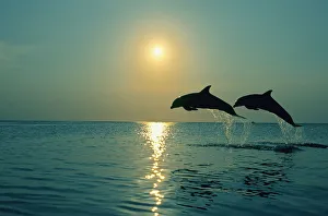
Background imageGulf Of Mexico Collection: Pair Of Bottle Nose Dolphins Jumping @ Sunset Roatan Honduras Summer Backlit

Pair Of Bottle Nose Dolphins Jumping @ Sunset Roatan Honduras Summer Backlit

Background imageGulf Of Mexico Collection: Old Texas Map

Old Texas Map - Scanned 1887 map

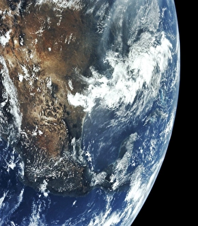
Background imageGulf Of Mexico Collection: Apollo 11, Close-Up, Cloud, Color Image, Environment, Exploration, Globe, Gulf Of Mexico

Apollo 11, Close-Up, Cloud, Color Image, Environment, Exploration, Globe, Gulf Of Mexico, Horizon, Infinity, Land, Majestic, Mexico, No People, North America, Pacific Ocean, Part Of, Photography

Background imageGulf Of Mexico Collection: GULF OF MEXICO: OIL RIG, 1950. An offshore oil drilling platform in the Gulf of Mexico

GULF OF MEXICO: OIL RIG, 1950. An offshore oil drilling platform in the Gulf of Mexico. Photograph, 1950

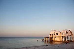
Background imageGulf Of Mexico Collection: Sunken domes of cape romano

Sunken domes of cape romano
sunrise over the sunken domes of Cape Romano. Once a vacation residence but two Hurricanes destroyed the island and so these abandoned buildings slowly wandered into the Gulf of Mexico

Background imageGulf Of Mexico Collection: A remora fish swimming up looking for a host

A remora fish swimming up looking for a host to ride and use as a suction pad

Background imageGulf Of Mexico Collection: Part of an oil slick in the Gulf of Mexico

Part of an oil slick in the Gulf of Mexico
May 7, 2010 - Part of an oil slick in the Gulf of Mexico. The U.S. Coast Guard is working with BP, Gulf residents and other federal agencies to slow the spread of oil following the explosion of

Background imageGulf Of Mexico Collection: Sea shells on South Padre Island beach, Gulf of Mexico, Texas, USA

Sea shells on South Padre Island beach, Gulf of Mexico, Texas, USA

Background imageGulf Of Mexico Collection: Mexico, Yucatan, Progreso. Statue of the founder of Progreso, Juan Miguel Castro

Mexico, Yucatan, Progreso. Statue of the founder of Progreso, Juan Miguel Castro. It is located at the west end of the pier, along the Malecon. It was established in 1926

Background imageGulf Of Mexico Collection: Mexico, Yucatan, Progreso. The beach of Progreso with the 5 mile long Progreso pier

Mexico, Yucatan, Progreso. The beach of Progreso with the 5 mile long Progreso pier in the background

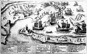
Background imageGulf Of Mexico Collection: BATTLE OF PENSACOLA, 1781. The siege of Pensacola, Florida, held by the British

BATTLE OF PENSACOLA, 1781. The siege of Pensacola, Florida, held by the British, by Spanish troops under the command of Bernardo de Galvez, 1781. Contemporary Spanish line engraving

Background imageGulf Of Mexico Collection: CABEZA de VACA EXPEDITION. Alvar Nunez Cabeza de Vaca and his men during their eight-year trek

CABEZA de VACA EXPEDITION. Alvar Nunez Cabeza de Vaca and his men during their eight-year trek between the Gulf of Mexico and Mexico City, 1528-36. Illustration by Alfred Russell

Background imageGulf Of Mexico Collection: PPIR2A-00001

PPIR2A-00001
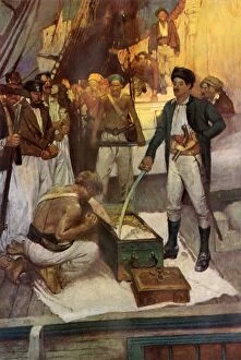
Pirate Jean Lafitte accepts a chest of ransom. Printed color halftone reproduction of a Frank Schoonover illustration

Background imageGulf Of Mexico Collection: EVNT2A-00160

EVNT2A-00160
US troops landing at Vera Cruz, Mexico, during the US-Mexican War, 1847. Hand-colored woodcut of a 19th-century illustration

Background imageGulf Of Mexico Collection: Mexico at the time of Cortes, 1500s

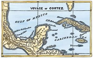
Mexico at the time of Cortes, 1500s
Map of Cortes landing area in Mexico, 1519. Hand-colored woodcut of a 19th-century illustration

Background imageGulf Of Mexico Collection: Early map of the New World, 1513

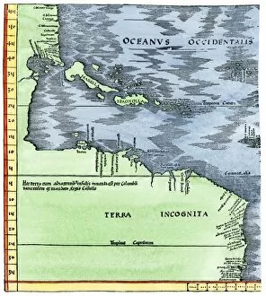
Early map of the New World, 1513
Tabula Terre Nove 1513: the Admirals Map of the Caribbean and Terra Incognita (unknown lands). Hand-colored woodcut reproduction

Background imageGulf Of Mexico Collection: CSS Sumter at New Orleans, 1861

CSS Sumter at New Orleans, 1861
Confederate cruiser " Sumter" leaving New Orleans, June 1861. Hand-colored woodcut of a 19th-century illustration

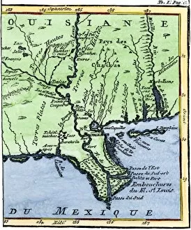
Background imageGulf Of Mexico Collection: EXPL2A-00302

EXPL2A-00302
Map of Louisiana, 1744, showing the mouths of the Mississippi River while part of New France. Hand-colored woodcut reproduction of the map


All Professionally Made to Order for Quick Shipping

The Gulf of Mexico: A Captivating Blend of History, Natural Beauty, and Coastal Delights Step into a world where the Caribbean islands meet the United States in the enchanting Gulf of Mexico. Since the 1870s, this stunning body of water has been a haven for travelers seeking paradise on earth. In Florida's St Pete Beach, nestled along the shores of the Gulf Of Mexico, lies an architectural gem known as Don CeSar Hotel or Pink Palace. Its grandeur is reminiscent of a bygone era when elegance reigned supreme. Venturing further south to Costa Rica reveals a vector map showcasing its proximity to this magnificent gulf. And off its coast lie Cape Romano sunken domes - mysterious structures that have captured imaginations for years. Travel back in time to Galveston, Texas during the 1800s when it served as a bustling seaport. The echoes of history still resonate through its streets and harbor today. Exploring ocean currents off the Americas unveils nature's intricate dance within these azure waters. EVCW2A-00109 captures this captivating phenomenon with scientific precision. Discovering The Lesser Antilles or Windward Islands offers glimpses into both their natural beauty and cultural heritage. These islands are complemented by Eastern part Leeward Islands - truly an archipelago worth exploring. Witness sea oats gracefully swaying atop sand dunes on South Padre Island – an idyllic scene that epitomizes tranquility along the Gulf Coastline. Delve deeper into history with a glance at a 17th-century map depicting New World discoveries – reminding us how exploration shaped our understanding of this vast region. For those seeking relaxation amidst white sands, Mississippi Beach at Biloxi Resort beckons visitors to unwind and soak up endless miles of pristine coastline along the Gulf Of Mexico coast. Finally, marvel at engineering prowess as you traverse Sunshine Skyway Bridge over Tampa Bay, connecting Saint Petersburg to the rest of Florida.