Fraud Blocker Skip to main content

Globe Navigational Equipment Collection

"Exploring the World

Background imageGlobe Navigational Equipment Collection: Map of Ireland 1897

Map of Ireland 1897
Map of Ireland

Background imageGlobe Navigational Equipment Collection: Scotland map 1875

Scotland map 1875
The Independent Course Comprehensive Geography by James Monteith, A.S. Barnes & Co, New York & Chicago 1875

Background imageGlobe Navigational Equipment Collection: Twilight at the Boudhanath Stupa in Kathmandu, Nepal

Twilight at the Boudhanath Stupa in Kathmandu, Nepal
Turn up the light in new year in Boudhanath Stupa Boudhanath is a UNESCO world heritage site in the Kathmandu valley, Nepal

Background imageGlobe Navigational Equipment Collection: Map of the world 1869

Map of the world 1869
Cornells Grammars-School Geography - S.S. Cornell - New York D. Appleton and Company 1869

Background imageGlobe Navigational Equipment Collection: Charon the ferryman engraving

Charon the ferryman engraving
Charon the ferryman of Hell engraving by Gustave Dore

Background imageGlobe Navigational Equipment Collection: England and Wales map 1875

England and Wales map 1875
The Independent Course Comprehensive Geography by James Monteith, A.S. Barnes & Co, New York & Chicago 1875

Background imageGlobe Navigational Equipment Collection: Italy map 1875

Italy map 1875
The Independent Course Comprehensive Geography by James Monteith, A.S. Barnes & Co, New York & Chicago 1875

Background imageGlobe Navigational Equipment Collection: Palestine map 1875

Palestine map 1875
The Independent Course Comprehensive Geography by James Monteith, A.S. Barnes & Co, New York & Chicago 1875

Background imageGlobe Navigational Equipment Collection: Map of the world according to Strabo

Map of the world according to Strabo 63 B.C

Background imageGlobe Navigational Equipment Collection: Solar System According to Ptolemy, Copernicus and Tycho, Geocentric Model, Heliocentric Model

Solar System According to Ptolemy, Copernicus and Tycho, Geocentric Model, Heliocentric Model

Background imageGlobe Navigational Equipment Collection: Map of Spain and France 1869

Map of Spain and France 1869
Cornells Grammars-School Geography - S.S. Cornell - New York D. Appleton and Company 1869

Background imageGlobe Navigational Equipment Collection: World map by Martin Behaim, 1492, wood engraving, published 1884

World map by Martin Behaim, 1492, wood engraving, published 1884
World map by Martin Behaim, 1492. Woodcut engraving from my archive, published in 1884

Background imageGlobe Navigational Equipment Collection: Map of Berlin 1895

Map of Berlin 1895
Map of Berlin (surroundings), Germany

Background imageGlobe Navigational Equipment Collection: Prayer flags with the Boudhanath Stupa in Kathmandu, Nepal

Prayer flags with the Boudhanath Stupa in Kathmandu, Nepal
Boudhanath Stupa in the Kathmandu valley, Nepal. Boudhanath is a UNESCO world heritage site

Background imageGlobe Navigational Equipment Collection: Ireland map 1875

Ireland map 1875
The Independent Course Comprehensive Geography by James Monteith, A.S. Barnes & Co, New York & Chicago 1875

Background imageGlobe Navigational Equipment Collection: Trang Tien (or Truong Tien) bridge from above in Hue, Vietnam

Trang Tien (or Truong Tien) bridge from above in Hue, Vietnam

Background imageGlobe Navigational Equipment Collection: Vintage Map of the World

Vintage Map of the World
Vintage map of the world from 1837

Background imageGlobe Navigational Equipment Collection: Satan and Beelzebub engraving

Satan and Beelzebub engraving
Satan and Beelzebub

Background imageGlobe Navigational Equipment Collection: Antique map of the world, 1873

Antique map of the world, 1873
Vintage engraving of a Victorian Antique map of the world, 1873

Background imageGlobe Navigational Equipment Collection: Map of Europe 1721

Map of Europe 1721

Background imageGlobe Navigational Equipment Collection: Machu Picchu, a UNESCO world heritage site in Peru

Machu Picchu, a UNESCO world heritage site in Peru. It is ruins city of Inca kingdom. The city ruins of Machu Picchu is surrounded by high mountains. The picture is captured in a clear blue sky day

Background imageGlobe Navigational Equipment Collection: Mt. Huangshan in Anhui, China

Mt. Huangshan in Anhui, China morning

Background imageGlobe Navigational Equipment Collection: Alabama Florida Georgia map 1881

Alabama Florida Georgia map 1881
Coltons Common School Geography 1881 New York Sheldon and Co

Background imageGlobe Navigational Equipment Collection: New York Maryland Pennsylvania map 1881

New York Maryland Pennsylvania map 1881
Coltons Common School Geography 1881 New York Sheldon and Co

Background imageGlobe Navigational Equipment Collection: Old Map Elements

Old Map Elements
Old map icons, eps 9

Background imageGlobe Navigational Equipment Collection: World map by Mathieu Albert Lotter, Augsburg, 1778

World map by Mathieu Albert Lotter, Augsburg, 1778
World map from 1778. Original hand-colored copper engraving by Matthieu Albert Lotter (1741 - 1810, Augsburg) with route of James Cooks First Circumnavigation (1770), through Tahiti

Background imageGlobe Navigational Equipment Collection: Asia map 1875

Asia map 1875
The Independent Course Comprehensive Geography by James Monteith, A.S. Barnes & Co, New York & Chicago 1875

Background imageGlobe Navigational Equipment Collection: USA New England states map 1875

USA New England states map 1875
The Independent Course Comprehensive Geography by James Monteith, A.S. Barnes & Co, New York & Chicago 1875

Background imageGlobe Navigational Equipment Collection: Angkor Wat temple at sunrise reflecting in water

Angkor Wat temple at sunrise reflecting in water

Background imageGlobe Navigational Equipment Collection: World eastern hemispheres 1883

World eastern hemispheres 1883
Warrens Common School Geography

Background imageGlobe Navigational Equipment Collection: Wisconsin Michigan map 1881

Wisconsin Michigan map 1881
Coltons Common School Geography 1881 New York Sheldon and Co

Background imageGlobe Navigational Equipment Collection: Arrival of souls purgatory engraving 1870

Arrival of souls purgatory engraving 1870
The Dore Gallery by Edmund Ollier - Cassel, Petter and Galpin (London-New York) 1870

Background imageGlobe Navigational Equipment Collection: Map of Suez Canal 1897

Map of Suez Canal 1897

Background imageGlobe Navigational Equipment Collection: Commercial chart of the world map 1875

Commercial chart of the world map 1875
The Independent Course Comprehensive Geography by James Monteith, A.S. Barnes & Co, New York & Chicago 1875

Background imageGlobe Navigational Equipment Collection: Map of Hannover 1895

Map of Hannover 1895
Map of Hannover, Germany

Background imageGlobe Navigational Equipment Collection: Map of Siberia 1895

Map of Siberia 1895
Map of Siberia

Background imageGlobe Navigational Equipment Collection: Map of St. Petersburg 1895

Map of St. Petersburg 1895
Map of St. Petersburg, Russia

Background imageGlobe Navigational Equipment Collection: Map of Fiji Sumatra Borneo 1897

Map of Fiji Sumatra Borneo 1897
Map of Fiji, Borneo, Sumatra, java

Background imageGlobe Navigational Equipment Collection: Western Hemisphere map 1856

Western Hemisphere map 1856
Colton and Fitchs Modern School Geography by George W. Fitch - New York 1856

Background imageGlobe Navigational Equipment Collection: Ancient Greece map 1875

Ancient Greece map 1875
The Independent Course Comprehensive Geography by James Monteith, A.S. Barnes & Co, New York & Chicago 1875

Background imageGlobe Navigational Equipment Collection: Germany map 1875

Germany map 1875
The Independent Course Comprehensive Geography by James Monteith, A.S. Barnes & Co, New York & Chicago 1875

Background imageGlobe Navigational Equipment Collection: Map of Kosice

Map of Kosice
Antique illustration of a map of Kosice

Background imageGlobe Navigational Equipment Collection: General view of Douro river and city of Oporto al sunset. Porto (Oporto), Portugal

General view of Douro river and city of Oporto al sunset. Porto (Oporto), Portugal

Background imageGlobe Navigational Equipment Collection: Bayon Castle, Angkor Thom, Cambodia

Bayon Castle, Angkor Thom, Cambodia

Background imageGlobe Navigational Equipment Collection: World western hemispheres 1883

World western hemispheres 1883
Warrens Common School Geography

Background imageGlobe Navigational Equipment Collection: Satan approaching earth engraving

Satan approaching earth engraving
Satan approaching the confines of the earth engraving by Gustave Dore

Background imageGlobe Navigational Equipment Collection: Ocean currents map 1875

Ocean currents map 1875
The Independent Course Comprehensive Geography by James Monteith, A.S. Barnes & Co, New York & Chicago 1875


All Professionally Made to Order for Quick Shipping

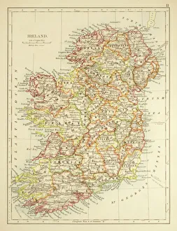
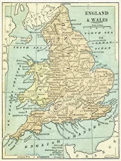
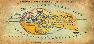
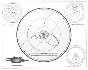
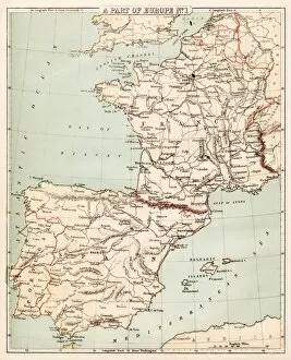
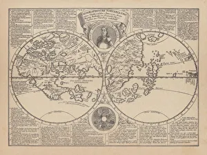
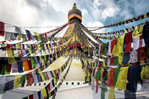
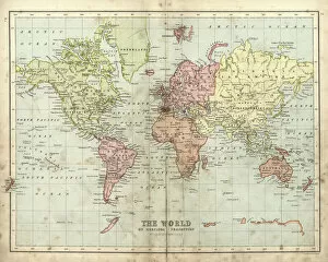
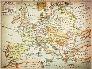
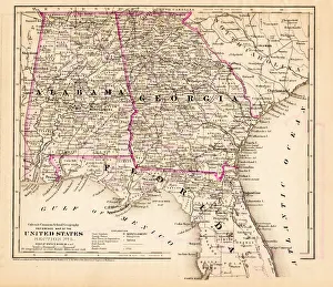
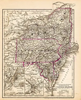
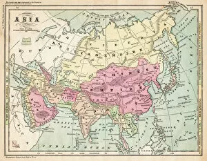
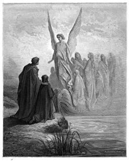
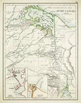
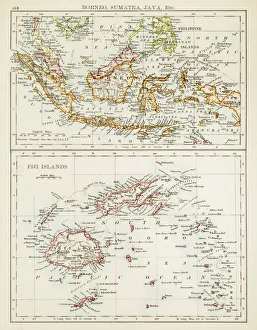
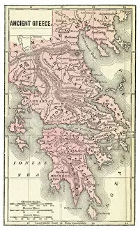
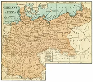
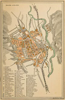
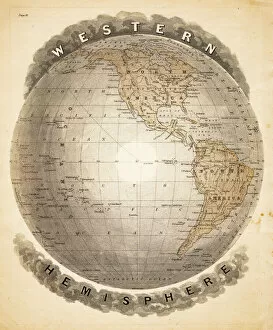
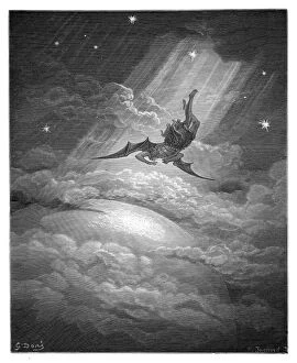
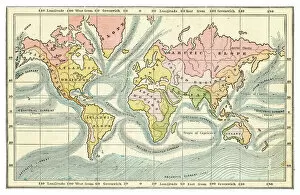
"Exploring the World: Navigating with Globe Navigational Equipment" Embark on a journey through time and space as we delve into the fascinating world of globe navigational equipment. From ancient maps to celestial models, these tools have guided explorers, scholars, and dreamers alike. Step back in time with the Map of Ireland from 1897, an intricate depiction of this enchanting land's topography and history. Travel further east to Palestine map from 1875, unraveling its rich cultural tapestry etched onto paper. Explore England and Wales through a map dating back to 1875, tracing the footsteps of generations past. Venture southward towards Spain and France with a map from 1869 - witness how borders have shifted over time while marveling at their shared heritage. As twilight descends upon Kathmandu's Boudhanath Stupa in Nepal, let your gaze wander upwards to celestial wonders depicted by Ptolemy, Copernicus, and Tycho in their geocentric and heliocentric models. Pause for reflection as you encounter Charon the ferryman engraving - a reminder of life's transient nature amidst our quest for knowledge. Continue your exploration across Italy via a map from 1875 or venture northwards towards Scotland where tales of clans unfold on another captivating cartographic piece. Discover Strabo's vision of the world through his ancient map that shaped perceptions centuries ago. Immerse yourself in spiritual traditions as prayer flags flutter alongside Nepal's iconic Boudhanath Stupa. Finally, travel back even further in time with Martin Behaim's wood engraving depicting his world map from 1492 - an invaluable artifact that captures mankind's evolving understanding of our planet. These glimpses into history remind us that globe navigational equipment has been instrumental in shaping our collective understanding of geography, culture, science, and spirituality throughout millennia.