Fraud Blocker Skip to main content

Geology Collection (page 2)

"Exploring the Earth's Rich Tapestry: A Journey through Geology" William Smith Geological Map: Unveiling the intricate layers of our planet's history

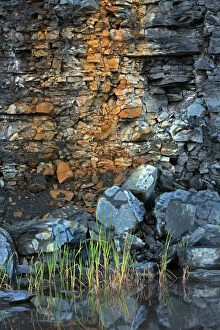
Background imageGeology Collection: Picture No. 11050092

Picture No. 11050092
Marcellus Shale natural gas bearing rock gas extracted using controversial fracking or hydraulic fracturing New York, USA Date:

Background imageGeology Collection: The Devils Chimney

The Devils Chimney, a distintive natural rock formation on Leckhampton Hill, overlooking the road between Cheltenham and Birdlip, Gloucestershire, England. Date: late 1930s

Background imageGeology Collection: Marsden Rock

Marsden Rock
Marden Rock, near South Shields, County Durham, England. Date: BC

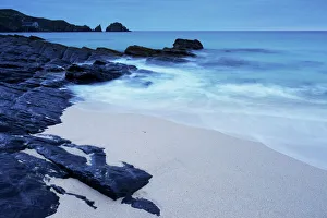
Background imageGeology Collection: Great Bernera beach, Isle of Lewis, Western Isles, Scotland, United Kingdom, Europe

Great Bernera beach, Isle of Lewis, Western Isles, Scotland, United Kingdom, Europe

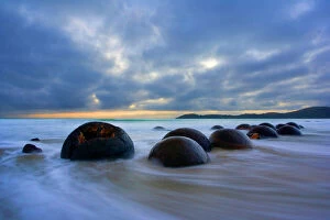
Background imageGeology Collection: Moeraki Boulders - massive spherical rocks at dawn surrounded by water of incoming tide Coastal

Moeraki Boulders - massive spherical rocks at dawn surrounded by water of incoming tide Coastal Otago, South Island
SAS-674 Moeraki Boulders - massive spherical rocks at dawn surrounded by water of incoming tide Coastal Otago, South Island

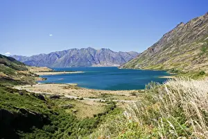
Background imageGeology Collection: New Zealand - Lake Wanaka formed by glacial action 10000 years ago. Wanaka - South Island

New Zealand - Lake Wanaka formed by glacial action 10000 years ago. Wanaka - South Island
MAB-769 New Zealand - Lake Wanaka formed by glacial action 10000 years ago. Wanaka - South Island Mark Boulton Please note that prints are for personal display purposes only

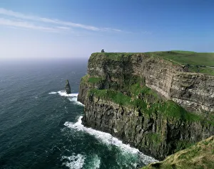
Background imageGeology Collection: Cliffs of Moher

Cliffs of Moher, County Clare, Munster, Eire (Republic of Ireland), Europe

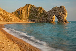
Background imageGeology Collection: Durdle Door at sunrise, Jurassic Coast, Dorset, England

Durdle Door at sunrise, Jurassic Coast, Dorset, England

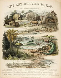
Background imageGeology Collection: A rare British broadsheet illustration with contemporary hand colouring

A rare British broadsheet illustration with contemporary hand colouring, drawn and engraved by John Emslie and published by James Reynolds in 1849

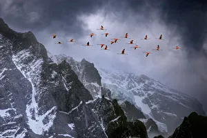
Background imageGeology Collection: Chilean flamingos (Phoenicopterus chilensis) in flight over mountain peaks with glacier in

Chilean flamingos (Phoenicopterus chilensis) in flight over mountain peaks with glacier in the distance, Torres Del Paine National Park, Chile

Background imageGeology Collection: Volcanic eruption, Eyjafjallajokull, near the Myrdalsjokull glacier, South Iceland, april 2010

Volcanic eruption, Eyjafjallajokull, near the Myrdalsjokull glacier, South Iceland, april 2010

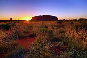
Background imageGeology Collection: Sunset at Uluru, Ayers Rock, Uluru-Kata Tjuta National Park, Northern Territory

Sunset at Uluru, Ayers Rock, Uluru-Kata Tjuta National Park, Northern Territory, Australia

Background imageGeology Collection: Mother Iveys Bay, Cornwall, England, United Kingdom, Europe

Mother Iveys Bay, Cornwall, England, United Kingdom, Europe

Background imageGeology Collection: Himalayas: Mount Everest

Himalayas: Mount Everest

Background imageGeology Collection: 1838 Mantells Geological Strata Section

1838 Mantells Geological Strata Section
An idealised geological section drawn by Gideon Mantell to accompany his book " Wonders of Geology" 1838. It shows the nomenclature in use during the early part of the nineteenth century

Background imageGeology Collection: Soil triangle diagram

Soil triangle diagram. This diagram is used to work out the type of soil in an area. A sample of soil is left to settle in water. Larger particles settle out of suspension faster than smaller ones

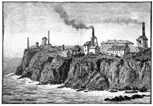
Background imageGeology Collection: Cornish tin mines, 19th century

Cornish tin mines, 19th century
Cornish tin mines, 19th-century artwork. These mines are in the parish of St Just in Penwith, Cornwall, UK. 19th-century tin mines in this area date back to 1721

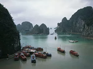
Background imageGeology Collection: Halong Bay, Quang Nin, Vietnam

Halong Bay, Quang Nin, Vietnam
View of Halong (or Ha Long) Bay, near Ha Long City (also known as Hong Gai), capital of Quang Nin Province, Vietnam. Ha Long Bay (meaning Descending Dragon Bay)

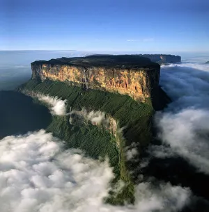
Background imageGeology Collection: Venezuela - Mount Roraima AWA0099

Venezuela - Mount Roraima AWA0099
AW-6610 Venezuela - Mount Roraima Adrian Warren Please note that prints are for personal display purposes only and may not be reproduced in any way

Background imageGeology Collection: Venezuela Mount Roraima from the north

Venezuela Mount Roraima from the north
AW-6510 VENEZUELA - Mount Roraima, viewed from the north Giant flat-topped mountain in the Canaima National Park. Venezuela Part of the Pakaraima mountain range Adrian Warren Please note that prints

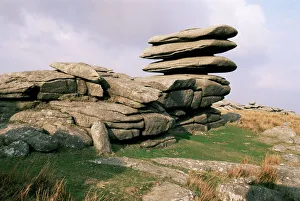
Background imageGeology Collection: Rough Tor Rocks, Bodmin Moor, near Camelford, Cornwall, England, United Kingdom, Europe

Rough Tor Rocks, Bodmin Moor, near Camelford, Cornwall, England, United Kingdom, Europe

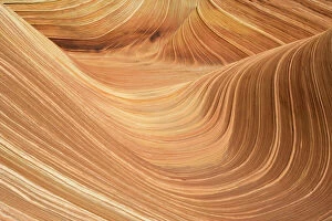
Background imageGeology Collection: USA - The Wave, a breathtaking work of art, naturally carved in beautiful red

USA - The Wave, a breathtaking work of art, naturally carved in beautiful red
TD-1851 The Wave, naturally carved in beautiful red and yellow striated soft Navajo sandstone. North Coyote Buttes, Paria Canyon-Vermilion Cliffs Wilderness, Vermilion Cliffs National Monument

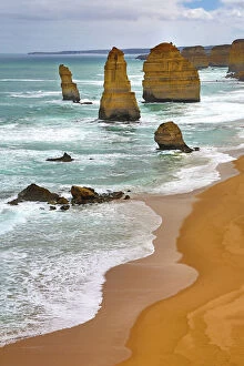
Background imageGeology Collection: The Twelve Apostles limestone stacks, Port Campbell National Park, Great Ocean Road

The Twelve Apostles limestone stacks, Port Campbell National Park, Great Ocean Road, Victoria, Australia

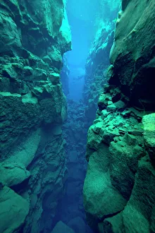
Background imageGeology Collection: Silfra Canyon - deep fault filled with fresh water in the rift valley between the Eurasian

Silfra Canyon - deep fault filled with fresh water in the rift valley between the Eurasian and American tectonic plates, at Thingvellir National Park, Iceland. June 2014

Background imageGeology Collection: Sunrise at Uluru, Ayers Rock, Uluru-Kata Tjuta Park, Australia

Sunrise at Uluru, Ayers Rock, Uluru-Kata Tjuta Park, Australia
Sunrise at Uluru, Ayers Rock, Uluru-Kata Tjuta National Park, Northern Territory, Australia

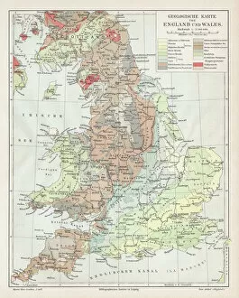
Background imageGeology Collection: England and wales map 1895

England and wales map 1895
Meyers Konversations-Lexikon. Ein Nachschlagewerk des allgemeinen Wissens, 5th edition 17 volumes Bibliographisches Institut - Leipzig 1895-1897

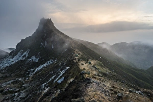
Background imageGeology Collection: Top of Sibayak Volcano at sunrise, Berastagi (Brastagi), North Sumatra, Indonesia

Top of Sibayak Volcano at sunrise, Berastagi (Brastagi), North Sumatra, Indonesia, Southeast Asia, Asia

Background imageGeology Collection: The sea caves of Benagil with natural windows on the clear waters of the Atlantic Ocean

The sea caves of Benagil with natural windows on the clear waters of the Atlantic Ocean, Faro District, Algarve, Portugal, Europe

Background imageGeology Collection: Bow Fiddle Rock, Portknockie, Moray, Scotland, United Kingdom

Bow Fiddle Rock, Portknockie, Moray, Scotland, United Kingdom

Background imageGeology Collection: Durdle Door, Lulworth Cove, Jurassic Coast, UNESCO World Heritage Site, Dorset, England

Durdle Door, Lulworth Cove, Jurassic Coast, UNESCO World Heritage Site, Dorset, England, United Kingdom, Europe

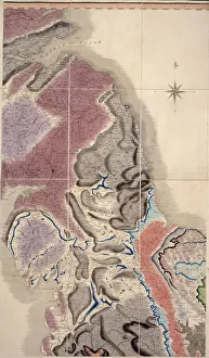
Background imageGeology Collection: First geological map of Britain, 1815 C016 / 5683

First geological map of Britain, 1815 C016 / 5683
First geological map of Britain, detail of the north east coast (figure 8). This map was published in 1815 by British geologist William Smith (1769-1839)

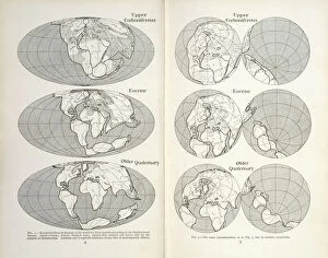
Background imageGeology Collection: Continental drift maps

Continental drift maps
Reconstruction of the map of the world for three periods according to the Displacement Theory. Figs 1-2 from The Origin of Continents and Oceans (1924) by Alfred Wegener

Background imageGeology Collection: Geological unconformity on the river Jed

Geological unconformity on the river Jed. Plate 3 from Theory of the Earth (1795) Vol. 1, by James Hutton
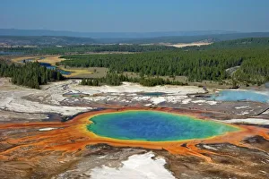
Background imageGeology Collection: Grand Prismatic Spring, Midway Geyser Basin, Yellowstone National Park

Grand Prismatic Spring, Midway Geyser Basin, Yellowstone National Park, UNESCO World Heritage Site, Wyoming, United States of America, North America

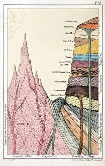
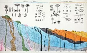
Background imageGeology Collection: 1836 Buckland geology cross-section

1836 Buckland geology cross-section
Detail from a large folding hand coloured copperplate engraving in William Bucklands contribution to the Bridgewater Treatises " Geology

Background imageGeology Collection: Aquamarine crystal

Aquamarine crystal. Aquamarine is a transparent blue or blue-green variety of beryl (beryllium aluminium silicate). The colour is due to trace amounts of iron within the crystal structure

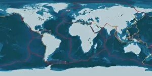
Background imageGeology Collection: Earths tectonic plates

Earths tectonic plates. Global map showing the boundaries of the tectonic plates that make up the Earths crust. The eight major plates are the: African Plate, Antarctic Plate, Indian Plate

Background imageGeology Collection: Continental drift, 100 million years ago

Continental drift, 100 million years ago. Map of the Earth showing the continents some 100 million years after the start of the break-up of the ancient supercontinent of Pangea

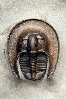
Background imageGeology Collection: Trilobite fossil

Trilobite fossil. Fossil of a trilobite (Aristoharpes sp.) from the Devonian period (around 370 million years ago), showing the species characteristic, spade-like shape

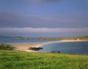
Background imageGeology Collection: St. Ninians Isle tombolo

St. Ninians Isle tombolo, connecting St Ninian to Mainland, South Mainland, Shetland Islands, Scotland, United Kingdom, Europe

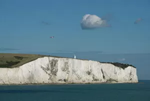
Background imageGeology Collection: White Cliffs of Dover, Dover, Kent, England, United Kingdom, Europe

White Cliffs of Dover, Dover, Kent, England, United Kingdom, Europe

Background imageGeology Collection: Hay Tor rocks, Dartmoor, Devon, England, United Kingdom, Europe

Hay Tor rocks, Dartmoor, Devon, England, United Kingdom, Europe

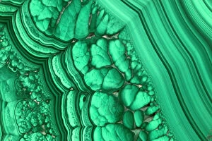
Background imageGeology Collection: Malachite - Lumumbashi, Katanga Province, Congo, Africa

Malachite - Lumumbashi, Katanga Province, Congo, Africa
CAN-2366 Malachite - Lumumbashi, Katanga Province, Congo, Africa John Cancalosi Please note that prints are for personal display purposes only and may not be reproduced in any way

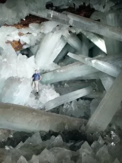
Background imageGeology Collection: Cave of Crystals, Naica Mine, Mexico

Cave of Crystals, Naica Mine, Mexico
^BCave of Crystals.^b Geologist in the Cave of Crystals (^ICueva de los Cristales^i) in Naica Mine, Chihuahua, Mexico. The crystals are the largest known in the world

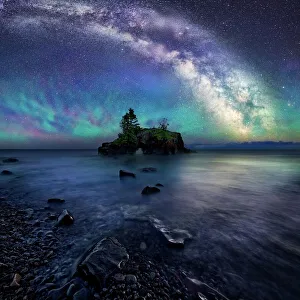
Background imageGeology Collection: Milky Way Over Hollow Rock

Milky Way Over Hollow Rock
Hollow rock is an iconic coastal formation located on the North West side of Lake Superior. Air glow creates a colorful luminescent atmosphere below the night sky and Milky Way

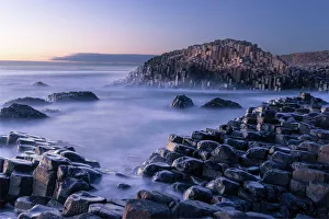
Background imageGeology Collection: The Giants Causeway rises out of the Atlantic late at night as the last light of

The Giants Causeway rises out of the Atlantic late at night as the last light of the sun disappears below the horizon, County Antrim, Northern Ireland, United Kingdom, Europe

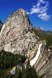
Background imageGeology Collection: Nevada Fall, Half Dome and Liberty Cap, Yosemite National Park, California

Nevada Fall, Half Dome and Liberty Cap, Yosemite National Park, California

Background imageGeology Collection: Clouds over Table Mountain, Cape Town, South Africa, Africa

Clouds over Table Mountain, Cape Town, South Africa, Africa


All Professionally Made to Order for Quick Shipping

"Exploring the Earth's Rich Tapestry: A Journey through Geology" William Smith Geological Map: Unveiling the intricate layers of our planet's history, this map showcases the pioneering work of geologist William Smith. Derwent Water, with Blencathra behind: Nature's masterpiece in Cumbria, England reveals geological wonders that have shaped this breathtaking landscape over millions of years. View to the Seven Sisters from Seaford Head: Witnessing the dramatic cliffs and rolling waves along East Sussex's coast reminds us of nature's relentless force and its impact on shaping our world. Continental drift after 250 million years: Delving into deep time, we unravel how tectonic plates have shifted and continents have drifted apart, reshaping our planet as we know it today. Sunset at Uluru, Ayers Rock: The vibrant hues painting the sky above Australia's iconic monolith remind us of ancient geological processes that formed this majestic landmark over countless millennia. Malham Cove, Yorkshire Dales: Marvel at Mother Nature's artistry as water erodes limestone to create magnificent formations like this awe-inspiring cove in England’s picturesque countryside. Tryfan viewed from Glyder Fach in Snowdonia: Gazing upon Wales' rugged beauty unveils a tale written by glaciers and volcanic activity—a testament to Earth’s dynamic past etched across these towering peaks. Antique colored illustrations - Geological map of England and Wales: Step back in time with these vintage maps that guided early geologists through uncharted territories, unlocking secrets hidden beneath our feet. Durdle Door, Dorset: Carved by relentless waves over eons, this natural limestone arch stands proudly on Dorset’s Jurassic Coast—a living testament to Earth’s ongoing transformational journey. Geological map of Britain and Ireland.