Fraud Blocker Skip to main content

Geography Collection (page 18)

"Exploring the Rich Tapestry of Geography: From Ancient Maps to Modern Wonders" The Al-Idrisi's world map from 1154 takes us back in time

Background imageGeography Collection: Bronze bas-relief with Allegory of Astronomy. Detail of the monument to Pope Sisto IV

Bronze bas-relief with Allegory of Astronomy. Detail of the monument to Pope Sisto IV. Vatican Grottoes, Vatica City. The monument is a work by Antonio del Pollaiolo

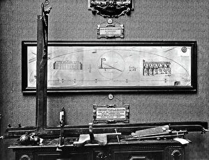
Background imageGeography Collection: Instruments used by the astronomer Gian Domenico Cassini, for determining the meridian in

Instruments used by the astronomer Gian Domenico Cassini, for determining the meridian in the Basilica of Bologna. The measurements were done in 1655

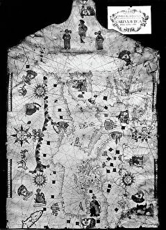
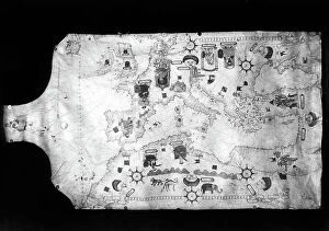
Background imageGeography Collection: Pilot's Book of the Majorcan scientist Banet-Paredes, depicting the basin of the Mediterranean Sea

Pilot's Book of the Majorcan scientist Banet-Paredes, depicting the basin of the Mediterranean Sea, Europe and the Black Sea

Background imageGeography Collection: Pilot's Book of a scientist from Siena, Giulio Cesare Petrucci

Pilot's Book of a scientist from Siena, Giulio Cesare Petrucci, depicting the basin of the Mediterranean Sea, Europe and the Black Sea

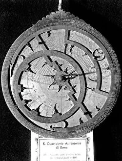
Background imageGeography Collection: Arab astrolab built by the scientist Hain-ibn-Said in 1917. The image shows the front part of

Arab astrolab built by the scientist Hain-ibn-Said in 1917. The image shows the front part of the object, with tympanum, the mother and net

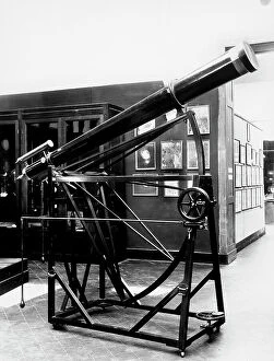
Background imageGeography Collection: Telescope with parallactic mounting, used by the Emilian astronomer P

Telescope with parallactic mounting, used by the Emilian astronomer P. Angelo Secchi, in the study of the solar rays. The instrument is preserved in the Astronomical Observatory of Rome

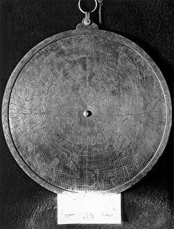
Background imageGeography Collection: Universal Astrolabe from the sixteenth century preserved in the Astronomic Observatory of Rome

Universal Astrolabe from the sixteenth century preserved in the Astronomic Observatory of Rome. The picture shows the rear part of the object where there are representations of the constellations

Background imageGeography Collection: Large globe from the cosmographer and geographer Vincenzo Maria Coronelli from 1688

Large globe from the cosmographer and geographer Vincenzo Maria Coronelli from 1688. The instrument, which has a small depictions of lions at its base is preserved in the Ximeniano Observatory of

Background imageGeography Collection: Medium telescope with sight from the astronomer and physicist Giovanni Battisti Amici preserved in

Medium telescope with sight from the astronomer and physicist Giovanni Battisti Amici preserved in the Astronomical Observatory of Arcetri

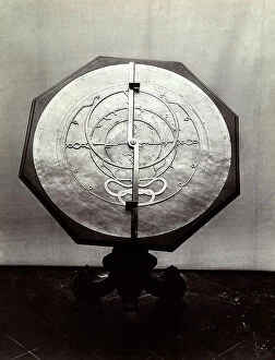
Background imageGeography Collection: Large Florentine astrolabe with lines and mesh, on a small octagonal table dating back to

Large Florentine astrolabe with lines and mesh, on a small octagonal table dating back to the first half of the seventh century

Background imageGeography Collection: Odometer used by the Accademia del Cimento and conserved in the Instituto e Museo di Storia della

Odometer used by the Accademia del Cimento and conserved in the Instituto e Museo di Storia della Scienza di Firenze. The photo was realeased in occasion of the Esposizione di Storia della Scienza

Background imageGeography Collection: Room in the Querini-Stampalia Museum in Venice

Room in the Querini-Stampalia Museum in Venice Venice Querini-Stampalia Museum. Date of Photograph:1962

Background imageGeography Collection: Captain's log depicting the British Islands. The photo was taken for the occasion of

Captain's log depicting the British Islands. The photo was taken for the occasion of the Exhibition of the History of Science from 1929, Florence. The work is preserved in Venice

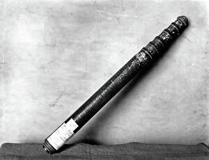
Background imageGeography Collection: Telescope from the scientist Eustachio Divini, from the XVII century

Telescope from the scientist Eustachio Divini, from the XVII century, preserved in the Copernican Museum of Rome. The photo was taken for the occasion of the Exhibition of the History of Science

Background imageGeography Collection: Universal astrolabe in the rear part that also serves as a quadrant of height

Universal astrolabe in the rear part that also serves as a quadrant of height, from the sixteenth century. The instrument is preserved in the Astronomic Observatory of Rome

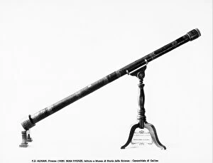
Background imageGeography Collection: One of the first monoculars attributed to Galileo Galilei which still exists in the Tribuna

One of the first monoculars attributed to Galileo Galilei which still exists in the Tribuna, preserved in the Instituto Mueso di Storia della Scienza in Florence

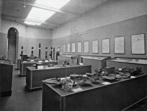
Background imageGeography Collection: Room with cases in the center and maps on the wall. In the case in the back are different types of

Room with cases in the center and maps on the wall. In the case in the back are different types of magnetic compasses; in the second case are an antique water clock

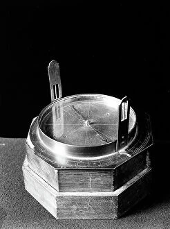
Background imageGeography Collection: Compass belonging to the Admiral Jacopo Inghirami in the eighteenth century

Compass belonging to the Admiral Jacopo Inghirami in the eighteenth century. The picture was taken during the Exhibition of Science History in 1929, in Florence

Background imageGeography Collection: Pilot's book representing a detail of the British Islands. The picture was taken during

Pilot's book representing a detail of the British Islands. The picture was taken during the Exhibition of Science History in 1929, in Florence

Background imageGeography Collection: Telescope belonged to the scientist Azzarelli dating back to the 1661

Telescope belonged to the scientist Azzarelli dating back to the 1661. The picture was taken during the Exhibition of Science History in 1929, in Florence

Background imageGeography Collection: Pilot?s book of the senese Giulio Cesare Petrucci representing the British Islands

Pilot?s book of the senese Giulio Cesare Petrucci representing the British Islands. The paper is dated 1571 and is preserved in the Astronomic Observatory of Bologna

Background imageGeography Collection: Pilot's Book of the Majorcan scientist, Matteo Brunes depicting the basin of the Mediterranean Sea

Pilot's Book of the Majorcan scientist, Matteo Brunes depicting the basin of the Mediterranean Sea, Europe and the Black Sea. The paper is preserved in the Astronomic Observatory of Bologna

Background imageGeography Collection: Pilot's Book of a scientist from Ancona, Rocco dall'Olmo depicting the basin of the Mediterranean

Pilot's Book of a scientist from Ancona, Rocco dall'Olmo depicting the basin of the Mediterranean Sea, Europe and the Black Sea

Background imageGeography Collection: Statue of San Tommaso Rangone; sculpture attributed to Jacopo Sansovino

Statue of San Tommaso Rangone; sculpture attributed to Jacopo Sansovino, located in the monumento to Tommaso Rangone, Church of San Giuliano in Venice Venice Church of S

Background imageGeography Collection: Busy view of Acquaverde in Genoa; in the foreground is a monument to Christopher Columbus

Busy view of Acquaverde in Genoa; in the foreground is a monument to Christopher Columbus. Genoa Piazza Acquaverde Monument Romanticism, Nineteenth century, 19th century, Europe

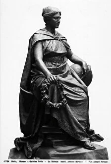
Background imageGeography Collection: Allegory of Scienza. Statue in bronze belonging to the monument of Quintino Sella

Allegory of Scienza. Statue in bronze belonging to the monument of Quintino Sella, realized by the sculptor Antonio Bortone

Background imageGeography Collection: Plan of the city of Florence, 1865, Giuseppe Poggi, Museum of 'Firenze Com'era', Florence

Plan of the city of Florence, 1865, Giuseppe Poggi, Museum of "Firenze Com'era", Florence Florence Museum of "Firenze Com'era" Print Arts and handicrafts of XIX century

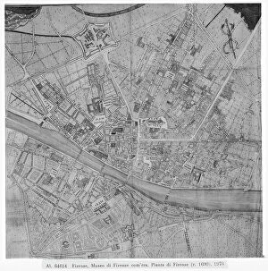
Background imageGeography Collection: Plan of the city of Florence, c. 1690, Museum of 'Firenze Com'era', Florence

Plan of the city of Florence, c. 1690, Museum of "Firenze Com'era", Florence Florence Museum of "Firenze Com'era" Print Renaissance

Background imageGeography Collection: Plan of the city of Florence, 1783, designed by Francesco Magnelli and engraved by Cosimo Zocchi

Plan of the city of Florence, 1783, designed by Francesco Magnelli and engraved by Cosimo Zocchi, Museum of "Firenze Com'era"

Background imageGeography Collection: Plan of the city of Florence, 1843, print, F. Fantozzi, Museum of 'Firenze Com'era', Florence

Plan of the city of Florence, 1843, print, F. Fantozzi, Museum of "Firenze Com'era", Florence Florence Museum of "Firenze Com'era" Print Arts

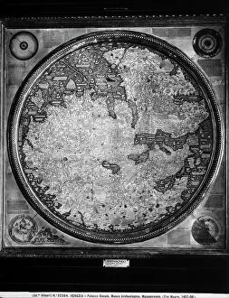
Background imageGeography Collection: Parchment world map on wooden panels; by Fra Mauro, in the Marciana Library in Venice

Parchment world map on wooden panels; by Fra Mauro, in the Marciana Library in Venice Venice Marciana Library Globe Early Renaissance, Renaissance, Renaissance-Baroque styles and periods, Europe

Background imageGeography Collection: Animated view of Piazza Caricamento in Genoa

Animated view of Piazza Caricamento in Genoa Genoa Piazza Caricamento Monument Arts and handicrafts of XIX century, Nineteenth century, 19th century, Europe, First and Second Millennium A.D

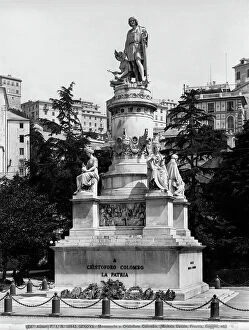
Background imageGeography Collection: View of the monument to Cristopher Columbus in Piazza Acquaverde in Genoa

View of the monument to Cristopher Columbus in Piazza Acquaverde in Genoa Genoa Piazza Acquaverde Monument Romanticism, Nineteenth century, 19th century, Europe, First and Second Millennium A.D

Background imageGeography Collection: Africa, artwork

Africa, artwork
Africa, computer artwork

Background imageGeography Collection: South America, artwork

South America, artwork
South America, computer artwork

Background imageGeography Collection: Atlantic Ocean, artwork

Atlantic Ocean, artwork
Atlantic Ocean, computer artwork

Background imageGeography Collection: Arctic, artwork

Arctic, artwork
Arctic, computer artwork

Background imageGeography Collection: Asia, artwork

Asia, artwork
Asia, computer artwork

Background imageGeography Collection: North America, artwork

North America, artwork
North America, computer artwork

Background imageGeography Collection: Antarctic, artwork

Antarctic, artwork
Antarctic, computer artwork

Background imageGeography Collection: Artic, artwork

Artic, artwork
Artic, computer artwork

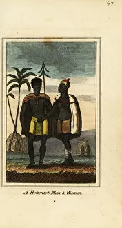
Background imageGeography Collection: Khoikhoi man and woman, South Africa, 1818

Khoikhoi man and woman, South Africa, 1818. They wear animal skins and woven skirts and stand in front of huts covered in animal hides

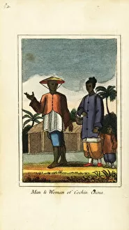
Background imageGeography Collection: Man and woman of Cochin China (Vietnam) 1818

Man and woman of Cochin China (Vietnam) 1818. Handcoloured copperplate engraving from Mary Anne Vennings A Geographical Present being Descriptions of the Principal Countries of the World, Darton

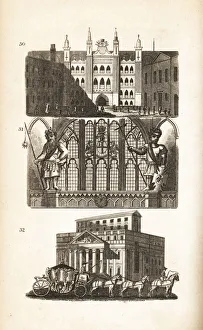
Background imageGeography Collection: London Guildhall, Gog and Magog and the Mansion House

London Guildhall, Gog and Magog and the Mansion House. View of the Guildhall in Moorgate 30, statues of the mythological giant Gogmagog and Corineus 31

Background imageGeography Collection: Aerial view showing the residential suburb of Walker in Newcastle upon Tyne

Aerial view showing the residential suburb of Walker in Newcastle upon Tyne, Tyne and Wear, England with the newly constructed 15 storey flats visible in the background near the St Anthonys gas

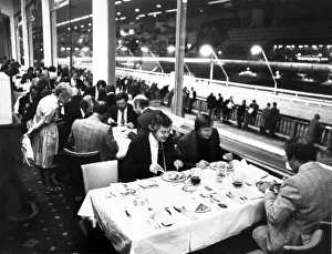
Background imageGeography Collection: Diners enjoying their meal at Belle Vue Greyhound stadium while punters line trails

Diners enjoying their meal at Belle Vue Greyhound stadium while punters line trails outside waiting for the next race. 23rd September 1976

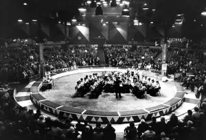
Background imageGeography Collection: The youth of Glossop School Band to play the last music in the Kings Hall at Belle Vue

The youth of Glossop School Band to play the last music in the Kings Hall at Belle Vue before it is torn down. February 1982

Background imageGeography Collection: Exterior view of Belle Vue Granada bowl, Greater Manchester. 7th June 1971

Exterior view of Belle Vue Granada bowl, Greater Manchester. 7th June 1971


All Professionally Made to Order for Quick Shipping

"Exploring the Rich Tapestry of Geography: From Ancient Maps to Modern Wonders" The Al-Idrisi's world map from 1154 takes us back in time, showcasing the early understanding and its importance in navigation. Derwent Water, with Blencathra standing tall behind it, offers a breathtaking view of nature's wonders in the Lake District, Cumbria, England. Jacopo de Barbari's Map of Venice in 1500 allows us to delve into the intricate layout of this enchanting city built on water. An antique map of Tasmania reveals how explorers once charted unknown territories and expanded our knowledge about distant lands. The V & A waterfront and Table Mountain create an awe-inspiring backdrop for Cape Town, South Africa – a testament to geography shaping stunning landscapes. Continental drift after 250 million years shows us that our planet is constantly evolving, reminding us of the dynamic forces at work beneath Earth's surface. Malham Cove stands as a geological marvel within Yorkshire Dales National Park, captivating visitors with its limestone formations carved by natural processes over millennia. Whole Earth (Blue Marble 2000) provides a mesmerizing image capturing our beautiful planet from space – highlighting both its vastness and interconnectedness through geography. The British Empire world map from the 19th century reflects an era when geographical exploration played a significant role in expanding colonial influence across continents. James Craig's Map of New Town Edinburgh from 1768 showcases meticulous topography planning that shaped one of Scotland's most iconic cities even today. Anglo-Saxon 10th-century world map gives insight into early European perceptions and interpretations regarding global geography during medieval times In summary, these diverse hints remind us that geography is not just about maps but also encompasses breathtaking landscapes, historical perspectives on human exploration and settlement, and the ever-changing nature of our planet.