Fraud Blocker Skip to main content

Geographical Collection (page 9)

"Journey through Time and Space: Exploring the Geographical Evolution" Al-Idrisi's World Map, 1154: Unveiling ancient cartographic wisdom

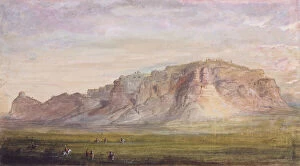
Background imageGeographical Collection: Formations of Rock near the Sweet Water, c. 1837 (w / c on paper)
Formations of Rock near the Sweet Water, c. 1837 (w / c on paper)
5310501 Formations of Rock near the Sweet Water, c.1837 (w/c on paper) by Miller, Alfred Jacob (1810-74); 23.5x33 cm; Joslyn Museum, Omaha, Nebraska

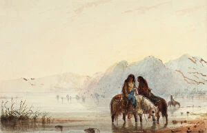
Background imageGeographical Collection: Indian Women, Shoshones, c. 1837 (w / c on paper)

Indian Women, Shoshones, c. 1837 (w / c on paper)
5310500 Indian Women, Shoshones, c.1837 (w/c on paper) by Miller, Alfred Jacob (1810-74); 11.1x16.9 cm; Joslyn Museum, Omaha, Nebraska

Background imageGeographical Collection: Approaching Buffalo, c. 1858 (w / c and gouache on paper)

Approaching Buffalo, c. 1858 (w / c and gouache on paper)
5310496 Approaching Buffalo, c.1858 (w/c and gouache on paper) by Miller, Alfred Jacob (1810-74); 21.6x16.9 cm; Joslyn Museum, Omaha, Nebraska

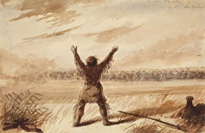
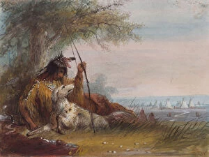
Background imageGeographical Collection: Trapper Disturbed in Rest by a Herd of Buffalo, c. 1837 (pencil, pen and ink, and wash on paper)

Trapper Disturbed in Rest by a Herd of Buffalo, c. 1837 (pencil, pen and ink, and wash on paper)
5310494 Trapper Disturbed in Rest by a Herd of Buffalo, c.1837 (pencil, pen and ink, and wash on paper) by Miller, Alfred Jacob (1810-74); 14.3x21.6 cm; Joslyn Museum, Omaha, Nebraska

Background imageGeographical Collection: Wind River Mountains, c. 1837 (pencil, w / c and gouache on paper)

Wind River Mountains, c. 1837 (pencil, w / c and gouache on paper)
5310487 Wind River Mountains, c.1837 (pencil, w/c and gouache on paper) by Miller, Alfred Jacob (1810-74); 14.0x20.4 cm; Joslyn Museum, Omaha, Nebraska

Background imageGeographical Collection: Scotts Bluff near the Nebraska (Platte), c. 1837 (w / c on paper)

Scotts Bluff near the Nebraska (Platte), c. 1837 (w / c on paper)
5310480 Scotts Bluff near the Nebraska (Platte), c.1837 (w/c on paper) by Miller, Alfred Jacob (1810-74); 17.8x32.4 cm; Joslyn Museum, Omaha, Nebraska

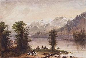
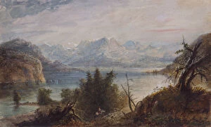
Background imageGeographical Collection: Lake, Wind River Mountains, c. 1837 (w / c on paper)

Lake, Wind River Mountains, c. 1837 (w / c on paper)
5310479 Lake, Wind River Mountains, c.1837 (w/c on paper) by Miller, Alfred Jacob (1810-74); 23.2x30.8 cm; Joslyn Museum, Omaha, Nebraska

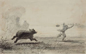
Background imageGeographical Collection: Fontenelle Chased by a Grizzly Bear, c. 1837 (pen, ink and wash on paper)

Fontenelle Chased by a Grizzly Bear, c. 1837 (pen, ink and wash on paper)
5310544 Fontenelle Chased by a Grizzly Bear, c.1837 (pen, ink and wash on paper) by Miller, Alfred Jacob (1810-74); 17.7x19.7 cm; Joslyn Museum, Omaha, Nebraska

Background imageGeographical Collection: Hunting the Mountain Sheep, c. 1837 (pencil, pen and ink, w / c and gouache on paper)

Hunting the Mountain Sheep, c. 1837 (pencil, pen and ink, w / c and gouache on paper)
5310528 Hunting the Mountain Sheep, c.1837 (pencil, pen and ink, w/c and gouache on paper) by Miller, Alfred Jacob (1810-74); 22.5x33 cm; Joslyn Museum, Omaha, Nebraska, USA; American

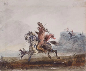
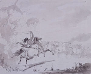
Background imageGeographical Collection: Snakes Pursued by Blackfeet, c. 1837 (watercolour on paper)

Snakes Pursued by Blackfeet, c. 1837 (watercolour on paper)
5054737 Snakes Pursued by Blackfeet, c.1837 (watercolour on paper) by Miller, Alfred Jacob (1810-74); 10.5x12.7 cm; Joslyn Museum, Omaha, Nebraska, USA; American, out of copyright

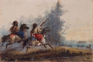
Background imageGeographical Collection: Females, Snake Tribe, Driving Horses, c. 1837 (pencil, w / c and gouache on paper)

Females, Snake Tribe, Driving Horses, c. 1837 (pencil, w / c and gouache on paper)
5054741 Females, Snake Tribe, Driving Horses, c.1837 (pencil, w/c and gouache on paper) by Miller, Alfred Jacob (1810-74); 10.8x19.7 cm; Joslyn Museum, Omaha, Nebraska, USA; American, out of copyright

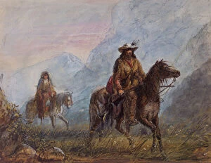
Background imageGeographical Collection: Captain Joseph Rutherford Walker, c. 1837 (w / c on paper)

Captain Joseph Rutherford Walker, c. 1837 (w / c on paper)
5310524 Captain Joseph Rutherford Walker, c.1837 (w/c on paper) by Miller, Alfred Jacob (1810-74); 17.8x23.5 cm; Joslyn Museum, Omaha, Nebraska

Background imageGeographical Collection: Shoshone Female Throwing the Lasso, c. 1837 (pencil, w / c and gouache on paper)

Shoshone Female Throwing the Lasso, c. 1837 (pencil, w / c and gouache on paper)
5054738 Shoshone Female Throwing the Lasso, c.1837 (pencil, w/c and gouache on paper) by Miller, Alfred Jacob (1810-74); 10.8x11.8 cm; Joslyn Museum, Omaha, Nebraska, USA; American, out of copyright

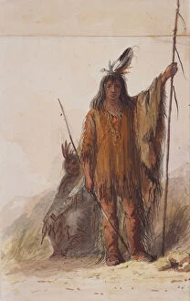
Background imageGeographical Collection: Crow Indian on Lookout, c. 1837 (pen and ink, wash, and gouache on paper)

Crow Indian on Lookout, c. 1837 (pen and ink, wash, and gouache on paper)
5310547 Crow Indian on Lookout, c.1837 (pen and ink, wash, and gouache on paper) by Miller, Alfred Jacob (1810-74); 26.1x20 cm; Joslyn Museum, Omaha, Nebraska, USA; American, out of copyright

Background imageGeographical Collection: Indian Runner, c. 1837 (pencil, watercolour and gouache on paper)

Indian Runner, c. 1837 (pencil, watercolour and gouache on paper)
5054747 Indian Runner, c.1837 (pencil, watercolour and gouache on paper) by Miller, Alfred Jacob (1810-74); 16.8x21.9 cm; Joslyn Museum, Omaha, Nebraska, USA; American, out of copyright

Background imageGeographical Collection: War Dress, c. 1837 (pencil, pen and ink, w / c and gouache on paper)

War Dress, c. 1837 (pencil, pen and ink, w / c and gouache on paper)
5054746 War Dress, c.1837 (pencil, pen and ink, w/c and gouache on paper) by Miller, Alfred Jacob (1810-74); 21.0x13.4 cm; Joslyn Museum, Omaha, Nebraska, USA; American, out of copyright

Background imageGeographical Collection: Lake, Wind River Chain of Mountains, c. 1837 (w / c on paper)

Lake, Wind River Chain of Mountains, c. 1837 (w / c on paper)
5310481 Lake, Wind River Chain of Mountains, c.1837 (w/c on paper) by Miller, Alfred Jacob (1810-74); 18.8x30.2 cm; Joslyn Museum, Omaha, Nebraska, USA; American, out of copyright

Background imageGeographical Collection: Sunrise, Trappers and Travellers at their Meals of Buffalo Hump Rib, c

Sunrise, Trappers and Travellers at their Meals of Buffalo Hump Rib, c
5310532 Sunrise, Trappers and Travellers at their Meals of Buffalo Hump Rib, c.1837 (w/c on paper) by Miller, Alfred Jacob (1810-74); 19.4x22.9 cm; Joslyn Museum, Omaha, Nebraska, USA; American

Background imageGeographical Collection: Trappers and Snake Indians Conversing by Signs, c. 1837 (pencil, w / c and gouache on paper)

Trappers and Snake Indians Conversing by Signs, c. 1837 (pencil, w / c and gouache on paper)
5310502 Trappers and Snake Indians Conversing by Signs, c.1837 (pencil, w/c and gouache on paper) by Miller, Alfred Jacob (1810-74); 22.9x35.3 cm; Joslyn Museum, Omaha, Nebraska, USA; American

Background imageGeographical Collection: Throwing the Lasso, c. 1837 (pen and ink with gray wash on gray card)

Throwing the Lasso, c. 1837 (pen and ink with gray wash on gray card)
5054750 Throwing the Lasso, c.1837 (pen and ink with gray wash on gray card) by Miller, Alfred Jacob (1810-74); 22.2x27.3 cm; Joslyn Museum, Omaha, Nebraska, USA; American, out of copyright

Background imageGeographical Collection: Shoshone Root Diggers, c. 1837 (pen and ink and watercolor on paper)

Shoshone Root Diggers, c. 1837 (pen and ink and watercolor on paper)
5054740 Shoshone Root Diggers, c.1837 (pen and ink and watercolor on paper) by Miller, Alfred Jacob (1810-74); 12.1x15.9 cm; Joslyn Museum, Omaha, Nebraska, USA; American, out of copyright

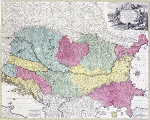
Background imageGeographical Collection: Geographical Map of the Theatre of War, showing the Kingdom of Hungary in the main

Geographical Map of the Theatre of War, showing the Kingdom of Hungary in the main
986323 Geographical Map of the Theatre of War, showing the Kingdom of Hungary in the main, 1771 (hand-coloured engraving.) by German School

Background imageGeographical Collection: Terrestrial globe, 1645-48 (wood, paper, gypsum and copper)

Terrestrial globe, 1645-48 (wood, paper, gypsum and copper)
4071431 Terrestrial globe, 1645-48 (wood, paper, gypsum and copper) by Blaeu, Willem (1571-1638) and Joan (1596-1673); Rijksmuseum, Amsterdam

Background imageGeographical Collection: Southern Asia, commercial (colour litho)

Southern Asia, commercial (colour litho)
3630829 Southern Asia, commercial (colour litho) by English School, (20th century); Private Collection; (add.info.: Southern Asia, commercial)

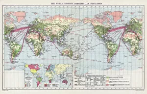
Background imageGeographical Collection: The world, regions commercially developed (colour litho)

The world, regions commercially developed (colour litho)
3630823 The world, regions commercially developed (colour litho) by English School, (20th century); Private Collection; (add.info.: The world, regions commercially developed)

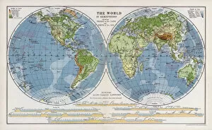
Background imageGeographical Collection: The world in hemispheres showing height of the land and depth of the sea (colour litho)

The world in hemispheres showing height of the land and depth of the sea (colour litho)
3630822 The world in hemispheres showing height of the land and depth of the sea (colour litho) by English School, (20th century); Private Collection; (add.info)

Background imageGeographical Collection: An accurate map of Canada, with the adjacent countries, 1761 (colour engraving)

An accurate map of Canada, with the adjacent countries, 1761 (colour engraving)
5242475 An accurate map of Canada, with the adjacent countries, 1761 (colour engraving) by Seale, Richard William (fl.1732-75); New York Public Library

Background imageGeographical Collection: Page 37c Plan of the harbour of St. Lucia

Page 37c Plan of the harbour of St. Lucia
5670304 Page 37c Plan of the harbour of St. Lucia by Unknown artist, (18th century); Mitchell Library, State Library of New South Wales; (add.info.: Original Sketches, Drawings)

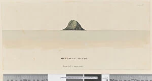
Background imageGeographical Collection: Page 25a / b Osnabrug Island bearings by W 5 leagues distant

Page 25a / b Osnabrug Island bearings by W 5 leagues distant
5670288 Page 25a/b Osnabrug Island bearings by W 5 leagues distant, 1768-75 (drawings & engravings) by Hodges, William (1744-97); Mitchell Library

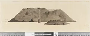
Background imageGeographical Collection: Page 25b / b Profile of unidentified Pacific Island showing a lagoon, 1768-75 (w / c)

Page 25b / b Profile of unidentified Pacific Island showing a lagoon, 1768-75 (w / c)
5670284 Page 25b/b Profile of unidentified Pacific Island showing a lagoon, 1768-75 (w/c) by Hodges, William (1744-97); Mitchell Library

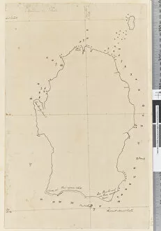
Background imageGeographical Collection: Page 38a Map of S. Andehman Island (pen & ink)

Page 38a Map of S. Andehman Island (pen & ink)
5670305 Page 38a Map of S. Andehman Island (pen & ink) by Unknown artist, (18th century); Mitchell Library, State Library of New South Wales; (add.info.: Original Sketches, Drawings)

Background imageGeographical Collection: Page 3b View of unidentified island. In ink on left hand side N by E

Page 3b View of unidentified island. In ink on left hand side N by E
5670254 Page 3b View of unidentified island. In ink on left hand side N by E and on right hand side E by N, 1768-75 (pen & ink and wash) by Hodges, William (1744-97) (attr)

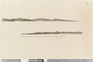
Background imageGeographical Collection: Page 3 Profile of the Island of St. Jago, Cape Verde Island

Page 3 Profile of the Island of St. Jago, Cape Verde Island
5670252 Page 3 Profile of the Island of St. Jago, Cape Verde Island. Titled The Island of St Jago where the point D bears WSW distant 3 leagues

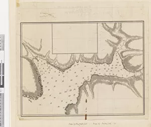
Background imageGeographical Collection: ib. A Plan of the Harbour of Croque in Newfoundland, 1763 (pen & ink and wash)

ib. A Plan of the Harbour of Croque in Newfoundland, 1763 (pen & ink and wash)
5670246 ib. A Plan of the Harbour of Croque in Newfoundland, 1763 (pen & ink and wash) by Cook, James (1728-79); Mitchell Library, State Library of New South Wales; (add.info.: Original Sketches)

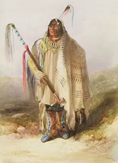
Background imageGeographical Collection: Pehriska-Ruhpa, Hidatsa warrior, 1833-34 (watercolour on paper)

Pehriska-Ruhpa, Hidatsa warrior, 1833-34 (watercolour on paper)
5054767 Pehriska-Ruhpa, Hidatsa warrior, 1833-34 (watercolour on paper) by Bodmer, Karl (1809-93); Joslyn Museum, Omaha, Nebraska

Background imageGeographical Collection: A View of the City of Vienna, the Capital of Germany (engraving)

A View of the City of Vienna, the Capital of Germany (engraving)
1092960 A View of the City of Vienna, the Capital of Germany (engraving) by English School, (18th century); Private Collection; (add.info.: A View of the City of Vienna)

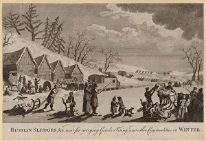
Background imageGeographical Collection: Russian Sledges, etc used for carrying Goods, Firing, and other Commodities in Winter (engraving)

Russian Sledges, etc used for carrying Goods, Firing, and other Commodities in Winter (engraving)
1092947 Russian Sledges, etc used for carrying Goods, Firing, and other Commodities in Winter (engraving) by English School, (18th century); Private Collection; (add.info.: Russian Sledges)

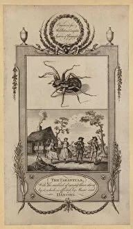
Background imageGeographical Collection: The Tarantula, with the method of curing those stung by it, which is effected by Music

The Tarantula, with the method of curing those stung by it, which is effected by Music and Dancing (engraving)
1092931 The Tarantula, with the method of curing those stung by it, which is effected by Music and Dancing (engraving) by English School

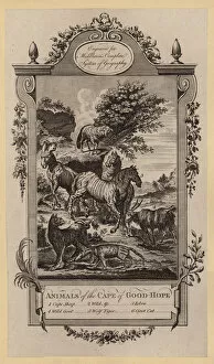
Background imageGeographical Collection: Animals of the Cape of Good-Hope (engraving)

Animals of the Cape of Good-Hope (engraving)
1092928 Animals of the Cape of Good-Hope (engraving) by English School, (18th century); Private Collection; (add.info.: Animals of the Cape of Good-Hope)

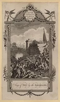
Background imageGeographical Collection: Siege of Diu by the Arabians (engraving)

Siege of Diu by the Arabians (engraving)
1092916 Siege of Diu by the Arabians (engraving) by English School, (18th century); Private Collection; (add.info.: Siege of Diu by the Arabians)

Background imageGeographical Collection: City of Tarifa (engraving)

City of Tarifa (engraving)
1092592 City of Tarifa (engraving) by English School, (19th century); Private Collection; (add.info.: City of Tarifa. Illustration for The Gallery of Geography by Thomas Milner (William Mackenzie)

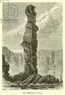
Background imageGeographical Collection: The Old Man of Hoy (engraving)

The Old Man of Hoy (engraving)
1092589 The Old Man of Hoy (engraving) by English School, (19th century); Private Collection; (add.info.: The Old Man of Hoy)

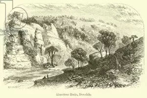
Background imageGeographical Collection: Limestone Rocks, Dovedale (engraving)

Limestone Rocks, Dovedale (engraving)
1092588 Limestone Rocks, Dovedale (engraving) by Sargent, G. F. (fl.1842-60) (after); Private Collection; (add.info.: Limestone Rocks, Dovedale)

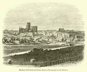
Background imageGeographical Collection: Durham Cathedral and Castle (engraving)

Durham Cathedral and Castle (engraving)
1092587 Durham Cathedral and Castle (engraving) by English School, (19th century); Private Collection; (add.info.: Durham Cathedral and Castle)

Background imageGeographical Collection: Island of Tahiti (engraving)

Island of Tahiti (engraving)
1092582 Island of Tahiti (engraving) by English School, (19th century); Private Collection; (add.info.: Island of Tahiti. Illustration for The Gallery of Geography by Thomas Milner)

Background imageGeographical Collection: Scene in the Desert (engraving)

Scene in the Desert (engraving)
1092578 Scene in the Desert (engraving) by English School, (19th century); Private Collection; (add.info.: Scene in the Desert)

Background imageGeographical Collection: White Quartz Cliffs on the Awass Bogs (engraving)

White Quartz Cliffs on the Awass Bogs (engraving)
1092575 White Quartz Cliffs on the Awass Bogs (engraving) by Jennings, E. (19th century); Private Collection; (add.info.: White Quartz Cliffs on the Awass Bogs)

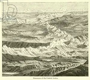
Background imageGeographical Collection: Panorama of the Central Andes (engraving)

Panorama of the Central Andes (engraving)
1092572 Panorama of the Central Andes (engraving) by English School, (19th century); Private Collection; (add.info.: Panorama of the Central Andes)


All Professionally Made to Order for Quick Shipping

"Journey through Time and Space: Exploring the Geographical Evolution" Al-Idrisi's World Map, 1154: Unveiling ancient cartographic wisdom, this map showcases the Islamic scholar's remarkable understanding of global geography. Continental Drift after 250 Million Years: Witnessing Earth's transformative power, this concept reveals how tectonic plates shaped our continents over millions of years. Malham Cove, Yorkshire Dales: A geological marvel standing tall in the picturesque Yorkshire Dales, showcasing nature's artistic prowess carved by ice and water. British Empire World Map, 19th Century: Tracing the vast expanse of an empire on which the sun never set; a testament to Britain's once-global dominance. James Craig Map of New Town, Edinburgh, Scotland (1768): The birth of urban planning captured in ink; explore Edinburgh’s meticulously designed New Town with its unique topography. Anglo-Saxon 10th Century World Map: Delving into medieval perceptions of our planet; discover how early societies envisioned their place within a world still shrouded in mystery. Catalan Atlas, 14th Century: Marvel at one of history’s most exquisite maps as it unveils Europe’s expanding knowledge during the Middle Ages – a true masterpiece. UK at Night from Space: Behold Britain illuminated like never before. This awe-inspiring view from space captures the vibrant tapestry that is modern-day United Kingdom after sundown. Orteliuss Map of Ottoman Empire (1570): Step back into time and witness one man’s meticulous depiction of an empire that spanned three continents - revealing cultural diversity and grandeur. Europe at Night - Satellite Image & Europe at Night - Illuminating Boundaries : Gaze upon two contrasting images capturing Europe under different lights – highlighting both unity and division across nations 17th Century World Map.