Fraud Blocker Skip to main content

Geographical Collection (page 6)

"Journey through Time and Space: Exploring the Geographical Evolution" Al-Idrisi's World Map, 1154: Unveiling ancient cartographic wisdom

Background imageGeographical Collection: Map of the Spanish coast from Huelva to Cadiz. From the book Life of Christopher Columbus by
Map of the Spanish coast from Huelva to Cadiz. From the book Life of Christopher Columbus by Clements R
2915320 Map of the Spanish coast from Huelva to Cadiz. From the book Life of Christopher Columbus by Clements R. Markham published 1892.; Photo © Hilary Morgan.

Background imageGeographical Collection: Western part of the Catalan map of the world, 1275. From the book Life of Christopher Columbus by

Western part of the Catalan map of the world, 1275. From the book Life of Christopher Columbus by Clements R
2915313 Western part of the Catalan map of the world, 1275. From the book Life of Christopher Columbus by Clements R. Markham published 1892.; Photo © Hilary Morgan.

Background imageGeographical Collection: Map of Rome and Carthage at the beginning of the Second Punic War, 218 BC, publ. 1923 (colour litho)

Map of Rome and Carthage at the beginning of the Second Punic War, 218 BC, publ. 1923 (colour litho)
2603515 Map of Rome and Carthage at the beginning of the Second Punic War, 218 BC, publ. 1923 (colour litho) by American School, (20th century); (add.info.: From Historical Atlas, published 1923.).

Background imageGeographical Collection: Map of India in the second century AD. From Hutchinson's History of the Nations, published 1915

Map of India in the second century AD. From Hutchinson's History of the Nations, published 1915
3033767 Map of India in the second century AD. From Hutchinson's History of the Nations, published 1915.; Private Collection.

Background imageGeographical Collection: Plan of Athens, Greece c.200 AD. From Historical Atlas, published 1923

Plan of Athens, Greece c.200 AD. From Historical Atlas, published 1923
2603507 Plan of Athens, Greece c.200 AD. From Historical Atlas, published 1923..

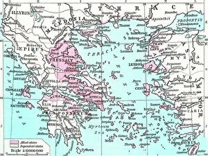
Background imageGeographical Collection: Map of the Athenian Empire at its height, c.450 B.C. From Historical Atlas

Map of the Athenian Empire at its height, c.450 B.C. From Historical Atlas, published 1923 (colour litho)
2603503 Map of the Athenian Empire at its height, c.450 B.C. From Historical Atlas, published 1923 (colour litho) by American School, (20th century).

Background imageGeographical Collection: Map showing the French dominions of Henry II King of england (print)

Map showing the French dominions of Henry II King of england (print)
1000965 Map showing the French dominions of Henry II King of england (print); Private Collection; (add.info.: From Illustrated Easy Stories from English History.).

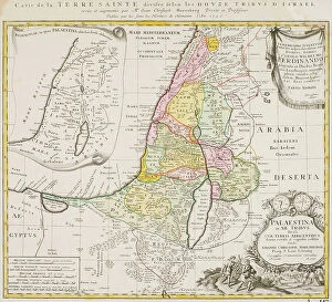
Background imageGeographical Collection: Map of the Twelve Tribes of Israel, Canaan, or Palestine, as it was divided between the twelve

Map of the Twelve Tribes of Israel, Canaan, or Palestine, as it was divided between the twelve tribes of Israel
6117853 Map of the Twelve Tribes of Israel, Canaan, or Palestine, as it was divided between the twelve tribes of Israel. After a map published in 1750 (map); Photo © Ken Welsh

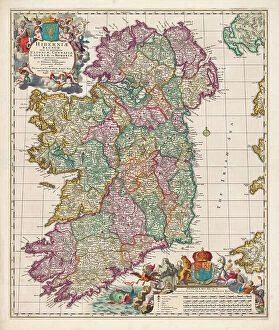
Background imageGeographical Collection: Map of Ireland, 17th century (map)

Map of Ireland, 17th century (map)
6117291 Map of Ireland, 17th century (map); (add.info.: Map of Ireland circa 1650-1675 by Dutch engraver, cartographer and publisher Nicolaes Visscher 1); Photo © Ken Welsh

Background imageGeographical Collection: Map of Brazil, Joan Blaeu, 1662 (map)

Map of Brazil, Joan Blaeu, 1662 (map)
6116655 Map of Brazil, Joan Blaeu, 1662 (map); (add.info.: Map of Brazil, by Dutch cartographer Johannes Willemszoon Blaeu, published in Amsterdam 1662 by Pieter Schenk.); Photo © Ken Welsh

Background imageGeographical Collection: Limerick, Ireland under siege in 1690

Limerick, Ireland under siege in 1690
6266297 Limerick, Ireland under siege in 1690; (add.info.: Map of Limerick, Ireland, dating from 1690 and showing the forces of William III besieging the city during the Williamite War of 1689-1691)

Background imageGeographical Collection: Map of Spain in the middle ages during the Muslim occupation

Map of Spain in the middle ages during the Muslim occupation
3253078 Map of Spain in the middle ages during the Muslim occupation; (add.info.: Map of Spain in the middle ages during the Muslim occupation. From Enciclopedia Ilustrada Segui, published c. 1900).

Background imageGeographical Collection: Map of portion of the West Indies, from the Weimar Map of 1527, ascribed to Fernando Columbus

Map of portion of the West Indies, from the Weimar Map of 1527, ascribed to Fernando Columbus
2915343 Map of portion of the West Indies, from the Weimar Map of 1527, ascribed to Fernando Columbus. From the book Life of Christopher Columbus by Clements R

Background imageGeographical Collection: Hydrographia sive Charta Marina Portugalensium, c.1504. From the book Life of Christopher Columbus

Hydrographia sive Charta Marina Portugalensium, c.1504. From the book Life of Christopher Columbus by Clements R
2915325 Hydrographia sive Charta Marina Portugalensium, c.1504. From the book Life of Christopher Columbus by Clements R. Markham published 1892.; Photo © Hilary Morgan.

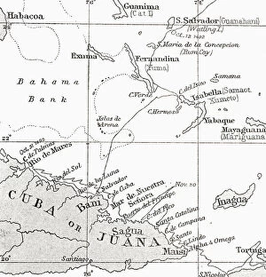
Background imageGeographical Collection: Map showing the course of Christopher Columbus from Guanahani to Cuba in 1492

Map showing the course of Christopher Columbus from Guanahani to Cuba in 1492
2915328 Map showing the course of Christopher Columbus from Guanahani to Cuba in 1492. From the book Life of Christopher Columbus by Clements R. Markham published 1892.; Photo © Hilary Morgan.

Background imageGeographical Collection: Ptolemaeus Map A.D. 150. From the book Life of Christopher Columbus by Clements R

Ptolemaeus Map A.D. 150. From the book Life of Christopher Columbus by Clements R. Markham published 1892
2915322 Ptolemaeus Map A.D. 150. From the book Life of Christopher Columbus by Clements R. Markham published 1892.; Photo © Hilary Morgan.

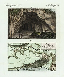
Background imageGeographical Collection: Geographical map of Mount St. Peter, Maastricht, and the main entrance to the caves

Geographical map of Mount St. Peter, Maastricht, and the main entrance to the caves
FLO4574405 Geographical map of Mount St. Peter, Maastricht, and the main entrance to the caves. Handcoloured copperplate engraving from Bertuch's " Bilderbuch fur Kinder"

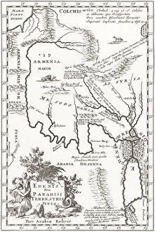
Background imageGeographical Collection: The Garden of Eden

The Garden of Eden
6266287 The Garden of Eden; (add.info.: Imagined situation of the Garden of Eden, in this case, in Mesopotamia, just east of Babylon)

Background imageGeographical Collection: Map of Roman Britain c. 410. From Historical Atlas, published 1923 (print)

Map of Roman Britain c. 410. From Historical Atlas, published 1923 (print)
2603520 Map of Roman Britain c. 410. From Historical Atlas, published 1923 (print).

Background imageGeographical Collection: Map of the Portuguese Colonial Dominions in India and the Malay Archipelago, 1498 -1580

Map of the Portuguese Colonial Dominions in India and the Malay Archipelago, 1498 -1580, 1923 (engraving)
2603519 Map of the Portuguese Colonial Dominions in India and the Malay Archipelago, 1498 -1580, 1923 (engraving); (add.info.: From Historical Atlas, published 1923.).

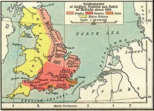
Background imageGeographical Collection: Map of the settlements of Angles, Saxons and Jutes in Britain c. 600 (print)

Map of the settlements of Angles, Saxons and Jutes in Britain c. 600 (print)
2603521 Map of the settlements of Angles, Saxons and Jutes in Britain c. 600 (print); (add.info.: From Historical Atlas, published 1923.).

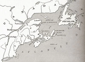
Background imageGeographical Collection: Map of Acadia, 17th century colony of New France in northeastern North America

Map of Acadia, 17th century colony of New France in northeastern North America, and the water highway to Canada
2603482 Map of Acadia, 17th century colony of New France in northeastern North America, and the water highway to Canada. From The History of Our Country, published 1899.

Background imageGeographical Collection: Portion of the Hauslab Globe based on the Martin Hylacomylus Waltzemu¨ller map of 1507

Portion of the Hauslab Globe based on the Martin Hylacomylus Waltzemu¨ller map of 1507
2915319 Portion of the Hauslab Globe based on the Martin Hylacomylus Waltzemu¨ller map of 1507. From the book Life of Christopher Columbus by Clements R

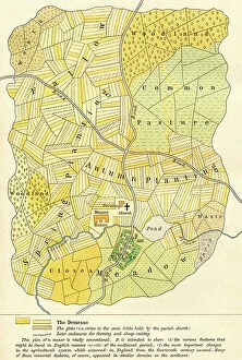
Background imageGeographical Collection: Plan of an English mediaeval manor ddated 14th century (print)

Plan of an English mediaeval manor ddated 14th century (print)
2603530 Plan of an English mediaeval manor ddated 14th century (print); (add.info.: From Historical Atlas, published 1923.).

Background imageGeographical Collection: A map of Spain after the invasion of the Visigoths in the 5th century

A map of Spain after the invasion of the Visigoths in the 5th century
3253072 A map of Spain after the invasion of the Visigoths in the 5th century; (add.info.: A map of Spain after the invasion of the Visigoths in the 5th century)

Background imageGeographical Collection: A map of China under the Hsia Dynasty, 2205 BC. From Hutchinson's History of the Nations

A map of China under the Hsia Dynasty, 2205 BC. From Hutchinson's History of the Nations, published 1915
3033759 A map of China under the Hsia Dynasty, 2205 BC. From Hutchinson's History of the Nations, published 1915.; Private Collection.

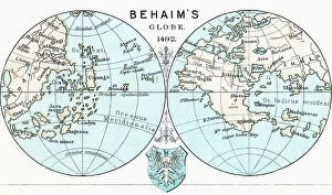
Background imageGeographical Collection: Martin Behaim´s Globe, 1492. From the book Life of Christopher Columbus by Clements R

Martin Behaim´s Globe, 1492. From the book Life of Christopher Columbus by Clements R. Markham published 1892
2915312 Martin Behaim´s Globe, 1492. From the book Life of Christopher Columbus by Clements R. Markham published 1892.; Photo © Hilary Morgan.

Background imageGeographical Collection: Plan of Paris, France in 1789. From Historical Atlas, published 1923 (print)

Plan of Paris, France in 1789. From Historical Atlas, published 1923 (print)
2603517 Plan of Paris, France in 1789. From Historical Atlas, published 1923 (print).

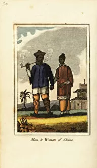
Background imageGeographical Collection: Man and woman of China, 1818

Man and woman of China, 1818. Man with tobacco pipe, holding hands with a woman. Handcoloured copperplate engraving from Mary Anne Vennings A Geographical Present being Descriptions of the Principal

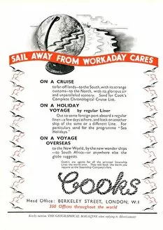
Background imageGeographical Collection: Thomas Cook - Travel Company - Advertisement

Thomas Cook - Travel Company - Advertisement in The Geographical Magazine - Sail Away From Workaday Cares. 20th century

Background imageGeographical Collection: Vietnam, Saigon, Ho Chi Minh ville, To Dinh Glac Lam pagoda

Vietnam, Saigon, Ho Chi Minh ville, To Dinh Glac Lam pagoda

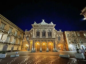
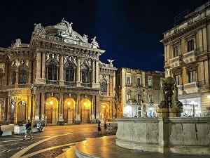
Background imageGeographical Collection: Italy, Sicily, Catania, Bellini Theatre

Italy, Sicily, Catania, Bellini Theatre

Background imageGeographical Collection: Cambodia, Angkor Thom, view

Cambodia, Angkor Thom, view

Background imageGeographical Collection: Vietnam, Ho Chi Minh City, Saigon, local craftsmanship

Vietnam, Ho Chi Minh City, Saigon, local craftsmanship

Background imageGeographical Collection: Cambodia, Angkor Thom, view

Cambodia, Angkor Thom, view

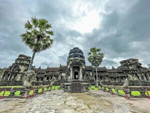
Background imageGeographical Collection: Cambodia, Angkor Wat, view

Cambodia, Angkor Wat, view

Background imageGeographical Collection: Italy, Sicily, Catania, Cathedral of Catania

Italy, Sicily, Catania, Cathedral of Catania

Background imageGeographical Collection: Italy, Sicily, Catania, Bellini Theatre

Italy, Sicily, Catania, Bellini Theatre

Background imageGeographical Collection: Cambodia, Angkor Thom, view

Cambodia, Angkor Thom, view

Background imageGeographical Collection: Cambodia, Siem Reap, Pub street

Cambodia, Siem Reap, Pub street

Background imageGeographical Collection: Italy, Sicily, Catania, Bellini Theatre

Italy, Sicily, Catania, Bellini Theatre

Background imageGeographical Collection: Italy, Sicily, Catania, Cathedral of Catania

Italy, Sicily, Catania, Cathedral of Catania

Background imageGeographical Collection: Italy, Sicily, Catania, Bellini Theatre

Italy, Sicily, Catania, Bellini Theatre

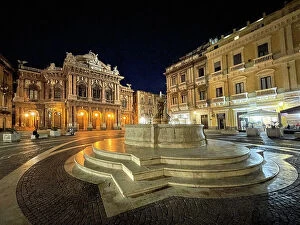
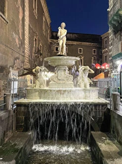
Background imageGeographical Collection: Italy, Sicily, Catania, Amenano Fountain

Italy, Sicily, Catania, Amenano Fountain

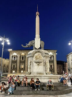
Background imageGeographical Collection: Italy, Sicily, Catania, Liotru

Italy, Sicily, Catania, Liotru

Background imageGeographical Collection: Cambodia, Sihanoukville, Wat Krom, Intra Ngean Pagoda

Cambodia, Sihanoukville, Wat Krom, Intra Ngean Pagoda

Background imageGeographical Collection: Cambodia, Angkor Thom, view

Cambodia, Angkor Thom, view

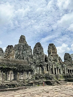
Background imageGeographical Collection: Cambodia, Bayon, Angkor Thom

Cambodia, Bayon, Angkor Thom


All Professionally Made to Order for Quick Shipping

"Journey through Time and Space: Exploring the Geographical Evolution" Al-Idrisi's World Map, 1154: Unveiling ancient cartographic wisdom, this map showcases the Islamic scholar's remarkable understanding of global geography. Continental Drift after 250 Million Years: Witnessing Earth's transformative power, this concept reveals how tectonic plates shaped our continents over millions of years. Malham Cove, Yorkshire Dales: A geological marvel standing tall in the picturesque Yorkshire Dales, showcasing nature's artistic prowess carved by ice and water. British Empire World Map, 19th Century: Tracing the vast expanse of an empire on which the sun never set; a testament to Britain's once-global dominance. James Craig Map of New Town, Edinburgh, Scotland (1768): The birth of urban planning captured in ink; explore Edinburgh’s meticulously designed New Town with its unique topography. Anglo-Saxon 10th Century World Map: Delving into medieval perceptions of our planet; discover how early societies envisioned their place within a world still shrouded in mystery. Catalan Atlas, 14th Century: Marvel at one of history’s most exquisite maps as it unveils Europe’s expanding knowledge during the Middle Ages – a true masterpiece. UK at Night from Space: Behold Britain illuminated like never before. This awe-inspiring view from space captures the vibrant tapestry that is modern-day United Kingdom after sundown. Orteliuss Map of Ottoman Empire (1570): Step back into time and witness one man’s meticulous depiction of an empire that spanned three continents - revealing cultural diversity and grandeur. Europe at Night - Satellite Image & Europe at Night - Illuminating Boundaries : Gaze upon two contrasting images capturing Europe under different lights – highlighting both unity and division across nations 17th Century World Map.