Fraud Blocker Skip to main content

From Space Collection (page 2)

"Exploring the vastness of space, we catch a glimpse of our humble abode - the Pale Blue Dot

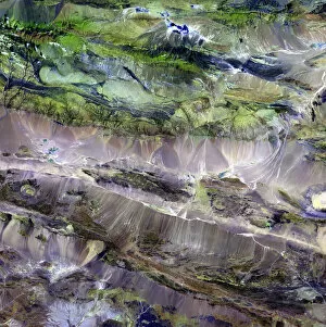
Background imageFrom Space Collection: Steppe-desert border, satellite image

Steppe-desert border, satellite image. North is at top. Arid areas of desert rock are brown, while grassy steppe areas are green. A small area of desert sands (yellow) is seen at far centre right

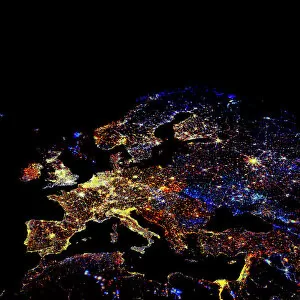
Background imageFrom Space Collection: Europe at night

Europe at night, satellite image. North is towards top left. Yellow lights mark the major cities. The Mediterranean coast is densely populated, as is the mainland of Britain

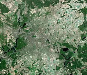
Background imageFrom Space Collection: Berlin, Germany, satellite image

Berlin, Germany, satellite image
Berlin, Germany. Satellite image of the city of Berlin (centre) and its surrounding area in northeastern Germany. North is at top
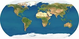
Background imageFrom Space Collection: Whole Earth, satellite image

Whole Earth, satellite image. This map is centred on the Greenwich meridian, at zero degrees latitude. Arctic and Antarctic ice is white, oceans are blue and land is green and brown

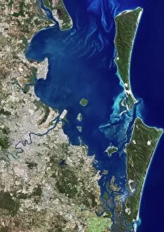
Background imageFrom Space Collection: Brisbane, Australia, satellite image

Brisbane, Australia, satellite image. North is at top, water is blue, shallow coastal areas are light blue, urban areas are grey and vegetation is green

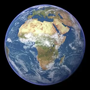
Background imageFrom Space Collection: Africa, satellite image

Africa, satellite image
Africa. Satellite image of the Earth centred on Africa. Clouds are white, oceans are blue and land is green and brown. Also seen are Europe (top) Asia (upper right), the Indian Ocean (right)

Background imageFrom Space Collection: Karbala, Iraq

Karbala, Iraq. Satellite image of Karbala, the capital city of the Al Karbala province, Iraq. Shi a Muslims consider it to be one of the holiest places in the world

Background imageFrom Space Collection: Kepler-22b, artwork C013 / 9945

Kepler-22b, artwork C013 / 9945
Kepler-22b. Computer artwork of the extrasolar planet Kepler-22b. Kepler-22b is about 2.5 times the size of Earth and orbits the G-type star Kepler-22 around 600 light years from Earth

Background imageFrom Space Collection: Richat Structure, satellite image

Richat Structure, satellite image. North is at top. Desert sands are pale yellow/white (top left and lower right), while less sandy, rocky areas are green, and volcanic rocks are blue

Background imageFrom Space Collection: Southeast Asia at night, satellite image

Southeast Asia at night, satellite image
Southeast Asia at night. Satellite image of the Earth seen at 18:00 (6pm) GMT (UCT), centred on China. City lights (yellow) show areas of dense population, particularly in India (left)

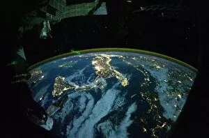
Background imageFrom Space Collection: Italy at night, ISS image

Italy at night, ISS image
Italy at night. International Space Station (ISS) image of Italy (centre) and the Adriatic coast (right) at night. The island of Sicily is at centre left

Background imageFrom Space Collection: Africa, night-day satellite image

Africa, night-day satellite image. This composite image of the Earth is set against a background of stars, and is centred on the continent of Africa. North is at top

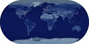
Background imageFrom Space Collection: Whole Earth at night, satellite image

Whole Earth at night, satellite image. This map is centred on the Greenwich meridian, at zero degrees latitude. City lights (yellow) show areas of dense population

Background imageFrom Space Collection: Venus from space, artwork C017 / 7375

Venus from space, artwork C017 / 7375
Venus from space. Computer artwork of the planet Venus. Venus is the second planet from the Sun. It is both the closest planet to Earth and the closest to Earth in size

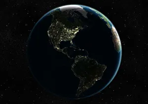
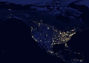
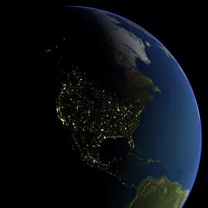
Background imageFrom Space Collection: North America at night, satellite image

North America at night, satellite image
North America at night. Black marble satellite image of North America at night. More densely populated areas are brighter

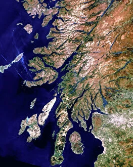
Background imageFrom Space Collection: True-colour satellite image of western Scotland

True-colour satellite image of western Scotland

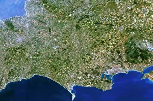
Background imageFrom Space Collection: Satellite image of southwest England

Satellite image of southwest England
Southwest England. True-colour satellite image of southwest England, centred on the counties of Dorset (at right) and Somerset (at left). North is at top

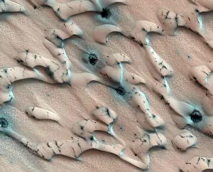
Background imageFrom Space Collection: Martian sand dunes, satellite image

Martian sand dunes, satellite image
Martian sand dunes. Coloured satellite image of north polar sand dunes blown into crescent shapes by the wind. The dunes are covered by carbon dioxide frost except dark-coloured patches where

Background imageFrom Space Collection: World map, February 2004

World map, February 2004
World Map. Blue Marble: Next Generation cloud-free true-colour composite image of the Earth in February 2004. It is winter in the Northern Hemisphere and large areas of land are covered in snow

Background imageFrom Space Collection: Europe at night, 1993-2003 changes

Europe at night, 1993-2003 changes
Europe at night, showing the change in illumination from 1993-2003. This data is based on satellite observations. Lights are colour-coded. Red lights appeared during that period

Background imageFrom Space Collection: Middle East, satellite image

Middle East, satellite image
Middle East. North is at top. Satellite image of the Middle East, showing the borders (white lines) of the countries. The Middle East is a Eurocentric term used to describe a region that roughly

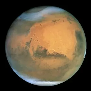
Background imageFrom Space Collection: Mars

Mars, optical image. This image was taken when Mars was 68 million kilometres from Earth. The Martian summer in the northern hemisphere results in a large south polar ice cap (white, bottom)

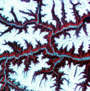
Background imageFrom Space Collection: Eastern Himalayas, satellite image

Eastern Himalayas, satellite image. North is at top. Snow is white, vegetation is red, barren areas are light blue and water is dark blue

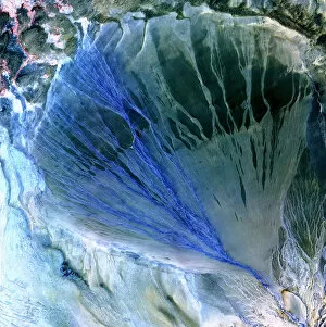
Background imageFrom Space Collection: Desert alluvial fan, satellite image

Desert alluvial fan, satellite image. North is at top. Desert areas can sometimes go for years without rain, and then intense storms will cause flooding that fills old dry river beds

Background imageFrom Space Collection: Europe, satellite image

Europe, satellite image
Europe. Satellite image centred on Europe. North converges towards top. Water is blue, vegetation is green, arid areas are brown, and snow and ice are white

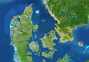
Background imageFrom Space Collection: Denmark - Sweden border, satellite image

Denmark - Sweden border, satellite image
Denmark. Satellite image of the European country of Denmark (left) and the surrounding area. North is at top. Water is blue, vegetation is green

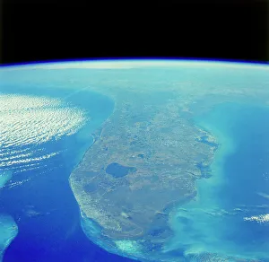
Background imageFrom Space Collection: Florida peninsula seen from Space Shuttle

Florida peninsula seen from Space Shuttle
Florida peninsula seen from space. To the right of the frame is the Atlantic Ocean, with the Gulf of Mexico to the left. Just right of centre jutting out into the Atlantic is Cape Canaveral

Background imageFrom Space Collection: True-colour satellite image of southwest Scotland

True-colour satellite image of southwest Scotland
Southwest Scotland. True-colour satellite image of the region of Dumfries and Galloway in southwest Scotland, Great Britain. North is at top

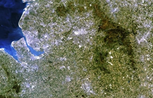
Background imageFrom Space Collection: Satellite image of Liverpool and Manchester, UK

Satellite image of Liverpool and Manchester, UK
Northwest England. True-colour satellite image of north-west England, Great Britain, including the cities of Liverpool (at centre left) and Manchester (at upper centre). North is at top

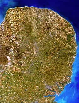
Background imageFrom Space Collection: True-colour satellite image of East Anglia, UK

True-colour satellite image of East Anglia, UK
East Anglia. Satellite image of East Anglia, England. The colours approximate to natural tones. North is at top. East Anglia is a predominantly low-relief agricultural area

Background imageFrom Space Collection: Moons surface, Zond 3 image

Moons surface, Zond 3 image
Moons surface. Photocopy of an image taken by the Soviet lunar probe Zond 3, on 1st September 1966, showing the cratered surface of the far side of the Moon

Background imageFrom Space Collection: Great Sandy Desert, satellite image

Great Sandy Desert, satellite image. North is at upper left. Vegetation is green and purple, while more barren, rocky areas are various shades of white and brown

Background imageFrom Space Collection: Great Salt Desert, satellite image

Great Salt Desert, satellite image. North is at top. Desert soil and mud is light brown, barren rocky areas are pink, and salt pans are blue

Background imageFrom Space Collection: North America at night

North America at night, satellite image. North is at top. Yellow lights mark the major cities. The western coast of the USA is the most brightly lit area, with the urban area of Los Angeles

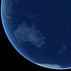
Background imageFrom Space Collection: Australia at night, satellite image

Australia at night, satellite image. City lights (yellow) show areas of more dense population, particularly in Southeast Asia (top left) and on Australias east coast

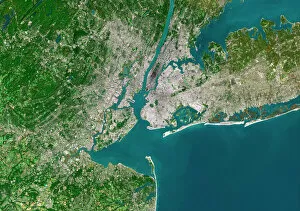
Background imageFrom Space Collection: New York City, satellite image

New York City, satellite image
New York City, USA, satellite image. North is attop. Urban areas are white, vegetation is greenand water is blue. The island of Manhattan is atupper centre on the east coast of the HudsonRiver

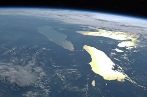
Background imageFrom Space Collection: The Great Lakes, ISS image C016 / 3870

The Great Lakes, ISS image C016 / 3870
The Great Lakes. View from the International Space Station (ISS) of the Great Lakes of the USA and Canada. North is towards upper right. Here, the ISS is over a point to the southeast of Nova Scotia

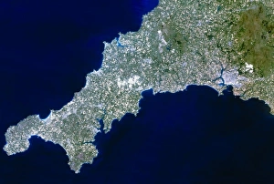
Background imageFrom Space Collection: True-colour satellite image of Cornwall, UK

True-colour satellite image of Cornwall, UK
Cornwall, southwest England. True-colour satellite image of the county of Cornwall in southwest England, Great Britain. North is at top

Background imageFrom Space Collection: True colour satellite image of Wales

True colour satellite image of Wales
Wales. True-colour satellite image of Wales, Great Britain. North is at top. The capital of Wales, Cardiff, is at bottom right

Background imageFrom Space Collection: Earth-like planet, artwork

Earth-like planet, artwork
Earth-like planet. Computer artwork of a view across a lake on the surface of an Earth-like planet with another planet (upper centre) and moon (centre right) in the distance

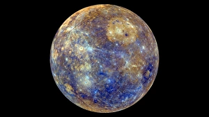
Background imageFrom Space Collection: Mercury hemisphere, MESSENGER image C016 / 9722

Mercury hemisphere, MESSENGER image C016 / 9722
Mercury hemisphere, MESSENGER image. North is at top. This image is centred at longitude 220 degrees West. The colours show chemical and mineralogical differences between the rocks

Background imageFrom Space Collection: SpaceX Dragon capsule at the ISS C016 / 4214

SpaceX Dragon capsule at the ISS C016 / 4214
SpaceX Dragon capsule at the ISS. View from the International Space Station (ISS) of the Dragon cargo capsule from SpaceX (Space Exploration Technologies)

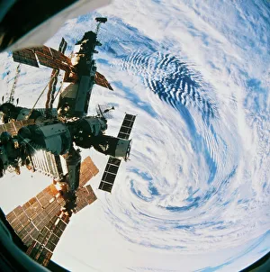
Background imageFrom Space Collection: Russian space station Mir over a storm on Earth

Russian space station Mir over a storm on Earth
Mir space station. Fisheye lens view of the Russian space station Mir ( peace ) orbiting over a storm (lower centre) on Earth. Mir was launched in February 1986

Background imageFrom Space Collection: Sandstorm, satellite image

Sandstorm, satellite image
Sandstorm, Aqua satellite image. Cloud of sand stretching into the Mediterranean Sea (blue). The sand is being blown from the Great Sand Sea

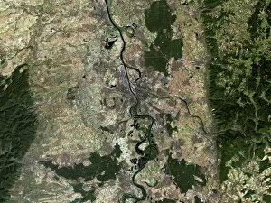
Background imageFrom Space Collection: Mannheim, satellite image

Mannheim, satellite image
Mannheim, Germany, satellite image. Mannheim is situated in the state of Baden-Wuttemburg. The city has a population of around 320

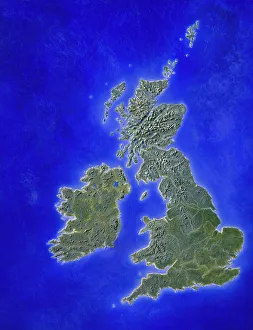
Background imageFrom Space Collection: Illustration of a relief map of the British Isles

Illustration of a relief map of the British Isles

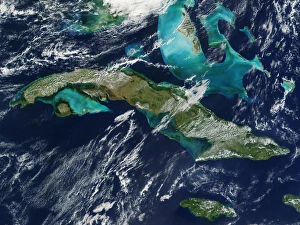
Background imageFrom Space Collection: Cuba

Cuba. True-colour satellite image of the island of Cuba (upper left to lower right) in the Caribbean Sea. North is at top. Vegetation is green, water is blue and clouds are white

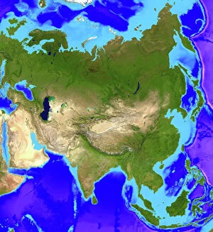
Background imageFrom Space Collection: Asia

Asia. Computer artwork, based on a satellite image, of Asia. North is at top. Water is blue, vegetation is green and desert is yellow


All Professionally Made to Order for Quick Shipping

"Exploring the vastness of space, we catch a glimpse of our humble abode - the Pale Blue Dot. Voyager 1's iconic image reminds us of Earth's insignificance in the grand scheme of things. " "The breathtaking Earthrise over Moon captured by Apollo 8 serves as a reminder that even from space, our home planet remains an awe-inspiring sight to behold. " "A mesmerizing view of the Whole Earth, also known as Blue Marble 2000, showcases the stunning beauty and fragility of our precious planet. " "From high above, a satellite image reveals the intricate details and natural splendor of the British Isles, offering a unique perspective on this enchanting region. " "As night falls upon the UK, its illuminated cities create a dazzling spectacle when viewed from space. The vibrant lights paint a picture of human activity against the dark canvas of night. " "Gazing down at Europe at night through satellite imagery unveils an interconnected web of bustling metropolises and tranquil landscapes intertwined under twinkling stars. " "Inspired by darkness, Europe at night captivates with its ethereal glow emanating from countless cities scattered across its diverse lands. A testament to humanity's constant motion even after sunset. " "Astonishingly beautiful yet hauntingly mysterious, witnessing Whole Earth at night through satellite imagery evokes contemplation about our place in this vast universe and how we illuminate it with life. " "Jupiter and Io dance gracefully in their celestial ballet as captured by New Horizons' lens. This captivating image transports us beyond our own world into realms where giants roam amidst swirling storms. " "Awe-inspiring from any angle; an exquisite satellite image captures Earth's majestic presence against infinite blackness. A reminder that every corner holds hidden wonders waiting to be discovered. "With remarkable clarity seen from above Scotland within UK is unveiled like never before through detailed satellite imaging—a land steeped in history and adorned with rugged beauty.