mail_outline sales@mediastorehouse.com
Framed Print
Antique Framed Print
Premium Framed Print
Canvas Print
Metal Print
Photographic Print
Poster Print
Fine Art Print
Mounted Print
Glass Frame
Acrylic Blox
Jigsaw Puzzle
Tote Bag
Photo Mug
Greetings Card
Postcard
Cushion
Mouse Mat
Glass Place Mat
Glass Coaster
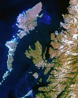
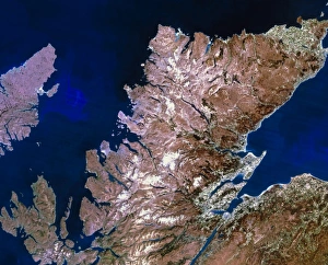
True-colour satellite image of northwest Scotland
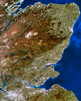
True-colour satellite image of southwest ScotlandSouthwest Scotland. True-colour satellite image of the region of Dumfries and Galloway in southwest Scotland, Great Britain. North is at top
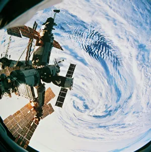
Russian space station Mir over a storm on EarthMir space station. Fisheye lens view of the Russian space station Mir ( peace ) orbiting over a storm (lower centre) on Earth. Mir was launched in February 1986
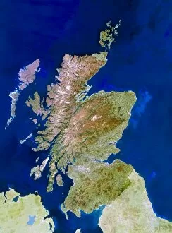
Satellite image of ScotlandScotland. Satellite image of Scotland, a part of Great Britain. The colours approximate to natural tones, although other parts of Britain have been lightened to highlight Scotland. North is at top
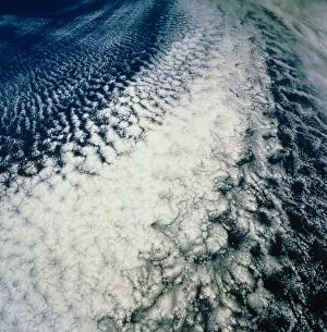
Stratocumulus cloud line over E. PacificFrontal stratocumulus clouds over the Pacific Ocean. The clouds delineate the boundary of a mass of warm air (top left) that has come from the Californian coast some 580km away
Dust storm over the Red SeaDust storm spreading out over the Red Sea. This view is looking south, looking toward the mainland of Africa in southern Sudan
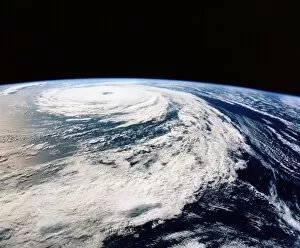
Hurricane Florence from space shuttleHurricane Florence. Photograph of the clouds associated with Hurricane Florence, taken from Space Shuttle Atlantis during Mission STS-66 of 3- 14 November 1994
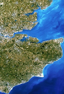
True-colour satellite image of southeast ScotlandScottish Borders. True-colour satellite image of the Scottish Border region, featuring southeast Scotland (at upper left) and Northumberland in England (at lower right). North is at top
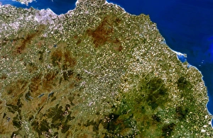
True-colour satellite image of northeast ScotlandNortheast Scotland. True-colour satellite image of northeast Scotland, Great Britain, centred on the Grampian mountains. North is at top
True-colour satellite image of southeast EnglandSoutheast England. True-colour satellite image of southeast England, featuring the counties of Kent (at centre right), Sussex (at lower left) and Essex (at upper centre). North is at top
True-colour satellite image of northern ScotlandNorthern Scotland. Satellite image of northern Scotland. The colours approximate to natural tones. North is at top. The city of Inverness is at lower right