Fraud Blocker Skip to main content

Fault Collection

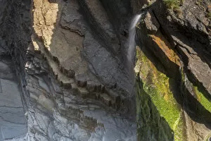
"Exploring the Depths: Silfra Canyon, a Majestic Fault Filled with Fresh Water" Silfra Canyon, nestled in the rift valley between the Eurasian tectonic plates

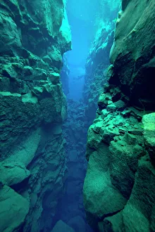
Background imageFault Collection: Silfra Canyon - deep fault filled with fresh water in the rift valley between the Eurasian

Silfra Canyon - deep fault filled with fresh water in the rift valley between the Eurasian and American tectonic plates, at Thingvellir National Park, Iceland. June 2014

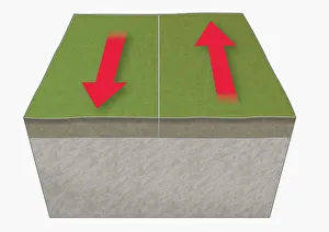
Background imageFault Collection: Illustration of tectonic plates moving past each other (transform boundary)

Illustration of tectonic plates moving past each other (transform boundary)

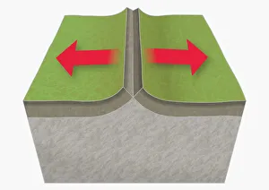
Background imageFault Collection: Illustration of tectonic plates moving apart (divergent boundary)

Illustration of tectonic plates moving apart (divergent boundary)

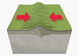
Background imageFault Collection: Illustration of tectonic plates moving together (convergent boundary), creating mountains

Illustration of tectonic plates moving together (convergent boundary), creating mountains

Background imageFault Collection: Find the Fault card No. 13

Find the Fault card No. 13 -- children with swing. circa 1930s

Background imageFault Collection: The Road to Redemption, handwritten on a white background

The Road to Redemption, handwritten on a white background

Background imageFault Collection: Find the Fault card No. 20

Find the Fault card No. 20 -- woman knitting a sock. circa 1930s

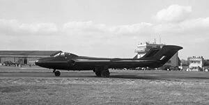
Background imageFault Collection: de Havilland DH. 110 WG240 2nd prototype

de Havilland DH. 110 WG240 2nd prototype
de Havilland DH.110 WG240 2nd prototype at the 1952 SBAC Farnborough air-show, (1-7 September). WG 240 was flown by test pilot John Derry in the air display from 1-5 September

Background imageFault Collection: Scuba diver exploring volcanic crack Nesgja, in Asbyrgi National Park, northern Iceland

Scuba diver exploring volcanic crack Nesgja, in Asbyrgi National Park, northern Iceland

Background imageFault Collection: Rift between the North American and Eurasian tectonic plates at Thingvellir, Thingvellir

Rift between the North American and Eurasian tectonic plates at Thingvellir, Thingvellir National Park, UNESCO World Heritage Site, Iceland, September. Photographed for the Freshwater Project

Background imageFault Collection: Find the Fault card No. 17

Find the Fault card No. 17 -- woman and mirror. circa 1930s

Background imageFault Collection: Aerial view on famous in Ukraine Kherson Grand Canyon or Kherson mountains or Stanislav Hills near

Aerial view on famous in Ukraine Kherson Grand Canyon or Kherson mountains or Stanislav Hills near Stanislav village Aerial view on famous in Ukraine Kherson Grand Canyon or Kherson mountains or

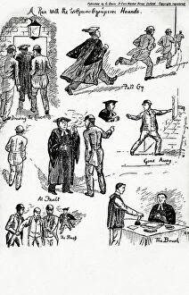
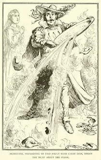
Background imageFault Collection: Comic Postcard - Oxford - A Run with the Man-pursuing Hounds

Comic Postcard - Oxford - A Run with the Man-pursuing Hounds
A Run with the ανθρϖπο θηρϖμενοι Hounds has sketches of the proctors and bulldogs (Oxford University constables)

Background imageFault Collection: Seismograph reading taken from the Omori Horizontal pendulum at Birmingham

Seismograph reading taken from the Omori Horizontal pendulum at Birmingham, showing the severity of the tremors during the San Francisco earthquake of 1906

Background imageFault Collection: Comic postcard, Woman complains to hotel manager Date: 20th century

Comic postcard, Woman complains to hotel manager Date: 20th century

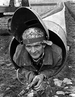
Background imageFault Collection: Lou Morris, The Human Pipe Cleaner, 6th November 1969. Lou pushes his 5ft 2in frame along

Lou Morris, The Human Pipe Cleaner, 6th November 1969. Lou pushes his 5ft 2in frame along on a trolley inside a 20 mile pipeline being built to carry natural gas to the West Country

Background imageFault Collection: Several faults cutting through Jurassic age, Liassic Limestones (Blue Lias) near Southerndown

Several faults cutting through Jurassic age, Liassic Limestones (Blue Lias) near Southerndown, South Glamorgan Heritage Coast, Wales, UK. September

Background imageFault Collection: Tilted beds of Carboniferous age, Culm Measures (Bude Formation) Sandy Mouth, near Bude

Tilted beds of Carboniferous age, Culm Measures (Bude Formation) Sandy Mouth, near Bude, Cornwall, UK, May

Background imageFault Collection: Millook Haven, Poundstock, Cornwall. 1905

Millook Haven, Poundstock, Cornwall. 1905
A view of the beach at Millook Haven showing the contorted strata in the cliffs. There is a man standing in the left foreground

Background imageFault Collection: Find the Fault card No. 8

Find the Fault card No. 8 -- cockerel. circa 1930s

Background imageFault Collection: Find the Fault card No. 24

Find the Fault card No. 24 -- fireplace. circa 1930s

Background imageFault Collection: Find the Fault card No. 21

Find the Fault card No. 21 -- office desk. circa 1930s

Background imageFault Collection: Find the Fault card No. 2

Find the Fault card No. 2 -- tray with bottle and glasses. circa 1930s

Background imageFault Collection: Find the Fault card No. 19

Find the Fault card No. 19 -- street scene. circa 1930s

Background imageFault Collection: Find the Fault card - key

Find the Fault card - key, giving all the answers. circa 1930s

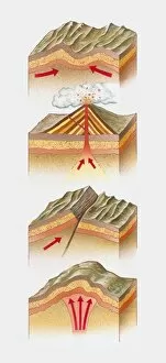
Background imageFault Collection: Cross section illustration of fold mountain, volcano, fault-block mountain, and dome mountain

Cross section illustration of fold mountain, volcano, fault-block mountain, and dome mountain

Background imageFault Collection: Stereoscopic view of North America

Stereoscopic view of North America
February 2000 - This stereoscopic shaded relief image shows Africas topography as measured by the Shuttle Radar Topography Mission (SRTM) in February 2000

Background imageFault Collection: Tectonic plate boundary types, diagram

Tectonic plate boundary types, diagram
Tectonic plate boundary types. Diagram showing three types of movement (arrows) at tectonic plate boundaries. Tectonic plates moving parallel to each other (bottom)

Background imageFault Collection: JGS0741516

JGS0741516
A view of the Trotternish Ridge on the Isle of Skye

Background imageFault Collection: JGS0741515

JGS0741515
A view of the Trotternish Ridge on the Isle of Skye

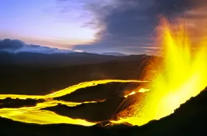
Background imageFault Collection: Nyiragongo volcano lava lake, Virungas National Park, Democratic Republic of Congo

Nyiragongo volcano lava lake, Virungas National Park, Democratic Republic of Congo February 2015

Background imageFault Collection: Find the Fault card No. 22

Find the Fault card No. 22 -- steam train. circa 1930s

Background imageFault Collection: Find the Fault card No. 4

Find the Fault card No. 4 -- King of Hearts playing card. circa 1930s

Background imageFault Collection: Find the Fault card No. 12

Find the Fault card No. 12 -- man reading. circa 1930s

Background imageFault Collection: Find the Fault card No. 14

Find the Fault card No. 14 -- bride and groom. circa 1930s

Background imageFault Collection: Find the Fault card No. 10

Find the Fault card No. 10 -- pair of gloves. circa 1930s

Background imageFault Collection: Find the Fault card No. 1

Find the Fault card No. 1 -- pastry on kitchen table. circa 1930s

Background imageFault Collection: Find the Fault card No. 9

Find the Fault card No. 9 -- red watering can. circa 1930s

Background imageFault Collection: German poster, England is to blame, WW1

German poster, England is to blame, WW1
German propaganda poster, declaring that England is to blame for all the problems in Germany during the First World War, depicting a man in a Scottish cap with a bulldog at his feet

Background imageFault Collection: Illustration of an earthquake

Illustration of an earthquake

Background imageFault Collection: Western hemisphere of the Earth during the Early Jurassic period

Western hemisphere of the Earth during the Early Jurassic period
This is how the western hemisphere of the Earth may have appeared 200 million years ago during the Early Jurassic period. North is at the top

Background imageFault Collection: Planet Earth 600 million years ago following the Cryogenian period

Planet Earth 600 million years ago following the Cryogenian period
This is how the Earth may have appeared 600 million years ago following the Cryogenian Snowball Earth period. The worldwide glaciers have melted and the ocean is largely liquid again

Background imageFault Collection: Fissure eruption of Chico Volcano into 9km diameter caldera. Sierra Negra volcano

Fissure eruption of Chico Volcano into 9km diameter caldera. Sierra Negra volcano, Isabela Island, Galapagos, Ecuador. October 2005

Background imageFault Collection: Find the Fault card outer wrapper

Find the Fault card outer wrapper. circa 1930s

Background imageFault Collection: Find the Fault card No. 7

Find the Fault card No. 7 -- pocket watch. circa 1930s

Background imageFault Collection: Find the Fault card No. 6

Find the Fault card No. 6 -- hand pump. circa 1930s

Background imageFault Collection: Find the Fault card No. 5

Find the Fault card No. 5 -- telephone kiosk. circa 1930s

Background imageFault Collection: Find the Fault card No. 3

Find the Fault card No. 3 -- cruise ship. circa 1930s

Background imageFault Collection: Find the Fault card No. 23

Find the Fault card No. 23 -- red belt. circa 1930s

Background imageFault Collection: Find the Fault card No. 16

Find the Fault card No. 16 -- kitchen cupboard. circa 1930s

Background imageFault Collection: Find the Fault card No. 15

Find the Fault card No. 15 -- three pence coin. circa 1930s

Background imageFault Collection: Find the Fault card No. 11

Find the Fault card No. 11 -- pen with nib. circa 1930s

Background imageFault Collection: Sopwith Model XII: Denudation of mineral veins

Sopwith Model XII: Denudation of mineral veins
This model shows the influence of surface denudation and faulting on inclined strata, with increased complexity to the situation in Model VII

Background imageFault Collection: Sopwith Model VII: Surface denudation of veins

Sopwith Model VII: Surface denudation of veins
This model shows the influence of surface denudation and faulting on otherwise flat, horizontal strata. The discontinuity between the beds as viewed at the surface can be seen

Background imageFault Collection: Sopwith Models: denudation & faulting

Sopwith Models: denudation & faulting
Models showing the effect of denudation and faulting on how rock strata appear at the surface. Thomas Sopwith (1803 - 1879)

Background imageFault Collection: Sopwith Model II: Coal strata near Newcastle

Sopwith Model II: Coal strata near Newcastle
Unlike the models of generic situations this representation of coal strata was specific to a particular surveyed location in England showing several thin, and mostly hidden, coal seams

Background imageFault Collection: Sopwith Model VII: Denudation of mineral veins

Sopwith Model VII: Denudation of mineral veins
This model shows the influence of surface denudation and faulting on otherwise flat, horizontal strata. The discontinuity between the beds as viewed at the surface can be seen

Background imageFault Collection: Sopwith Model VI: Intersecting mineral veins

Sopwith Model VI: Intersecting mineral veins
This Model, rather than representing the strata as they would appear at the surface, shows how a seam of coal can be displaced in the subsurface by various modes of faulting

Background imageFault Collection: Sopwith Model XI: Vertical intersecting veins

Sopwith Model XI: Vertical intersecting veins
This model, when separated, shows the complex interface between faulted strata of rocks. Thomas Sopwith (1803 - 1879) was an eminent geologist

Background imageFault Collection: Sopwith Model XII: Mineral vein denudation

Sopwith Model XII: Mineral vein denudation
This model shows the influence of surface denudation and faulting on inclined strata, with increased complexity to the situation in Model VII

Background imageFault Collection: Sopwith Model VII: Surface denudation

Sopwith Model VII: Surface denudation
This model shows the influence of surface denudation and faulting on otherwise flat, horizontal strata. The discontinuity between the beds as viewed at the surface can be seen


All Professionally Made to Order for Quick Shipping

"Exploring the Depths: Silfra Canyon, a Majestic Fault Filled with Fresh Water" Silfra Canyon, nestled in the rift valley between the Eurasian tectonic plates, is a captivating sight. This deep fault brims with crystal-clear fresh water, offering an otherworldly experience for divers and explorers alike. As you venture into its depths, you witness nature's incredible power at play. In one illustration, tectonic plates gracefully move apart along a divergent boundary. This mesmerizing dance creates new oceanic crust and allows magma to rise from Earth's core. The result? A breathtaking display of underwater landscapes and unique ecosystems. On another card lies an illustration of convergent boundaries where tectonic plates collide head-on. These powerful forces give birth to majestic mountain ranges like the Himalayas or Andes—a testament to Earth's ever-changing topography shaped by these colossal clashes. Meanwhile, a transform boundary comes alive through yet another illustration as tectonic plates slide past each other horizontally. This lateral movement can cause earthquakes that shake the very foundations of our world—seismograph readings capturing their intensity during events like San Francisco's devastating earthquake in 1906. Amidst this exploration of faults and plate movements lie intriguing "Find the Fault" cards numbered 13, 20, 17, 8, and 2—each inviting us to unravel hidden mysteries within Earth's dynamic geology. As we journey further back in time through vintage postcards from Oxford or Millook Haven in Cornwall circa early 1900s—an era when seismic science was still evolving—we gain glimpses into humanity's fascination with understanding these fault lines that shape our planet. So let us embrace curiosity and embark on this geological odyssey together—a quest to comprehend Earth's intricate fault systems while marveling at their beauty and immense power.

© Copyright Media Storehouse, All Rights Reserved 2003 - 2024
Facebook     Pinterest     Card Payments     Reviews IO