Fraud Blocker Skip to main content

Earth Observation Collection (page 4)

"Earth Observation: Glimpses of Our Pale Blue Dot and Beyond" In the vast expanse of space

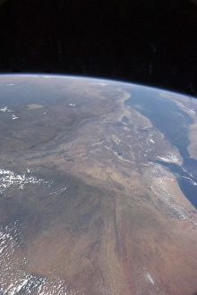
Background imageEarth Observation Collection: Oblique photo of Ethiopia and part of the Red Sea as viewed from space

Oblique photo of Ethiopia and part of the Red Sea as viewed from space
October 20, 2012 - Oblique photo of Ethiopia and part of the Red Sea as viewed from space. The name of the funnel-shaped area is the Afar Depression or Afar Triangle

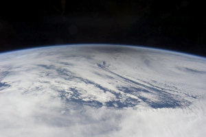
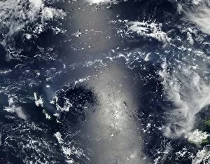
Background imageEarth Observation Collection: The gray shadow of the moon cast on bright clouds of the northern Pacific Ocean

The gray shadow of the moon cast on bright clouds of the northern Pacific Ocean
May 20, 2012 - The smoky gray shadow of the moon cast on bright clouds of the northern Pacific Ocean, as the May 20 solar eclipse point tracked towards the Aleutian Islands

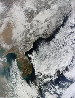
Background imageEarth Observation Collection: Cloud streets in the Sea of Japan and Yellow Sea

Cloud streets in the Sea of Japan and Yellow Sea
January 9, 2014 - Cloud streets in the Sea of Japan and Yellow Sea

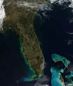
Background imageEarth Observation Collection: Satellite view of Florida

Satellite view of Florida
February 17, 2014 - Satellite view of Florida

Background imageEarth Observation Collection: Satellite view of Princess Charlotte Bay in Australia

Satellite view of Princess Charlotte Bay in Australia
April 20, 2013 - Satellite view of Princess Charlotte Bay in Australia. The area lies along the east coast of Queenslands Cape York Peninsula

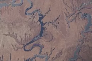
Background imageEarth Observation Collection: View from space of Lake Powell and the Rincon in Utah

View from space of Lake Powell and the Rincon in Utah
April 30, 2012 - View from space of Lake Powell and the Rincon in Utah. The lake extends across southeastern Utah and northeastern Arizona

Background imageEarth Observation Collection: View from space of the Florida peninsula

View from space of the Florida peninsula
January 1, 2012 - View from space of the Florida peninsula. Cape Canaveral and the Kennedy Space Center are near frame center. The Gulf of Mexico is in the top portion of the photo

Background imageEarth Observation Collection: Satellite view of Central Europe

Satellite view of Central Europe
March 12, 2014 - Satellite view of Central Europe

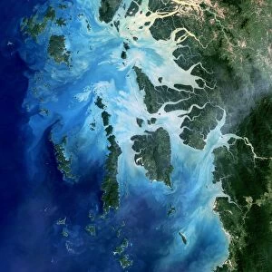
Background imageEarth Observation Collection: Satellite view of the Mergui Archipelago showing Auckland and Whale Bays

Satellite view of the Mergui Archipelago showing Auckland and Whale Bays
December 14, 2004 - Satellite view of the Mergui Archipelago showing Auckland and Whale Bays. The archipelago in the Andaman Sea is made up of more than 800 islands surrounded by extensive coral

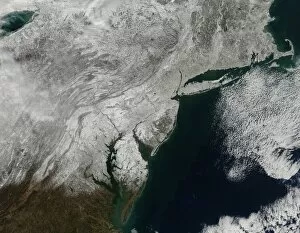
Background imageEarth Observation Collection: Snow cover across the northeastern United States

Snow cover across the northeastern United States
March 9, 2013 - Snow cover across the northeastern United States, stretching from West Virginia into Canada, and from the western shore of Lake Ontario to the Atlantic Ocean

Background imageEarth Observation Collection: Cloud coverage over the United States and Atlantic Ocean

Cloud coverage over the United States and Atlantic Ocean
February 2, 2014 - Satellite view of cloud coverage over the continental United States and Atlantic Ocean

Background imageEarth Observation Collection: Satellite view of Copahue Volcano

Satellite view of Copahue Volcano
February 19, 2013 - Satellite view of Copahue Volcano. Copahueas summit features a glacier adjacent to a warm, acidic lake

Background imageEarth Observation Collection: Satellite view of a new island forming in the Red Sea

Satellite view of a new island forming in the Red Sea
January 7, 2012 - Satellite view of a new island forming in the Red Sea, where a plume of steam, other volcanic gases, and ash spews from a distinct cone

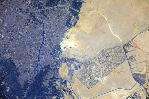
Background imageEarth Observation Collection: View from space of the Pyramids at Giza, Egypt

View from space of the Pyramids at Giza, Egypt
July 26, 2012 - View from space of the Pyramids at Giza, Egypt. The Great Pyramids at Giza (center) are the last of the Seven Wonders of the Ancient World

Background imageEarth Observation Collection: View of ice breaking up on Hudson Bay

View of ice breaking up on Hudson Bay
June 18, 2014 - View of ice breaking up on Hudson Bay. Sea ice appears white, open water is dark blue
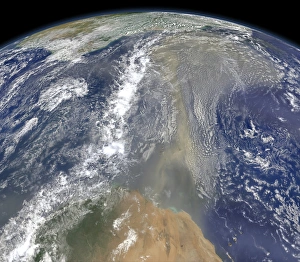
Background imageEarth Observation Collection: A plume of Saharan dust spans the Mediterranean Sea

A plume of Saharan dust spans the Mediterranean Sea
January 21, 2013 - A plume of Saharan dust spans the Mediterranean Sea, stretching from the coast of Libya to southern Italy and mingled with clouds in the north

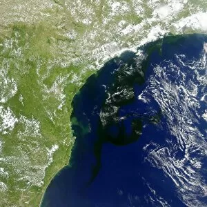
Background imageEarth Observation Collection: A bloom of microscopic organisms off the coast of Brazil

A bloom of microscopic organisms off the coast of Brazil
January 19, 2014 - Satellite view capturing a bloom of microscopic organisms off the southeastern coast of Brazil. Note how the waters of the South Atlantic are darkened in patches stretching as much

Background imageEarth Observation Collection: Satellite view of a cold front that brought clouds and thunderstorms to the coast

Satellite view of a cold front that brought clouds and thunderstorms to the coast
July 16, 2014 - Satellite view of a cold front that brought clouds and thunderstorms to the coast. The clouds follow the front which stretches from the Florida panhandle

Background imageEarth Observation Collection: Satellite view of smoke and fires burning in Sumatra

Satellite view of smoke and fires burning in Sumatra
March 12, 2014 - Satellite view of smoke and fires burning in Sumatra

Background imageEarth Observation Collection: Satellite view of Clearwater Lakes in Quebec, Canada

Satellite view of Clearwater Lakes in Quebec, Canada
June 29, 2013 - Satellite view of Clearwater Lakes in Quebec, Canada. About 290 million years ago, two large asteroids smashed into Earth

Background imageEarth Observation Collection: Vog from Ambrym Volcano, Vanuatu

Vog from Ambrym Volcano, Vanuatu
January 7, 2014 - Vog from Ambrym Volcano, Vanuatu

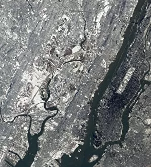
Background imageEarth Observation Collection: Satellite view of East Rutherford, New Jersy, and Manhattan

Satellite view of East Rutherford, New Jersy, and Manhattan
January 30, 2014 - Satellite view of East Rutherford, New Jersy, and Manhattan. Metlife Stadium and Meadowlands Racetrack is visible near center

Background imageEarth Observation Collection: Satellite view of Central Australia

Satellite view of Central Australia
January 8, 2014 - Satellite view of Central Australia

Background imageEarth Observation Collection: Satellite view of Venice and the Venetian Lagoon

Satellite view of Venice and the Venetian Lagoon
September 4, 2013 - Satellite view of Venice and the Venetian Lagoon

Background imageEarth Observation Collection: View from space showing parts of Texas and New Mexico

View from space showing parts of Texas and New Mexico
November 16, 2013 - View from space showing parts of Texas and New Mexico and the Mexican border area including El Paso and Juarez, Mexico

Background imageEarth Observation Collection: Satellite view of snow in the northeastern United States

Satellite view of snow in the northeastern United States
January 4, 2014 - Satellite view of snow in the northeastern United States

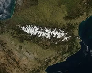
Background imageEarth Observation Collection: Satellite view of the Pyrenees Mountains

Satellite view of the Pyrenees Mountains
February 23, 2014 - Satellite view of the Pyrenees Mountains

Background imageEarth Observation Collection: View from space featuring the Bahama Islands and part of peninsular Florida

View from space featuring the Bahama Islands and part of peninsular Florida
July 12, 2011 - View from space featuring The Tongue of the Ocean and several of the 2, 700 islands in the Bahamas chain and part of peninsular Florida

Background imageEarth Observation Collection: View from space of Saharan dust blowing westward into the Atlantic Ocean

View from space of Saharan dust blowing westward into the Atlantic Ocean
July 15, 2012 - View from space of Saharan dust blowing westward from Africa out into the tropical Atlantic Ocean. The margin of the hazy air in this image reaches as far as Haiti (top center)

Background imageEarth Observation Collection: Ice lingering north of the Weddell Sea, east of the Antarctic Peninsula

Ice lingering north of the Weddell Sea, east of the Antarctic Peninsula
February 22, 2013 - Ice lingering north of the Weddell Sea, east of the Antarctic Peninsula. The coastline of the Antarctic Peninsula appears as a gray line

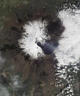
Background imageEarth Observation Collection: Gas and ash stream from multiple craters on Sicilyas Mount Etna

Gas and ash stream from multiple craters on Sicilyas Mount Etna
March 23, 2013 - Gas and ash stream from multiple craters on Sicilyas Mount Etna. Dark lava, ash, cinders, and scoria (dense volcanic rock filled with gas bubbles) coat the southeastern slopes

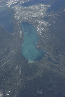
Background imageEarth Observation Collection: View from space of Lake Ontario

View from space of Lake Ontario
August 23, 2013 - View from space highlighting a late-summer whiting event visible across much of Lake Ontario. Such events are caused by changes in water temperature

Background imageEarth Observation Collection: Satellite view of Northern Argentina

Satellite view of Northern Argentina
March 12, 2014 - Satellite view of Northern Argentina

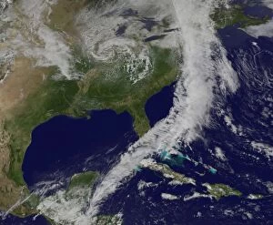
Background imageEarth Observation Collection: Satellite view of a powerful cold front moving off the United States East Coast

Satellite view of a powerful cold front moving off the United States East Coast
May 16, 2014 - Satellite view of a powerful cold front moving off the United States East Coast. The clouds stretch from Maine south through the Mid-Atlantic down to southern Florida with a tail of

Background imageEarth Observation Collection: Satellite view of Krasnaya Polyana, Russia

Satellite view of Krasnaya Polyana, Russia
February 8, 2014 - Satellite view of Krasnaya Polyana, a small town tucked between the Aibiga and Psekhako Ridges in the western Caucasus where the skiing events for the XXII Olympic Games are taking

Background imageEarth Observation Collection: Satellite view of Alaska, United States

Satellite view of Alaska, United States
June 17, 2013 - Satellite view of Alaska, United States. Snow-covered mountains such as the Alaska Range and Chugach Mountains were visible in southern Alaska

Background imageEarth Observation Collection: Bezymianny Volcano emits a plume of steam and gases from its lava dome

Bezymianny Volcano emits a plume of steam and gases from its lava dome
April 5, 2013 - Bezymianny Volcano emits a plume of steam and other volcanic gases from its large and growing lava dome. It is one of several erupting volcanoes on the Kamchatka Peninsula

Background imageEarth Observation Collection: Dust heading west toward South America and the Gulf of Mexico

Dust heading west toward South America and the Gulf of Mexico
June 25, 2014 - Dust heading west toward South America and the Gulf of Mexico. The dust appears to be streaming from Mauritania, Senegal, and Western Sahara

Background imageEarth Observation Collection: Satellite view of an alluvial fan in Kazakhstanas Almaty province

Satellite view of an alluvial fan in Kazakhstanas Almaty province
September 9, 2013 - Satellite view of an alluvial fan in Kazakhstanas Almaty province. In the lower left of the image, the Tente River flows through a narrow channel in the foothills of

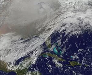
Background imageEarth Observation Collection: Satellite view the Polar Vortex in the Northern United States

Satellite view the Polar Vortex in the Northern United States
January 6, 2014 - Satellite view the Polar Vortex in the Northern United States. The Polar Vortex is a whirling and persistent large area of low pressure

Background imageEarth Observation Collection: View from space of the Indus Valley in Pakistan

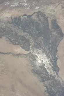
View from space of the Indus Valley in Pakistan
August 14, 2013 - View from space of the Indus Valley in Pakistan with its huge August floods brilliantly visible in sunglint

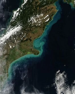
Background imageEarth Observation Collection: Satellite view showing sediment near Christchurch, New Zealand

Satellite view showing sediment near Christchurch, New Zealand
March 6, 2014 - Satellite view showing sediment near Christchurch, New Zealand

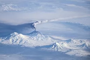
Background imageEarth Observation Collection: An eruption plume emanating from Kliuchevskoi volcano

An eruption plume emanating from Kliuchevskoi volcano
An eruption plume emanating from Kliuchevskoi, one of the many active volcanoes on the Kamchatka Peninsula. The plume, likely a combination of steam, volcanic gases, and ash

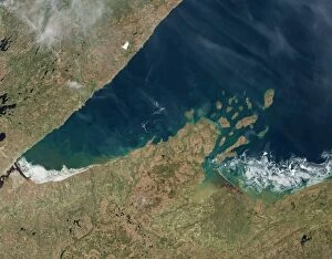
Background imageEarth Observation Collection: Satellite view showing chunks of ice afloat on Lake Superior

Satellite view showing chunks of ice afloat on Lake Superior
May 23, 2014 - Satellite view showing chunks of ice afloat on Lake Superior near Chequamegon Bay, Wisconsin

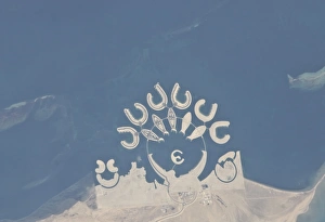
Background imageEarth Observation Collection: Durrat Al Bahrain, Bahrain

Durrat Al Bahrain, Bahrain
January 23, 2011 - Durrat Al Bahrain, Bahrain. Set at the southern end of Bahrain Island, at the furthest point from the cities of the kingdom, is a new complex of 14 artificial islands

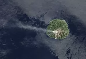
Background imageEarth Observation Collection: Sporadic eruptions from Paluweh Volcano

Sporadic eruptions from Paluweh Volcano
April 19, 2013 - Sporadic eruptions from Paluweh Volcano emitting ash and volcanic gases into the air

Background imageEarth Observation Collection: The Great Salt Desert in Iran

The Great Salt Desert in Iran
October 24, 2000 - Dasht-e Kavir, or Great Salt Desert, is the largest desert in Iran. It is primarily uninhabited wasteland

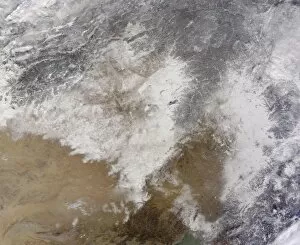
Background imageEarth Observation Collection: Satellite view of snow in northeastern China

Satellite view of snow in northeastern China
January 8, 2014 - Satellite view of snow in northeastern China


All Professionally Made to Order for Quick Shipping

"Earth Observation: Glimpses of Our Pale Blue Dot and Beyond" In the vast expanse of space, Voyager 1 captured an awe-inspiring image that forever changed our perspective. The iconic "Pale Blue Dot" photograph revealed Earth as a tiny speck in the cosmic ocean, reminding us of our interconnectedness on this magnificent planet. Zooming in closer, we witness the intricate details of human achievements. The Wimbledon tennis complex stands out amidst the bustling cityscape of London, UK. From high above, a satellite image showcases the British Isles with its lush green landscapes and rugged coastlines – a testament to nature's beauty. As night falls, lights illuminate cities across Europe like constellations on Earth's canvas. A mesmerizing satellite image captures the brilliance of UK at night from space – a tapestry woven by millions living their lives under starry skies. Expanding further into darkness reveals Europe at night; clusters of light representing vibrant metropolises and quiet towns alike. And then there it is - an astonishing view showcasing our entire planet bathed in nocturnal glow - Whole Earth at night seen from space. Venturing beyond terrestrial boundaries, Tenerife emerges through a satellite lens – its volcanic terrain contrasting against azure waters surrounding this Spanish island paradise. The International Space Station floats gracefully in orbit around Earth during 2008 – humanity's outpost where astronauts conduct research while gazing back upon their home planet with wonderment. From afar, another satellite image depicts Earth from space - swirling clouds dance over continents and oceans; an ever-changing masterpiece painted by atmospheric currents and weather patterns. Closer to home once more, Scotland's stunning landscape unfolds beneath us through yet another captivating satellite image. Majestic mountains blend seamlessly with lochs and glens creating breathtaking scenery that captivates all who behold it.