Fraud Blocker Skip to main content

Earth Observation Collection

"Earth Observation: Glimpses of Our Pale Blue Dot and Beyond" In the vast expanse of space

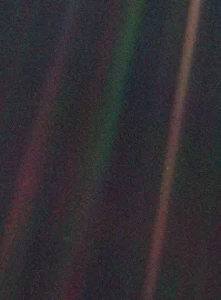
Background imageEarth Observation Collection: Pale Blue Dot, Voyager 1

Pale Blue Dot, Voyager 1
This unique narrow-angle color image is of the Earth, dubbed Pale Blue Dot, is a part of the first ever portrait of the solar system taken by Voyager 1

Background imageEarth Observation Collection: International Space Station, 2008

International Space Station, 2008
International Space Station (ISS), February 2008, taken from the Space Shuttle Atlantis after undocking took place towards the end of the Shuttles mission to the ISS

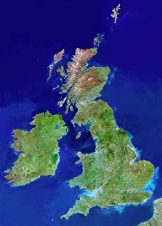
Background imageEarth Observation Collection: British Isles, satellite image

British Isles, satellite image
UK and Ireland. Satellite image of the UK and the Republic of Ireland (Eire). North is at top. Water is blue, vegetation is green, dry or barren areas are brown, and snow and ice are white

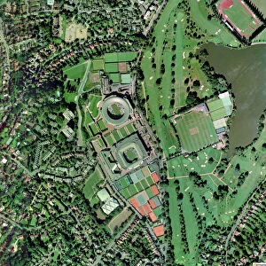
Background imageEarth Observation Collection: Wimbledon tennis complex, UK

Wimbledon tennis complex, UK
Wimbledon tennis complex, aerial photograph. This complex is host to the Wimbledon tennis championships, the oldest tennis tournament in the world

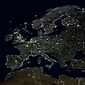
Background imageEarth Observation Collection: Europe at night

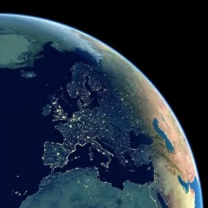
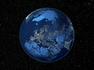
Europe at night, satellite image. North is at top. Yellow lights mark the major cities and population areas, showing a clearly delineated Mediterranean coast

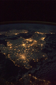
Background imageEarth Observation Collection: UK at night from space

UK at night from space
UK at night, as seen from the International Space Station (ISS). City lights (yellow) show areas of dense population. France is at bottom. Image taken on 24th December 2010

Background imageEarth Observation Collection: Earth from space, satellite image

Earth from space, satellite image
Earth from space. Satellite image showing North and South America as seen from 35, 000 kilometres above the Earths surface. North is at top and the Moon is at upper right

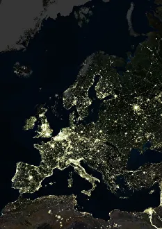
Background imageEarth Observation Collection: Europe at night, satellite image

Europe at night, satellite image. City lights (yellow) of increasing intensity show areas of increasing population, with areas of few lights being more sparsely populated

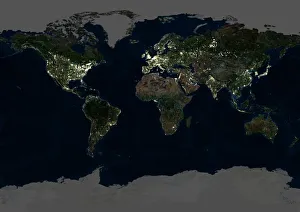
Background imageEarth Observation Collection: Whole Earth at night, satellite image

Whole Earth at night, satellite image
Whole Earth map at night, satellite image. Here, Africa is seen at centre. City lights (yellow) of increasing intensity show areas of increasing population

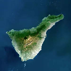
Background imageEarth Observation Collection: Tenerife, satellite image

Tenerife, satellite image. Satellite image of Tenerife showing Mount Teide (lower centre). Vegetation is green, and water is blue

Background imageEarth Observation Collection: Europe at night, satellite image

Europe at night, satellite image. City lights (yellow) show areas of dense population. There are few lights in North Africa (bottom) and the Arctic (top) since they are more sparsely populated

Background imageEarth Observation Collection: Moon rising over Earths horizon

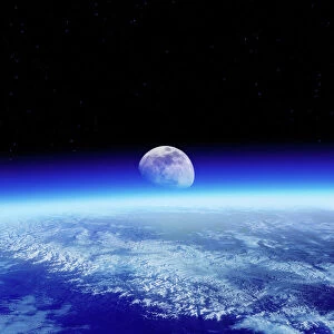
Moon rising over Earths horizon, composite image. The blue haze of Earths atmosphere can be seen above the horizon. Earth is thought to be the only planet in the solar system that can support life

Background imageEarth Observation Collection: Sheffield, UK, aerial image

Sheffield, UK, aerial image
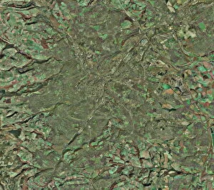
Sheffield, UK, aerial photograph. Sheffield is a city of some 510, 000 people (2003) in South Yorkshire. The M1 motorway (running down right) links Sheffield with London (to the south)

Background imageEarth Observation Collection: North America at night, satellite image

North America at night, satellite image
Africa at night. Satellite image of the Earth at night, set against a background of stars, centred on the continent of Africa. North is at top. City lights (yellow) show areas of dense population
Background imageEarth Observation Collection: North Sea at night, satellite image

North Sea at night, satellite image
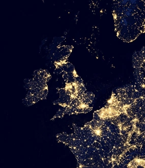
North Sea at night. Black marble satellite image of the North Sea at night. Lights from ships and flares from gas and oil platforms can be seen. On land, more densely populated areas are brighter

Background imageEarth Observation Collection: Scotland, UK, satellite image

Scotland, UK, satellite image
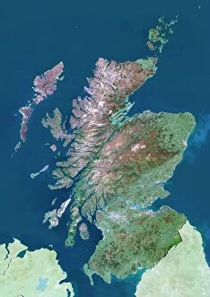
Scotland, UK. North is at top. Natural colour satellite image showing Scotland in the United Kingdom, with the surrounding territories shaded out

Background imageEarth Observation Collection: Aurora over Antarctica, satellite image

Aurora over Antarctica, satellite image
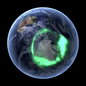
Aurora over Antarctica, ultraviolet satellite image. Australia is at upper left. This is the aurora australis (green ring), the southern lights display

Background imageEarth Observation Collection: Earth

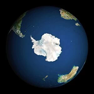
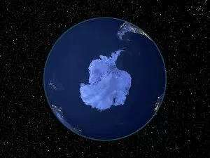
Earth. Satellite image of the Earth, centred on Antarctica. The South Pole is at centre. Water is blue, vegetation is green, arid areas are brown, and snow and ice are white

Background imageEarth Observation Collection: Mariana trench sea floor topography

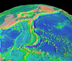
Mariana trench sea floor topography
Mariana trench topography. Computer model of the topography of the region surrounding the Mariana trench (purple arc, lower centre) in the Pacific Ocean, the deepest point on Earth

Background imageEarth Observation Collection: Palm Islands construction, Dubai

Palm Islands construction, Dubai
Luxury island construction, Dubai. Ikonos satellite image of an artificial palm tree-shaped island created in the Persian Gulf, off the coast of Dubai. This is the Jumeirah Palm resort

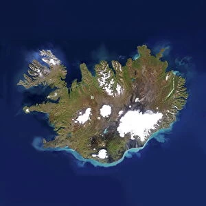
Background imageEarth Observation Collection: Iceland

Iceland, satellite image. Located in the Atlantic Ocean, just below the Arctic Circle, Iceland is a sparsely populated country of around 300, 000 people and an area of 100, 000 square kilometres

Background imageEarth Observation Collection: Ocean currents off the Americas

Ocean currents off the Americas. Satellite-based graphic showing ocean currents (swirling coloured lines) on an Earth globe centred on the Americas

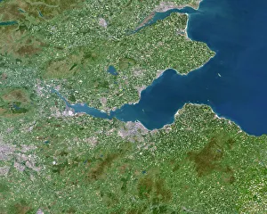
Background imageEarth Observation Collection: Firth of Forth, UK, satellite image

Firth of Forth, UK, satellite image. The Firth of Forth is the major estuary of the River Forth in Scotland. The grey area at centre is the city of Edinburgh

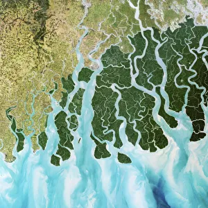
Background imageEarth Observation Collection: Ganges River delta, India

Ganges River delta, India
Ganges delta, India, satellite image. The Ganges is a river which flows for over 2400 kilometres from the Himalayas to the Indian Oceans Bay of Bengal

Background imageEarth Observation Collection: Reading, UK

Reading, UK, aerial photograph

Background imageEarth Observation Collection: Barbados, satellite image

Barbados, satellite image
Barbados. Landsat image of the island of Barbados in the Caribbean sea. North is at top. Barbados has a total land area of about 430 square kilometres

Background imageEarth Observation Collection: Earth from space

Earth from space. Computer artwork of a gibbous Earth, seen from space

Background imageEarth Observation Collection: Australia, satellite image

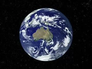
Australia, satellite image
Australia. Satellite image of the Earth, set against a background of stars, centred on the island continent of Australia. North is at top. Clouds (white) are seen in the atmosphere

Background imageEarth Observation Collection: Australia, satellite image

Australia, satellite image. North is at top. Australia is the worlds smallest continent. It is located in the southern hemisphere, southeast of Asia

Background imageEarth Observation Collection: Central Manchester, aerial view

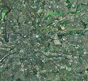
Central Manchester, aerial view. North is at top. Manchester is one of the largest cities in the UK. The River Irwell (upper left) flows through the city centre (centre left)

Background imageEarth Observation Collection: Bombetoka Bay, Madagascar

Bombetoka Bay, Madagascar, satellite image. This bay links the Betsiboka River (at right) with the Mozambique Channel (top left), part of the Indian Ocean

Background imageEarth Observation Collection: South America at night, satellite image

South America at night, satellite image
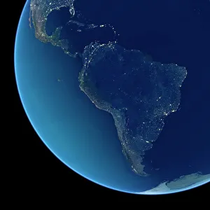
South America at night. Satellite image of the Earth at night, set against a background of stars, centred on the continent of South America. North is at top

Background imageEarth Observation Collection: India at night, satellite image

India at night, satellite image
India at night, satellite view. This image is a composite showing the change in illumination over India from 1992-2003. Satellite data from 2003 is coloured red

Background imageEarth Observation Collection: South America at night, satellite image

South America at night, satellite image. City lights (yellow) show areas of dense population, particularly in North America (top left) and South Americas coasts

Background imageEarth Observation Collection: North America at night, satellite image

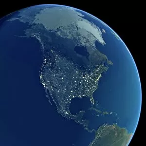
North America at night, satellite image. City lights (yellow) show areas of dense population, particularly in North America (upper centre)

Background imageEarth Observation Collection: London, UK, satellite image

London, UK, satellite image
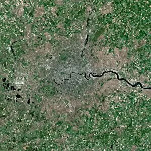
London, UK. Satellite image of the city of London (centre) and its surrounding area. North is at top. The River Thames is seen running through the city from left to right

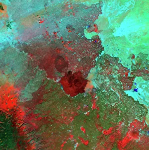
Background imageEarth Observation Collection: Syrian Desert, satellite image

Syrian Desert, satellite image. North is at top. Vegetation is red and dark green, while arid areas of sand and rock are light green and light blue. Water is blue

Background imageEarth Observation Collection: Saudi Arabian desert

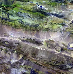
Saudi Arabian desert. Combined infrared and visible satellite image of the Jabal Tuwayq ridge (down centre) in the rocky desert region of Najd in central Saudi Arabia. North is at top

Background imageEarth Observation Collection: Water vapour maps of Antarctica, 2004

Water vapour maps of Antarctica, 2004
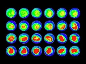
Water vapour maps of Antarctica. Satellite images of the increase in water vapour over Antarctica from 13 August to 14 October 2004 (the austral spring)

Background imageEarth Observation Collection: Fareham, UK, aerial image

Fareham, UK, aerial image
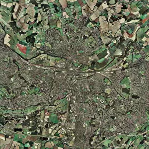
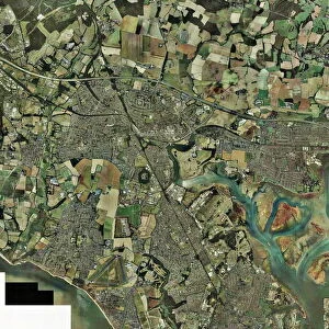
Fareham, UK, aerial photograph. Fareham is a market town in Hampshire, England, between the two cities of Portsmouth and Southampton

Background imageEarth Observation Collection: Southampton, UK, aerial photograph

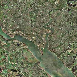
Southampton, UK, aerial photograph. Southampton is a city and major port on the south coast of England. Running from centre left to bottom right is Southampton Water

Background imageEarth Observation Collection: Earth from space, artwork

Earth from space, artwork. View of the Earth centred on 165 degrees East, showing Russia (top left), Southeast Asia (centre left), China and Japan (upper left), Australia (lower left)

Background imageEarth Observation Collection: Hurricane Epsilon, ISS image

Hurricane Epsilon, ISS image
Hurricane Epsilon. International Space Station (ISS) image of hurricane Epsilon over the central Atlantic Ocean on 3rd December 2005

Background imageEarth Observation Collection: Steppe-desert border, satellite image

Steppe-desert border, satellite image. North is at top. Arid areas of desert rock are brown, while grassy steppe areas are green. A small area of desert sands (yellow) is seen at far centre right

Background imageEarth Observation Collection: Europe at night

Europe at night, satellite image. North is towards top left. Yellow lights mark the major cities. The Mediterranean coast is densely populated, as is the mainland of Britain

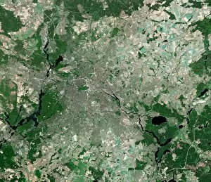
Background imageEarth Observation Collection: Berlin, Germany, satellite image

Berlin, Germany, satellite image
Berlin, Germany. Satellite image of the city of Berlin (centre) and its surrounding area in northeastern Germany. North is at top

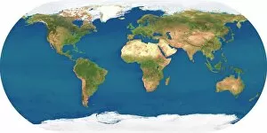
Background imageEarth Observation Collection: Whole Earth, satellite image

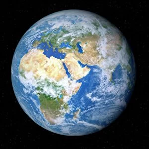
Whole Earth, satellite image. This map is centred on the Greenwich meridian, at zero degrees latitude. Arctic and Antarctic ice is white, oceans are blue and land is green and brown

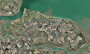
Background imageEarth Observation Collection: Isle of Sheppey, UK, aerial view C014 / 6171

Isle of Sheppey, UK, aerial view C014 / 6171
Isle of Sheppey. Aerial photograph of the Isle of Sheppey, Kent, UK


All Professionally Made to Order for Quick Shipping

"Earth Observation: Glimpses of Our Pale Blue Dot and Beyond" In the vast expanse of space, Voyager 1 captured an awe-inspiring image that forever changed our perspective. The iconic "Pale Blue Dot" photograph revealed Earth as a tiny speck in the cosmic ocean, reminding us of our interconnectedness on this magnificent planet. Zooming in closer, we witness the intricate details of human achievements. The Wimbledon tennis complex stands out amidst the bustling cityscape of London, UK. From high above, a satellite image showcases the British Isles with its lush green landscapes and rugged coastlines – a testament to nature's beauty. As night falls, lights illuminate cities across Europe like constellations on Earth's canvas. A mesmerizing satellite image captures the brilliance of UK at night from space – a tapestry woven by millions living their lives under starry skies. Expanding further into darkness reveals Europe at night; clusters of light representing vibrant metropolises and quiet towns alike. And then there it is - an astonishing view showcasing our entire planet bathed in nocturnal glow - Whole Earth at night seen from space. Venturing beyond terrestrial boundaries, Tenerife emerges through a satellite lens – its volcanic terrain contrasting against azure waters surrounding this Spanish island paradise. The International Space Station floats gracefully in orbit around Earth during 2008 – humanity's outpost where astronauts conduct research while gazing back upon their home planet with wonderment. From afar, another satellite image depicts Earth from space - swirling clouds dance over continents and oceans; an ever-changing masterpiece painted by atmospheric currents and weather patterns. Closer to home once more, Scotland's stunning landscape unfolds beneath us through yet another captivating satellite image. Majestic mountains blend seamlessly with lochs and glens creating breathtaking scenery that captivates all who behold it.