Fraud Blocker Skip to main content

Compass Collection (page 3)

The compass, a versatile tool used in carpentry and joinery, has a rich history that spans across various fields and cultures

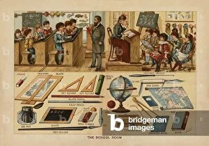
Background imageCompass Collection: The School Room (colour litho)

The School Room (colour litho)
8633173 The School Room (colour litho) by English School, (19th century); Private Collection; (add.info.: The School Room)

Background imageCompass Collection: Candidate taking the oath of an Entered Apprentice (engraving)

Candidate taking the oath of an Entered Apprentice (engraving)
8673090 Candidate taking the oath of an Entered Apprentice (engraving) by American School, (19th century); Private Collection; (add.info.: Candidate taking the oath of an Entered Apprentice)

Background imageCompass Collection: Boussole marine ou compas de route avec son mode de suspension ordinaire (engraving)

Boussole marine ou compas de route avec son mode de suspension ordinaire (engraving)
8653356 Boussole marine ou compas de route avec son mode de suspension ordinaire (engraving) by European School, (19th century); Private Collection; (add.info)

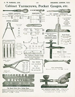
Background imageCompass Collection: Page from Gamage's General Catalogue (96th edition), c.1927 (litho)

Page from Gamage's General Catalogue (96th edition), c.1927 (litho)
8669514 Page from Gamage's General Catalogue (96th edition), c.1927 (litho) by English School, (20th century); Private Collection; (add.info)

Background imageCompass Collection: Mrs. Bryan and her Children, 1797 (engraving)

Mrs. Bryan and her Children, 1797 (engraving)
7340002 Mrs. Bryan and her Children, 1797 (engraving) by Shelley, Samuel (1750-1808); 29x13 cm; National Maritime Museum, London

Background imageCompass Collection: Captain Henry Osborn (1697-1771), 1743-44 (oil on canvas)

Captain Henry Osborn (1697-1771), 1743-44 (oil on canvas)
7338007 Captain Henry Osborn (1697-1771), 1743-44 (oil on canvas) by Arnulphy, Claude (1697-1786); 91.5x71 cm; National Maritime Museum, London

Background imageCompass Collection: Taking a Lunar Distance Illustration from Dunkins Night Sky, c.1869 (print)

Taking a Lunar Distance Illustration from Dunkins Night Sky, c.1869 (print)
7337581 Taking a Lunar Distance Illustration from Dunkins Night Sky, c.1869 (print) by Unknown Artist, (19th century); 30x37.7 cm; National Maritime Museum, London, UK; (add.info.: Unknown Artist)

Background imageCompass Collection: Illustration depicting a Galvanometer showing magnet and rotating coil

Illustration depicting a Galvanometer showing magnet and rotating coil. A galvanometer is an electromechanical
5311474 Illustration depicting a Galvanometer showing magnet and rotating coil. A galvanometer is an electromechanical instrument used for detecting and indicating electric current

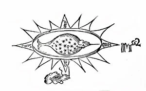
Background imageCompass Collection: A woodcut depicting a simple compass in the shape of a fish. The loadstone is suspended on a

A woodcut depicting a simple compass in the shape of a fish. The loadstone is suspended on a thread, 17th century
5311527 A woodcut depicting a simple compass in the shape of a fish. The loadstone is suspended on a thread, 17th century; Universal History Archive/UIG

Background imageCompass Collection: Illustration of a ship's helmsman using a night compass. 1870

Illustration of a ship's helmsman using a night compass. 1870
5311177 Illustration of a ship's helmsman using a night compass. 1870; (add.info.: Date: 1870); Universal History Archive/UIG

Background imageCompass Collection: Butterfield dial for latitude 40 degrees, with magnetic compass Silver instrument

Butterfield dial for latitude 40 degrees, with magnetic compass Silver instrument, 18th century (silver)
MMM5474088 Butterfield dial for latitude 40 degrees, with magnetic compass Silver instrument, 18th century (silver); National Maritime Museum, London

Background imageCompass Collection: Butterfield dial for latitude 50 degrees, in its case. Silver instrument, 1700-1720

Butterfield dial for latitude 50 degrees, in its case. Silver instrument, 1700-1720, by John Rowley ()
MMM5474069 Butterfield dial for latitude 50 degrees, in its case. Silver instrument, 1700-1720, by John Rowley (?), 1700-20 (silver) by Rowley, John (1668-1728); National Maritime Museum, London

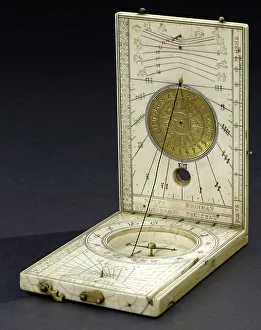
Background imageCompass Collection: Diptych sundial (open), for latitude 5 degrees, with magnetic compass

Diptych sundial (open), for latitude 5 degrees, with magnetic compass. Ivory instrument, c.1600 (ivory)
MMM5473981 Diptych sundial (open), for latitude 5 degrees, with magnetic compass. Ivory instrument, c.1600 (ivory) by Reinmann, Paul (1557-1609); National Maritime Museum, London

Background imageCompass Collection: Magnetic azimuth dial from Dieppe (France), for latitude 50 degrees, open, with magnetic compass

Magnetic azimuth dial from Dieppe (France), for latitude 50 degrees, open, with magnetic compass
MMM5474564 Magnetic azimuth dial from Dieppe (France), for latitude 50 degrees, open, with magnetic compass, c.1650-1700 (silver and ivory); National Maritime Museum, London

Background imageCompass Collection: Latitude 49 degree sundial and magnetic compass, with lid, 17th century (copper and ivory)

Latitude 49 degree sundial and magnetic compass, with lid, 17th century (copper and ivory)
MMM5470060 Latitude 49 degree sundial and magnetic compass, with lid, 17th century (copper and ivory); National Maritime Museum, London

Background imageCompass Collection: Horizontal solar and lunar dial, c.1577 (copper and glass)

Horizontal solar and lunar dial, c.1577 (copper and glass)
MMM5469120 Horizontal solar and lunar dial, c.1577 (copper and glass); National Maritime Museum, London, UK; (add.info.: Horizontal solar and lunar dial)

Background imageCompass Collection: Compass with tilting dial, for latitude 0-90 degrees, c.1750-1800 (copper)

Compass with tilting dial, for latitude 0-90 degrees, c.1750-1800 (copper)
MMM5469092 Compass with tilting dial, for latitude 0-90 degrees, c.1750-1800 (copper); National Maritime Museum, London, UK; (add.info.: Compass with tilting dial, for latitude 0-90 degrees)

Background imageCompass Collection: Diptych dial, for latitude 50 degrees, with magnetic compass and engraved table

Diptych dial, for latitude 50 degrees, with magnetic compass and engraved table, as well as some decorations
MMM5469020 Diptych dial, for latitude 50 degrees, with magnetic compass and engraved table, as well as some decorations, 1733 (ivory and copper); National Maritime Museum, London

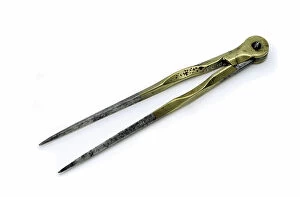
Background imageCompass Collection: Marine compass, used to measure distances on maps. Copper and steel object

Marine compass, used to measure distances on maps. Copper and steel object, c.1770 (copper and steel)
MMM5476139 Marine compass, used to measure distances on maps. Copper and steel object, c.1770 (copper and steel); National Maritime Museum, London, UK; (add.info.: Marine compass)

Background imageCompass Collection: Sundial with lid, with gnomon mounted on the circle of hours, c.1700 (brass)

Sundial with lid, with gnomon mounted on the circle of hours, c.1700 (brass)
MMM5475190 Sundial with lid, with gnomon mounted on the circle of hours, c.1700 (brass); National Maritime Museum, London, UK; (add.info.: Sundial with lid)

Background imageCompass Collection: Butterfield sundial, with magnetic compass, in silver, dated late 17th century, from Chapotot ()

Butterfield sundial, with magnetic compass, in silver, dated late 17th century, from Chapotot (?) (silver)
MMM5475378 Butterfield sundial, with magnetic compass, in silver, dated late 17th century, from Chapotot (?) (silver); National Maritime Museum, London, UK; (add.info.: Butterfield sundial)

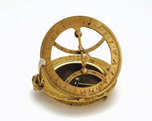
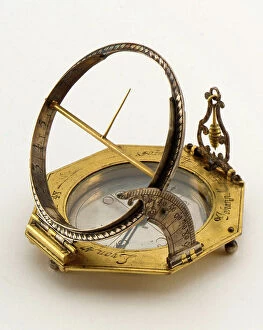
Background imageCompass Collection: Sundial from Augsburg (Germany), deployed, probably for latitude 6 degrees

Sundial from Augsburg (Germany), deployed, probably for latitude 6 degrees. Golden brass instrument, 1670-1710 (brass)
MMM5474502 Sundial from Augsburg (Germany), deployed, probably for latitude 6 degrees. Golden brass instrument, 1670-1710 (brass); National Maritime Museum, London

Background imageCompass Collection: Clock in marble and ormolu, made by Vulliamy, with the Young Geographers boys holding compasset

Clock in marble and ormolu, made by Vulliamy, with the Young Geographers boys holding compasset and sextant
FLO4689239 Clock in marble and ormolu, made by Vulliamy, with the Young Geographers boys holding compasset and sextant. Medallion of the Three Graces. Chromolithograph by W

Background imageCompass Collection: A drawing table showing a graduated T-square in use on diagram (drawing)

A drawing table showing a graduated T-square in use on diagram (drawing)
5616457 A drawing table showing a graduated T-square in use on diagram (drawing); (add.info.: Illustration depicting a drawing table showing a graduated T-square in use on diagram)

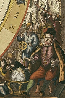
Background imageCompass Collection: CELLARIUS, Andreas (1596-1665). Atlas Coelestis seu Harmonia Macrocosmica. 1661

CELLARIUS, Andreas (1596-1665). Atlas Coelestis seu Harmonia Macrocosmica. 1661. BRAHE, Tycho (1546-1601)
CUL4868671 CELLARIUS, Andreas (1596-1665). Atlas Coelestis seu Harmonia Macrocosmica. 1661. BRAHE, Tycho (1546-1601). Danish astronomer. Andreas Cellarius Macrocosmic Harmony (Amsterdam, 1661)

Background imageCompass Collection: Windrose with compass, illustration from : ' Die Welt in Bildern ' (images of the world)

Windrose with compass, illustration from : " Die Welt in Bildern " (images of the world), published by Dr
UTD4921171 Windrose with compass, illustration from : " Die Welt in Bildern " (images of the world), published by Dr. Chr. G

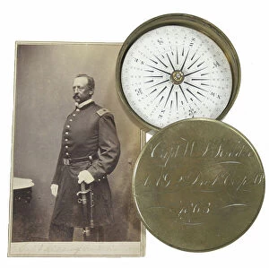
Background imageCompass Collection: Brass pocket compass and Carte de Visite of Captain W L Kidder

Brass pocket compass and Carte de Visite of Captain W L Kidder
3029105 Brass pocket compass and Carte de Visite of Captain W L Kidder; Private Collection; (add.info.: Brass pocket compass and Carte de Visite of Captain W L Kidder, Assistant Adj)

Background imageCompass Collection: The Great Eastern compass, 1850

The Great Eastern compass, 1850
3330795 The Great Eastern compass, 1850; (add.info.: Illustration depicting The Great Eastern compass. Dated 19th Century.); Universal History Archive/UIG

Background imageCompass Collection: Map of South America in 1582, 18th - 19th century (pen, ink & w/c on paper)

Map of South America in 1582, 18th - 19th century (pen, ink & w/c on paper)
PNP351100 Map of South America in 1582, 18th - 19th century (pen, ink & w/c on paper) by American School, (18th century); Private Collection; Peter Newark American Pictures

Background imageCompass Collection: 8622648

8622648

Background imageCompass Collection: Page from Gamage's General Catalogue (96th edition), c.1927 (litho)

Page from Gamage's General Catalogue (96th edition), c.1927 (litho)
8670011 Page from Gamage's General Catalogue (96th edition), c.1927 (litho) by English School, (20th century); Private Collection; (add.info)

Background imageCompass Collection: Compasses placed in a lodge of Entered Apprentices (engraving)

Compasses placed in a lodge of Entered Apprentices (engraving)
8673106 Compasses placed in a lodge of Entered Apprentices (engraving) by American School, (19th century); Private Collection; (add.info.: Compasses placed in a lodge of Entered Apprentices)

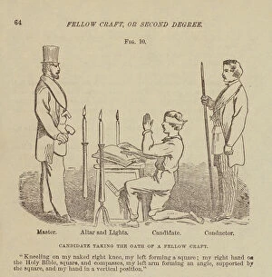
Background imageCompass Collection: Candidate taking the oath of a Fellow Craft (engraving)

Candidate taking the oath of a Fellow Craft (engraving)
8673103 Candidate taking the oath of a Fellow Craft (engraving) by American School, (19th century); Private Collection; (add.info.: Candidate taking the oath of a Fellow Craft)

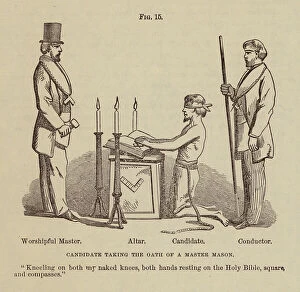
Background imageCompass Collection: Candidate taking the oath of a Master Mason (engraving)

Candidate taking the oath of a Master Mason (engraving)
8673102 Candidate taking the oath of a Master Mason (engraving) by American School, (19th century); Private Collection; (add.info.: Candidate taking the oath of a Master Mason)

Background imageCompass Collection: John Harrison, Print, after Thomas King's 1767 oil portrait, in the collection of the Science

John Harrison, Print, after Thomas King's 1767 oil portrait, in the collection of the Science Museum, London
7337507 John Harrison, Print, after Thomas King's 1767 oil portrait, in the collection of the Science Museum, London. 1768 (mezzotint) by Tassaert

Background imageCompass Collection: Cosimo I de Medici (Cosimo I de Medici, 1519-1574) planning the conquest of Siena in 1555. Detail

Cosimo I de Medici (Cosimo I de Medici, 1519-1574) planning the conquest of Siena in 1555. Detail
BEN5475972 Cosimo I de Medici (Cosimo I de Medici, 1519-1574) planning the conquest of Siena in 1555. Detail. With a compass and a map on his desk, he is looking for a combat strategy

Background imageCompass Collection: Universal equinoxial dial for all latitudes, deployed. Brass instrument and enamel

Universal equinoxial dial for all latitudes, deployed. Brass instrument and enamel, c.1800-50 (brass)
MMM5475103 Universal equinoxial dial for all latitudes, deployed. Brass instrument and enamel, c.1800-50 (brass); National Maritime Museum, London

Background imageCompass Collection: Sundial from Augsburg (Germany), deployed, for latitude 0. Copper and silver instrument

Sundial from Augsburg (Germany), deployed, for latitude 0. Copper and silver instrument, 1682 (copper and silver)
MMM5474505 Sundial from Augsburg (Germany), deployed, for latitude 0. Copper and silver instrument, 1682 (copper and silver); National Maritime Museum, London

Background imageCompass Collection: Sundial from Augsburg (Germany), deployed, for latitude 12 degrees

Sundial from Augsburg (Germany), deployed, for latitude 12 degrees. Brass instrument, 18th century (brass)
MMM5474454 Sundial from Augsburg (Germany), deployed, for latitude 12 degrees. Brass instrument, 18th century (brass); National Maritime Museum, London

Background imageCompass Collection: Sundial and lunar in diptych, c.1850-1900 (varnished wood)

Sundial and lunar in diptych, c.1850-1900 (varnished wood)
MMM5474421 Sundial and lunar in diptych, c.1850-1900 (varnished wood); National Maritime Museum, London, UK; (add.info.: Sundial and lunar in diptych, open)

Background imageCompass Collection: Diptych sundial for 49° latitude, with magnetic compass. Wooden instrument

Diptych sundial for 49° latitude, with magnetic compass. Wooden instrument, first half of the 18th century
MMM5474050 Diptych sundial for 49° latitude, with magnetic compass. Wooden instrument, first half of the 18th century; National Maritime Museum, London

Background imageCompass Collection: Diptych sundial, open, for latitude 41 degrees, 19th century (wood)

Diptych sundial, open, for latitude 41 degrees, 19th century (wood)
MMM5474041 Diptych sundial, open, for latitude 41 degrees, 19th century (wood); National Maritime Museum, London, UK; (add.info.: Diptych sundial, open, for latitude 41 degrees)

Background imageCompass Collection: Polyhedral sundial for latitude 20 degrees, with magnetic compass on its base

Polyhedral sundial for latitude 20 degrees, with magnetic compass on its base, 18th century (brass and wood)
MMM5474000 Polyhedral sundial for latitude 20 degrees, with magnetic compass on its base, 18th century (brass and wood); National Maritime Museum, London

Background imageCompass Collection: Diptych sundial (open) for Latitude 48, with magnetic compass. Ivory instrument, 1619 (ivory)

Diptych sundial (open) for Latitude 48, with magnetic compass. Ivory instrument, 1619 (ivory)
MMM5473337 Diptych sundial (open) for Latitude 48, with magnetic compass. Ivory instrument, 1619 (ivory); National Maritime Museum, London, UK; (add.info.: Diptych sundial (open) for Latitude 48

Background imageCompass Collection: Marine compass, a 16th century navigational instrument, divided into 32 points

Marine compass, a 16th century navigational instrument, divided into 32 points
MMM5470234 Marine compass, a 16th century navigational instrument, divided into 32 points, c.1570 (ivory and copper hand-painted parchment); National Maritime Museum, London

Background imageCompass Collection: Latitude 46 degree sundial, with magnetic compass, 16th century (gold)

Latitude 46 degree sundial, with magnetic compass, 16th century (gold)
MMM5470214 Latitude 46 degree sundial, with magnetic compass, 16th century (gold); National Maritime Museum, London, UK; (add.info.: Latitude 46 degree sundial, with magnetic compass)

Background imageCompass Collection: Magnetic compass and thermeter, for latitude 51 degrees. Ivory object and wooden base

Magnetic compass and thermeter, for latitude 51 degrees. Ivory object and wooden base, 1825-75 (ivory)
MMM5470107 Magnetic compass and thermeter, for latitude 51 degrees. Ivory object and wooden base, 1825-75 (ivory); National Maritime Museum, London, UK; (add.info.: Magnetic compass and thermeter)

Background imageCompass Collection: Latitude 51 degree magnetic compass. Copper and glass object, c.1835 (copper and glass)

Latitude 51 degree magnetic compass. Copper and glass object, c.1835 (copper and glass)
MMM5470001 Latitude 51 degree magnetic compass. Copper and glass object, c.1835 (copper and glass); National Maritime Museum, London, UK; (add.info.: Latitude 51 degree magnetic compass)


All Professionally Made to Order for Quick Shipping

The compass, a versatile tool used in carpentry and joinery, has a rich history that spans across various fields and cultures. From the Compass Drill on the Training Ship Arethusa in Greenhithe, Kent to Captain John Smith's intricate map of Virginia in 1612, this instrument has played a crucial role in shaping our understanding of the world. Intriguingly, even ancient manuscripts have depicted the compass as an emblem of divine creation. Manuscript illuminations from the 13th century French Bible showcase God as the great Architect of the Universe, holding a compass to symbolize his meticulous design. Moving forward through time, we find ourselves at Newmarket Race Course in 1940 where precision is key for determining accurate distances. The compass aids not only navigators but also cartographers like those who created maps such as "Map of Cyprus - The Island of Venus" or "The North and East Ridings of Yorkshire" engraved by Jodocus Hondius (1563-1612). These maps provide invaluable insights into geographical features and historical contexts. Beyond geography lies Feng-Shui; an ancient Chinese practice that utilizes a specialized compass to harmonize energies within spaces. This Feng-Shui Compass guides practitioners towards optimal arrangements for balance and prosperity. Even artistic endeavors have been influenced by this remarkable tool. An Atlas of the World from Venice in 1553 showcases Italy with intricate details meticulously drawn using ink on vellum – all made possible with precise measurements provided by none other than the trusty compass. Whether it be aiding sailors at sea or guiding architects' hands, whether it be unlocking hidden energies or creating stunning works of art – throughout history and across continents –the humble yet powerful compass continues to play an indispensable role in shaping our world both physically and metaphorically.