Fraud Blocker Skip to main content

Common Road Collection

"Exploring the hidden gems along the common road, from Slough to Richmond upon Thames and beyond

Background imageCommon Road Collection: Slough SL3 8 Map

Slough SL3 8 Map
Postcode Sector Map of Slough SL3 8

Background imageCommon Road Collection: Norfolk NR12 8 Map

Norfolk NR12 8 Map
Postcode Sector Map of Norfolk NR12 8

Background imageCommon Road Collection: Mole Valley KT23 3 Map

Mole Valley KT23 3 Map
Postcode Sector Map of Mole Valley KT23 3

Background imageCommon Road Collection: South Derbyshire DE11 9 Map

South Derbyshire DE11 9 Map
Postcode Sector Map of South Derbyshire DE11 9

Background imageCommon Road Collection: South Staffordshire WV5 0 Map

South Staffordshire WV5 0 Map
Postcode Sector Map of South Staffordshire WV5 0

Background imageCommon Road Collection: Leeds WF3 4 Map

Leeds WF3 4 Map
Postcode Sector Map of Leeds WF3 4

Background imageCommon Road Collection: York YO60 7 Map

York YO60 7 Map
Postcode Sector Map of York YO60 7

Background imageCommon Road Collection: York YO8 5 Map

York YO8 5 Map
Postcode Sector Map of York YO8 5

Background imageCommon Road Collection: York YO19 5 Map

York YO19 5 Map
Postcode Sector Map of York YO19 5

Background imageCommon Road Collection: Three Rivers WD3 5 Map

Three Rivers WD3 5 Map
Postcode Sector Map of Three Rivers WD3 5

Background imageCommon Road Collection: Hertsmere WD23 1 Map

Hertsmere WD23 1 Map
Postcode Sector Map of Hertsmere WD23 1

Background imageCommon Road Collection: Powys SY16 4 Map

Powys SY16 4 Map
Postcode Sector Map of Powys SY16 4

Background imageCommon Road Collection: Richmond upon Thames SW13 0 Map

Richmond upon Thames SW13 0 Map
Postcode Sector Map of Richmond upon Thames SW13 0

Background imageCommon Road Collection: Staffordshire ST16 3 Map

Staffordshire ST16 3 Map
Postcode Sector Map of Staffordshire ST16 3

Background imageCommon Road Collection: Central Bedfordshire SG19 2 Map

Central Bedfordshire SG19 2 Map
Postcode Sector Map of Central Bedfordshire SG19 2

Background imageCommon Road Collection: North Hertfordshire SG5 4 Map

North Hertfordshire SG5 4 Map
Postcode Sector Map of North Hertfordshire SG5 4

Background imageCommon Road Collection: Central Bedfordshire SG18 9 Map

Central Bedfordshire SG18 9 Map
Postcode Sector Map of Central Bedfordshire SG18 9

Background imageCommon Road Collection: Wiltshire SN16 0 Map

Wiltshire SN16 0 Map
Postcode Sector Map of Wiltshire SN16 0

Background imageCommon Road Collection: Kirklees WF17 8 Map

Kirklees WF17 8 Map
Postcode Sector Map of Kirklees WF17 8

Background imageCommon Road Collection: Kirklees WF17 7 Map

Kirklees WF17 7 Map
Postcode Sector Map of Kirklees WF17 7

Background imageCommon Road Collection: Wakefield WF9 5 Map

Wakefield WF9 5 Map
Postcode Sector Map of Wakefield WF9 5

Background imageCommon Road Collection: Wakefield WF9 3 Map

Wakefield WF9 3 Map
Postcode Sector Map of Wakefield WF9 3

Background imageCommon Road Collection: Wychavon WR11 4 Map

Wychavon WR11 4 Map
Postcode Sector Map of Wychavon WR11 4

Background imageCommon Road Collection: Berkshire RG19 8 Map

Berkshire RG19 8 Map
Postcode Sector Map of Berkshire RG19 8

Background imageCommon Road Collection: Bassetlaw S80 3 Map

Bassetlaw S80 3 Map
Postcode Sector Map of Bassetlaw S80 3

Background imageCommon Road Collection: Rotherham S26 7 Map

Rotherham S26 7 Map
Postcode Sector Map of Rotherham S26 7

Background imageCommon Road Collection: Rotherham S26 2 Map

Rotherham S26 2 Map
Postcode Sector Map of Rotherham S26 2

Background imageCommon Road Collection: Barnsley S72 9 Map

Barnsley S72 9 Map
Postcode Sector Map of Barnsley S72 9

Background imageCommon Road Collection: Rotherham S25 4 Map

Rotherham S25 4 Map
Postcode Sector Map of Rotherham S25 4

Background imageCommon Road Collection: Rotherham S25 3 Map

Rotherham S25 3 Map
Postcode Sector Map of Rotherham S25 3

Background imageCommon Road Collection: Barnsley S63 0 Map

Barnsley S63 0 Map
Postcode Sector Map of Barnsley S63 0

Background imageCommon Road Collection: Ashford TN17 2 Map

Ashford TN17 2 Map
Postcode Sector Map of Ashford TN17 2

Background imageCommon Road Collection: Sevenoaks TN11 0 Map

Sevenoaks TN11 0 Map
Postcode Sector Map of Sevenoaks TN11 0

Background imageCommon Road Collection: Sevenoaks TN15 9 Map

Sevenoaks TN15 9 Map
Postcode Sector Map of Sevenoaks TN15 9

Background imageCommon Road Collection: St. Helens WA12 9 Map

St. Helens WA12 9 Map
Postcode Sector Map of St. Helens WA12 9

Background imageCommon Road Collection: Pembrokeshire SA71 4 Map

Pembrokeshire SA71 4 Map
Postcode Sector Map of Pembrokeshire SA71 4

Background imageCommon Road Collection: Reigate and Banstead RH1 6 Map

Reigate and Banstead RH1 6 Map
Postcode Sector Map of Reigate and Banstead RH1 6

Background imageCommon Road Collection: Bracknell Forest SL4 6 Map

Bracknell Forest SL4 6 Map
Postcode Sector Map of Bracknell Forest SL4 6

Background imageCommon Road Collection: Eastleigh SO53 1 Map

Eastleigh SO53 1 Map
Postcode Sector Map of Eastleigh SO53 1

Background imageCommon Road Collection: Rochford SS3 0 Map

Rochford SS3 0 Map
Postcode Sector Map of Rochford SS3 0

Background imageCommon Road Collection: Wiltshire SP5 2 Map

Wiltshire SP5 2 Map
Postcode Sector Map of Wiltshire SP5 2

Background imageCommon Road Collection: West Oxfordshire OX29 6 Map

West Oxfordshire OX29 6 Map
Postcode Sector Map of West Oxfordshire OX29 6

Background imageCommon Road Collection: Boston PE22 9 Map

Boston PE22 9 Map
Postcode Sector Map of Boston PE22 9

Background imageCommon Road Collection: Fenland PE14 7 Map

Fenland PE14 7 Map
Postcode Sector Map of Fenland PE14 7

Background imageCommon Road Collection: South Holland PE12 0 Map

South Holland PE12 0 Map
Postcode Sector Map of South Holland PE12 0

Background imageCommon Road Collection: South Holland PE12 6 Map

South Holland PE12 6 Map
Postcode Sector Map of South Holland PE12 6

Background imageCommon Road Collection: Oxford OX3 9 Map

Oxford OX3 9 Map
Postcode Sector Map of Oxford OX3 9

Background imageCommon Road Collection: Northumberland NE71 6 Map

Northumberland NE71 6 Map
Postcode Sector Map of Northumberland NE71 6


All Professionally Made to Order for Quick Shipping

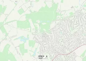
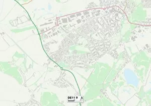
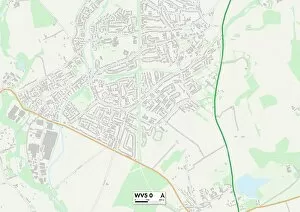
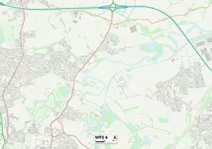
"Exploring the hidden gems along the common road, from Slough to Richmond upon Thames and beyond. 🚗✨ Discover picturesque landscapes in Mole Valley and South Derbyshire, marked on the map as KT23 3 and DE11 9 respectively. Take a scenic drive through South Staffordshire's WV5 0 area or immerse yourself in the vibrant city life of Leeds (WF3 4) and York (YO60 7, YO8 5, YO19 5). Navigate through Three Rivers' WD3 5 region for a taste of tranquility before venturing into Hertsmere's WD23 1 district with its charming villages. Don't miss out on Powys' SY16 4 spot for breathtaking views that will leave you speechless. Finally, make your way to Richmond upon Thames SW13 0 where history meets modernity. Buckle up for an unforgettable journey along this common road. "