Fraud Blocker Skip to main content

Chesapeake Bay Collection (page 2)

"Exploring the Rich History and Natural Beauty of Chesapeake Bay" Discover the captivating allure of Chesapeake Bay

Background imageChesapeake Bay Collection: Battle of Pocomoke Sound in colonial Maryland, 1630s

Battle of Pocomoke Sound in colonial Maryland, 1630s
William Claiborne and Leonard Calvert in battle, the first naval conflict on Chesapeake Bay, 1630s. Hand-colored woodcut of a 19th-century illustration

Background imageChesapeake Bay Collection: British Navy bombarding the shores of Chesapeake Bay, War of 1812

British Navy bombarding the shores of Chesapeake Bay, War of 1812
Fort McHenry and Baltimore under British naval artillery attack, 1814. Hand-colored woodcut of a 19th-century illustration

Background imageChesapeake Bay Collection: EXPL2A-00289

EXPL2A-00289
Captain John Smith exploring the Chesapeake Bay region, early 1600s. Hand-colored woodcut of a 19th-century illustration

Background imageChesapeake Bay Collection: Netting Catching Diamond-Back Terrapins Chesapeake Bay

Netting Catching Diamond-Back Terrapins Chesapeake Bay
Netting Diamond-Back Terrapins. In the 19th century canneries processed and exported tons of product until the turtle populations collapsed

Background imageChesapeake Bay Collection: Catching Turtles Snapping Turtle Farm Chesapeake Bay

Catching Turtles Snapping Turtle Farm Chesapeake Bay
Catching turtles on a Snapping Turtle farm, Chesapeake Bay, Maryland, United States of America. In the 19th century canneries processed

Background imageChesapeake Bay Collection: Raking Oysters Chesapeake Bay Estuary Chesapeake Watermen

Raking Oysters Chesapeake Bay Estuary Chesapeake Watermen
Raking for oysters in Chesapeake Bay, 19th century. From America Revisited: From The Bay of New York to The Gulf of Mexico, published 1886

Background imageChesapeake Bay Collection: Map of New England by Explorer John Smith, Circa 1624

Map of New England by Explorer John Smith, Circa 1624
Beautifully Illustrated Antique Engraved Victorian Illustration of Historical Map of New England from Explorer Captain John Smith, Circa 1624. Source: Original edition from my own archives

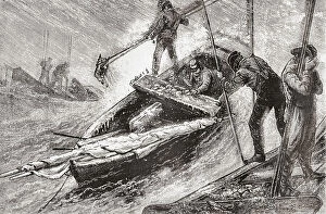
Background imageChesapeake Bay Collection: CHESAPEAKE BAY, 1955. The three masts of the sunken ship Edward J

CHESAPEAKE BAY, 1955. The three masts of the sunken ship Edward J. Baird emerging from the waters of Chesapeake Bay. Photograph by A. Aubrey Bodine, 1955

Background imageChesapeake Bay Collection: BALTIMORE: FELLs POINT. Levering Coffee Warehouse on Philpot Street, Fells Point

BALTIMORE: FELLs POINT. Levering Coffee Warehouse on Philpot Street, Fells Point, Baltimore, Maryland. Photograph by Louise Taft, September 1985

Background imageChesapeake Bay Collection: BALTIMORE: FELLs POINT. Rukert Terminals Corporation, Browns Wharf Warehouses

BALTIMORE: FELLs POINT. Rukert Terminals Corporation, Browns Wharf Warehouses, on Fell Street, Fells Point, Baltimore, Maryland. Photograph by Louise Taft, September 1985

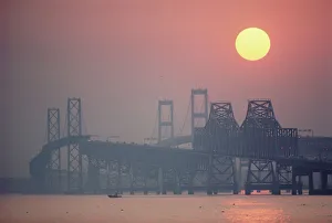
Background imageChesapeake Bay Collection: USA, Maryland, Chesapeake Bay Bridge near Annapolis, sunset

USA, Maryland, Chesapeake Bay Bridge near Annapolis, sunset

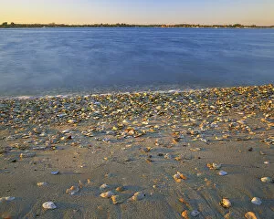
Background imageChesapeake Bay Collection: USA, Virginia, Chesapeak Bay, Shore at Sunset

USA, Virginia, Chesapeak Bay, Shore at Sunset
USA, Virginia, Chesapeake Bay, Shore at Sunset (Large format sizes available)

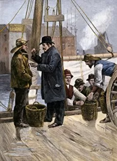
Background imageChesapeake Bay Collection: Sampling the Maryland oyster catch, 1800s

Sampling the Maryland oyster catch, 1800s
Oyster buyer tasting a sample on the dock in Baltimore, Maryland, 1880s. Hand-colored woodcut of a 19th-century illusttration

Background imageChesapeake Bay Collection: EVNT2A-00009

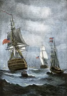
EVNT2A-00009
British ships blockading Chesapeake Bay at the outset of the War of 1812. Hand-colored halftone of a 19th century illustration

Background imageChesapeake Bay Collection: Chesapeake Bay entrance before settlers arrived

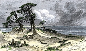
Chesapeake Bay entrance before settlers arrived
Entrance to Chesapeake Bay, as it appeared to early explorers and colonists. Hand-colored woodcut of a 19th-century illustration

Background imageChesapeake Bay Collection: Fort Monroe and its environs

Fort Monroe and its environs
Vintage engraving from 1863 of a map of Fort Monroe and its environs. Fort Monroe played an important role in the American Civil War

Background imageChesapeake Bay Collection: OYSTER BOAT, c1920. Fishermen on the deck of an oyster boat in Chesapeake Bay, Maryland

OYSTER BOAT, c1920. Fishermen on the deck of an oyster boat in Chesapeake Bay, Maryland. Stereograph, c1920

Background imageChesapeake Bay Collection: A severe winter storm around the Washington D. C. area

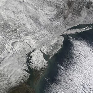
A severe winter storm around the Washington D. C. area
February 7, 2010 - A severe winter storm around the Washington D.C. area, showing part of the region affected by heavy snowfall

Background imageChesapeake Bay Collection: A severe winter storm along the United States east coast

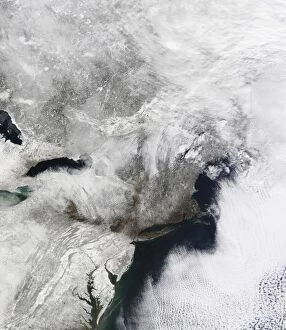
A severe winter storm along the United States east coast
February 11, 2010 - A severe winter storm along the United States east coast. Snow cover thins in southeastern Virginia, but snow cover appears unbroken to the north

Background imageChesapeake Bay Collection: Satellite view of a Nor easter snow storm over the Mid-Atlantic and Northeastern

Satellite view of a Nor easter snow storm over the Mid-Atlantic and Northeastern
December 21, 2009 - Satellite view of a massive Nor easter snow storm over the Mid-Atlantic and Northeastern United States showing a view of the Chesapeake Bay area cloaked in white

Background imageChesapeake Bay Collection: Satellite view of a massive Nor easter snow storm over Chesapeake Bay

Satellite view of a massive Nor easter snow storm over Chesapeake Bay
December 20, 2009 - Satellite view of a massive Nor easter snow storm over the Chesapeake Bay region of the Mid-Atlantic states as the clouds are clearing

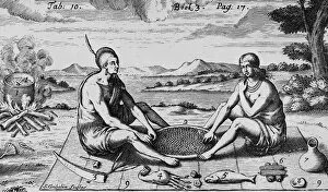
Background imageChesapeake Bay Collection: A Man And His Wife At Dinner, 1705 (engraving)

A Man And His Wife At Dinner, 1705 (engraving)
XJF396081 A Man And His Wife At Dinner, 1705 (engraving) by Gribelin, Simon II (1661-1733); Private Collection; (add.info.: from Robert Beverley, The History and Present State of Virginia, London)

Background imageChesapeake Bay Collection: CAPTAIN SMITH, FROM THE PORTRAIT IN HIS VIRGINIA, He was an English soldier, explorer

CAPTAIN SMITH, FROM THE PORTRAIT IN HIS VIRGINIA, He was an English soldier, explorer, and author. He was considered to have played an important part in the establishment of the first permanent

Background imageChesapeake Bay Collection: Map of Raleighs Virginia (lithograph)

Map of Raleighs Virginia (lithograph)
BAL109987 Map of Raleighs Virginia (lithograph) by White, John (fl.1570-93) (after); 48x23.5 cm; Private Collection; English, out of copyright

Background imageChesapeake Bay Collection: Three sailboats on Chesapeake Bay, between 1860 and 1865, drawing on cream paper pencil

Three sailboats on Chesapeake Bay, between 1860 and 1865, drawing on cream paper pencil, 13.7 x 9.8 cm. (sheet), 1862-1865, by Alfred R Waud, 1828-1891

Background imageChesapeake Bay Collection: USA, Virginia, Jamestown, Jamestown Island, cannon

USA, Virginia, Jamestown, Jamestown Island, cannon

Background imageChesapeake Bay Collection: MARYLAND: OYSTER FLEET. A fleet of oyster boats in the harbor in Baltimore, Maryland

MARYLAND: OYSTER FLEET. A fleet of oyster boats in the harbor in Baltimore, Maryland. Photograph, late 19th century

Background imageChesapeake Bay Collection: STEAMBOAT ADVERTISEMENT. Advertisement, c1870, for Chesapeake & Ohio Railroad packet

STEAMBOAT ADVERTISEMENT. Advertisement, c1870, for Chesapeake & Ohio Railroad packet steamers

Background imageChesapeake Bay Collection: JOANNES de LAET: MAP, 1630. Detail of Virginia and Chesapeake Bay from Joannes

JOANNES de LAET: MAP, 1630. Detail of Virginia and Chesapeake Bay from Joannes de Laets map of 1630

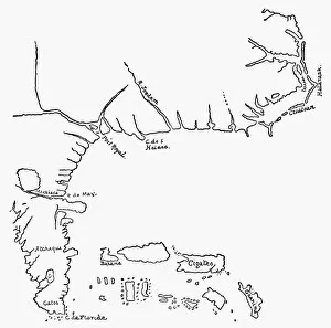
Background imageChesapeake Bay Collection: MAP OF NORTH AMERICA, 1585. John Whites map of Americas eastern coast from Chesapeake

MAP OF NORTH AMERICA, 1585. John Whites map of Americas eastern coast from Chesapeake to Florida, 1585

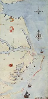
Background imageChesapeake Bay Collection: MAP: JOHN WHITE, c1585. Map of Sir Walter Raleighs Virginia (the eastern coast

MAP: JOHN WHITE, c1585. Map of Sir Walter Raleighs Virginia (the eastern coast of North America from Cape Lookout to the Chesapeake Bay). Drawing, c1585, by John White

Background imageChesapeake Bay Collection: MAP: VIRGINIA, 1862. Map of the theatre of the war in Virginia. Engraving, 1862

MAP: VIRGINIA, 1862. Map of the theatre of the war in Virginia. Engraving, 1862

Background imageChesapeake Bay Collection: WAR OF 1812: CHESAPEAKE BAY. Last page of a report by Joshua Barney, 4 July 1813

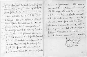
WAR OF 1812: CHESAPEAKE BAY. Last page of a report by Joshua Barney, 4 July 1813, on the postition of the British Navy in Chesapeake Bay, and of plans for the American defence

Background imageChesapeake Bay Collection: WAR OF 1812: CHESAPEAKE BAY. Defence of Chesapeake Bay

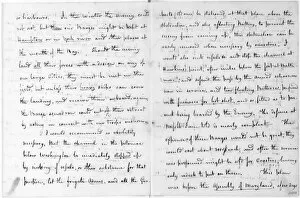
WAR OF 1812: CHESAPEAKE BAY. Defence of Chesapeake Bay. First page of the report by Joshua Barney, 4 July 1813, on the British fleet in Chesapeake Bay and plans for the American defence

Background imageChesapeake Bay Collection: USA, Virginia, Chesapeake Bay, Shore at sunset

USA, Virginia, Chesapeake Bay, Shore at sunset

Background imageChesapeake Bay Collection: USA, Maryland, Easton. Eastern Shore of Chesapeake Bay, town center buildings

USA, Maryland, Easton. Eastern Shore of Chesapeake Bay, town center buildings
Town center buildings, Eastern Shore of Chesapeake Bay, Easton, Maryland, USA

Background imageChesapeake Bay Collection: MARYLAND. USA. Cirrus fibratus clouds above colorful foliage & Chesapeake Bay in autumn

MARYLAND. USA. Cirrus fibratus clouds above colorful foliage & Chesapeake Bay in autumn

Background imageChesapeake Bay Collection: MARYLAND. USA. Lighthouse in Chesapeake Bay

MARYLAND. USA. Lighthouse in Chesapeake Bay

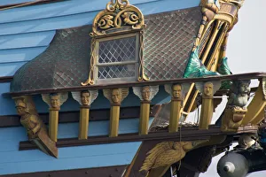
Background imageChesapeake Bay Collection: MARYLAND. USA. Carved faces on rail at aft of tall ship the Kalmar Nyckel. Chesapeake Bay

MARYLAND. USA. Carved faces on rail at aft of tall ship the Kalmar Nyckel. Chesapeake Bay. (Editorial Usage Only)

Background imageChesapeake Bay Collection: USA, Virginia, Chesapeake Bay, Sailboats at Dusk

USA, Virginia, Chesapeake Bay, Sailboats at Dusk

Background imageChesapeake Bay Collection: Defence of Chesapeake Bay. Sixth and seventh pages of the report by Joshua Barney, 4 July 1813

Defence of Chesapeake Bay. Sixth and seventh pages of the report by Joshua Barney, 4 July 1813
WAR OF 1812: CHESAPEAKE BAY. Defence of Chesapeake Bay. Sixth and seventh pages of the report by Joshua Barney, 4 July 1813, on the British fleet in Chesapeake Bay and plans for the American defence

Background imageChesapeake Bay Collection: Battle of Virginia Capes between the French and English fleets, 5-10 September 1781

Battle of Virginia Capes between the French and English fleets, 5-10 September 1781
BATTLE OF VIRGINIA CAPES. Battle of Virginia Capes between the French and English fleets, 5-10 September 1781. The positions of the British and French fleets before the action

Background imageChesapeake Bay Collection: Defence of Chesapeake Bay. Fourth and fifth pages of the report by Joshua Barney, 4 July 1813

Defence of Chesapeake Bay. Fourth and fifth pages of the report by Joshua Barney, 4 July 1813
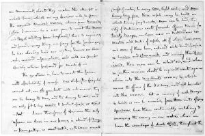
WAR OF 1812: CHESAPEAKE BAY. Defence of Chesapeake Bay. Fourth and fifth pages of the report by Joshua Barney, 4 July 1813, on the British fleet in Chesapeake Bay and plans for the American defence

Background imageChesapeake Bay Collection: Battle of Virgnia Capes between the French and English fleets, 5-10 September 1781

Battle of Virgnia Capes between the French and English fleets, 5-10 September 1781
BATTLE OF VIRGINIA CAPES. Battle of Virgnia Capes between the French and English fleets, 5-10 September 1781. The positions of the British and French fleets before the action

Background imageChesapeake Bay Collection: Defence of Chesapeake Bay. Second and third pages of the report by Joshua Barney, 4 July 1813

Defence of Chesapeake Bay. Second and third pages of the report by Joshua Barney, 4 July 1813
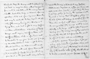
WAR OF 1812: CHESAPEAKE BAY. Defence of Chesapeake Bay. Second and third pages of the report by Joshua Barney, 4 July 1813, on the British fleet in Chesapeake Bay and plans for the American defence

Background imageChesapeake Bay Collection: Defence of Chesapeake Bay. Eighth and ninth pages of the report by Joshua Barney, 4 July 1813

Defence of Chesapeake Bay. Eighth and ninth pages of the report by Joshua Barney, 4 July 1813
WAR OF 1812: CHESAPEAKE BAY. Defence of Chesapeake Bay. Eighth and ninth pages of the report by Joshua Barney, 4 July 1813, on the British fleet in Chesapeake Bay and plans for the American defence

Background imageChesapeake Bay Collection: CAPTAIN SMITH, FROM THE PORTRAIT IN HIS VIRGINIA, He was an English soldier, explorer, and author

CAPTAIN SMITH, FROM THE PORTRAIT IN HIS VIRGINIA, He was an English soldier, explorer, and author. He was considered to have played an important part in the establishment of the first permanent

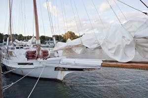
Background imageChesapeake Bay Collection: Tilghman Island, Maryland. Skipjacks are among the last working sailboats in America

Tilghman Island, Maryland. Skipjacks are among the last working sailboats in America


All Professionally Made to Order for Quick Shipping

"Exploring the Rich History and Natural Beauty of Chesapeake Bay" Discover the captivating allure of Chesapeake Bay, a stunning body of water nestled between Maryland and Virginia. Steeped in history, this region has witnessed significant events that have shaped America's past. Step back in time to 1612 with Captain John Smith's map of Virginia, which provides a fascinating glimpse into the early days of exploration. Fast forward to 1738 when Maryland and Virginia were settled, marking the beginning of two states forever linked by their shared connection to this majestic bay. Immerse yourself in maritime heritage as you witness the grandeur of the tall ship Kalmar Nyckel sailing through these waters. Its impressive presence pays homage to centuries-old traditions that still thrive today. Knapps Narrows beckons adventurers seeking tranquility amidst nature's wonders. This narrow passage offers breathtaking views and serves as a gateway for unforgettable experiences along Chesapeake Bay. Delve into American history with Thomas Jefferson's meticulously drawn map showcasing Milford Haven on Chesapeake Bay during June or July 1776. Gain insight into military strategies employed during times of conflict while admiring Jefferson's cartographic skill. Experience an age-old tradition as you envision duck hunting expeditions from 1888. Picture canvas-back ducks soaring across these vast waters while hunters eagerly await their prized catch—a testament to both sport and sustenance throughout generations. Stroll through St. Michaels, a charming town steeped in maritime culture where quaint streets wind alongside picturesque waterfronts. Immerse yourself in its rich heritage, explore historic landmarks, and savor delectable seafood cuisine that showcases the bounty harvested from these very shores. Chesapeake Bay is more than just a body of water; it is an embodiment of America's past intertwined with its present beauty. From colonial explorations to modern-day adventures, this enchanting bay continues to captivate all who venture here – offering endless opportunities for discovery and awe-inspiring moments.