Fraud Blocker Skip to main content

Chesapeake Bay Collection

"Exploring the Rich History and Natural Beauty of Chesapeake Bay" Discover the captivating allure of Chesapeake Bay

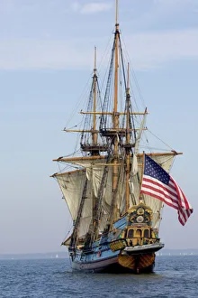
Background imageChesapeake Bay Collection: MARYLAND. USA. Tall ship the Kalmar Nyckel. Chesapeake Bay

MARYLAND. USA. Tall ship the Kalmar Nyckel. Chesapeake Bay

Background imageChesapeake Bay Collection: VIRGINIA MAP, 1612. Captain John Smiths map of Virginia, 1612

VIRGINIA MAP, 1612. Captain John Smiths map of Virginia, 1612

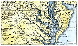
Background imageChesapeake Bay Collection: Virginia and Maryland settled in 1738

Virginia and Maryland settled in 1738
Portions of Maryland and Virginia settled in 1738. Hand-colored 19th-century woodcut reproduction of a document

Background imageChesapeake Bay Collection: Knapps Narrows

Knapps Narrows, Tilghman Island, Talbot County, Chesapeake Bay area, Maryland, United States of America, North America

Background imageChesapeake Bay Collection: EXPL2A-00165

EXPL2A-00165
Map of colonial New Sweden in America, 1638-1685. Hand-colored 19th-century woodcut reproduction of a 17th-century map

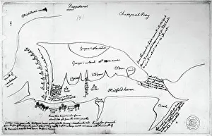
Background imageChesapeake Bay Collection: Map drawn by Thomas Jefferson of Milford Haven on Chesapeake Bay and vicinity

Map drawn by Thomas Jefferson of Milford Haven on Chesapeake Bay and vicinity
CHESAPEAKE BAY, 1776. Map drawn by Thomas Jefferson of Milford Haven on Chesapeake Bay and vicinity, showing camp on Gwynns Island and enemy fortifications, June or July 1776

Background imageChesapeake Bay Collection: Knapps Narrows

Knapps Narrows, Tilghman Island, Talbot County, Chesapeake Bay area, Maryland, United States of America, North America

Background imageChesapeake Bay Collection: Map of Norfolk, c.1900 (engraving)

Map of Norfolk, c.1900 (engraving)
532810 Map of Norfolk, c.1900 (engraving); (add.info.: Map of Norfolk, Portsmouth, Newport News, Hampton, and Hampton Roads, circa 1900)

Background imageChesapeake Bay Collection: La Mission Joffre-Viviani en Amerique; Le cuirasse americain venu au-devant de la Lorraine

La Mission Joffre-Viviani en Amerique; Le cuirasse americain venu au-devant de la Lorraine... 1917 Creator: Unknown
La Mission Joffre-Viviani en Amerique; Le cuirasse americain venu au-devant de la Lorraine, a Norfolk, pour l'escorter dans la baie de Chesapeake, 1917

Background imageChesapeake Bay Collection: La Mission Joffre-Viviani en Amerique; L'arrivee a Hampton-Roads, le 24 avril: le marechal

La Mission Joffre-Viviani en Amerique; L'arrivee a Hampton-Roads, le 24 avril: le marechal... 1917 Creator: Unknown
La Mission Joffre-Viviani en Amerique; L'arrivee a Hampton-Roads, le 24 avril: le marechal Joffre observant le fort Monroe qui defend L'entree de la baie de Chesapeake, 1917

Background imageChesapeake Bay Collection: Cape Henry light houses (old & new ), Va. c1905. Creator: Unknown

Cape Henry light houses (old & new ), Va. c1905. Creator: Unknown. Cape Henry light houses (old & new ), Va. c1905
Cape Henry light houses (old & new ), Va. c1905

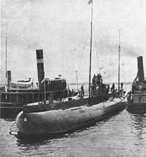
Background imageChesapeake Bay Collection: Le 'Deutschland'; le submersible allemand 'Deutschland' dans la baie de Chesapeake, 1916

Le "Deutschland"; le submersible allemand "Deutschland" dans la baie de Chesapeake, 1916. From "Collection de la Guerre IV. L'Illustration Tome CXLVIII

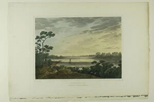
Background imageChesapeake Bay Collection: Lynnhaven Bay, plate one of the second number of Picturesque Views of American Scenery, 1819/21

Lynnhaven Bay, plate one of the second number of Picturesque Views of American Scenery, 1819/21. Creator: John Hill
Lynnhaven Bay, plate one of the second number of Picturesque Views of American Scenery, 1819/21

Background imageChesapeake Bay Collection: The Civil War in America: scene of operations in eastern Virginia, showing M'Clellan's... 1862

The Civil War in America: scene of operations in eastern Virginia, showing M'Clellan's... 1862
The Civil War in America: scene of operations in eastern Virginia, showing M'Clellan's present position, 1862. Map of...an area of about 20, 000 square miles

Background imageChesapeake Bay Collection: Meeting Chesapeake Bay 1941 Newly Appointed British Ambassador To The United States

Meeting Chesapeake Bay 1941 Newly Appointed British Ambassador To The United States
EDITORIAL The meeting in Chesapeake Bay in 1941 of the newly appointed British Ambassador to the United States, Lord Halifax and President Roosevelt

Background imageChesapeake Bay Collection: Baltimore, Maryland, USA inner harbor and downtown skyline at dusk

Baltimore, Maryland, USA inner harbor and downtown skyline at dusk

Background imageChesapeake Bay Collection: Baltimore, Maryland, USA downtown cityscape

Baltimore, Maryland, USA downtown cityscape

Background imageChesapeake Bay Collection: USA, Maryland, Eastern Shore of Chesapeake Bay, St

USA, Maryland, Eastern Shore of Chesapeake Bay, St. Michaels, Chesapeake Bay Maritime Museum, Hooper Straight screw-pile Lighthouse

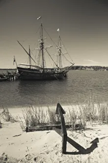
Background imageChesapeake Bay Collection: USA, Maryland, Western Shore of Chesapeake Bay, St

USA, Maryland, Western Shore of Chesapeake Bay, St. Marys City, Maryland Dove replica of 17th century sailing ship

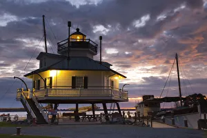
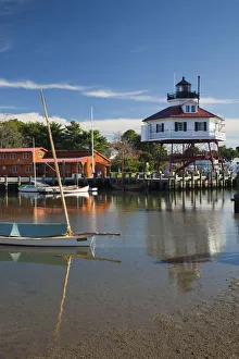
Background imageChesapeake Bay Collection: USA, Maryland, Western Shore of Chesapeake Bay, Solomons, Calvert Marine Museum

USA, Maryland, Western Shore of Chesapeake Bay, Solomons, Calvert Marine Museum and Drum Point Lighthouse, screw-pile design, b.1883

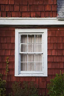
Background imageChesapeake Bay Collection: USA, Maryland, Eastern Shore of Chesapeake Bay, Royal Oak, old house detail

USA, Maryland, Eastern Shore of Chesapeake Bay, Royal Oak, old house detail

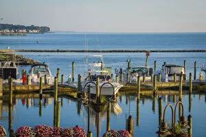
Background imageChesapeake Bay Collection: Chesapeake Beach docks, USA

Chesapeake Beach docks, USA

Background imageChesapeake Bay Collection: Map of Virginia, discovered and described by Captain John Smith, 1606

Map of Virginia, discovered and described by Captain John Smith, 1606
STC174211 Map of Virginia, discovered and described by Captain John Smith, 1606, engraved by William Hole (fl. 1607-24), published 1612 (engraving) (see also 174212) by Smith

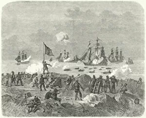
Background imageChesapeake Bay Collection: British forces attempting a landing in Chesapeake Bay, 1814 (engraving)

British forces attempting a landing in Chesapeake Bay, 1814 (engraving)
3647643 British forces attempting a landing in Chesapeake Bay, 1814 (engraving) by German School, (19th century); Private Collection; (add.info)

Background imageChesapeake Bay Collection: Raking for Oysters in Chesapeake Bay (engraving)

Raking for Oysters in Chesapeake Bay (engraving)
2812782 Raking for Oysters in Chesapeake Bay (engraving) by Sala, George Augustus (1828-95); Private Collection; (add.info.: Raking for Oysters in Chesapeake Bay)

Background imageChesapeake Bay Collection: Shooting Canvas-Back Ducks in Chesapeake Bay, Maryland, US (engraving)

Shooting Canvas-Back Ducks in Chesapeake Bay, Maryland, US (engraving)
1589445 Shooting Canvas-Back Ducks in Chesapeake Bay, Maryland, US (engraving) by American School, (19th century); Private Collection; (add.info.: Shooting Canvas-Back Ducks in Chesapeake Bay)

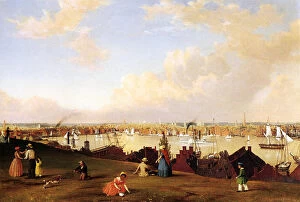
Background imageChesapeake Bay Collection: View of Baltimore, c. 1850 (oil on canvas)

View of Baltimore, c. 1850 (oil on canvas)
938815 View of Baltimore, c.1850 (oil on canvas) by Lane, Fitz Henry (1804-65); 48x71 cm; Private Collection; American, out of copyright

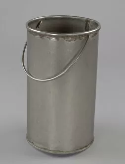
Background imageChesapeake Bay Collection: Shucking Bucket, 20th century. Creator: Unknown

Shucking Bucket, 20th century. Creator: Unknown
A cylindrical metal shucking bucket. The bucket has a welded seam along the bottom. The top edge of the bucket is rolled outward to form curved a rim

Background imageChesapeake Bay Collection: John Beale Bordley, 1770. Creator: Charles Willson Peale

John Beale Bordley, 1770. Creator: Charles Willson Peale
John Beale Bordley, 1770

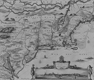
Background imageChesapeake Bay Collection: Novi Belgii Novaeque Angliae Nec Non Partis Virginiae, 1651-55. 1651-55

Novi Belgii Novaeque Angliae Nec Non Partis Virginiae, 1651-55. 1651-55
Novi Belgii Novaeque Angliae Nec Non Partis Virginiae, 1651-55

Background imageChesapeake Bay Collection: Scenes in Baltimore, 1874. Creator: James H. Richardson

Scenes in Baltimore, 1874. Creator: James H. Richardson
Scenes in Baltimore, 1874. Places in the city of Baltimore, Maryland, USA: Locust Point, " Pungies" [schooners] coming up the Chesapeake, Spears Wharf, Calvert Street

Background imageChesapeake Bay Collection: General map of the camps and marche of the army in America on the orders of Rochambeau

General map of the camps and marche of the army in America on the orders of Rochambeau
XIR440788 General map of the camps and marche of the army in America on the orders of Rochambeau, detail of the left side, from Guerre de l Amerique

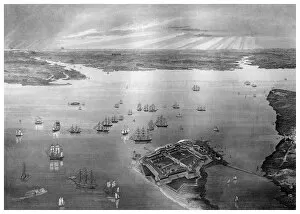
Background imageChesapeake Bay Collection: Fortress Monroe, Old Point Comfort, Virginia, 1862-1867. Artist: R Hinshelwood

Fortress Monroe, Old Point Comfort, Virginia, 1862-1867. Artist: R Hinshelwood
Fortress Monroe, Old Point Comfort, Virginia, 1862-1867. Although the state of Virginia seceded to become part of the Confederacy in April 1861

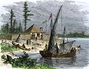
Background imageChesapeake Bay Collection: Colonial trading post on Kent Island, Maryland

Colonial trading post on Kent Island, Maryland
William Claibornes trading post on Kent Island in Chesapeake Bay, 1631. Hand-colored woodcut of a 19th-century illustration

Background imageChesapeake Bay Collection: Battle of Pocomoke Sound in colonial Maryland, 1630s

Battle of Pocomoke Sound in colonial Maryland, 1630s
William Claiborne and Leonard Calvert in battle, the first naval conflict on Chesapeake Bay, 1630s. Hand-colored woodcut of a 19th-century illustration

Background imageChesapeake Bay Collection: EXPL2A-00289

EXPL2A-00289
Captain John Smith exploring the Chesapeake Bay region, early 1600s. Hand-colored woodcut of a 19th-century illustration

Background imageChesapeake Bay Collection: Netting Catching Diamond-Back Terrapins Chesapeake Bay

Netting Catching Diamond-Back Terrapins Chesapeake Bay
Netting Diamond-Back Terrapins. In the 19th century canneries processed and exported tons of product until the turtle populations collapsed

Background imageChesapeake Bay Collection: Catching Turtles Snapping Turtle Farm Chesapeake Bay

Catching Turtles Snapping Turtle Farm Chesapeake Bay
Catching turtles on a Snapping Turtle farm, Chesapeake Bay, Maryland, United States of America. In the 19th century canneries processed

Background imageChesapeake Bay Collection: Raking Oysters Chesapeake Bay Estuary Chesapeake Watermen

Raking Oysters Chesapeake Bay Estuary Chesapeake Watermen
Raking for oysters in Chesapeake Bay, 19th century. From America Revisited: From The Bay of New York to The Gulf of Mexico, published 1886

Background imageChesapeake Bay Collection: Map of New England by Explorer John Smith, Circa 1624

Map of New England by Explorer John Smith, Circa 1624
Beautifully Illustrated Antique Engraved Victorian Illustration of Historical Map of New England from Explorer Captain John Smith, Circa 1624. Source: Original edition from my own archives

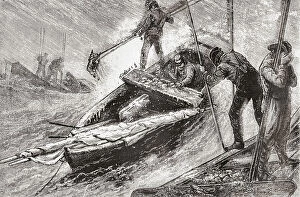
Background imageChesapeake Bay Collection: CHESAPEAKE BAY, 1955. The three masts of the sunken ship Edward J

CHESAPEAKE BAY, 1955. The three masts of the sunken ship Edward J. Baird emerging from the waters of Chesapeake Bay. Photograph by A. Aubrey Bodine, 1955

Background imageChesapeake Bay Collection: BALTIMORE: FELLs POINT. Levering Coffee Warehouse on Philpot Street, Fells Point

BALTIMORE: FELLs POINT. Levering Coffee Warehouse on Philpot Street, Fells Point, Baltimore, Maryland. Photograph by Louise Taft, September 1985

Background imageChesapeake Bay Collection: BALTIMORE: FELLs POINT. Rukert Terminals Corporation, Browns Wharf Warehouses

BALTIMORE: FELLs POINT. Rukert Terminals Corporation, Browns Wharf Warehouses, on Fell Street, Fells Point, Baltimore, Maryland. Photograph by Louise Taft, September 1985

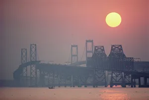
Background imageChesapeake Bay Collection: USA, Maryland, Chesapeake Bay Bridge near Annapolis, sunset

USA, Maryland, Chesapeake Bay Bridge near Annapolis, sunset

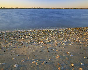
Background imageChesapeake Bay Collection: USA, Virginia, Chesapeak Bay, Shore at Sunset

USA, Virginia, Chesapeak Bay, Shore at Sunset
USA, Virginia, Chesapeake Bay, Shore at Sunset (Large format sizes available)

Background imageChesapeake Bay Collection: Reconstructed sail and rigging plan of the sloop Mediator, built on the Chesapeake, 1741-42

Reconstructed sail and rigging plan of the sloop Mediator, built on the Chesapeake, 1741-42
SLOOP PLANS, 1741-42. Reconstructed sail and rigging plan of the sloop Mediator, built on the Chesapeake, 1741-42

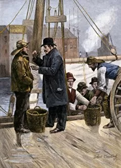
Background imageChesapeake Bay Collection: Sampling the Maryland oyster catch, 1800s

Sampling the Maryland oyster catch, 1800s
Oyster buyer tasting a sample on the dock in Baltimore, Maryland, 1880s. Hand-colored woodcut of a 19th-century illusttration

Background imageChesapeake Bay Collection: EVNT2A-00009

EVNT2A-00009
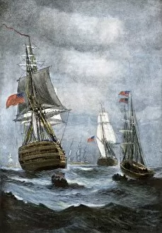
British ships blockading Chesapeake Bay at the outset of the War of 1812. Hand-colored halftone of a 19th century illustration


All Professionally Made to Order for Quick Shipping

"Exploring the Rich History and Natural Beauty of Chesapeake Bay" Discover the captivating allure of Chesapeake Bay, a stunning body of water nestled between Maryland and Virginia. Steeped in history, this region has witnessed significant events that have shaped America's past. Step back in time to 1612 with Captain John Smith's map of Virginia, which provides a fascinating glimpse into the early days of exploration. Fast forward to 1738 when Maryland and Virginia were settled, marking the beginning of two states forever linked by their shared connection to this majestic bay. Immerse yourself in maritime heritage as you witness the grandeur of the tall ship Kalmar Nyckel sailing through these waters. Its impressive presence pays homage to centuries-old traditions that still thrive today. Knapps Narrows beckons adventurers seeking tranquility amidst nature's wonders. This narrow passage offers breathtaking views and serves as a gateway for unforgettable experiences along Chesapeake Bay. Delve into American history with Thomas Jefferson's meticulously drawn map showcasing Milford Haven on Chesapeake Bay during June or July 1776. Gain insight into military strategies employed during times of conflict while admiring Jefferson's cartographic skill. Experience an age-old tradition as you envision duck hunting expeditions from 1888. Picture canvas-back ducks soaring across these vast waters while hunters eagerly await their prized catch—a testament to both sport and sustenance throughout generations. Stroll through St. Michaels, a charming town steeped in maritime culture where quaint streets wind alongside picturesque waterfronts. Immerse yourself in its rich heritage, explore historic landmarks, and savor delectable seafood cuisine that showcases the bounty harvested from these very shores. Chesapeake Bay is more than just a body of water; it is an embodiment of America's past intertwined with its present beauty. From colonial explorations to modern-day adventures, this enchanting bay continues to captivate all who venture here – offering endless opportunities for discovery and awe-inspiring moments.