Fraud Blocker Skip to main content

Chart Collection (page 20)

"Unlocking the Secrets: Exploring the Fascinating World of Charts" Dive into the realm of reflexology with a detailed foot map chart

Background imageChart Collection: Control Centre of the Empress of Britain, chart-room and wheel-house, 1936

Control Centre of the Empress of Britain, chart-room and wheel-house, 1936
The Control Centre of the Empress of Britain, comprises the chart-room and the wheel-house, 1936. From Shipping Wonders of the World, Vol. 1, edited by Clarence Winchester

Background imageChart Collection: Planisphere by Copernicus, illustration in Harmonia Macrocosmica, 1660 by Andreas Cellarius

Planisphere by Copernicus, illustration in Harmonia Macrocosmica, 1660 by Andreas Cellarius

Background imageChart Collection: Catalan Atlas (1375). Detail of Spain and North Africa

Catalan Atlas (1375). Detail of Spain and North Africa. Reproduction of the original which is located in the National Library in Paris

Background imageChart Collection: Atlas of Joan Martines, Messina, 1582. Portulan chart of the island of Sicily

Atlas of Joan Martines, Messina, 1582. Portulan chart of the island of Sicily

Background imageChart Collection: Map of Spain with all their kingdoms, Portugal and the Country of Llenguadoc

Map of Spain with all their kingdoms, Portugal and the Country of Llenguadoc. Atlas by Frederick de Witt

Background imageChart Collection: Map of London Engraving

Map of London Engraving
Engraved illustration of the City of London, England from Iconographic Encyclopedia of Science, Literature and Art, Published in 1851. Copyright has expired on this artwork. Digitally restored

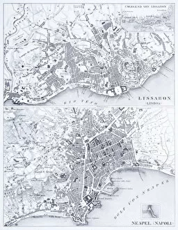
Background imageChart Collection: Engraving: Lisbon and Naples

Engraving: Lisbon and Naples
Engraved illustrations of the Cities of Lisbon and Naples from Iconographic Encyclopedia of Science, Literature and Art, Published in 1851. Copyright has expired on this artwork. Digitally restored

Background imageChart Collection: Engraving: Leghorn, Florence, Ancona and Modena

Engraving: Leghorn, Florence, Ancona and Modena
Engraved illustrations of the cities of Leghorn, Florence, Ancona and Modena from Iconographic Encyclopedia of Science, Literature and Art, Published in 1851. Copyright has expired on this artwork

Background imageChart Collection: Engraving: Rome and Milan

Engraving: Rome and Milan
Engraved illustrations of the cities of Rome and Milan from Iconographic Encyclopedia of Science, Literature and Art, Published in 1851. Copyright has expired on this artwork. Digitally restored

Background imageChart Collection: Engraving: Copenhagen, Stockholm, Antwerp and Amsterdam

Engraving: Copenhagen, Stockholm, Antwerp and Amsterdam
Engraved illustrations of the cities of Copenhagen, Stockholm, Antwerp and Amsterdam from Iconographic Encyclopedia of Science, Literature and Art, Published in 1851

Background imageChart Collection: Engraving: Map of Antwerp

Engraving: Map of Antwerp
Engraved illustrations of the Map of Antwerp from Iconographic Encyclopedia of Science, Literature and Art, Published in 1851. Copyright has expired on this artwork. Digitally restored

Background imageChart Collection: Engraving: Map of Copenhagen

Engraving: Map of Copenhagen
Engraved illustrations of the Map of Copenhagen from Iconographic Encyclopedia of Science, Literature and Art, Published in 1851. Copyright has expired on this artwork. Digitally restored

Background imageChart Collection: Engraving: Amsterdam

Engraving: Amsterdam
Engraved illustrations of the city of Amsterdam from Iconographic Encyclopedia of Science, Literature and Art, Published in 1851. Copyright has expired on this artwork. Digitally restored

Background imageChart Collection: Engraving: Stockholm

Engraving: Stockholm
Engraved illustrations of the City of Stockholm from Iconographic Encyclopedia of Science, Literature and Art, Published in 1851. Copyright has expired on this artwork. Digitally restored

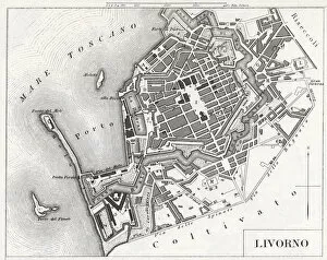
Background imageChart Collection: Engraving: Livorno, Italy

Engraving: Livorno, Italy
Engraved illustrations of the city of Livorno, Italy from Iconographic Encyclopedia of Science, Literature and Art, Published in 1851. Copyright has expired on this artwork. Digitally restored

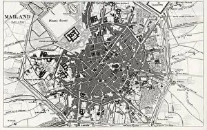
Background imageChart Collection: Engraving: Milan, Italy

Engraving: Milan, Italy
Engraved illustrations of the city of Milan, Italy from Iconographic Encyclopedia of Science, Literature and Art, Published in 1851. Copyright has expired on this artwork. Digitally restored

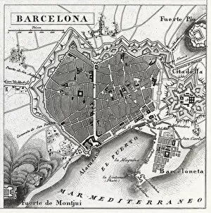
Background imageChart Collection: Engraving: Barcelona, Spain

Engraving: Barcelona, Spain
Engraved illustrations of the City of Barcelona, Spain from Iconographic Encyclopedia of Science, Literature and Art, Published in 1851. Copyright has expired on this artwork. Digitally restored

Background imageChart Collection: Engraved image of Lisbon, Portugal

Engraved image of Lisbon, Portugal
Engraved illustrations of the City of Lisbon, Portugal from Iconographic Encyclopedia of Science, Literature and Art, Published in 1851. Copyright has expired on this artwork. Digitally restored

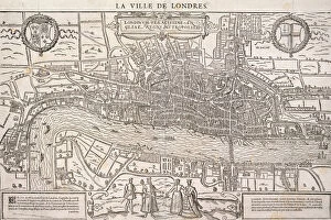
Background imageChart Collection: Map of the City of London, Southwark and part of Westminster, 1572

Map of the City of London, Southwark and part of Westminster, 1572

Background imageChart Collection: Proposed plan for the rebuilding of the City of London after the Great Fire in 1666

Proposed plan for the rebuilding of the City of London after the Great Fire in 1666

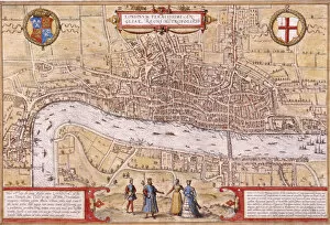
Background imageChart Collection: Map of the City of London and City of Westminster with four figures in the foreground, (c1572?)

Map of the City of London and City of Westminster with four figures in the foreground, (c1572?). Heraldic shield on left depicts the Tudor royal arms and shield on left depicts the City of London arms

Background imageChart Collection: Victory at Pyongyang Castle, 1894

Victory at Pyongyang Castle, 1894
Victory at Pyongyang Castle, pub. 1894 (colour woodcut)

Background imageChart Collection: Engraving: Great Britain and Ireland

Engraving: Great Britain and Ireland
Engraved illustrations of the Countries of Great Britain and Ireland from Iconographic Encyclopedia of Science, Literature and Art, Published in 1851. Copyright has expired on this artwork

Background imageChart Collection: Nautical chart, 1558

Nautical chart, 1558. Found in the collection of British Museum

Background imageChart Collection: Nautical chart of the Mediterranean Sea, 1508

Nautical chart of the Mediterranean Sea, 1508. Found in the collection of Museo Maritimo, Barcelona

Background imageChart Collection: Nautical chart of the Mediterranean Sea and the Black Sea, 1440s. Artist: Rossell (Rosselli)

Nautical chart of the Mediterranean Sea and the Black Sea, 1440s. Artist: Rossell (Rosselli)
Nautical chart of the Mediterranean Sea and the Black Sea, 1440s. Found in the collection of the Bibliotheque Nationale de France

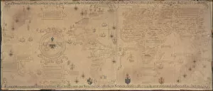
Background imageChart Collection: World Map (Propoganda), 1529. Artist: Ribeiro, Diogo (?-1533)

World Map (Propoganda), 1529. Artist: Ribeiro, Diogo (?-1533)
World Map (Propoganda), 1529. Found in the collection of the Biblioteca Apostolica Vaticana

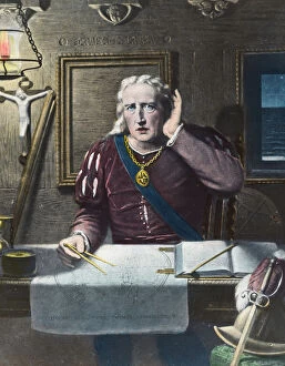
Background imageChart Collection: Land! Land! Land!, Columbus arriving in America, 1492 (late 19th or early 20th century)

Land! Land! Land!, Columbus arriving in America, 1492 (late 19th or early 20th century)
Land! Land! Land!, Christopher Columbus arriving in America, 1492 (late 19th or early 20th century). Sponsored by Ferdinand and Isabella of Spain

Background imageChart Collection: Admiral, 18th century (c1890-c1893)

Admiral, 18th century (c1890-c1893). A print from Her Majestys Navy Including its Deeds and Battles, by Lieut Chas Rathbone Low, Volume I, JS Virtue & Co, London, 1890-1893

Background imageChart Collection: The Astrologer, c19th century. Artist: J Demannez

The Astrologer, c19th century. Artist: J Demannez
The Astrologer, c19th century. A Victorian view of a 16th-century practitioner of astrology

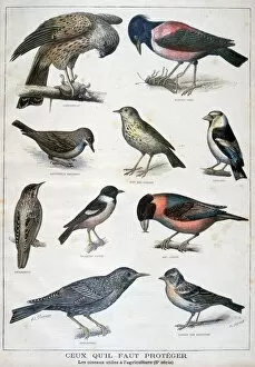
Background imageChart Collection: Birds that are protected, and helpful in agriculture, 1897. Artist: F Meaulle

Birds that are protected, and helpful in agriculture, 1897. Artist: F Meaulle
Birds that are protected, and helpful in agriculture, 1897. An illustration from Le Petit Journal, 31st January 1897

Background imageChart Collection: Good and bad mushrooms, 1896

Good and bad mushrooms, 1896. An illustration from Le Petit Journal, 25th October 1896

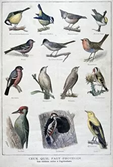
Background imageChart Collection: Useful birds in agriculture, 1896. Artist: A Clement

Useful birds in agriculture, 1896. Artist: A Clement
Useful birds in agriculture, 1896. An illustration from Le Petit Journal, 13th December 1896

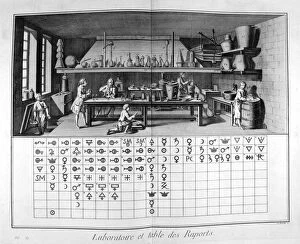
Background imageChart Collection: Laboratory and chart, 1751-1777

Laboratory and chart, 1751-1777. A print from the Encyclopedie, ou Dictionnaire Raisonne des Sciences, des Arts et des Metiers by Diderot & d Alembert, 1751-1777. Private Collection

Background imageChart Collection: Geographic chart of the world after the deluge, 1675. Artist: Athanasius Kircher

Geographic chart of the world after the deluge, 1675. Artist: Athanasius Kircher
Geographic chart of the world after the deluge, 1675. A print from Arca Noe, Amsterdam, 1675. Found in the collection of Jean Claude Carriere

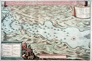
Background imageChart Collection: Battle of Vigo Bay, Spain, 12 October 1702

Battle of Vigo Bay, Spain, 12 October 1702. Dutch plan of the engagement during the War of the Spanish Succession (1701-1714)

Background imageChart Collection: An astrological chart, 1646. Artist: Athanasius Kircher

An astrological chart, 1646. Artist: Athanasius Kircher
An astrological chart, 1646. A man with his internal organs revealed standing in front of a circular chart. One hand has been replaced by a sun

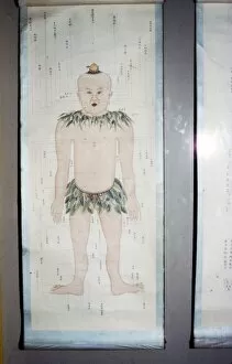
Background imageChart Collection: Chinese Acupuncture Chart, Front View

Chinese Acupuncture Chart, Front View

Background imageChart Collection: Tibetan painting of the wheel of transmigratory existence

Tibetan painting of the wheel of transmigratory existence
A Tibetan painting of the wheel of transmigratory existence. The images are, from the top clockwise: Gods, Demigods, tormented spirits, hells, animals, human

Background imageChart Collection: French Map of Central and South America, French, 1550

French Map of Central and South America, French, 1550. Map showing Florida, the Gulf of Mexico, the Caribbean islands and Antilles, and South America with the River Plate prominent

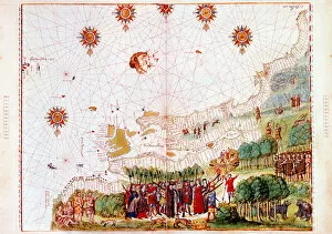
Background imageChart Collection: Map by Bastian Lopez showing Europe, the British Isles and part of Africa, Portuguese, 1558

Map by Bastian Lopez showing Europe, the British Isles and part of Africa, Portuguese, 1558. Artist: Bastiaim Lopez
Map by Bastian Lopez showing Europe, the British Isles and part of Africa, Portuguese, 1558. From the British Museum

Background imageChart Collection: Map of Barbados, 1683

Map of Barbados, 1683. Barbados was first settled by the British in 1627. From the British Museum

Background imageChart Collection: Map of the east coast of North America, early 16th century

Map of the east coast of North America, early 16th century. Map of pre-1547 based on Jacques Cartiers discoveries of 1534-1541

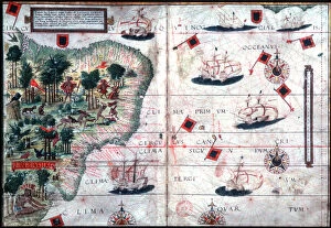
Background imageChart Collection: Map of Brazil by Portuguese navigators Pedro Reinel and Lopo Homen, c1525. Artist: Pedro Reinel

Map of Brazil by Portuguese navigators Pedro Reinel and Lopo Homen, c1525. Artist: Pedro Reinel
Map of Brazil by Portuguese navigators Pedro Reinel and Lopo Homen, c1525

Background imageChart Collection: Part of South America, 1582

Part of South America, 1582. A Spanish map, showing the Amazon and the River Plate

Background imageChart Collection: Astrologers preparing a horoscope, 1617-1619

Astrologers preparing a horoscope, 1617-1619. From the title page of section on casting horoscopes in Utriusque cosmi historia, Oppenheim, [1617-19]

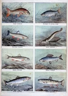
Background imageChart Collection: Freshwater fish, 1898. Artist: F Meaulle

Freshwater fish, 1898. Artist: F Meaulle
Freshwater fish, 1898. An illustration from Le Petit Journal, 12th June 1898

Background imageChart Collection: Nicholas Culpepper (1616-54)

Nicholas Culpepper (1616-54) English physician, herbalist and astrologer Frontispiece from his School of Physickshowing him with hand on a skull and with blank horoscope chart. Copperplate engraving


All Professionally Made to Order for Quick Shipping

"Unlocking the Secrets: Exploring the Fascinating World of Charts" Dive into the realm of reflexology with a detailed foot map chart, revealing hidden connections between pressure points and overall well-being. Immerse yourself in breathtaking artwork as "Kiss of the Oceans" captures the meeting point between Atlantic and Pacific through a mesmerizing chart inspired by the Panama Canal. Travel back in time with a captivating map showcasing the vast Ancient Persian Empire, unraveling its grandeur and historical significance. Follow in the footsteps of greatness as you trace King Alexander the Great's conquests on an intricate chart mapping his empire's expansion across continents. Join forces with The Salvation Army Campaign through their emblematic chart, highlighting their noble mission to bring hope and aid to those in need. Unveil Masonic mysteries through an enchanting chart that delves into both symbolic imagery and rich history surrounding Free and Accepted Masons. Embark on a journey through time with a remarkable Masonic chart, shedding light on ancient rituals, traditions, and brotherhood within this enigmatic society. Explore distant lands from centuries past as an Anglo-Saxon 10th-century world map unfolds before your eyes, offering insights into early cartography techniques. Discover rugged beauty amidst towering peaks with an old map of the Alps; let it guide you through nature's wonders while tracing historic routes taken by explorers long ago. Gain strategic insight during WWII using a military-focused map of Beirut, Lebanon; uncover hidden locations crucial for wartime operations throughout this historically significant cityscape. Step back in time to 1768 Edinburgh as James Craig's Map reveals New Town's first plan—a testament to meticulous topography shaping Scotland's capital cityscape over centuries. Test your vision acuity against an eye-catching eyesight test chart; decipher letters or symbols while appreciating the importance of visual health in our daily lives.