
Burngreave Collection
Burngreave, located in Sheffield S4 7 Map, is a historic neighborhood that has witnessed the passage of time and the evolution of its surroundings


All Professionally Made to Order for Quick Shipping
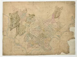
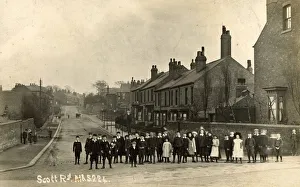
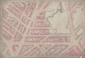
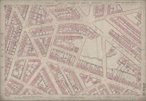
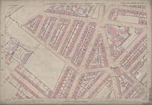
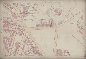
Burngreave, located in Sheffield S4 7 Map, is a historic neighborhood that has witnessed the passage of time and the evolution of its surroundings. Scott Road, Burngreave Sheffield, captured in a photograph from c. 1920, showcases the charm and character of this area. The Ordnance Survey Maps from 1889 provide glimpses into different parts of Burngreave's past. One such map reveals the Gower Street area in Burngreave during Yorkshire sheet No. 294. 23 times. It allows us to visualize how life must have been back then and appreciate the changes that have occurred over the years. Similarly, another map highlights Somerset Street area in Burngreave during Yorkshire sheet no. 294. 22 era, giving us insight into its layout and structure at that time. The Lyons Street/Carlisle Street area is also featured on an Ordnance Survey Map from 1889 (Yorkshire sheet no. 294. 19). This snapshot provides a glimpse into daily life within this part during those times. Additionally, we can explore Ellesmere Road/Lyons Road area through an Ordnance Survey Map dated back to Yorkshire sheet number 294. 18 from 1889 – offering further insights into historical aspects of this vibrant community. The Duke of Norfolk's estates in Brightside Bierlow played a significant role in shaping Burngreave throughout the mid-19th century - leaving behind traces of their influence on this neighborhood's development. Advertisements for local businesses add color to our understanding of everyday life in Burngreave: Francis A Tinker & Sons' General Decorators and Contractors were prominent figures along Spital Hill; Moorwoods Ltd. 's Harleston Iron Works contributed to industrial growth; John Heath & Sons operated as Motor Car Proprietors and Funeral Directors on Earsham Street since1939 – all integral parts of Burngreave's commercial landscape.