Fraud Blocker Skip to main content

Bartholomew Close Collection

"Exploring the Historical Trails of Bartholomew Close

Background imageBartholomew Close Collection: Blakeney's Head public house, 1850

Blakeney's Head public house, 1850
3478095 Blakeney's Head public house, 1850; (add.info.: Illustration depicting Blakeney's Head public house, Bartholomew Close, not far from St. Martin's-le-Grand, London)

Background imageBartholomew Close Collection: Wandsworth SW18 1 Map

Wandsworth SW18 1 Map
Postcode Sector Map of Wandsworth SW18 1

Background imageBartholomew Close Collection: Waverley GU27 1 Map

Waverley GU27 1 Map
Postcode Sector Map of Waverley GU27 1

Background imageBartholomew Close Collection: London in the Year 1560 (engraving)

London in the Year 1560 (engraving)
1594517 London in the Year 1560 (engraving) by English School, (19th century); Private Collection; (add.info.: London in the Year 1560. Illustration for The Pictorial Times, 2 October 1847)

Background imageBartholomew Close Collection: Checking an importation of civet from Ethiopia (b / w photo)

Checking an importation of civet from Ethiopia (b / w photo)
5999017 Checking an importation of civet from Ethiopia (b/w photo) by English Photographer, (20th century); Private Collection; (add.info)

Background imageBartholomew Close Collection: Rotherham S60 4 Map

Rotherham S60 4 Map
Postcode Sector Map of Rotherham S60 4

Background imageBartholomew Close Collection: West Oxfordshire OX29 7 Map

West Oxfordshire OX29 7 Map
Postcode Sector Map of West Oxfordshire OX29 7

Background imageBartholomew Close Collection: West Oxfordshire OX29 4 Map

West Oxfordshire OX29 4 Map
Postcode Sector Map of West Oxfordshire OX29 4

Background imageBartholomew Close Collection: Rushcliffe NG12 4 Map

Rushcliffe NG12 4 Map
Postcode Sector Map of Rushcliffe NG12 4

Background imageBartholomew Close Collection: Milton Keynes MK7 7 Map

Milton Keynes MK7 7 Map
Postcode Sector Map of Milton Keynes MK7 7

Background imageBartholomew Close Collection: Knowsley L35 6 Map

Knowsley L35 6 Map
Postcode Sector Map of Knowsley L35 6

Background imageBartholomew Close Collection: Lincoln LN3 5 Map

Lincoln LN3 5 Map
Postcode Sector Map of Lincoln LN3 5

Background imageBartholomew Close Collection: City of London EC1A 7 Map

City of London EC1A 7 Map
Postcode Sector Map of City of London EC1A 7

Background imageBartholomew Close Collection: Kent CT21 4 Map

Kent CT21 4 Map
Postcode Sector Map of Kent CT21 4

Background imageBartholomew Close Collection: Uttlesford CB10 1 Map

Uttlesford CB10 1 Map
Postcode Sector Map of Uttlesford CB10 1

Background imageBartholomew Close Collection: Bartholomew Close, City of London, c1870

Bartholomew Close, City of London, c1870. View of old houses in Bartholomew Close with a shop, possibly a greengrocer s, in the foreground and people gathered in the street

Background imageBartholomew Close Collection: Bartholomew Close, London, 1889. Artist: John Crowther

Bartholomew Close, London, 1889. Artist: John Crowther
View of Batholomew Close, London, 1889; showing nos 35 and 53, on opposite sides of a narrowing of the close; on the right a greengrocers can be seen

Background imageBartholomew Close Collection: Coach and Horses Inn, Bartholomew Close, London, 1851. Artist: John Wykeham Archer

Coach and Horses Inn, Bartholomew Close, London, 1851. Artist: John Wykeham Archer
Interior view of a bedroom in the Coach and Horses Inn, Bartholomew Close, London, 1851

Background imageBartholomew Close Collection: Bartholomew Close, Smithfield, London, 1912. Artist: Frederick Adcock

Bartholomew Close, Smithfield, London, 1912. Artist: Frederick Adcock
Bartholomew Close, Smithfield, London, 1912. English artist and engraver William Hogarth (1697-1764) was born here. Palmer s, a famous printing house, also had premises here in the 18th century

Background imageBartholomew Close Collection: Entrance Bartholomew Close, Smithfield, London, England, engraving 19th century, Britain

Entrance Bartholomew Close, Smithfield, London, England, engraving 19th century, Britain, UK


All Professionally Made to Order for Quick Shipping

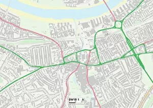
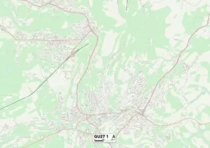
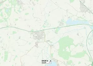
"Exploring the Historical Trails of Bartholomew Close: A Journey Through Time" Step into the past and embark on a captivating journey through the fascinating history of Bartholomew Close. Located in Wandsworth SW18 1, this quaint neighborhood holds secrets that date back centuries. Transport yourself to London in the year 1560 with an enchanting engraving capturing the essence of this vibrant city. Immerse yourself in its rich heritage as you wander through its narrow streets, guided by maps from Waverley GU27 1 and Rotherham S60 Uncover tales of trade and exotic imports as you delve into black-and-white photographs depicting Bartholomew Close's bustling market scene. Witness traders checking an importation of civet from Ethiopia, a snapshot frozen in time that reveals the area's historical significance. Continue your exploration to West Oxfordshire OX29 7 and OX29 4, where hidden treasures await. Traverse Rushcliffe NG12 4 and Milton Keynes MK7 7, discovering how these diverse locations intertwine with Bartholomew Close's story. As you navigate through Knowsley L35 6 and Lincoln LN3 5, let your imagination run wild envisioning what life was like for those who once called this place home. Marvel at their resilience amidst changing times while studying detailed maps showcasing their surroundings. Finally, return to modernity but retain a sense of wonderment as you explore City of London EC1A 7 – where old meets new seamlessly. Reflect on how Bartholomew Close has evolved over time yet still retains echoes of its storied past. Join us on this captivating journey through time as we unravel the mysteries surrounding Bartholomew Close – a neighborhood steeped in history waiting to be discovered anew.