
Bartholomew And Co Collection
"Exploring the World through Bartholomew & Co: A Journey into History" Step back in time and embark on a captivating journey with Bartholomew & Co


All Professionally Made to Order for Quick Shipping
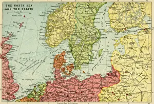
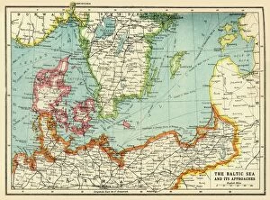
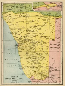
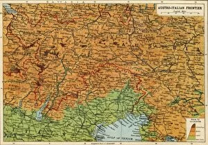
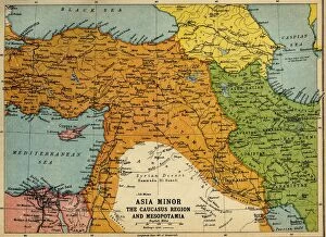
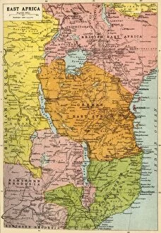
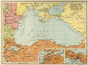
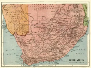
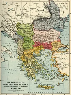
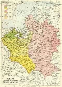
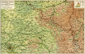
"Exploring the World through Bartholomew & Co: A Journey into History" Step back in time and embark on a captivating journey with Bartholomew & Co, as we delve into their remarkable collection of maps that offer glimpses into various corners of the world during significant historical periods. Unveiling a Map of the North Sea and the Baltic from around 1914, meticulously crafted by John Bartholomew & Son, we are transported to an era when these waters were bustling with maritime activity. The map serves as a window to explore trade routes, naval strategies, and geopolitical dynamics prevalent during that time. Continuing our expedition, let us navigate towards The Baltic Sea and Its Approaches during the First World War. This masterpiece from c1915 provides invaluable insights into military operations and highlights strategic points crucial for both sides involved in this global conflict. Our exploration takes us further south to German South West Africa during the same period. This compelling map sheds light on colonial territories amidst wartime tensions while showcasing John Bartholomew & Son's expertise in cartography. Shifting our focus eastwards, we encounter Austria-Hungary and Neighbouring Lands through another exquisite creation dating back to 1920. As political boundaries shifted after World War I, this map captures a pivotal moment in European history. Venturing beyond Europe's borders brings us face-to-face with Africa - specifically East Africa - depicted vividly on yet another treasure from c1920. Discover how African nations played roles within complex alliances amid global conflicts. The Black Sea: Bosphorus and Dardanelles map transports us to c1914 when these straits held immense strategic importance due to their connection between Europe and Asia Minor. Witness how control over these waterways shaped regional politics at that time. South Africa beckons next as we immerse ourselves in its diverse landscapes through an enchanting depiction captured around 1914 by John Bartholomew & Son.