
Avhrr Collection
AVHRR, or Advanced Very High Resolution Radiometer, is a powerful satellite imaging system that provides us with stunning views of our planet from space


All Professionally Made to Order for Quick Shipping
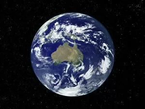
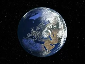
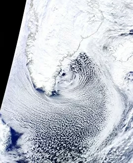
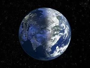
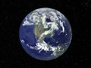
AVHRR, or Advanced Very High Resolution Radiometer, is a powerful satellite imaging system that provides us with stunning views of our planet from space. In Australia, AVHRR captures the vibrant colors and diverse landscapes of this vast continent, allowing us to appreciate its natural beauty from above. Moving to Africa, AVHRR reveals the stark contrast between night and day through its satellite images. The lights that dot the African landscape at night give way to the warm hues of sunrise as dawn breaks across the continent. Venturing into The Arctic, AVHRR showcases an icy wonderland like no other. Its satellite images capture the breathtaking expanse of frozen tundra and glistening icebergs that define this remote region. Zooming out to view a Whole Earth map created by AVHRR data, we gain a comprehensive understanding of our planet's intricate ecosystems and interconnectedness. This global perspective reminds us of how small yet significant each part is in shaping our world. In Europe, AVHRR captures another mesmerizing night-day satellite image. The twinkling city lights illuminate bustling urban centers while neighboring areas remain shrouded in darkness—a testament to human activity amidst nature's tranquility. Journeying southward towards Antarctica, we are treated to a unique perspective captured by MODIS observations combined with polar sea ice imagery taken by satellites. These striking visuals reveal the delicate balance between landmasses covered in snow and ice against vast stretches of open water surrounding them. Heading over Greenland brings us face-to-face with captivating cloud streets—elongated rows of cumulus clouds formed by atmospheric conditions specific to this region. Thanks to AVHRR's detailed satellite images, we can witness these extraordinary formations firsthand. Shifting gears slightly but still utilizing AVHRR technology leads us to explore sea surface temperatures worldwide through a 2010 global map C016/3800 generated by this remarkable system. This visualization helps scientists monitor oceanic patterns and understand the impact of climate change on our seas.