
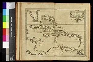
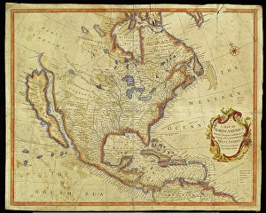
Amerique Centrale Collection
Amérique Centrale: A Land of Discovery and Controversy In 1882, an explorer's camp was established in Guatemala, marking the beginning of a new era for Central America


All Professionally Made to Order for Quick Shipping
Amérique Centrale: A Land of Discovery and Controversy In 1882, an explorer's camp was established in Guatemala, marking the beginning of a new era for Central America. Yet, this region was no stranger to scandal. From the Panama Scandal involving President Ulysses S. Grant in 1898, to the Baker and Egyptian scandals, Marianne, the symbol of France, seemed to bear the brunt of the controversy. Despite the scandals, the arts continued to honor Amérique Centrale. Caricaturist Willette depicted Marianne facing the scandals with the caption, "Luckily the arts do me honor." The construction of the Panama Canal began in the late 19th century, with soldiers toiling away at the isthmus of Panama and Darien. Engineers used innovative machines like the Osgood excavator, the great American dredge, and the Bigue pontoon to persevere through the challenges of the terrain. Workers labored tirelessly on the trench site in Lower Obispo, their efforts contributing to the engineering marvel that would connect the Atlantic and Pacific oceans. The Panama Canal works were a testament to human ingenuity and determination, overcoming the obstacles of nature and scandal alike.