Fraud Blocker Skip to main content

Aerial Photography Collection (page 3)

Capturing the world from above, aerial photography unveils breathtaking vistas and hidden wonders

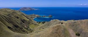
Background imageAerial Photography Collection: Seen from a bird's eye view, the tropical islands within Komodo National Park, Indonesia

Seen from a bird's eye view, the tropical islands within Komodo National Park, Indonesia, are fringed by amazing, biodiverse coral reefs

Background imageAerial Photography Collection: Aerial picture of turquoise blue tropical ocean lagoon, white sandy beach

Aerial picture of turquoise blue tropical ocean lagoon, white sandy beach, sandbank coral reef shallow water with boat. Nature perfection in Maldives

Background imageAerial Photography Collection: Fantastic aerial landscape, luxury tropical resort or hotel with water villas

Fantastic aerial landscape, luxury tropical resort or hotel with water villas and beautiful beach scenic. Amazing bird eyes view in Maldives landscape

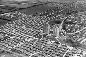
Background imageAerial Photography Collection: Aerial view of the Orchard Park Estate, Hull 10th September 1980

Aerial view of the Orchard Park Estate, Hull 10th September 1980

Background imageAerial Photography Collection: Aerial view of the British Oil & Cake Mill, on the banks of the River Hull, Stoneferry

Aerial view of the British Oil & Cake Mill, on the banks of the River Hull, Stoneferry, Hull. 1st September 1954

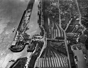
Background imageAerial Photography Collection: Aerial view of Riverside Quay, Hull. 21st April 1958

Aerial view of Riverside Quay, Hull. 21st April 1958

Background imageAerial Photography Collection: Aerial view of Hull College, The Wiberforce Monument and Hull Police Headquarters

Aerial view of Hull College, The Wiberforce Monument and Hull Police Headquarters. 28th February 1971

Background imageAerial Photography Collection: Aerial View of Hull Marshalling Yards Circa 1950

Aerial View of Hull Marshalling Yards Circa 1950

Background imageAerial Photography Collection: An aerial view showing the St Mary Le Port area of Bristol before the Blitz Circa June

An aerial view showing the St Mary Le Port area of Bristol before the Blitz Circa June 1939

Background imageAerial Photography Collection: Aerial view of Bristol Airport in 1960s

Aerial view of Bristol Airport in 1960s

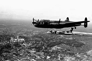
Background imageAerial Photography Collection: The City of Lincoln Lancaster (which now forms part of the Battle of Britain Memorial

The City of Lincoln Lancaster (which now forms part of the Battle of Britain Memorial Flight), closely followed by XL 317 Vulcan flying over Lincoln, with Lincoln Cathedral clearly visible

Background imageAerial Photography Collection: Great Barrier Reef and Hardy Reef, Australia

Great Barrier Reef and Hardy Reef, Australia
Aerial images from a private charter helicopter over the Great Barrier Reef and Hardy Reef, Australia

Background imageAerial Photography Collection: Williamson Eagle Vertical Aerial Camera System Component?

Williamson Eagle Vertical Aerial Camera System Component?
Williamson Eagle Vertical Aerial Camera System Components Aerial-Photography Date: 19??

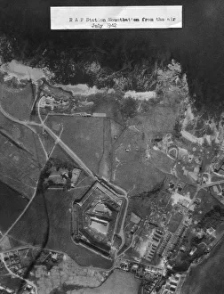
Background imageAerial Photography Collection: Vertical Aerial Photograph of Flying-Boats and Hangars a?

Vertical Aerial Photograph of Flying-Boats and Hangars a?
Vertical Aerial Photograph of Flying-Boats and Hangars at RAF Mount Batten, Plymouth Sound, Devon, UK England Aerial-Photography Date: 1942

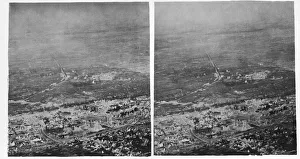
Background imageAerial Photography Collection: Stereoscopic Oblique Aerial Photography of Ypres and WW1?

Stereoscopic Oblique Aerial Photography of Ypres and WW1?
Stereoscopic Oblique Aerial Photography of Ypres and WW1 Battlefield Aerial-Photography Date: 1917

Background imageAerial Photography Collection: Atherton Tablelands

Atherton Tablelands
Aerial view of a creek through rolling hills with trees and ferns amongst the cattle tracks

Background imageAerial Photography Collection: Aerial view of the City of Arts and Sciences, Valencia, Spain

Aerial view of the City of Arts and Sciences, Valencia, Spain

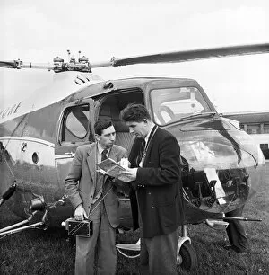
Background imageAerial Photography Collection: Route planning JLP01_08_049267b

Route planning JLP01_08_049267b
FILTON AIRFIELD, SOUTH GLOUCESTERSHIRE. Two men, one holding a camera, conferring over maps beside a helicopter at Filton Airfield

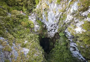
Background imageAerial Photography Collection: Highlining above Harwoods Hole, Golden Bay, New Zealand, Oceania

Highlining above Harwoods Hole, Golden Bay, New Zealand, Oceania

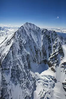
Background imageAerial Photography Collection: Aerial view of Peak Piazzi Valdidentro Sondrio Valtellina Lombardy Italy Europe

Aerial view of Peak Piazzi Valdidentro Sondrio Valtellina Lombardy Italy Europe

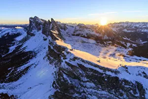
Background imageAerial Photography Collection: Aerial view of the Odle at sunset. Dolomites Gardena Valley Trentino Alto Adige Italy

Aerial view of the Odle at sunset. Dolomites Gardena Valley Trentino Alto Adige Italy Europe

Background imageAerial Photography Collection: Aerial view of Forni Glacier and Mount Cevedale Valtellina Lombardy Italy Europe

Aerial view of Forni Glacier and Mount Cevedale Valtellina Lombardy Italy Europe

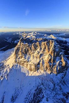
Background imageAerial Photography Collection: Aerial view of Sassolungo Sassopiatto and Grohmann peak at sunset

Aerial view of Sassolungo Sassopiatto and Grohmann peak at sunset. Dolomites Sella Group Trentino Alto Adige Italy Europe

Background imageAerial Photography Collection: Aerial view of Sassolungo at sunset. Dolomites Sella Group Trentino Alto Adige Italy

Aerial view of Sassolungo at sunset. Dolomites Sella Group Trentino Alto Adige Italy Europe

Background imageAerial Photography Collection: Aerial view of Catinaccio Group at sunset

Aerial view of Catinaccio Group at sunset. Sciliar Natural Park Dolomites Trentino Alto Adige Italy Europe

Background imageAerial Photography Collection: Aerial view of Masino Valley at sunset Valtellina Lombardy Italy Europe

Aerial view of Masino Valley at sunset Valtellina Lombardy Italy Europe

Background imageAerial Photography Collection: Aerial view of peaks Torrone and Cima of Castello at sunset Masino Valley Valtellina

Aerial view of peaks Torrone and Cima of Castello at sunset Masino Valley Valtellina Lombardy Italy Europe

Background imageAerial Photography Collection: Aerial view of peaks Torrone and Bernina Group at sunset Masino Valley Valtellina

Aerial view of peaks Torrone and Bernina Group at sunset Masino Valley Valtellina Lombardy Italy Europe

Background imageAerial Photography Collection: Aerial view of Catinaccio Group and Vajolet Towers at sunset

Aerial view of Catinaccio Group and Vajolet Towers at sunset. Sciliar Natural Park Dolomites Trentino Alto Adige Italy Europe

Background imageAerial Photography Collection: Aerial view of snowy peaks of Grignone with Brioschi Refuge on the summit Lecco Province

Aerial view of snowy peaks of Grignone with Brioschi Refuge on the summit Lecco Province Lombardy Italy Europe

Background imageAerial Photography Collection: Aerial view of the green hill and castle overlooking Varenna surrounded by Lake Como

Aerial view of the green hill and castle overlooking Varenna surrounded by Lake Como Lecco Province Lombardy Italy Europe

Background imageAerial Photography Collection: Aerial view of the village of Varenna frames by the blue water of Lake Como Lecco

Aerial view of the village of Varenna frames by the blue water of Lake Como Lecco Province Lombardy Italy Europe

Background imageAerial Photography Collection: Aerial view of the picturesque village of Varenna overlooking the blue waters of Lake

Aerial view of the picturesque village of Varenna overlooking the blue waters of Lake Como Lecco Province Lombardy Italy Europe

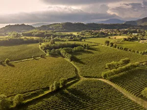
Background imageAerial Photography Collection: Aerial view of Franciacorta fields, Franciacorta, Brescia province, Lombardy district

Aerial view of Franciacorta fields, Franciacorta, Brescia province, Lombardy district, Italy

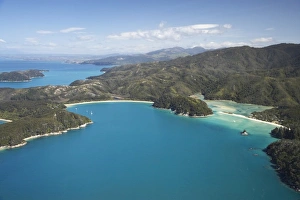
Background imageAerial Photography Collection: The Anchorage (left) and Torrent Bay (right), Abel Tasman National Park, Nelson Region

The Anchorage (left) and Torrent Bay (right), Abel Tasman National Park, Nelson Region, South Island, New Zealand - aerial

Background imageAerial Photography Collection: The Black Church, Biserica neagra, View of Brasov, Brasov, Transylvania, Romania

The Black Church, Biserica neagra, View of Brasov, Brasov, Transylvania, Romania
aerial, aerial photo, aerial photograph, aerial photography, aerial photos, aerial shot, air, airs, architectural photograph, architectural view, balkan, balkan peninsula, bird's eye view

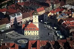
Background imageAerial Photography Collection: Former Kronstadt City Hall, Casa Primariei, now Historical Museum

Former Kronstadt City Hall, Casa Primariei, now Historical Museum, in the Old Town on Piata Sfatului Square
administration building, administrative building, administrative buildings, aerial, aerial photo, aerial photograph, aerial photography, aerial photos, aerial shot, air, airs

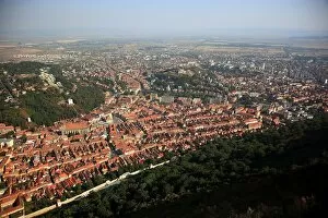
Background imageAerial Photography Collection: View of Brasov, Brasov, Transylvania, Romania

View of Brasov, Brasov, Transylvania, Romania
aerial, aerial photo, aerial photograph, aerial photography, aerial photos, aerial shot, air, airs, architectural photograph, architectural view, balkan, balkan peninsula, bird's eye view

Background imageAerial Photography Collection: In the picture the Black Church, Biserica neagra, view of Brasov, Brasov, Transylvania, Romania

In the picture the Black Church, Biserica neagra, view of Brasov, Brasov, Transylvania, Romania
aerial, aerial photo, aerial photograph, aerial photography, aerial photos, aerial shot, air, airs, architectural photograph, architectural view, balkan, balkan peninsula, bird's eye view

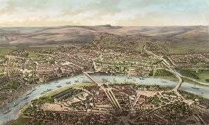
Background imageAerial Photography Collection: Bird's-eye view of Dresden, c. 1855, Saxony, Germany, Historic

Bird's-eye view of Dresden, c. 1855, Saxony, Germany, Historic, digitally restored reproduction from an 18th or
1900s, 19th-century, aerial, aerial photo, aerial photograph, aerial photography, aerial photos, aerial shot, art work, arts, artwork, artworks, bird's eye view, birds-eyes-view, black


All Professionally Made to Order for Quick Shipping

Capturing the world from above, aerial photography unveils breathtaking vistas and hidden wonders. In the heart of Wimbledon's tennis complex in the UK, a bird's-eye view reveals meticulously maintained courts awaiting fierce battles. Meanwhile, synchronized swimmers gracefully glide through sparkling waters in Sheffield, UK, their movements forming an exquisite dance. Venturing further afield to Tongariro National Park's Central Plateau on New Zealand's North Island, Mt Ruapehu stands tall alongside the majestic Grand Chateau. The snow-capped peaks and lush landscapes create a picture-perfect scene that seems straight out of a fairytale. Across continents to Adelaide in South Australia, we soar over Adelaide Oval with its sprawling River Torrens and bustling Central Business District below. The cityscape unfolds like an intricate tapestry against nature's backdrop. In San Francisco, California, Lombard Street claims fame as the "world's crookedest street. " From above, its winding path resembles an artist's brushstroke on a canvas. Nearby lies AT&T Park or Giants Ballpark - home to San Francisco baseball enthusiasts who gather beneath our lens for thrilling games under sunny skies. Queenstown and Lake Wakatipu grace our vision next as we hover over New Zealand's South Island. This aerial perspective showcases nature at its finest – serene blue waters surrounded by rugged mountains and verdant forests that beckon adventurers from afar. Avebury ring emerges mysteriously before us; this ancient stone circle holds secrets from centuries past within its enigmatic structure. As we continue our journey across England to Newcastle United’s St James Park Stadium – where passionate fans unite to cheer on their beloved team – excitement fills the air both on and off the pitch. The Firth of Forth captivates us next with its captivating beauty captured by satellite imagery. Its vast expanse merges land and sea seamlessly while inviting exploration into unknown depths beyond what meets the eye.