
1610 1698 Collection
"Exploring the Cartographic Treasures of Frederick de Wit (1610-1698)" Step into the world of cartography with Frederick de Wit


All Professionally Made to Order for Quick Shipping
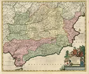
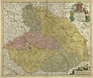
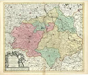
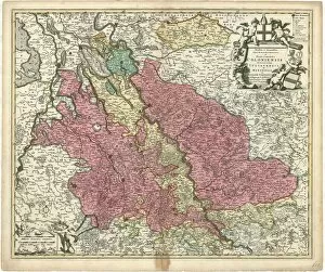
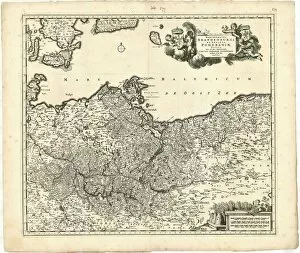
"Exploring the Cartographic Treasures of Frederick de Wit (1610-1698)" Step into the world of cartography with Frederick de Wit, a renowned Dutch mapmaker from the 17th century. His exquisite copperplate prints have stood the test of time and continue to captivate historians and enthusiasts alike. One such masterpiece is the "Map Insularum Sardiniae et Corsicae descriptio, " which showcases the intricate details of these Mediterranean islands. De Wit's meticulous craftsmanship brings to life their coastlines, mountains, and cities, providing a glimpse into their geographical features during that era. Another remarkable creation by de Wit is the "Map Insula Malta. " This depiction highlights Malta's strategic location in the Mediterranean Sea while showcasing its towns, fortifications, and natural beauty. The print serves as a historical snapshot capturing Malta's significance during this period. Moving on to mainland Europe, we encounter de Wit's "Le gouvernement general du Dauphiné divisé en Haut et Bas. " This map delves into one of France's historic regions - Dauphiné - revealing its administrative divisions and topographical characteristics. It offers valuable insights into regional governance structures at that time. De Wit also turns his attention towards Burgundy with his work titled "Ducatus Burgundiae nova descriptio. " This detailed map presents an accurate representation of Burgundy's territories, including major cities like Dijon and Beaune. It provides an invaluable resource for understanding political boundaries within this influential French region. Venturing further south in France leads us to another captivating piece: "Comté et gouvernement général de Provence divisé en ses sénéchaussées. " Here, de Wit meticulously illustrates Provence's counties and administrative divisions while highlighting notable landmarks such as Marseille and Avignon. The map sheds light on Provence's rich history as well as its regional organization during this period.