Home > Europe > United Kingdom > England > Maps
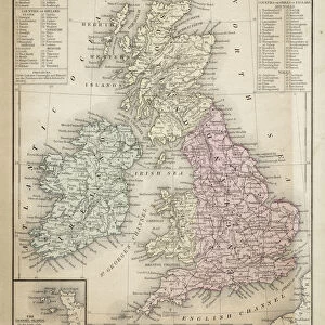
Vintage map of New England

![]()
Wall Art and Photo Gifts from Fine Art Storehouse
Vintage map of New England
Vintage map of NEw England around 1700
Unleash your creativity and transform your space into a visual masterpiece!
duncan1890
Media ID 13666627
© duncan1890
18th Century 18th Century Style American Culture Eastern Usa Ephemera Geographical Locations Illustrations And Vector Art Image Created 18th Century Image Date Information Equipment Manufactured Object Navigational Equipment New England New England Usa Objects Equipment Past Printed Media Styles
FEATURES IN THESE COLLECTIONS
> Europe
> United Kingdom
> England
> Maps
> Europe
> United Kingdom
> England
> Paintings
> Fine Art Storehouse
> Map
> Historical Maps
> Fine Art Storehouse
> Map
> USA Maps
> Maps and Charts
> Early Maps
> North America
> United States of America
> Maps
MADE IN THE UK
Safe Shipping with 30 Day Money Back Guarantee
FREE PERSONALISATION*
We are proud to offer a range of customisation features including Personalised Captions, Color Filters and Picture Zoom Tools
SECURE PAYMENTS
We happily accept a wide range of payment options so you can pay for the things you need in the way that is most convenient for you
* Options may vary by product and licensing agreement. Zoomed Pictures can be adjusted in the Basket.