Fraud Blocker Skip to main content

Home > Fine Art Storehouse > Map

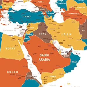
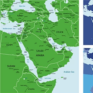
Map of the Middle East

Map of the Middle East
In Stock
We accept all major payment options so you can pay for the things you need in the way that is most convenient for you

Choose Your Product

Framed Photos
Buy from £59.99
Photo Prints
Buy from £6.99
Jigsaw Puzzles
Buy from £32.99
Poster Prints
Buy from £16.99
Canvas Prints
Buy from £34.99
Fine Art Prints
Buy from £49.99
Mounted Prints
Buy from £17.99
Metal Prints
Buy from £169.99
Cards
Buy from £8.97
Home Decor
Buy from £14.99

Fine Art Storehouse Photo Prints and Wall Art

Map of the Middle East

wov041.jpg. Unleash your creativity and transform your space into a visual masterpiece. © This content is subject to copyright

Jennifer Thermes

Media ID 13880247

SECURE PAYMENTS
We accept all major payment options so you can pay for the things you need in the way that is most convenient for you

Made in UK
Safe Shipping, Easy Returns

FREE PERSONALISATION
We are proud to offer a range of customisation including Cropping, Captions, and Filters. Zoom Cropping can be adjusted in the basket


EDITORS COMMENTS

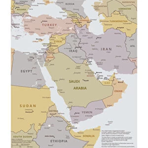
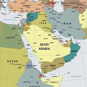
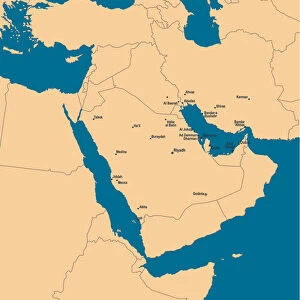
This photo print, titled "Map of the Middle East (wov041. jpg)" by Jennifer Thermes, takes us on a visual journey through the intricate tapestry of the region. With its vibrant colors and meticulous details, this artwork invites us to explore the rich history and diverse cultures that have shaped the Middle East. The map serves as a gateway to understanding the complexities and interconnectedness of nations in this part of the world. It beautifully captures both ancient landmarks and modern cities, showcasing iconic sites like Egypt's pyramids, Jordan's Petra, or Israel's Dome of the Rock. As our eyes wander across its surface, we are transported from bustling markets to serene deserts and lush oases. Jennifer Thermes' masterful technique is evident in every brushstroke; her attention to detail allows for an immersive experience as we examine each border line or decipher place names etched delicately onto parchment-like paper. The choice of warm hues evokes a sense of timelessness while highlighting regional diversity. This print not only appeals to cartography enthusiasts but also sparks curiosity among those seeking cultural enlightenment. It serves as a reminder that beyond political boundaries lie stories waiting to be discovered – tales woven into landscapes that have witnessed centuries-old civilizations rise and fall. Whether displayed in homes or educational institutions, "Map of the Middle East (wov041. jpg)" is sure to captivate viewers with its beauty and inspire them to delve deeper into this fascinating part of our world's heritage.

diamond
Made With High Grade Materials
thumb_up
Professional Quality Finish
package_2
Carefully Packed To Aid Safe Arrival

You May Also Like


Colored Map of Middle EastColored Map of Middle East
Add to Basket
Map of Middle East - illustrationMap of Middle East - illustration
Add to Basket
Political map of The Middle EastPolitical map of The Middle East
Add to Basket
Map of Middle East - illustrationMap of Middle East - illustration
Add to Basket
Antique map of the holy land with the Sea of GalileeAntique map of the holy land with the Sea of Galilee
Add to Basket
Madaba Mosaic Map, 6th century AD, detail showing Jerusalem, Madaba, JordanMadaba Mosaic Map, 6th century AD, detail showing Jerusalem, Madaba, Jordan
Add to Basket
Map of Middle EastMap of Middle East
Add to Basket
Vintage flat map of the Middle EastVintage flat map of the Middle East
Add to Basket
Middle east mapMiddle east map
Add to Basket
Africa Political MapAfrica Political Map
Add to Basket
Birds sit on the back of a zebra in the Nairobi National Park, near NairobiBirds sit on the back of a zebra in the Nairobi National Park, near Nairobi
Add to Basket
Stream in Sam Mack Meadow, John Muir Wilderness, Sierra Nevada Mountains, California, USAStream in Sam Mack Meadow, John Muir Wilderness, Sierra Nevada Mountains, California, USA
Add to Basket

Gallery Wall Inspiration

Battle Of Waterloo
Antique Map of Norwich, England, 1880
Map of earth population 1895
Antique map of the Roman Empire
Map of Middle East - illustration
Map of Cyprus, published in 1880
Earth map according to Herodotus
Antique map of Britain under the Anglo Saxons
Antique map of Ancient Syria, Mesopotamia, Assyria, Atlas of Ancient Geography
Map of Anglo-Saxon Kingdoms and the Danelaw, 9th Century
Map of North and East sea 1896
Antique map of Britain under the Ancient Romans
Reference Map of Spain
Apostle Pauls Missionary Journeys, lithograph, published in 1886
Detailed map of Europe
Sicily map 1895
Coloured Map of Nigeria with Flag
Map of Ireland 1897
Antique map of Tasmania
England in the Ninth Century
Old map of Australia 1899
Ethnological map of the Austro-Hungarian Empire, lithograph, published in 1897
Cornwall map 1884
Antique map of Ireland
Old Caucasus map
Map of Portugal
Carte du Tendre: imaginary map by a character in the novel Cl├®lie


© Copyright Media Storehouse, All Rights Reserved 2003 - 2024
Facebook     Pinterest     100% Payment Secure     Reviews IO