Home > North America > United States of America > New York > New York > Maps
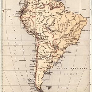
Map of South America 1855

![]()
Wall Art and Photo Gifts from Fine Art Storehouse
Map of South America 1855
System of Geography for the use of schools by Sidney E. Morse - Published by Harper & Brothers - New York 1855
Unleash your creativity and transform your space into a visual masterpiece!
THEPALMER
Media ID 13668811
© Roberto A Sanchez
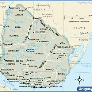
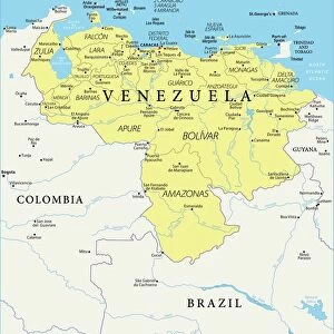
Argentina Atlantic Ocean Backgrounds Brazil Colombia Direction Latin America Pacific Ocean Paper Patina Sepia Toned South America Textured Effect Uruguay Venezuela Obsolete Retro Styled
FEATURES IN THESE COLLECTIONS
> Fine Art Storehouse
> The Magical World of Illustration
> Palmer Illustrated Collection
> Maps and Charts
> World
> North America
> United States of America
> New York
> New York
> Maps
> South America
> Argentina
> Maps
> South America
> Brazil
> Maps
> South America
> Colombia
> Maps
> South America
> Uruguay
> Maps
> South America
> Venezuela
> Maps
EDITORS COMMENTS
This print takes us back in time to the year 1855, showcasing a beautifully detailed "Map of South America". With its retro-styled design and sepia-toned finish, this piece exudes an air of nostalgia and charm. The map was originally featured in Sidney E. Morse's "System of Geography for the use of schools" published by Harper & Brothers in New York. The intricate cartography on display provides a glimpse into the past, revealing the physical geography of South America as it was understood over 150 years ago. From Venezuela to Uruguay, Colombia to Brazil, Argentina to Peru, this vintage map highlights each country with precision and accuracy. The textured effect adds depth and character to the print, giving it an authentic feel reminiscent of old paper maps that have stood the test of time. As we explore this antique treasure, we can almost imagine tracing our fingers along its patina-covered surface. With both the Pacific Ocean and Atlantic Ocean surrounding its borders, South America is depicted as a continent rich in natural beauty and vast possibilities waiting to be discovered. This vertical illustration serves as a reminder not only of our planet's ever-changing landscapes but also how far our understanding has evolved since this map was first created. "The Map of South America 1855" by THEPALMER is more than just a decorative piece; it invites us on a journey through history while celebrating the artistry behind early cartography.
MADE IN THE UK
Safe Shipping with 30 Day Money Back Guarantee
FREE PERSONALISATION*
We are proud to offer a range of customisation features including Personalised Captions, Color Filters and Picture Zoom Tools
SECURE PAYMENTS
We happily accept a wide range of payment options so you can pay for the things you need in the way that is most convenient for you
* Options may vary by product and licensing agreement. Zoomed Pictures can be adjusted in the Basket.