Home > Arts > Still life artwork > Watercolor paintings > Fine art
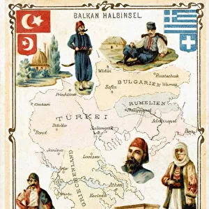
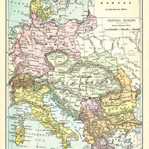
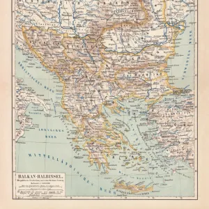
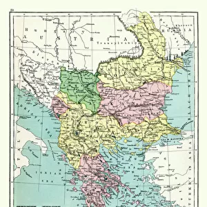
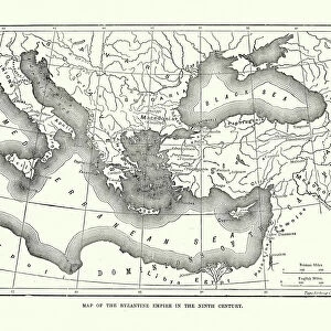
Illustrated map of France, Southern and Southeastern Europe

![]()
Wall Art and Photo Gifts from Fine Art Storehouse
Illustrated map of France, Southern and Southeastern Europe
Unleash your creativity and transform your space into a visual masterpiece!
Dorling Kindersley
Media ID 13545257
© This content is subject to copyright
Balkans Bulgaria Education French Culture Geography Greece Greek Culture Illustrated Map Italian Culture Local Landmark National Landmark Picture Romania Southeastern Europe Southern Europe Watercolour Painting
FEATURES IN THESE COLLECTIONS
> Arts
> Still life artwork
> Watercolor paintings
> Fine art
> Europe
> Bulgaria
> Paintings
> Europe
> Croatia
> Paintings
> Fine Art Storehouse
> Map
> Italian Maps
> Fine Art Storehouse
> Photo Libraries
> Dorling Kindersley Prints
EDITORS COMMENTS
This print showcases an exquisitely detailed illustrated map of France, Southern and Southeastern Europe. Created by the talented artist Dorling Kindersley, this watercolor painting is a true masterpiece that beautifully captures the essence of these enchanting regions. The vibrant colors and intricate details bring to life the diverse landscapes and rich cultural heritage of countries such as France, Italy, Greece, Spain, Romania, and Bulgaria. From iconic national landmarks to local gems hidden within each country's borders, every corner of this map tells a unique story. Perfect for educational purposes or simply as a stunning piece of art to adorn your walls, this horizontal print is sure to spark curiosity about geography and ignite wanderlust in anyone who gazes upon it. The white background adds a touch of elegance while allowing the vivid hues to take center stage. Whether you are passionate about cartography or simply appreciate the beauty found in physical geography, this illustrated map will transport you on an imaginary journey through Southern and Southeastern Europe. Immerse yourself in French culture, Greek traditions, Italian charm - all from the comfort of your own home with this remarkable studio shot print from Fine Art Storehouse.
MADE IN THE UK
Safe Shipping with 30 Day Money Back Guarantee
FREE PERSONALISATION*
We are proud to offer a range of customisation features including Personalised Captions, Color Filters and Picture Zoom Tools
SECURE PAYMENTS
We happily accept a wide range of payment options so you can pay for the things you need in the way that is most convenient for you
* Options may vary by product and licensing agreement. Zoomed Pictures can be adjusted in the Basket.