Home > Maps and Charts > Americas
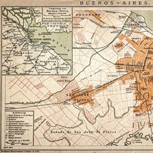
Map of the southern part of South America, c.1900 (engraving)
![]()

Wall Art and Photo Gifts from Fine Art Finder
Map of the southern part of South America, c.1900 (engraving)
533267 Map of the southern part of South America, c.1900 (engraving); (add.info.: Map of southern South America, with inset maps of Buenos Aires, Montevideo, Valparaiso, and Santiago, circa 1902, from the 10th edition of Encyclopaedia Britannica.); Encyclopaedia Britannica/UIG
Media ID 38099796
© Encyclopaedia Britannica/UIG / Bridgeman Images
1902 19th Century Style America Continent Argentina Atlantic Ocean Buenos Aires Cartography Geographical Border Guidance Illustration Technique Latinamerica Latine America Meridian Montevideo Navigational Equipment Old Fashioned Pacific Ocean Part Of Physical Geography Santiago Southamerica The Past Valparaiso Western Script
FEATURES IN THESE COLLECTIONS
> Fine Art Finder
> Temp Classification
> South America
> Argentina
> Buenos Aires
> South America
> Argentina
> Maps
> South America
> Argentina
> Related Images
EDITORS COMMENTS
This engraving from c.1900 showcases a detailed map of the southern part of South America, offering a glimpse into the geographical landscape of this diverse continent. The intricate design includes inset maps of key cities such as Buenos Aires, Montevideo, Valparaiso, and Santiago, providing valuable insight into the urban centers of the region at that time.
As we delve into this historical piece from the 10th edition of Encyclopaedia Britannica, we are transported back to an era marked by exploration and discovery. The old-fashioned charm of the map is evident in its 19th-century style and Western script labeling, reflecting a time when cartography was both an art form and a scientific endeavor.
The map not only serves as a navigational tool but also as a window into the past, showcasing physical geography features such as coastlines, meridians, and seas with precision and accuracy. It stands as a testament to human curiosity and ingenuity in mapping out uncharted territories for exploration.
With no people in sight, this illustration transports us to an era where maps were essential tools for understanding our world's vast landscapes. Through this engraving by Bridgeman Images from Fine Art Finder, we are reminded of the importance of preserving historical artifacts that offer insights into our planet's rich history and cultural heritage.
MADE IN THE UK
Safe Shipping with 30 Day Money Back Guarantee
FREE PERSONALISATION*
We are proud to offer a range of customisation features including Personalised Captions, Color Filters and Picture Zoom Tools
SECURE PAYMENTS
We happily accept a wide range of payment options so you can pay for the things you need in the way that is most convenient for you
* Options may vary by product and licensing agreement. Zoomed Pictures can be adjusted in the Basket.


