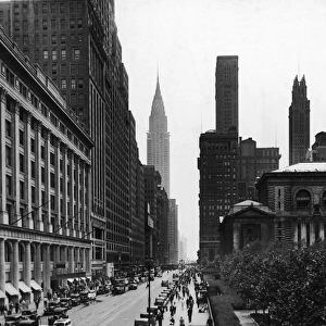
Home > North America > United States of America > New York > New York > Sights > New York Public Library
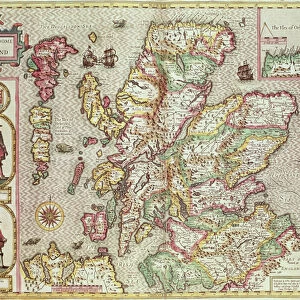
A new and accurate map of the world, 1676 (hand coloured print)
")
![]()
Wall Art and Photo Gifts from Fine Art Finder
A new and accurate map of the world, 1676 (hand coloured print)
XOS1765712 A new and accurate map of the world, 1676 (hand coloured print) by Speed, John (1552-1629) (after); 41x54 cm; New York Public Library, USA; (add.info.: A new and accurat map of the world drawne according to ye truest descriptions, latest discoueries & best obseruations yt haue beene made by English or strangers, 1651 published in John Speeds Prospect of the most famous parts of the world, 1676. Includes additional maps and diagrams.); English, out of copyright
Media ID 12742551
© www.bridgemanimages.com
Atlas Cartography Celestial Drake Eclipse Elements Explorers Globe Hemispheres Hydrography Latitude Longitude Magellan Moon Navigation Planets Sea Chart Sphere World Map
FEATURES IN THESE COLLECTIONS
> Arts
> Artists
> S
> John Speed
> Fine Art Finder
> Artists
> John (after) Speed
> Fine Art Finder
> Maps (celestial & Terrestrial)
> Maps and Charts
> World
> North America
> United States of America
> Maps
> North America
> United States of America
> New York
> New York
> Maps
> North America
> United States of America
> New York
> New York
> Sights
> New York Public Library
EDITORS COMMENTS
This hand-coloured print, titled "A new and accurate map of the world, 1676" takes us back in time to an era of exploration and discovery. Created by John Speed, a renowned English cartographer from the 17th century, this map showcases his meticulous attention to detail. Measuring at 41x54 cm, this masterpiece is housed in the prestigious New York Public Library. It offers a glimpse into the knowledge and understanding of the world during that period. The map draws upon true descriptions, latest discoveries, and observations made by both English explorers and foreigners alike. As we explore this intricate work of art, we are transported across vast oceans and coastlines. Its hydrography reveals detailed sea charts that guided sailors through uncharted territories. Hemispheres depict continents such as America with remarkable accuracy for its time. The inclusion of additional maps and diagrams enhances our understanding of maritime navigation techniques used during expeditions led by famous explorers like Magellan, Drake, Van der Noort, Candish - names synonymous with adventure. Beyond Earthly boundaries lie celestial elements: a moon shining brightly amidst stars in a celestial sphere. This print not only serves as a navigational tool but also sparks curiosity about our place within the universe. With every glance at this historic artifact capturing centuries-old knowledge on paper, we are reminded of humanity's insatiable desire for exploration – to uncover hidden treasures on land or unravel mysteries beyond our planet's borders.
MADE IN THE UK
Safe Shipping with 30 Day Money Back Guarantee
FREE PERSONALISATION*
We are proud to offer a range of customisation features including Personalised Captions, Color Filters and Picture Zoom Tools
SECURE PAYMENTS
We happily accept a wide range of payment options so you can pay for the things you need in the way that is most convenient for you
* Options may vary by product and licensing agreement. Zoomed Pictures can be adjusted in the Basket.