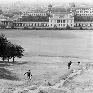
Home > Europe > United Kingdom > England > London > Museums > National Maritime Museum
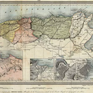
Ireland south of Limerick, 1590 (paper, linen)
")
![]()
Wall Art and Photo Gifts from Fine Art Finder
Ireland south of Limerick, 1590 (paper, linen)
7339812 Ireland south of Limerick, 1590 (paper, linen) by Unknown Artist, (16th century); 78.5x38.5 cm; National Maritime Museum, London, UK; (add.info.: Creator: unknown
Scale: [ca. 1:300 000]. Cartographic Note: Drawn on a pencil copying grid of 13 mm squares. From volume eight, Maps of Ireland, of the Dartmouth collection of maps and plans, compiled for or by George Legge, Master General of the Ordnance.); © National Maritime Museum, Greenwich, London
Media ID 38288588
© © National Maritime Museum, Greenwich, London / Bridgeman Images
FEATURES IN THESE COLLECTIONS
> Arts
> Realistic drawings
> Pencil drawings
> Fine art
> Europe
> Republic of Ireland
> Limerick
> Europe
> Republic of Ireland
> Maps
> Europe
> United Kingdom
> England
> London
> Boroughs
> Greenwich
> Europe
> United Kingdom
> England
> London
> Museums
> Greenwich Heritage Centre
> Europe
> United Kingdom
> England
> London
> Museums
> National Maritime Museum
> Europe
> United Kingdom
> England
> London
> Towns
> Greenwich
> Europe
> United Kingdom
> Heritage Sites
> Maritime Greenwich
> Europe
> United Kingdom
> Maps
> Fine Art Finder
> Artists
> Luis de Surville
> Fine Art Finder
> Artists
> Unknown Artist
EDITORS COMMENTS
This stunning print captures a glimpse of Ireland south of Limerick in 1590, showcasing the intricate details and artistry of cartography from the 16th century. The unknown artist behind this masterpiece has meticulously drawn out the landscape on paper, creating a visual representation that transports us back in time.
Measuring at 78.5x38.5 cm, this piece is not only a historical artifact but also a work of art that reflects the skill and precision required to map out such vast territories. The use of linen as a medium adds texture and depth to the illustration, enhancing its overall aesthetic appeal.
The map itself is filled with vibrant colors that bring life to the various regions depicted, from lush greenery to winding rivers and coastal lines. It is evident that every detail was carefully considered and executed with care, making it a true testament to the craftsmanship of cartographers during this period.
Displayed at the National Maritime Museum in London, UK, this print offers viewers a window into Ireland's past while also serving as a reminder of the importance of preserving our history through art and documentation. It stands as both an educational tool and a visual delight for all who have the privilege to admire it.
MADE IN THE UK
Safe Shipping with 30 Day Money Back Guarantee
FREE PERSONALISATION*
We are proud to offer a range of customisation features including Personalised Captions, Color Filters and Picture Zoom Tools
SECURE PAYMENTS
We happily accept a wide range of payment options so you can pay for the things you need in the way that is most convenient for you
* Options may vary by product and licensing agreement. Zoomed Pictures can be adjusted in the Basket.