Fraud Blocker Skip to main content

Home > Fine Art Finder > Artists > Joris (after) Hoefnagel

Joris (after) Hoefnagel Collection (page 3)

179 items

Background imageJoris (after) Hoefnagel Collection: Map of Flissinga, from Civitates Orbis Terrarum

Map of Flissinga, from Civitates Orbis Terrarum
STC138924 Map of Flissinga, from Civitates Orbis Terrarum by Georg Braun (1541-1622) and Frans Hogenberg (1535-90) c.1572-1617 (coloured engraving) by Hoefnagel

Background imageJoris (after) Hoefnagel Collection: Map of Nijmegen, from Civitates Orbis Terrarum

Map of Nijmegen, from Civitates Orbis Terrarum
STC138910 Map of Nijmegen, from Civitates Orbis Terrarum by Georg Braun (1541-1622) and Frans Hogenberg (1535-90) c.1572-1617 (coloured engraving) by Hoefnagel

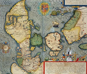
Background imageJoris (after) Hoefnagel Collection: Map of Northern Europe, from Civitates Orbis Terrarum

Map of Northern Europe, from Civitates Orbis Terrarum
STC138976 Map of Northern Europe, from Civitates Orbis Terrarum by Georg Braun (1541-1622) and Frans Hogenberg (1535-90) c.1572-1617 (coloured engraving) by Hoefnagel

Background imageJoris (after) Hoefnagel Collection: Map of Regensburg, from Civitates Orbis Terrarum

Map of Regensburg, from Civitates Orbis Terrarum
STC138963 Map of Regensburg, from Civitates Orbis Terrarum by Georg Braun (1541-1622) and Frans Hogenberg (1535-90) 1594 (coloured engraving) by Hoefnagel

Background imageJoris (after) Hoefnagel Collection: Elsenor and Ripen, from Civitates Orbis Terrarum

Elsenor and Ripen, from Civitates Orbis Terrarum
STC138951 Elsenor and Ripen, from Civitates Orbis Terrarum by Georg Braun (1541-1622) and Frans Hogenburg (1535-90), c.1572 (coloured engraving) by Hoefnagel

Background imageJoris (after) Hoefnagel Collection: Map of Rostock, from Civitates Orbis Terrarum by Georg Braun (1541-1622

Map of Rostock, from Civitates Orbis Terrarum by Georg Braun (1541-1622
STC138945 Map of Rostock, from Civitates Orbis Terrarum by Georg Braun (1541-1622) and Frans Hogenberg (1535-90) c.1572-1617 (coloured engraving) by Hoefnagel

Background imageJoris (after) Hoefnagel Collection: Map of Linz, from Civitates Orbis Terrarum by Georg Braun (1541-1622

Map of Linz, from Civitates Orbis Terrarum by Georg Braun (1541-1622
STC138938 Map of Linz, from Civitates Orbis Terrarum by Georg Braun (1541-1622) and Frans Hogenberg (1535-90) 1594 (coloured engraving) by Hoefnagel

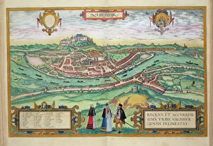
Background imageJoris (after) Hoefnagel Collection: Map of Salzburg, from Civitates Orbis Terrarum

Map of Salzburg, from Civitates Orbis Terrarum
STC138909 Map of Salzburg, from Civitates Orbis Terrarum by Georg Braun (1541-1622) and Frans Hogenberg (1535-90) c.1572-1617 (coloured engraving) by Hoefnagel

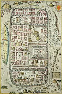
Background imageJoris (after) Hoefnagel Collection: Map of Jerusalem and the surrounding area, from Civitates Orbis Terrarum

Map of Jerusalem and the surrounding area, from Civitates Orbis Terrarum
STC138907 Map of Jerusalem and the surrounding area, from Civitates Orbis Terrarum by Georg Braun (1541-1622) and Frans Hogenberg (1535-90) c.1572-1617 (coloured engraving) (see 138905-96)

Background imageJoris (after) Hoefnagel Collection: T. E. Lawrence and Mr L. Thomas outside their tent, 1919 (b / w photo)

T. E. Lawrence and Mr L. Thomas outside their tent, 1919 (b / w photo)
ILN135206 T. E. Lawrence and Mr L. Thomas outside their tent, 1919 (b/w photo) by English Photographer, (20th century); The Illustrated London News Picture Library, London

Background imageJoris (after) Hoefnagel Collection: Maps of Galway, Dublin, Limerick, and Cork, from Civitates Orbis Terrarum

Maps of Galway, Dublin, Limerick, and Cork, from Civitates Orbis Terrarum
STC135203 Maps of Galway, Dublin, Limerick, and Cork, from Civitates Orbis Terrarum by Georg Braun (1541-1622) and Frans Hogenberg (1535-90), c.1573 (coloured engraving) by Hoefnagel

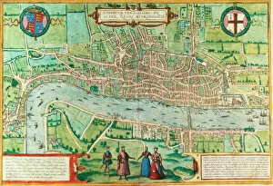
Background imageJoris (after) Hoefnagel Collection: Map of London, from Civitates Orbis Terrarum, by Georg Braun (1542-1622

Map of London, from Civitates Orbis Terrarum, by Georg Braun (1542-1622
GUL58543 Map of London, from Civitates Orbis Terrarum, by Georg Braun (1542-1622) and Frans Hogenburg (1635-90), c.1572 (coloured engraving) (see also 51896 & 66112) by Hoefnagel

Background imageJoris (after) Hoefnagel Collection: Views of Sendomiria and Biecz, from Civitates Orbis Terrarum

Views of Sendomiria and Biecz, from Civitates Orbis Terrarum
CZA229117 Views of Sendomiria and Biecz, from Civitates Orbis Terrarum by Georg Braun (1541-1622) and Frans Hogenberg (1535-90) (coloured engraving) by Hoefnagel

Background imageJoris (after) Hoefnagel Collection: Amazons, illustration from Histoire des voyages autour du monde by J

Amazons, illustration from Histoire des voyages autour du monde by J
CHT289156 Amazons, illustration from Histoire des voyages autour du monde by J. Dufay, published by Courvalet & Co. Paris, 1826 (colour engraving) 1826 (colour engraving) by French School

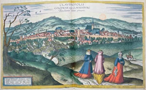
Background imageJoris (after) Hoefnagel Collection: Map of Claudiopolis, from Civitates Orbis Terrarum

Map of Claudiopolis, from Civitates Orbis Terrarum
BMR289152 Map of Claudiopolis, from Civitates Orbis Terrarum by Georg Braun (1541-1622) and Frans Hogenberg (1535-90) Brussels, 1574 (coloured engraving) by Hoefnagel

Background imageJoris (after) Hoefnagel Collection: Metz, Wurtzburg, and Sittensen, from Civitates Orbis Terrarum

Metz, Wurtzburg, and Sittensen, from Civitates Orbis Terrarum
STC213499 Metz, Wurtzburg, and Sittensen, from Civitates Orbis Terrarum by Georg Braun (1541-1622) and Frans Hogenburg (1535-90), c.1572 (coloured engraving) by Hoefnagel

Background imageJoris (after) Hoefnagel Collection: In the Polder, 1644 (pencil, chalk and brush on paper)

In the Polder, 1644 (pencil, chalk and brush on paper)
XKH141388 In the Polder, 1644 (pencil, chalk and brush on paper) by Cuyp, Aelbert (1620-91); 19.5x31.4 cm; Hamburger Kunsthalle, Hamburg, Germany; (add.info.: low-lying land reclaimed from the sea)

Background imageJoris (after) Hoefnagel Collection: Map of Canterbury, from Civitates Orbis Terrarum

Map of Canterbury, from Civitates Orbis Terrarum
STC138980 Map of Canterbury, from Civitates Orbis Terrarum by Georg Braun (1541-1622) and Frans Hognenberg (1535-90) c.1572-1617 (coloured engraving) by Hoefnagel

Background imageJoris (after) Hoefnagel Collection: Map of Rotterdam and Gouda, from Civitates Orbis Terrarum

Map of Rotterdam and Gouda, from Civitates Orbis Terrarum
STC138978 Map of Rotterdam and Gouda, from Civitates Orbis Terrarum by Georg Braun (1541-1622) and Frans Hogenberg (1535-90) c.1572-1617 (coloured engraving) by Hoefnagel

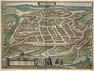
Background imageJoris (after) Hoefnagel Collection: Map of Vilnius, Lithuania, from Civitates Orbis Terrarum

Map of Vilnius, Lithuania, from Civitates Orbis Terrarum
STC138977 Map of Vilnius, Lithuania, from Civitates Orbis Terrarum by Georg Braun (1541-1622) and Frans Hogenberg (1535-90) c.1572-1617 (coloured engraving) by Hoefnagel

Background imageJoris (after) Hoefnagel Collection: Two Views of Comorra, from Civitates Orbis Terrarum

Two Views of Comorra, from Civitates Orbis Terrarum
STC138939 Two Views of Comorra, from Civitates Orbis Terrarum by Georg Braun (1541-1622) and Frans Hogenburg (1535-90), c.1572 (coloured engraving) by Hoefnagel

Background imageJoris (after) Hoefnagel Collection: View of San Marco, and the Palazzo Ducale on fire, from Civitates Orbis Terrarum

View of San Marco, and the Palazzo Ducale on fire, from Civitates Orbis Terrarum
STC138936 View of San Marco, and the Palazzo Ducale on fire, from Civitates Orbis Terrarum by Georg Braun (1541-1622) and Frans Hogenberg (1535-90) 1578 (coloured engraving) by Hoefnagel

Background imageJoris (after) Hoefnagel Collection: map of Luneburg, from Civitates Orbis Terrarum

map of Luneburg, from Civitates Orbis Terrarum
STC138935 map of Luneburg, from Civitates Orbis Terrarum by Georg Braun (1541-1622) and Frans Hogenberg (1535-90) c.1572-1617 (coloured engraving) by Hoefnagel

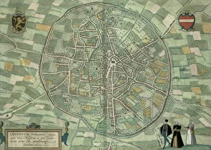
Background imageJoris (after) Hoefnagel Collection: Map of Louvain, from Civitates Orbis Terrarum by Georg Braun (1541-1622

Map of Louvain, from Civitates Orbis Terrarum by Georg Braun (1541-1622
STC138916 Map of Louvain, from Civitates Orbis Terrarum by Georg Braun (1541-1622) and Frans Hogenberg (1535-90) c.1572-1617 (coloured engraving) by Hoefnagel

Background imageJoris (after) Hoefnagel Collection: Map of Arnhem, Velmo, Gelre, and Ruerm, from Civitates Orbis Terrarum

Map of Arnhem, Velmo, Gelre, and Ruerm, from Civitates Orbis Terrarum
STC138911 Map of Arnhem, Velmo, Gelre, and Ruerm, from Civitates Orbis Terrarum by Georg Braun (1541-1622) and Frans Hogenberg (1535-90) c.1572-1617 (coloured engraving) by Hoefnagel

Background imageJoris (after) Hoefnagel Collection: Map of Jerusalem and the surrounding area, from Civitates Orbis Terrarum

Map of Jerusalem and the surrounding area, from Civitates Orbis Terrarum
STC138905 Map of Jerusalem and the surrounding area, from Civitates Orbis Terrarum by Georg Braun (1541-1622) and Frans Hogenberg (1535-90) c.1572-1617 (coloured engraving) (see 138906) by Hoefnagel

Background imageJoris (after) Hoefnagel Collection: Daniel Dashiel Warner (1815-80) 1874 (oil on canvas)

Daniel Dashiel Warner (1815-80) 1874 (oil on canvas)
AKM202055 Daniel Dashiel Warner (1815-80) 1874 (oil on canvas) by Sully, Thomas (1783-1872); 61x50.8 cm; Philadelphia History Museum at the Atwater Kent; ePhiladelphia History Museum at the Atwater

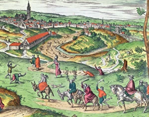
Background imageJoris (after) Hoefnagel Collection: Town Plan of Seville, from Civitates Orbis Terrarum

Town Plan of Seville, from Civitates Orbis Terrarum
CHT202049 Town Plan of Seville, from Civitates Orbis Terrarum by Georg Braun (1541-1622) and Frans Hogenberg (1535-90), 1593 (coloured engraving) (detail of 121051) by Hoefnagel

Background imageJoris (after) Hoefnagel Collection: The Streatlam Stud, Mares and Foals, 1836 (oil on canvas)

The Streatlam Stud, Mares and Foals, 1836 (oil on canvas)
CH349298 The Streatlam Stud, Mares and Foals, 1836 (oil on canvas) by Herring Snr, John Frederick (1795-1865); 106.7x158.8 cm; Private Collection; Photo eChristies Images; English, out of copyright

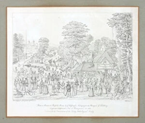
Background imageJoris (after) Hoefnagel Collection: Fete at Horseydown in c. 1590 (pen & ink on paper)

Fete at Horseydown in c. 1590 (pen & ink on paper)
CRD349289 Fete at Horseydown in c.1590 (pen & ink on paper) by Hoefnagel, Joris (1542-1600) (after); Croydon Art Collection, Museum of Croydon

Background imageJoris (after) Hoefnagel Collection: Reproduction of a Poster Advertising Loie Fuller at the Folies-Bergere

Reproduction of a Poster Advertising Loie Fuller at the Folies-Bergere
STC121210 Reproduction of a Poster Advertising Loie Fuller at the Folies-Bergere, 1893 (litho) by Cheret, Jules (1836-1932); Private Collection; The Stapleton Collection; French, out of copyright

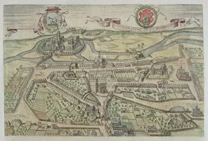
Background imageJoris (after) Hoefnagel Collection: Map of Augsburg, from Civitates Orbis Terrarum

Map of Augsburg, from Civitates Orbis Terrarum
STC121018 Map of Augsburg, from Civitates Orbis Terrarum by Georg Braun (1541-1622) and Frans Hogenberg (1535-90), c.1572 (coloured engraving) by Hoefnagel

Background imageJoris (after) Hoefnagel Collection: Map of Cracow, from Civitates Orbis Terrarum by Georg Braun (1541-1622

Map of Cracow, from Civitates Orbis Terrarum by Georg Braun (1541-1622
STC121015 Map of Cracow, from Civitates Orbis Terrarum by Georg Braun (1541-1622) and Frans Hogenberg (1535-90), c.1572 (coloured engraving) by Hoefnagel

Background imageJoris (after) Hoefnagel Collection: Map of Nijmegen, from Civitates Orbis Terrarum

Map of Nijmegen, from Civitates Orbis Terrarum
STC121009 Map of Nijmegen, from Civitates Orbis Terrarum by Georg Braun (1541-1622) and Frans Hogenburg (1535-90), c.1572 (coloured engraving) by Hoefnagel

Background imageJoris (after) Hoefnagel Collection: Town Plan of Brussels, from Civitates Orbis Terrarum

Town Plan of Brussels, from Civitates Orbis Terrarum
STC121002 Town Plan of Brussels, from Civitates Orbis Terrarum by Georg Braun (1542-1622) and Frans Hogenburg (1635-90), c.1572 (coloured engraving) by Hoefnagel

Background imageJoris (after) Hoefnagel Collection: View of Lowicz, from Civitates Orbis Terrarum by Georg Braun (1541-1622

View of Lowicz, from Civitates Orbis Terrarum by Georg Braun (1541-1622
CZA229118 View of Lowicz, from Civitates Orbis Terrarum by Georg Braun (1541-1622) and Frans Hogenberg (1535-90) (coloured engraving) by Hoefnagel

Background imageJoris (after) Hoefnagel Collection: A Game of Billiards, late seventeenth century (coloured engraving)

A Game of Billiards, late seventeenth century (coloured engraving)
CHT293686 A Game of Billiards, late seventeenth century (coloured engraving) by Arnoult, Nicolas (17th century); Private Collection; (add.info)

Background imageJoris (after) Hoefnagel Collection: Map of Warsaw, from Civitates Orbis Terrarum by Georg Braun (1541-1622

Map of Warsaw, from Civitates Orbis Terrarum by Georg Braun (1541-1622
CHT293685 Map of Warsaw, from Civitates Orbis Terrarum by Georg Braun (1541-1622) and Frans Hogenberg (1535-90), 1599 (coloured engraving) by Hoefnagel

Background imageJoris (after) Hoefnagel Collection: Map of Visby, from Civitates Orbis Terrarum by Georg Braun (1541-1622

Map of Visby, from Civitates Orbis Terrarum by Georg Braun (1541-1622
STC138996 Map of Visby, from Civitates Orbis Terrarum by Georg Braun (1541-1622) and Frans Hogenberg (1535-90) c.1572-1617 (coloured engraving) by Hoefnagel

Background imageJoris (after) Hoefnagel Collection: Map of Delft, from Civitates Orbis Terrarum by Georg Braun (1541-1622

Map of Delft, from Civitates Orbis Terrarum by Georg Braun (1541-1622
STC138983 Map of Delft, from Civitates Orbis Terrarum by Georg Braun (1541-1622) and Frans Hogenberg (1535-90) c.1572-1617 (coloured engraving) by Hoefnagel

Background imageJoris (after) Hoefnagel Collection: Map of Lublin, from Civitates Orbis Terrarum by Georg Braun (1541-1622

Map of Lublin, from Civitates Orbis Terrarum by Georg Braun (1541-1622
STC138952 Map of Lublin, from Civitates Orbis Terrarum by Georg Braun (1541-1622) and Frans Hogenberg (1535-90) c.1572-1617 (coloured engraving) by Hoefnagel

Background imageJoris (after) Hoefnagel Collection: Map of Raab, from Civitates Orbis Terrarum by Georg Braun (1541-1622

Map of Raab, from Civitates Orbis Terrarum by Georg Braun (1541-1622
STC138940 Map of Raab, from Civitates Orbis Terrarum by Georg Braun (1541-1622) and Frans Hogenberg (1535-90) 1597 (coloured engraving) by Hoefnagel

Background imageJoris (after) Hoefnagel Collection: Map of Barth, from Civitates Orbis Terrarum by Georg Braun (1541-1622

Map of Barth, from Civitates Orbis Terrarum by Georg Braun (1541-1622
STC138932 Map of Barth, from Civitates Orbis Terrarum by Georg Braun (1541-1622) and Frans Hogenberg (1535-90) c.1572-1617 (coloured engraving) by Hoefnagel

Background imageJoris (after) Hoefnagel Collection: Map of Vienna, from Civitates Orbis Terrarum by Georg Braun (1541-1622

Map of Vienna, from Civitates Orbis Terrarum by Georg Braun (1541-1622
STC138931 Map of Vienna, from Civitates Orbis Terrarum by Georg Braun (1541-1622) and Frans Hogenberg (1535-90) c.1572-1617 (coloured engraving) by Hoefnagel

Background imageJoris (after) Hoefnagel Collection: Map of Warsaw, from Civitates Orbis Terrarum by Georg Braun (1541-1622

Map of Warsaw, from Civitates Orbis Terrarum by Georg Braun (1541-1622
STC138928 Map of Warsaw, from Civitates Orbis Terrarum by Georg Braun (1541-1622) and Frans Hogenberg (1535-90) c.1572-1617 (coloured engraving) by Hoefnagel

Background imageJoris (after) Hoefnagel Collection: Map of Palermo, from Civitates Orbis Terrarum by Georg Braun (1541-1622

Map of Palermo, from Civitates Orbis Terrarum by Georg Braun (1541-1622
STC138923 Map of Palermo, from Civitates Orbis Terrarum by Georg Braun (1541-1622) and Frans Hogenberg (1535-90) c.1572-1617 (coloured engraving) by Hoefnagel

Background imageJoris (after) Hoefnagel Collection: Map of Edinburgh, from Civitates Orbis Terrarum

Map of Edinburgh, from Civitates Orbis Terrarum
STC138920 Map of Edinburgh, from Civitates Orbis Terrarum by Georg Braun (1541-1622) and Frans Hogenberg (1535-90) c.1572-1617 (coloured engraving) by Hoefnagel

Background imageJoris (after) Hoefnagel Collection: Map of Jerusalem and the surrounding area, from Civitates Orbis Terrarum

Map of Jerusalem and the surrounding area, from Civitates Orbis Terrarum
STC138906 Map of Jerusalem and the surrounding area, from Civitates Orbis Terrarum by Georg Braum (1541-1622) and Frans Hogenberg (1535-90) c.1572-1617 (coloured engraving) (see 138905) by Hoefnagel


All Professionally Made to Order for Quick Shipping


-

Why Choose Us?

We are a leading provider of Art Prints and Photo Gifts since 2003, working in partnership with a range of Sporting Clubs, Charities, Museums and Picture Libraries. A large share of profits from any of their images will go directly towards supporting that charity or club. Our archive of images is carefully curated to bring you a wide range of subjects, including landscapes, wildlife, architecture, and more. We ship from our partner labs in the UK, USA, EU (Netherlands) and Australia.
+

How do I place an order?

Ordering is quick & easy - Just follow 5 Simple Steps:
  1. Find your image: Use our search box or browse our online photo Collections to find the image you want.

  2. Choose your print format: Select your desired product and add it to your cart.

  3. Enter your details: If you're a returning customer, simply enter your email address and password, and we'll fill in your billing and shipping address details. All personal details are held securely and are fully GDPR compliant. As standard, we remove all Personally Identifiable Information after 12 months.

  4. Pay for your purchase: We use state-of-the-art security for online shopping and do not have access to your card details.

  5. Sit back and relax: We'll email you confirmation of your order and when it's dispatched. Registered customers can also track orders in the 'My Account' area.

+

How do I pay for an order?

You can pay for your order with most of the major credit and debit cards, or PayPal. For added security, major financial institutions process payment details separately and securely on our behalf. We do not have access to your online payment card details. Online payments are preferred however we do take phone orders. For UK customers only we accept cheques issued against a UK bank.
+

Is my data safe?

We take data security very seriously. We do not have access to your full card details and all payments are requested over a fully secure connection. Additionally, we fully comply with current European and GDPR legislation, and automatically remove all personal data after at most 12 months (unless you have an account with us and have signed in recently). We also have a strict opt-in policy and would never sell your personal details. Your data is only used to fulfill your order promptly and efficiently.
+

Is wall art ready to hang?

For quick and easy installation all wall art, including framed prints, canvas prints and metal prints are supplied with a ready to hang solution on the back. Generally, saw tooth hangers are applied as they allow wall art to hang flush against the wall. The serrated edge of the hanger prevents the frame from shifting or tilting when hung.
+

Are the photo prints fade resistant?

Yes, we use archival quality photo paper photographic paper for vivid reproduction Prints are an accurate representations of the original artwork, which is preserved for artistic character and authenticity. We guarantee they match previews shown on our web site