Home > Fine Art Finder > Artists > Henri Manuel
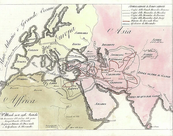
Map of the world showing the boundaries of the Roman, Macedonian, Persian and Assyrian Empires. Handcoloured copperplate engraving by Andrea Bernieri from Giulio Ferrario's Ancient and Modern Costumes of all the Peoples of the World, 1843
![]()

Wall Art and Photo Gifts from Fine Art Finder
Map of the world showing the boundaries of the Roman, Macedonian, Persian and Assyrian Empires. Handcoloured copperplate engraving by Andrea Bernieri from Giulio Ferrario's Ancient and Modern Costumes of all the Peoples of the World, 1843
FLO4622384 Map of the world showing the boundaries of the Roman, Macedonian, Persian and Assyrian Empires. Handcoloured copperplate engraving by Andrea Bernieri from Giulio Ferrario's Ancient and Modern Costumes of all the Peoples of the World, 1843.; (add.info.: Map of the world showing the boundaries of the Roman, Macedonian, Persian and Assyrian Empires. Handcoloured copperplate engraving by Andrea Bernieri from Giulio Ferrario's Ancient and Modern Costumes of all the Peoples of the World, 1843.); © Florilegius
Media ID 38462478
© © Florilegius / Bridgeman Images
Alexandre Carte Geographique Asie Geographical Map
EDITORS COMMENTS
This stunning handcoloured copperplate engraving from 1843 showcases a detailed map of the world, highlighting the boundaries of four great empires - Roman, Macedonian, Persian and Assyrian. Created by Andrea Bernieri for Giulio Ferrario's "Ancient and Modern Costumes of all the Peoples of the World," this intricate piece provides a fascinating glimpse into the ancient geopolitical landscape.
The vibrant colors bring to life the vast territories controlled by these powerful empires, spanning across Europe and Asia. From the Mediterranean shores conquered by Rome to Alexander the Great's expansive Macedonian Empire reaching into Persia, each empire's reach is clearly delineated on this historical map.
As you study this image, you can't help but marvel at the sheer scale of these ancient civilizations and their impact on world history. The attention to detail in every line and boundary speaks to Bernieri's skill as an engraver and his dedication to accurately portraying these significant empires.
Whether you're a history buff or simply appreciate fine art, this print is sure to captivate your imagination and transport you back in time to an era when these mighty empires ruled over vast swaths of land. It serves as a reminder of our shared human history and how borders have shifted over centuries.
MADE IN THE UK
Safe Shipping with 30 Day Money Back Guarantee
FREE PERSONALISATION*
We are proud to offer a range of customisation features including Personalised Captions, Color Filters and Picture Zoom Tools
SECURE PAYMENTS
We happily accept a wide range of payment options so you can pay for the things you need in the way that is most convenient for you
* Options may vary by product and licensing agreement. Zoomed Pictures can be adjusted in the Basket.

