Home > Europe > Netherlands > Maps
Map of Holland, 1720-1744 (engraving)
")
![]()
Wall Art and Photo Gifts from Fine Art Finder
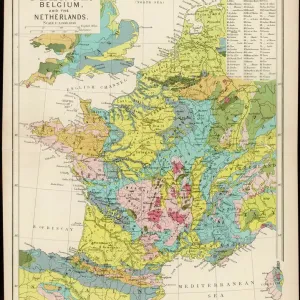
Map of Holland, 1720-1744 (engraving)
1953912 Map of Holland, 1720-1744 (engraving) by Seutter, Georg Matthaus (1678-1757); (add.info.: Map of Holland (Belgium Foederatum) from "Atlas Minor" by Matthaeus Seutter, Augsbourg, 1720-1744); Photo © CCI
Media ID 33092268
© © CCI / Bridgeman Images
18e Siecle 18th Century Gravure Engraving
FEATURES IN THESE COLLECTIONS
> Europe
> Belgium
> Related Images
> Europe
> Netherlands
> Maps
> Europe
> Netherlands
> Posters
> Europe
> Netherlands
> Related Images
> Fine Art Finder
> Artists
> Conrad (after) Gesner
> Fine Art Finder
> Artists
> Georg Matthäus Seutter
> Maps and Charts
> Early Maps
> Maps and Charts
> Netherlands
EDITORS COMMENTS
This print showcases a remarkable piece of cartographic history - the "Map of Holland, 1720-1744" by Georg Matthaus Seutter. Created during the 18th century, this engraving provides an intricate and detailed depiction of Holland (Belgium Foederatum) as it existed at that time. Seutter's map is a testament to his skill and artistry in capturing geographical information with precision. The vibrant colors used in this print bring life to the historical landscape, allowing viewers to immerse themselves in the past. From its borders with neighboring countries to its numerous cities and towns, every aspect of Holland is meticulously represented on this map. The significance of this artwork lies not only in its aesthetic appeal but also in its historical value. It offers us a glimpse into what Holland looked like centuries ago, providing insights into how society was structured and how land was utilized during that period. As we gaze upon this enchanting engraving, we are reminded of the enduring power of maps as tools for exploration and understanding. This particular piece serves as a reminder that even though our world has changed dramatically over time, there are elements from our past that continue to shape our present. With Bridgeman Images' expert photography skills, they have captured every intricate detail within Seutter's masterpiece. This print allows us to appreciate both the artistic beauty and historical significance encapsulated within "Map of Holland, 1720-1744. "
MADE IN THE UK
Safe Shipping with 30 Day Money Back Guarantee
FREE PERSONALISATION*
We are proud to offer a range of customisation features including Personalised Captions, Color Filters and Picture Zoom Tools
SECURE PAYMENTS
We happily accept a wide range of payment options so you can pay for the things you need in the way that is most convenient for you
* Options may vary by product and licensing agreement. Zoomed Pictures can be adjusted in the Basket.