
Maps Collection
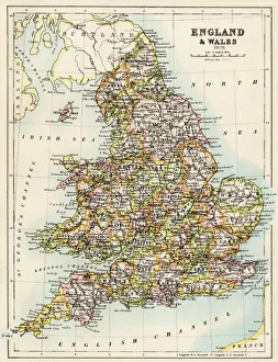
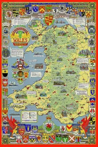
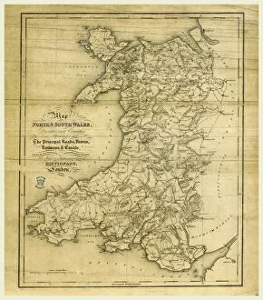
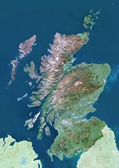
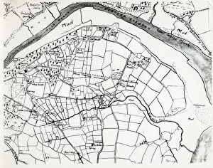
Wales is a country located in the United Kingdom, and it has been mapped for centuries
Choose a picture from our Maps Collection for your Wall Art and Photo Gifts
1,292 items


All Professionally Made to Order for Quick Shipping
-
Maps Collection
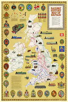
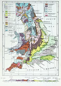
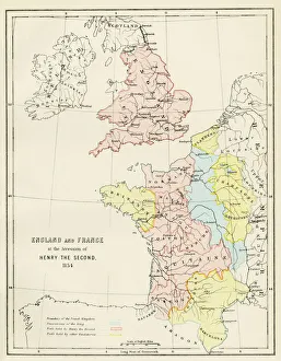
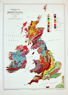
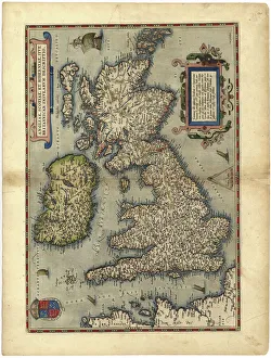
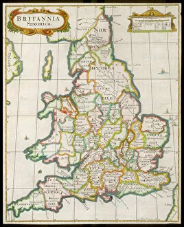
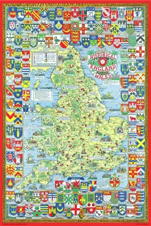
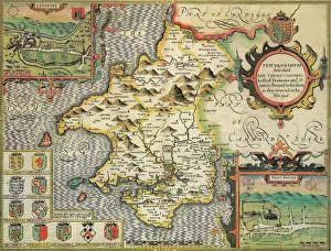
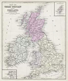
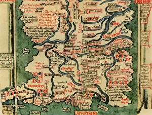
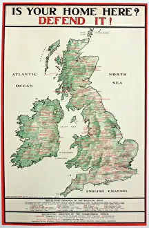
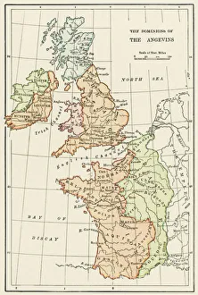
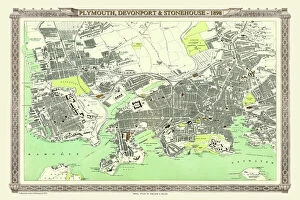
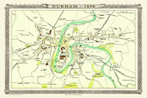
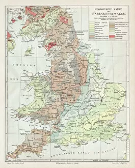
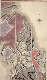
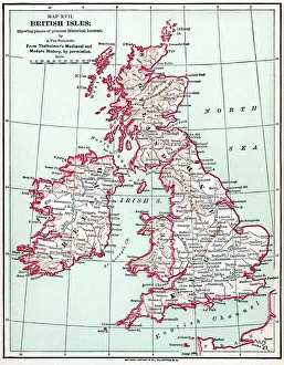
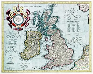
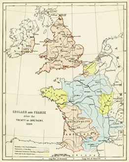
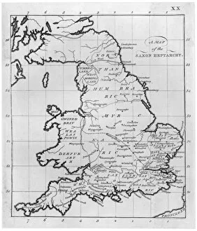
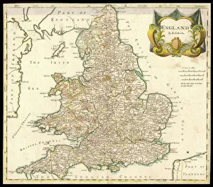
Wales is a country located in the United Kingdom, and it has been mapped for centuries. Maps of Wales have been used to document its geography, topography, and infrastructure. These they are be found in various formats such as paper maps, online maps, and digital GIS systems. They provide detailed information about the physical features of Wales such as mountains, rivers, lakes, roads and railways. Additionally they also show political boundaries between countries within Europe that border Wales such as England and Ireland. Maps of Wales are an invaluable resource for anyone wanting to explore this beautiful country or understand its history better.
+
Our beautiful pictures are available as Framed Prints, Photos, Wall Art and Photo Gifts
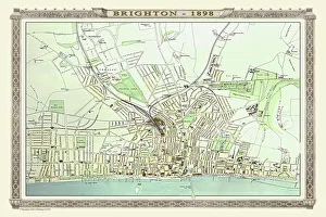
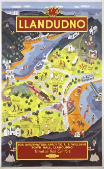
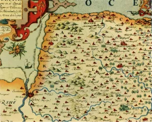
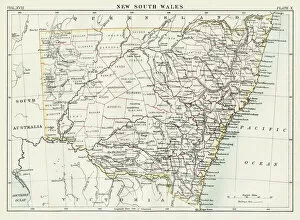
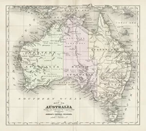
Media Storehouse offers a collection of Maps of Wales United Kingdom Europe, which includes various wall art options such as framed prints, photo prints, canvas prints, jigsaw puzzles and greeting cards. The maps showcase the geography and topography of Wales in detail with different scales and styles. Our collection features historical maps from the 16th century to modern-day versions that highlight the country's political boundaries, cities, towns and natural landmarks. These maps are perfect for those interested in Welsh history or geography enthusiasts who want to explore the region's diverse landscapes. The Media Storehouse Maps of Wales United Kingdom Europe collection is an excellent way to add character to any room while also providing educational value. Whether it be for personal use or as a gift idea for someone special, these maps offer something unique that can't be found elsewhere. With so many options available at affordable prices, anyone can find their ideal map print or puzzle within this extensive collection.
+
What are Maps of Wales United Kingdom Europe art prints?
Maps of Wales United Kingdom Europe art prints are high-quality reproductions of historical and contemporary maps that depict the geography, topography, and landmarks of Wales, the United Kingdom, and Europe. These prints showcase the intricate details of each map in stunning clarity and vivid colors. They are perfect for anyone who loves history, geography or wants to add a touch of sophistication to their home decor. These art prints come in various sizes and styles to suit different tastes and preferences. Some feature antique maps from centuries ago while others show modern-day roadmaps with detailed information on cities, towns, highways, rivers, mountains among others. The Maps of Wales United Kingdom Europe art prints make great gifts for students studying geography or history as well as those who have an interest in cartography. Overall these beautiful pieces offer a unique way to explore the rich cultural heritage of Wales UK & Europe through its landscapes depicted on paper.
+
What Maps of Wales United Kingdom Europe art prints can I buy from Media Storehouse?
We offer a wide range of Maps of Wales United Kingdom Europe art prints that showcase the beauty and diversity of this region. You can choose from vintage maps, contemporary designs, and everything in between. These prints are available in various sizes to suit your needs and preferences. Some popular options include antique maps that depict the historical boundaries of Wales or detailed topographical maps that highlight its natural features. You can also find artistic renditions that capture the unique character and charm of Welsh towns and cities. Whether you're looking for a decorative piece for your home or office, or you want to gift someone with a meaningful keepsake, we have something for everyone. Their high-quality prints are produced using state-of-the-art printing technology on premium materials to ensure long-lasting durability and vibrant colors. With so many options to choose from, you're sure to find the perfect map print that captures your love for Wales United Kingdom Europe.
+
How do I buy Maps of Wales United Kingdom Europe art prints?
To purchase Maps of Wales United Kingdom Europe art prints, you can visit our online gallery. We offer a wide range of high-quality maps that are perfect for decorating your home or office space. You can browse through our collection and select the map that best suits your preferences. Once you have selected the map, you can choose from various sizes and framing options to customize it according to your needs. We offer a variety of frames such as black wood, white wood, silver metal, and gold metal. To complete your order, simply add the item to your cart and proceed to checkout. You will be prompted to enter your shipping information and payment details before submitting the order. Media Storehouse ensures that all their products are printed on high-quality paper using state-of-the-art printing technology. This guarantees that you receive a beautiful piece of artwork that is both durable and visually stunning.
+
How much do Maps of Wales United Kingdom Europe art prints cost?
We offer a wide range of Maps of Wales United Kingdom Europe art prints at varying prices. Our collection includes vintage and contemporary maps that showcase the beauty and history of Wales, the United Kingdom, and Europe as a whole. The cost of these prints depends on several factors such as size, framing options, and paper quality. Our you can choose from different sizes ranging from small to large formats to suit their needs. We also provide various framing options such as black or white frames that complement the artwork's style. Additionally, our high-quality paper ensures that each print is durable and long-lasting. Whether you're looking for a unique piece to decorate your home or office space or searching for an ideal gift for someone special who loves maps, we have something for everyone in our collection. So explore our website today to discover beautiful Maps of Wales United Kingdom Europe art prints at affordable prices.
+
How will my Maps of Wales United Kingdom Europe art prints be delivered to me?
We take great care in ensuring that your Maps of Wales United Kingdom Europe art prints are delivered to you safely and securely. We use high-quality packaging materials to protect your artwork during transit, so it arrives at your doorstep in pristine condition. We work with trusted delivery partners who have a proven track record for delivering packages on time and without any damage. Depending on where you live, we may use different carriers to ensure the fastest possible delivery times. Once your order is dispatched from our warehouse, you will receive an email notification with tracking information so that you can keep tabs on its progress. If there are any issues with the delivery or if you have any questions about your order, our customer service team is always available to assist you. We strive to make sure that receiving your Maps of Wales United Kingdom Europe art prints is a hassle-free experience that leaves you completely satisfied with both the product and service provided by Media Storehouse.