
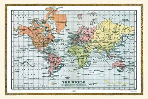
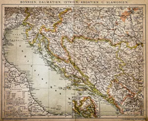
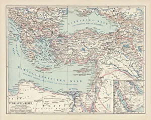
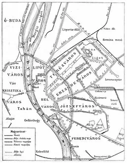
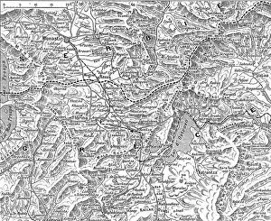
Maps Collection
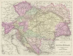
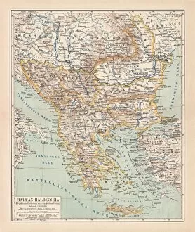
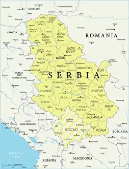
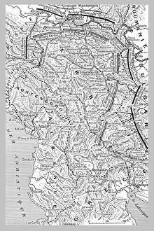
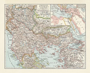
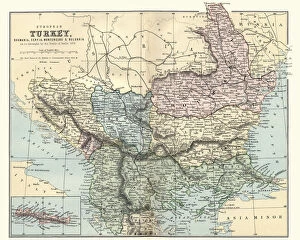
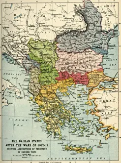
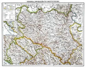
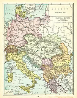
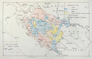
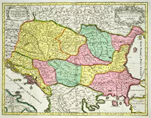
Serbia is a country located in the Balkan region of Europe, and is bordered by Hungary, Romania, Bulgaria, North Macedonia, Croatia and Bosnia and Herzegovina
Choose a picture from our Maps Collection for your Wall Art and Photo Gifts
171 items


All Professionally Made to Order for Quick Shipping
-
Maps Collection
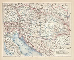
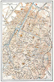
Serbia is a country located in the Balkan region of Europe, and is bordered by Hungary, Romania, Bulgaria, North Macedonia, Croatia and Bosnia and Herzegovina. Serbia has a rich history and culture that dates back to the 6th century BC. Maps of Serbia Europe show its diverse geography which includes mountains, rivers, plains and valleys. The capital city Belgrade is situated at the confluence of two major European rivers - the Danube and Sava Rivers. Other major cities include Novi Sad, Nis and Kragujevac. The country also has many national parks such as Tara National Park which offers stunning views of forests and lakes as well as some archaeological sites from ancient times. Serbia's economy relies heavily on agriculture but it also has an industrial sector which produces steel products among other goods for export to other countries in Europe.
+
Our beautiful pictures are available as Framed Prints, Photos, Wall Art and Photo Gifts
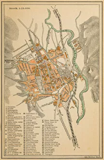
Media Storehouse offers a collection of Maps of Serbia Europe wall art and framed prints. Our collection features vintage maps that showcase the geography, topography, and landmarks of Serbia in intricate detail. These maps are perfect for history enthusiasts or anyone who wants to add a touch of sophistication to their home decor. The Maps of Serbia Europe collection includes various styles and sizes, from colorful antique maps to black-and-white prints with fine details. Some pieces feature annotations that provide historical context or highlight important locations within the country. These high-quality prints are made using premium materials that ensure longevity and durability. They are printed on archival paper using advanced printing techniques that produce vibrant colors and sharp details. Whether you're looking for a unique gift or want to decorate your own space with beautiful artwork, our Maps of Serbia Europe collection is an excellent choice. With its vast selection and exceptional quality, our collection is sure to impress any art lover or history buff.
+
What are Maps of Serbia Europe art prints?
Maps of Serbia Europe art prints are high-quality reproductions of maps that depict the geography and topography of Serbia and its surrounding regions in Europe. These prints are created using advanced printing techniques to ensure that every detail is captured accurately, resulting in a stunning visual representation of the area. These art prints can be used for a variety of purposes, from educational tools to decorative pieces for homes or offices. They provide an excellent way to explore the history and culture of Serbia, as well as its place within the larger European context. Whether you're looking for a detailed map to study or simply want a beautiful piece of artwork to display on your wall, Maps of Serbia Europe art prints offer something for everyone. With their vibrant colors and intricate details, these prints are sure to impress anyone who sees them.
+
What Maps of Serbia Europe art prints can I buy from Media Storehouse?
We offer a wide range of Serbia Europe art prints that you can buy. These maps are available in various sizes and formats, including canvas prints, framed prints, and photographic prints. You can choose from different styles of maps such as antique maps, topographical maps or political maps. One popular option is the detailed map of Serbia which shows all major cities and towns along with their respective borders. This map also highlights important landmarks like national parks, rivers and lakes making it perfect for those interested in geography or planning a trip to the country. Another great choice is the vintage-style travel poster featuring Belgrade - the capital city of Serbia. This print captures the essence of this vibrant city with its iconic architecture and bustling streets. Media Storehouse has an extensive collection of high-quality Serbia Europe art prints that will suit any taste or style preference. Whether you're looking for something modern or traditional, they have got you covered.
+
How do I buy Maps of Serbia Europe art prints?
To buy Maps of Serbia Europe art prints from Media Storehouse, you can browse our extensive collection of maps online. Once you have found the map that you would like to purchase, simply add it to your cart and proceed to checkout. You will be prompted to enter your shipping and payment information before completing the transaction. We offer a variety of sizes for their art prints, so make sure to select the size that best fits your needs. We also offer different framing options if you prefer a framed print. If you have any questions or concerns about purchasing Maps of Serbia Europe art prints from Media Storehouse, they have a customer service team available via email or phone who can assist with any inquiries. Buying maps as art prints is an excellent way to add unique and interesting decor to your home or office space while also showcasing your love for travel and geography.
+
How much do Maps of Serbia Europe art prints cost?
We offer a wide range of Maps of Serbia Europe art prints that are available for purchase. The cost of these prints varies depending on the size and type of print you choose. We have a variety of options to suit every budget, from affordable paper prints to high-quality canvas prints. Our Maps of Serbia Europe art prints are perfect for anyone who loves geography or wants to add some unique artwork to their home or office decor. They make great gifts too. Whether you're looking for a small print to hang in your bedroom or a large canvas print for your living room, we have something that will fit your needs and style preferences. So why not browse our collection today and find the perfect Maps of Serbia Europe art print for you?
+
How will my Maps of Serbia Europe art prints be delivered to me?
We take great care in delivering your Maps of Serbia Europe art prints to you. We use high-quality packaging materials to ensure that your artwork arrives in perfect condition. Your print will be carefully rolled and placed into a sturdy tube for safe transportation. We work with trusted delivery partners who offer reliable and efficient services. Once your order has been dispatched, you will receive a tracking number so that you can monitor the progress of your delivery. We understand how important it is for our customers to receive their orders promptly, which is why we aim to dispatch all orders as quickly as possible. However, please note that delivery times may vary depending on your location. Westrive to provide our customers with a hassle-free and enjoyable shopping experience from start to finish.